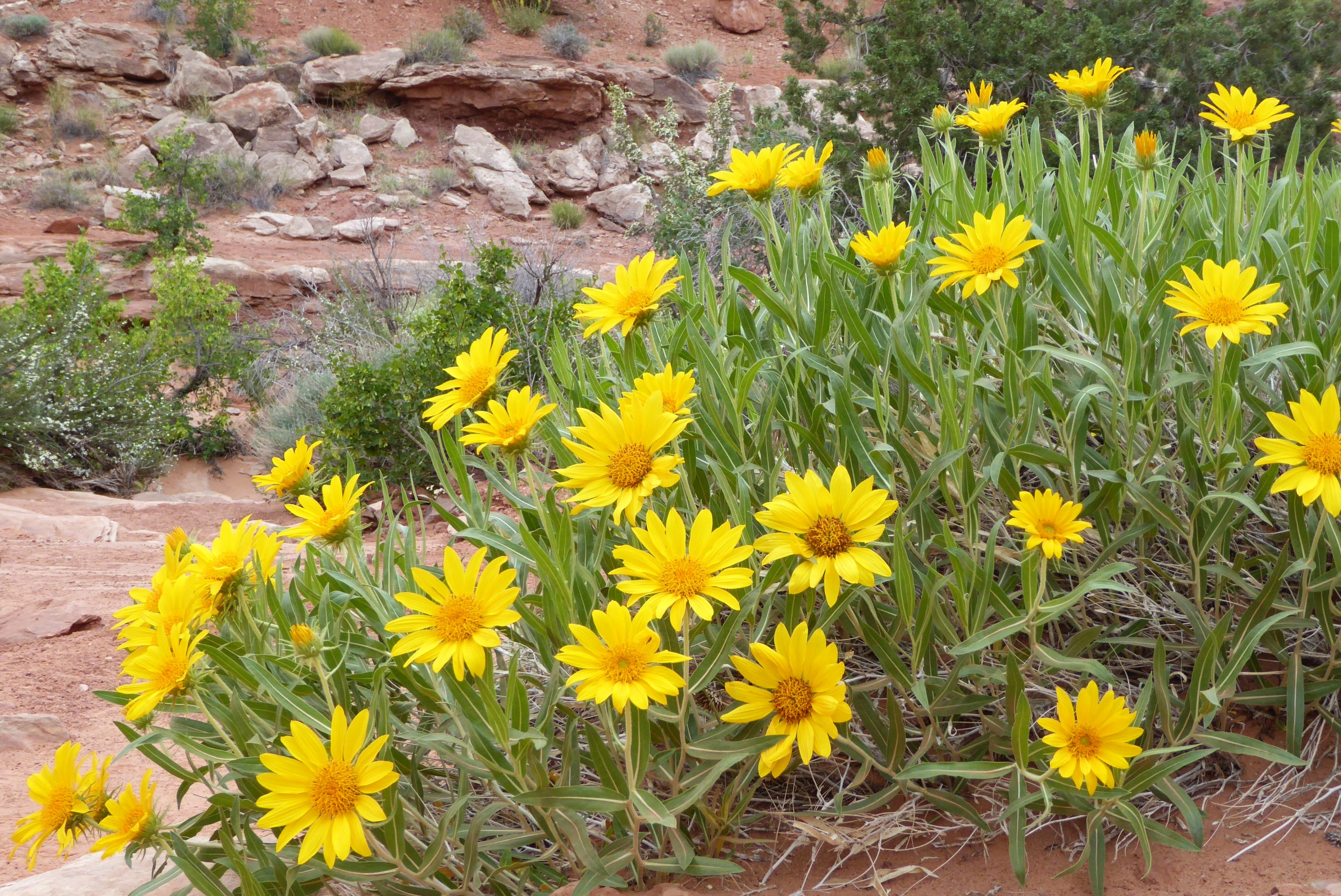
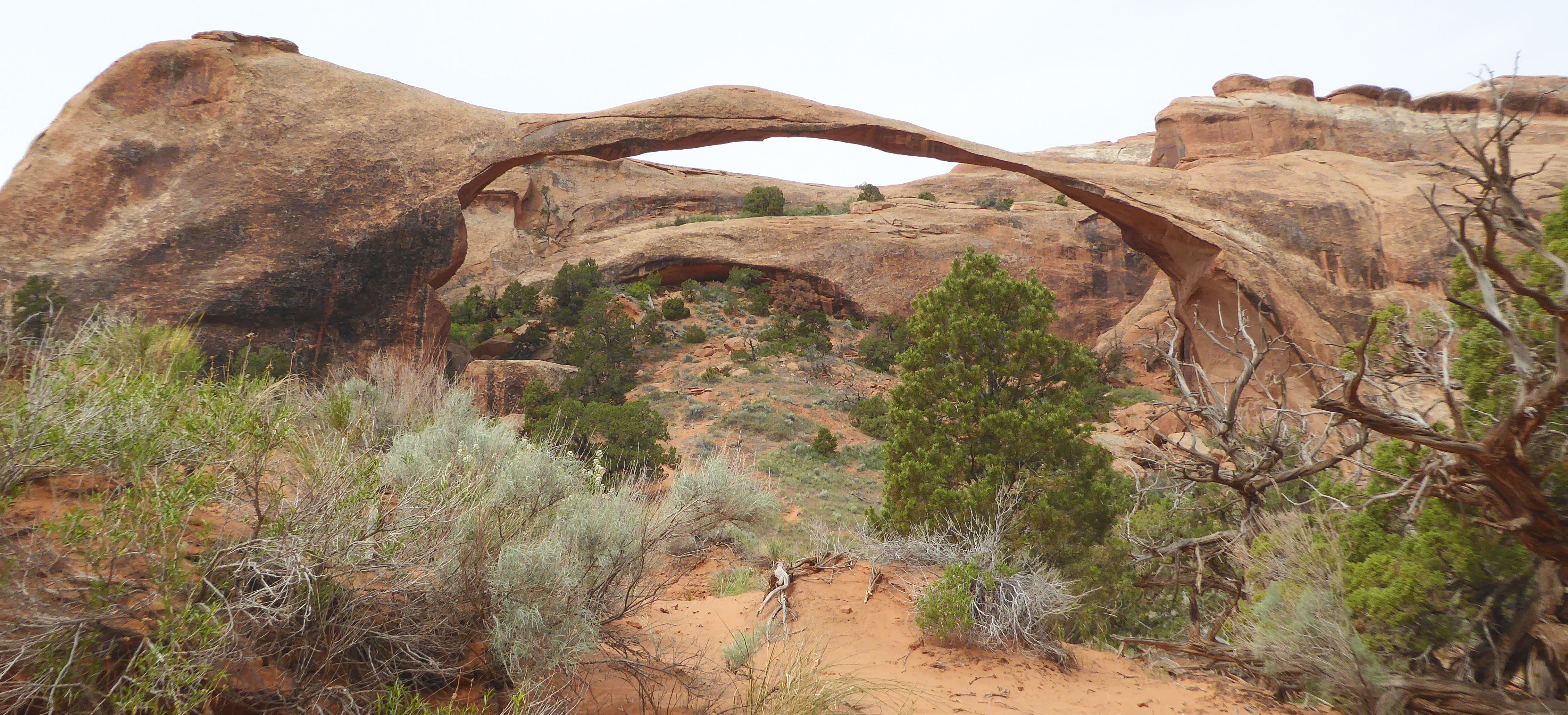
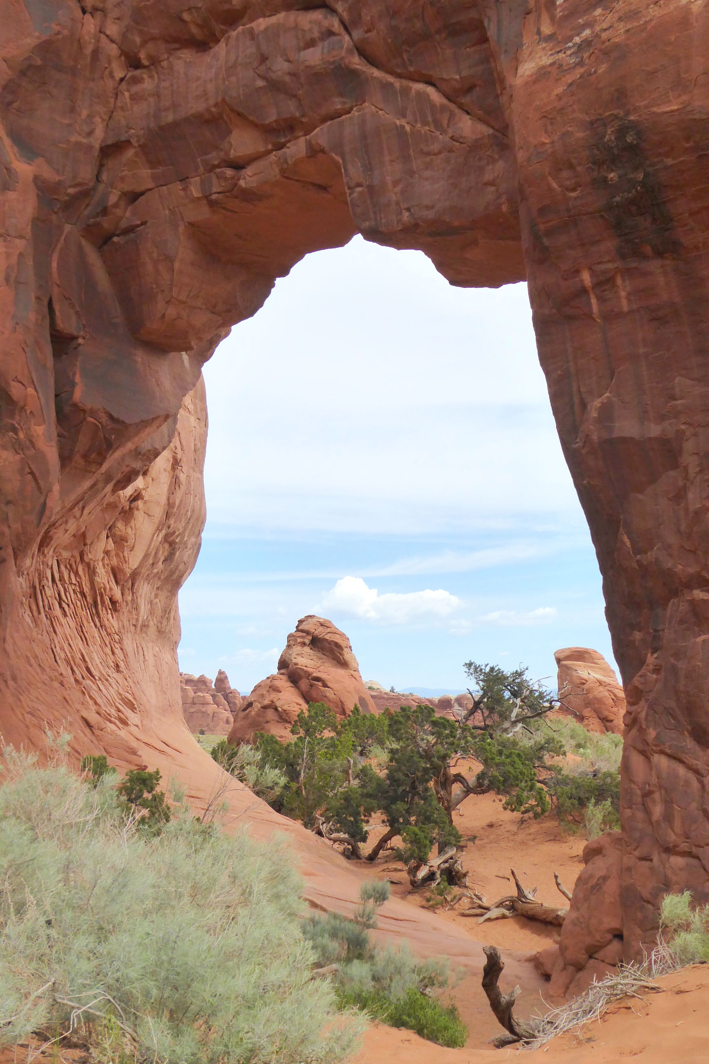
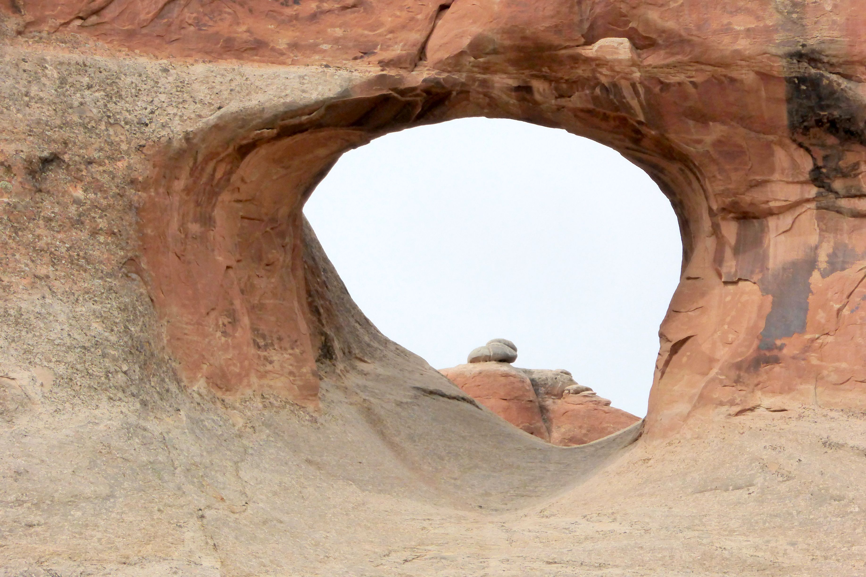
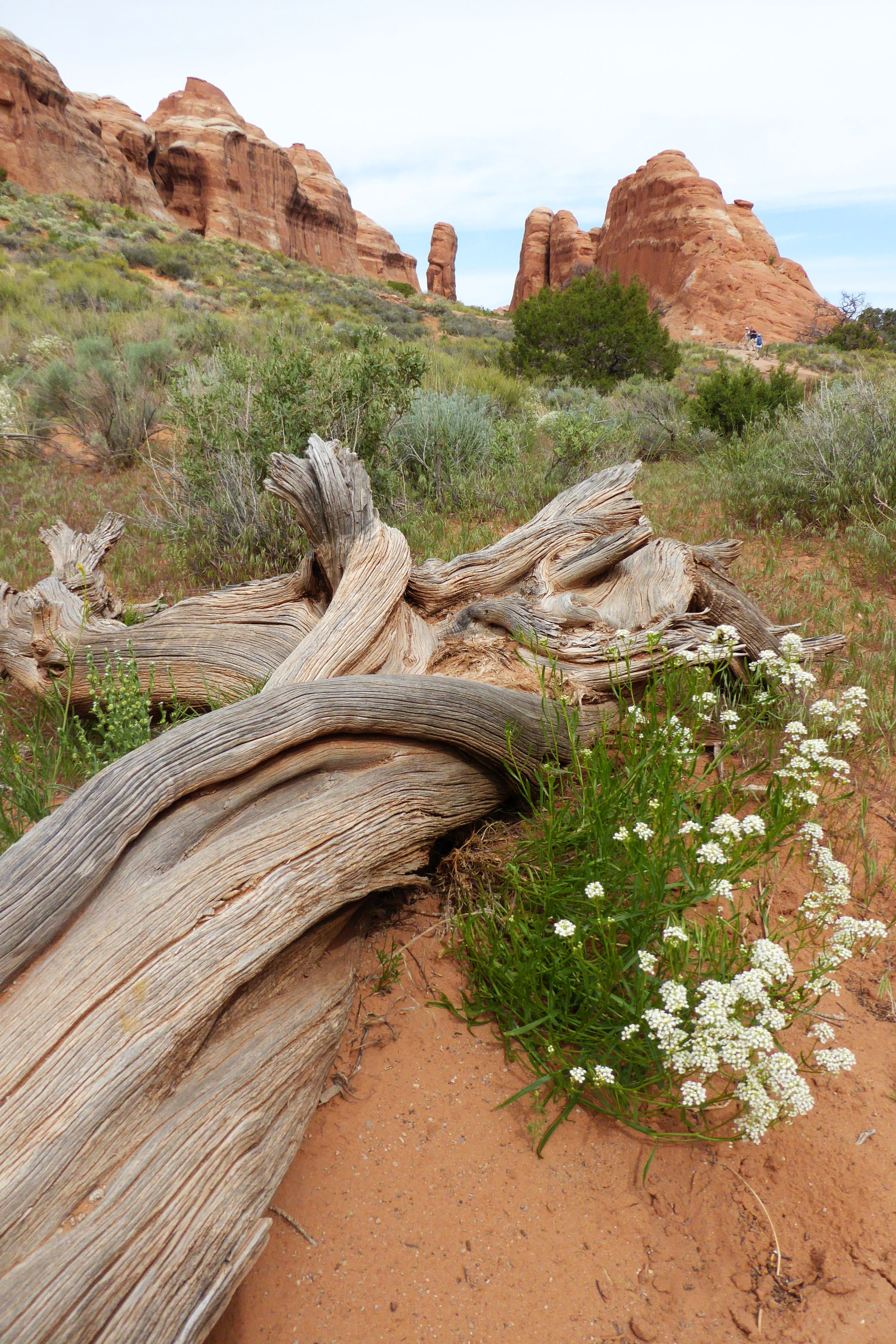
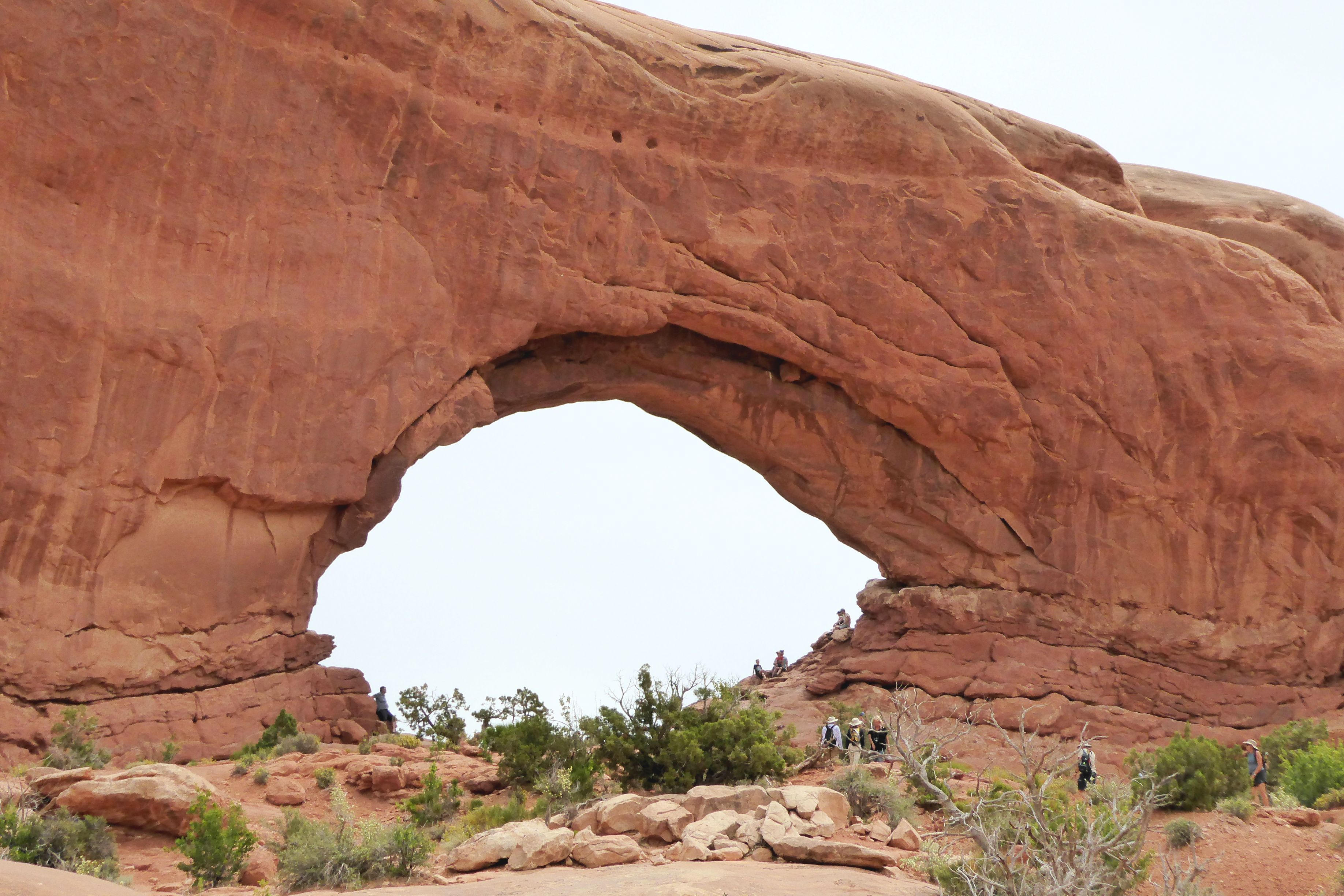
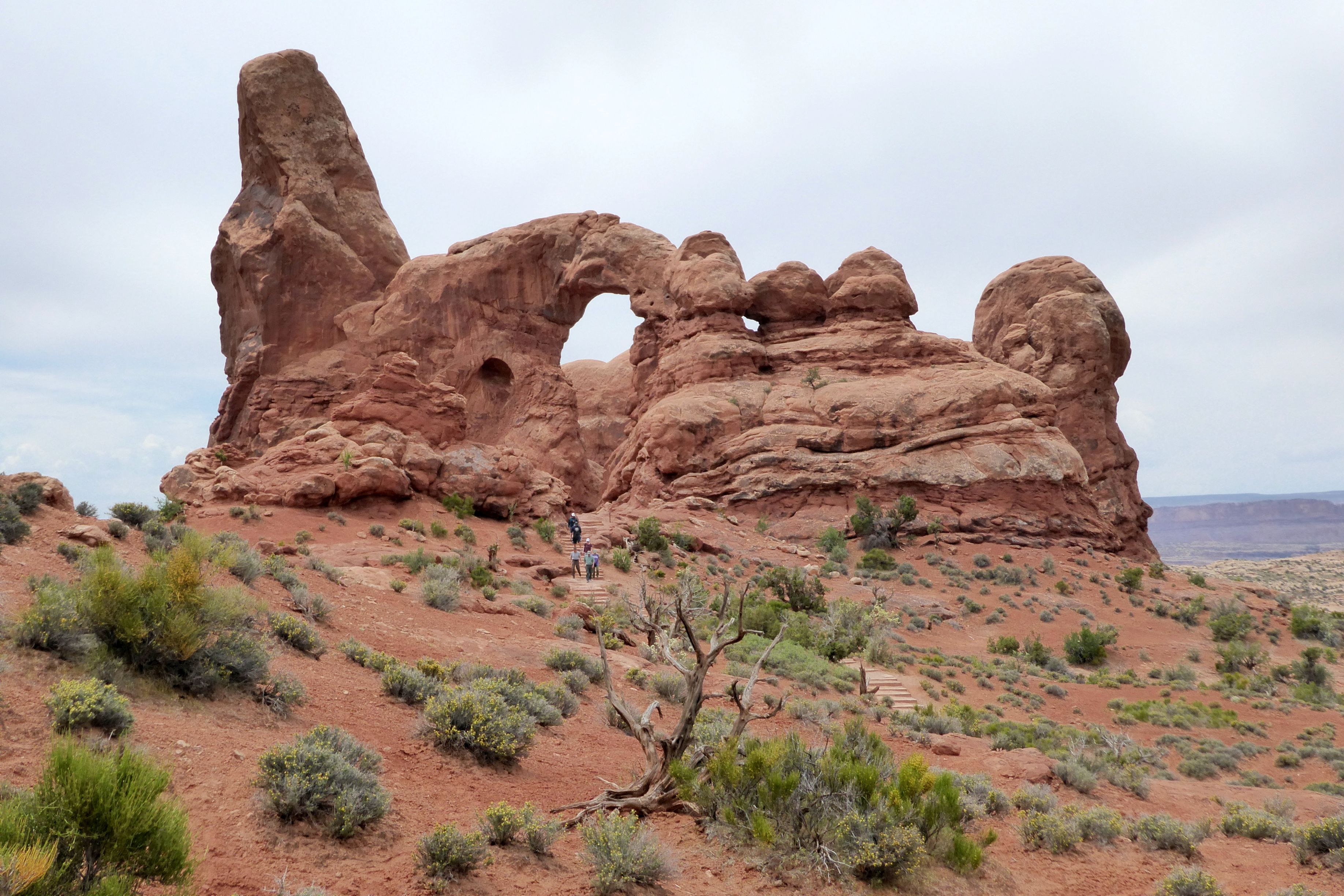
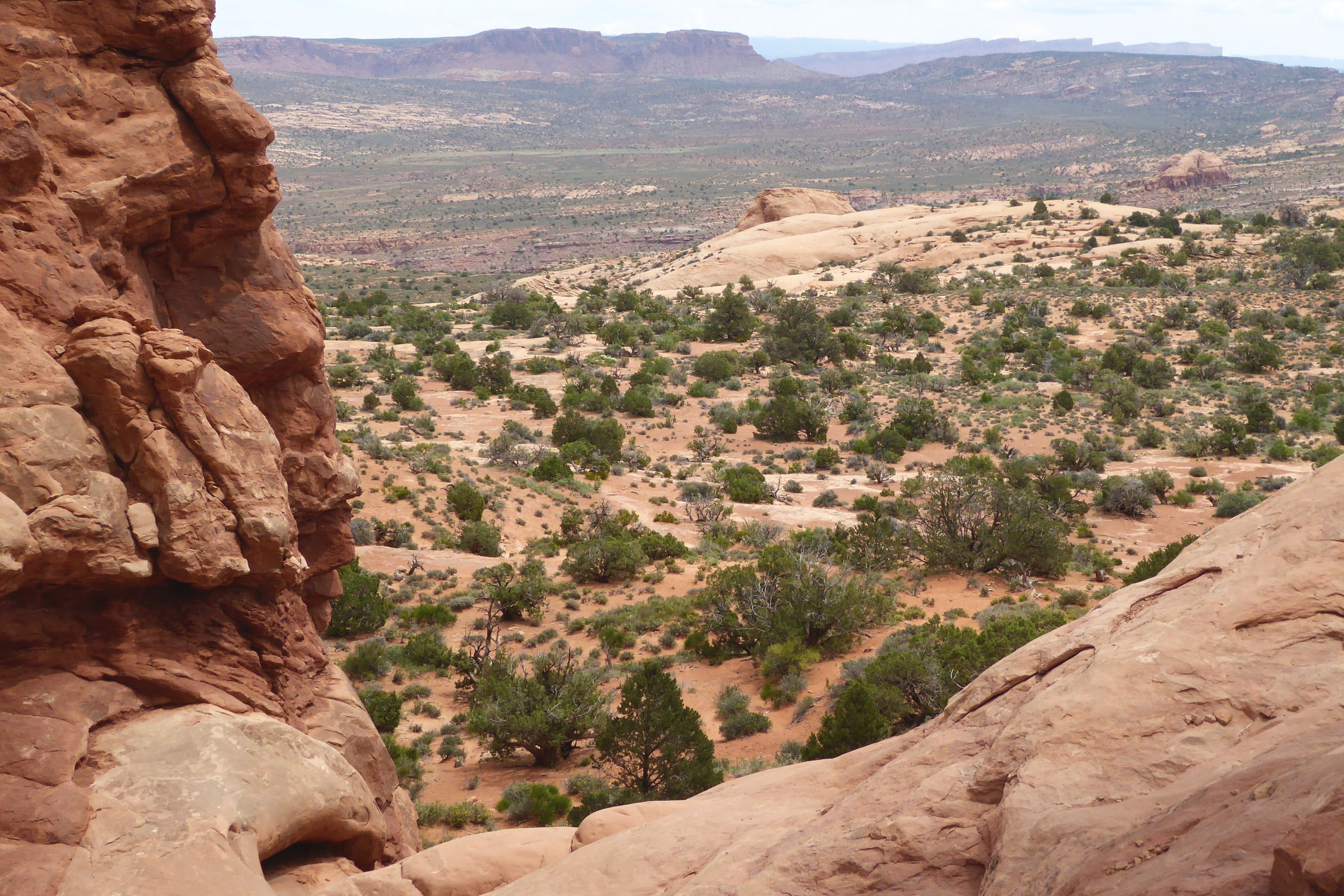
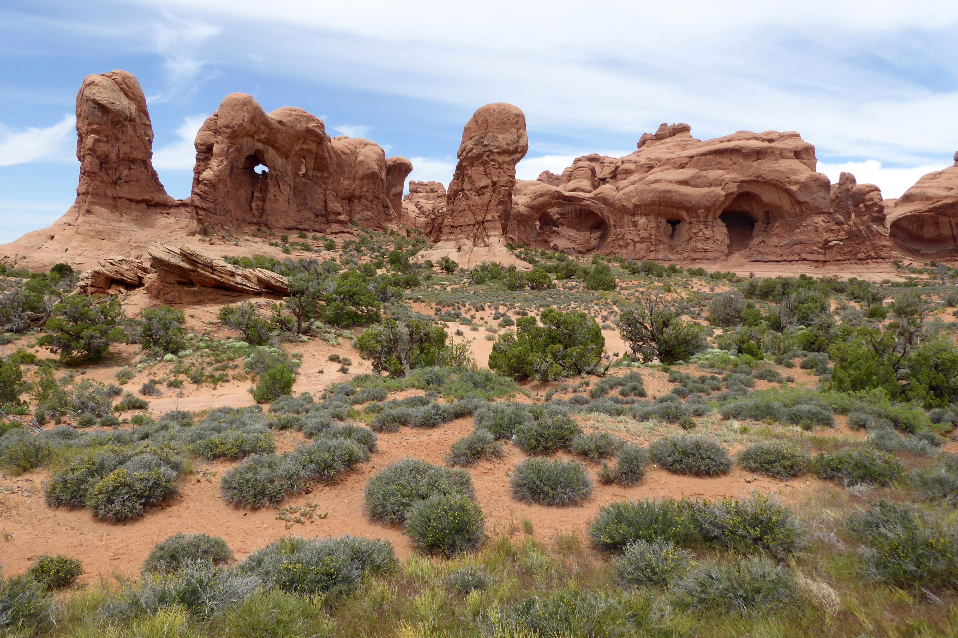
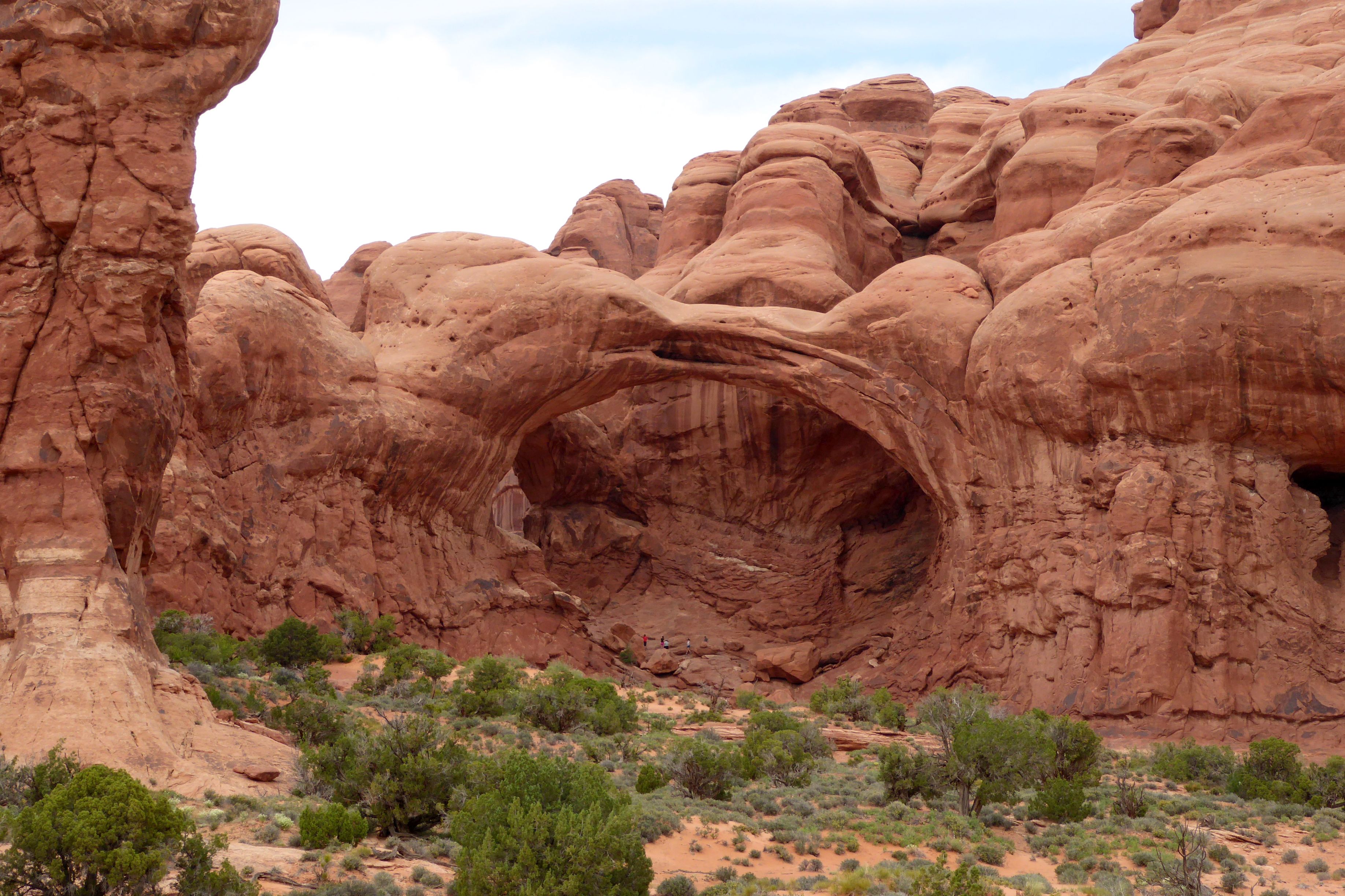
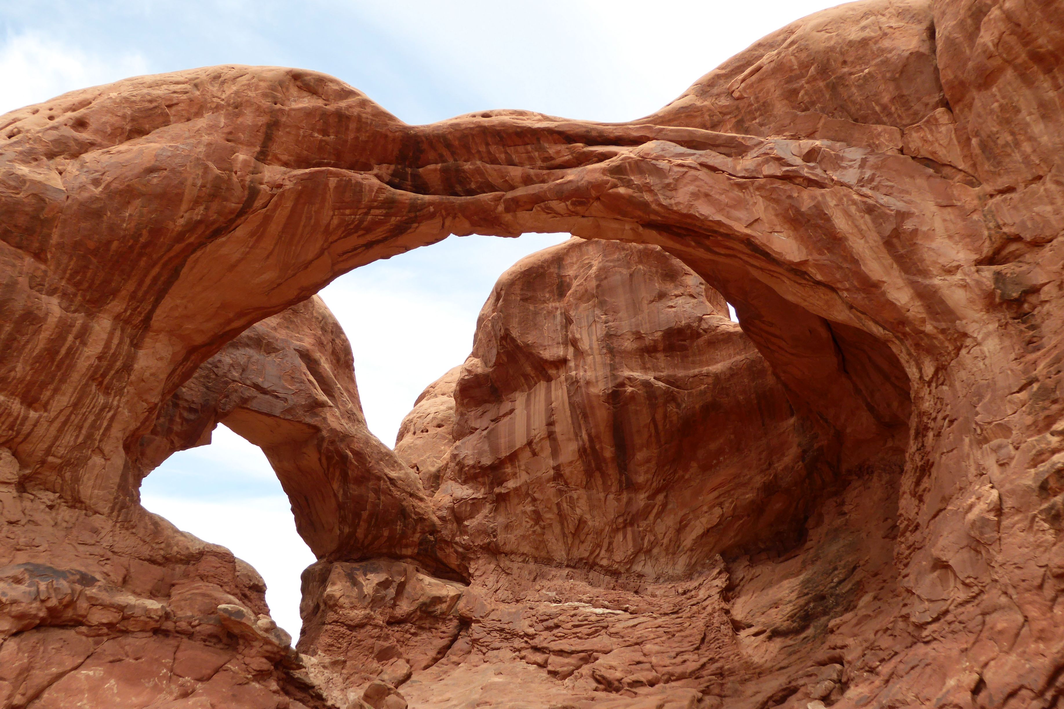
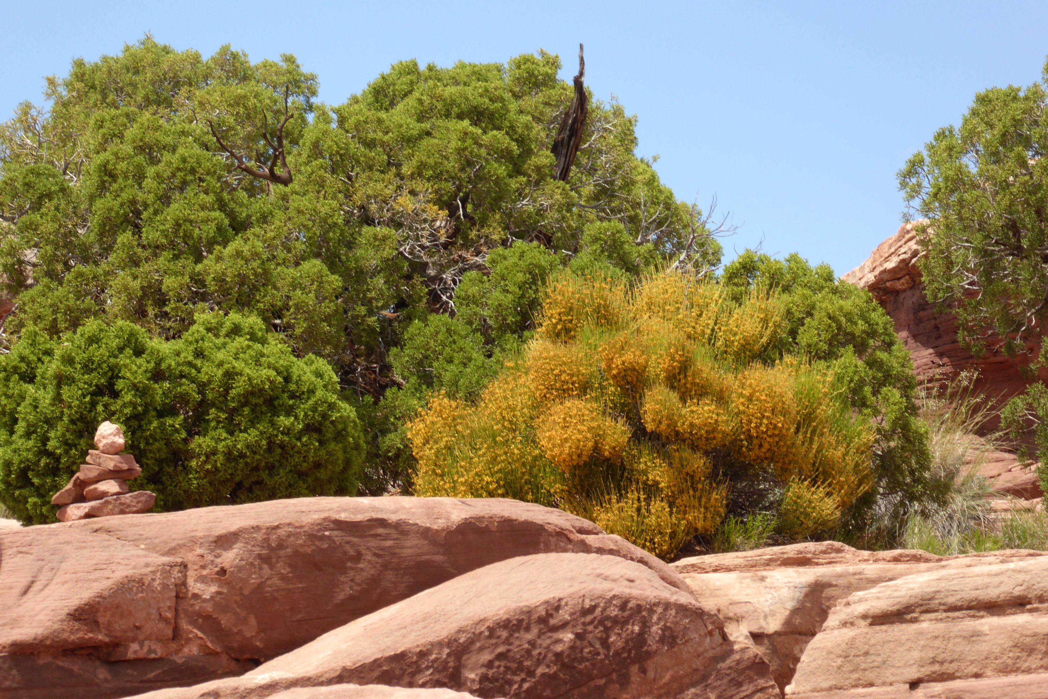
Arches National Parkis one of those places that you have to see in person to really grasp how amazing it is. There are over 2,000 natural Entrada Sandstone arches, in addition to all of the other magnificent rock formations.
This is an easy park to get to; it’s only four miles from Moab, Utah. Get there early, though, because the parking lots fill up fast. We were fortunate to be on a bus and not have to worry about that.
The explanation of how these arches were formed over 300 million years is too involved to explain in this post, but it is quite interesting. Check it out here.
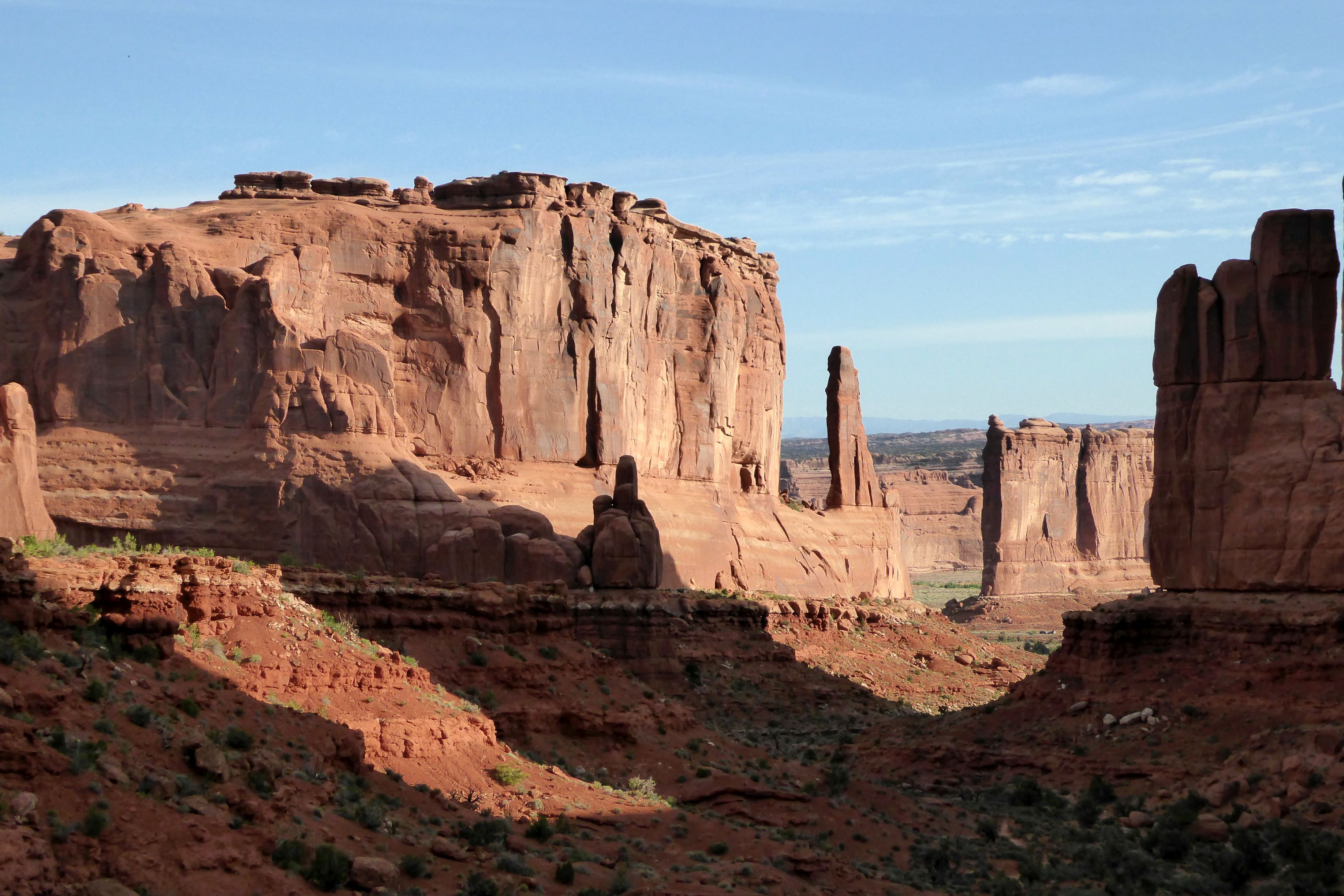
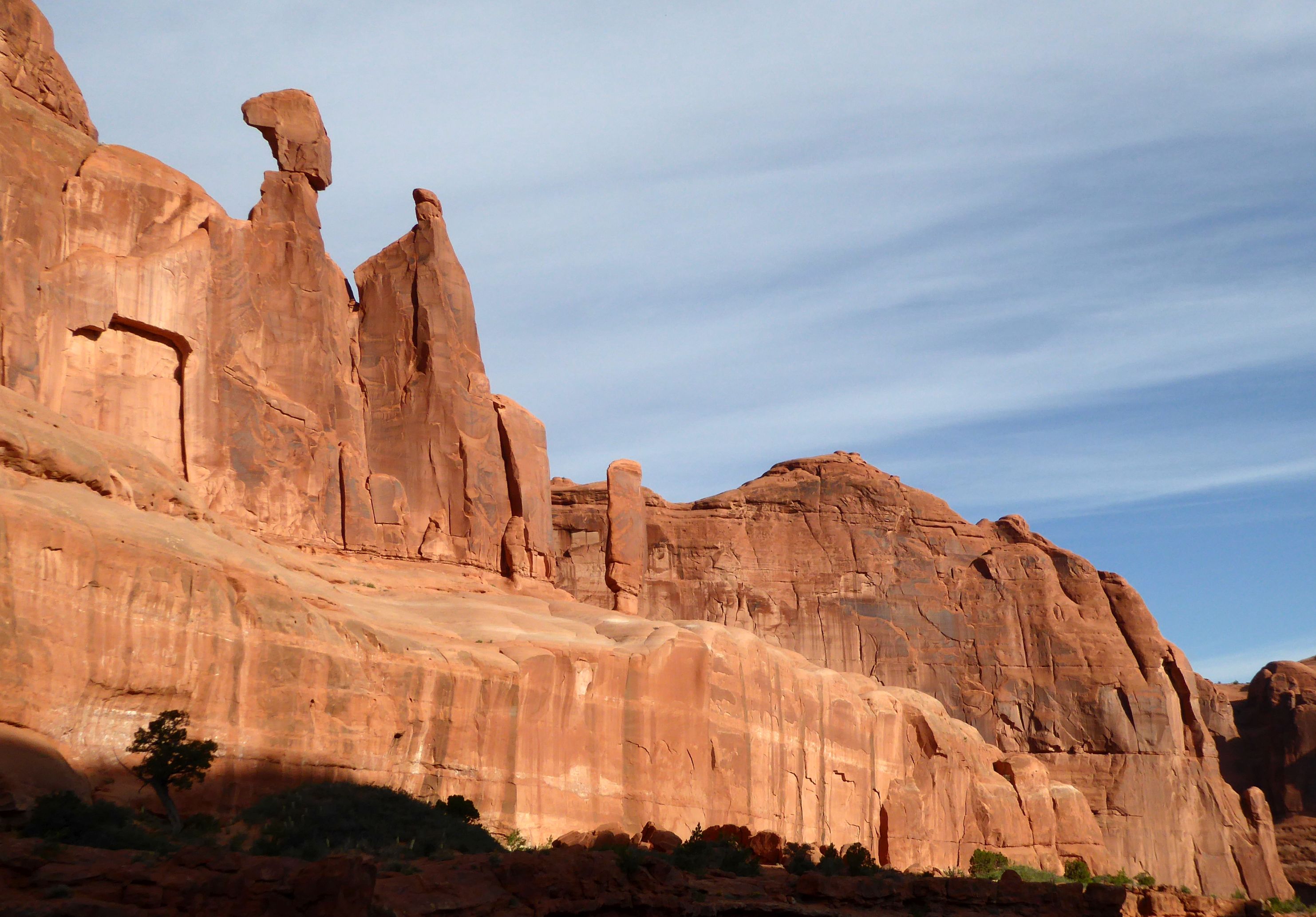
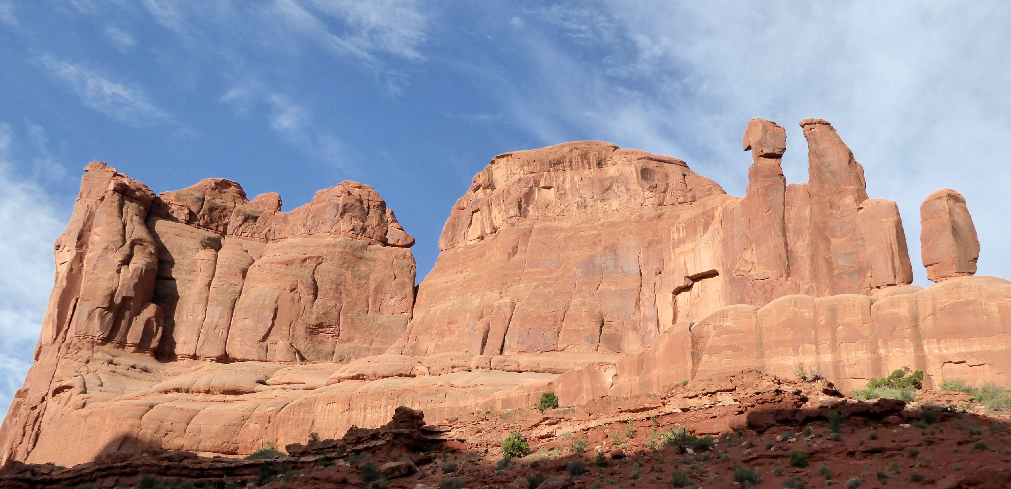
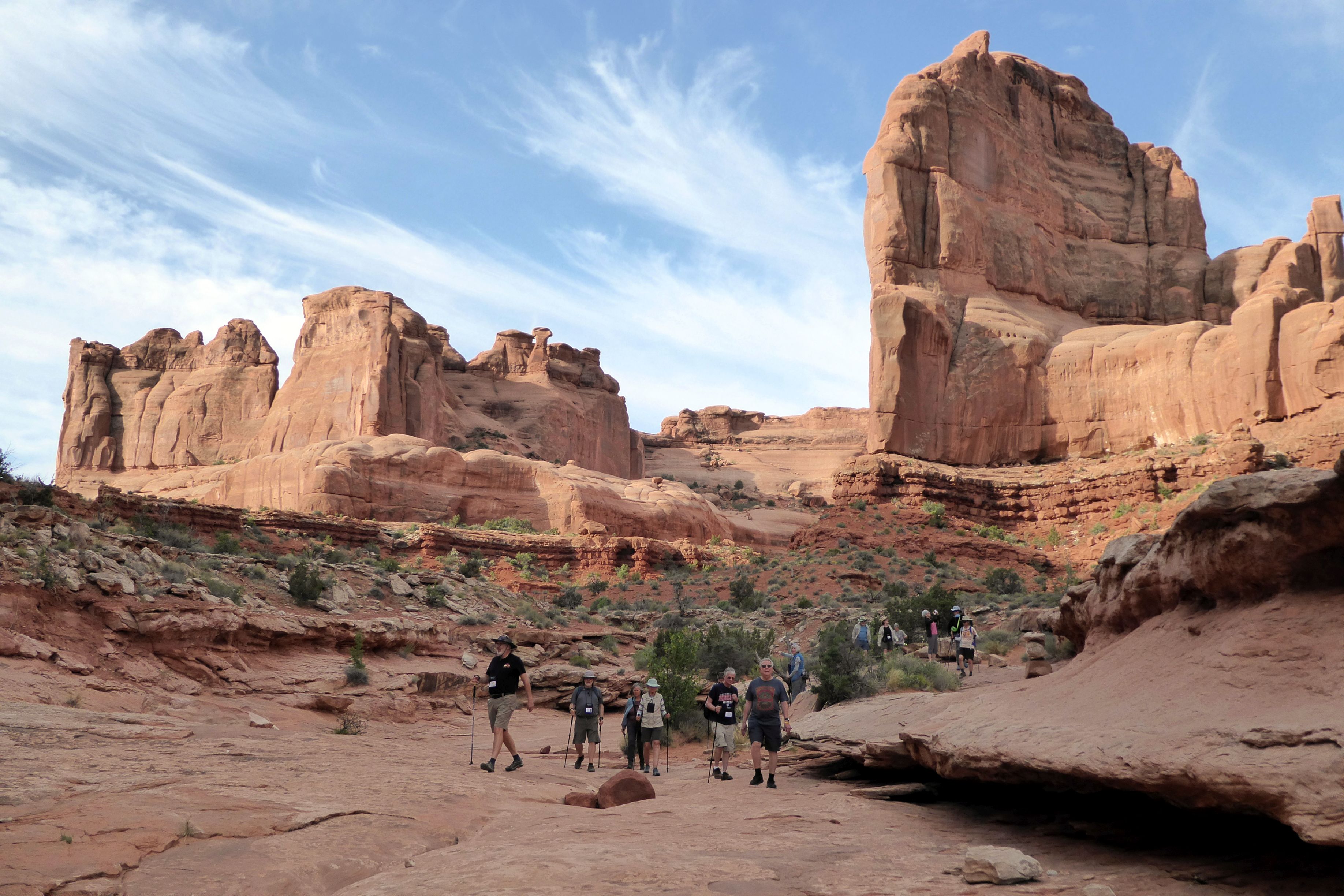
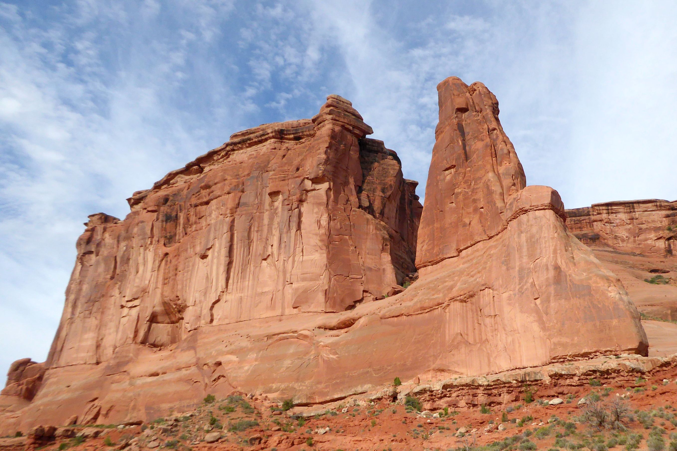
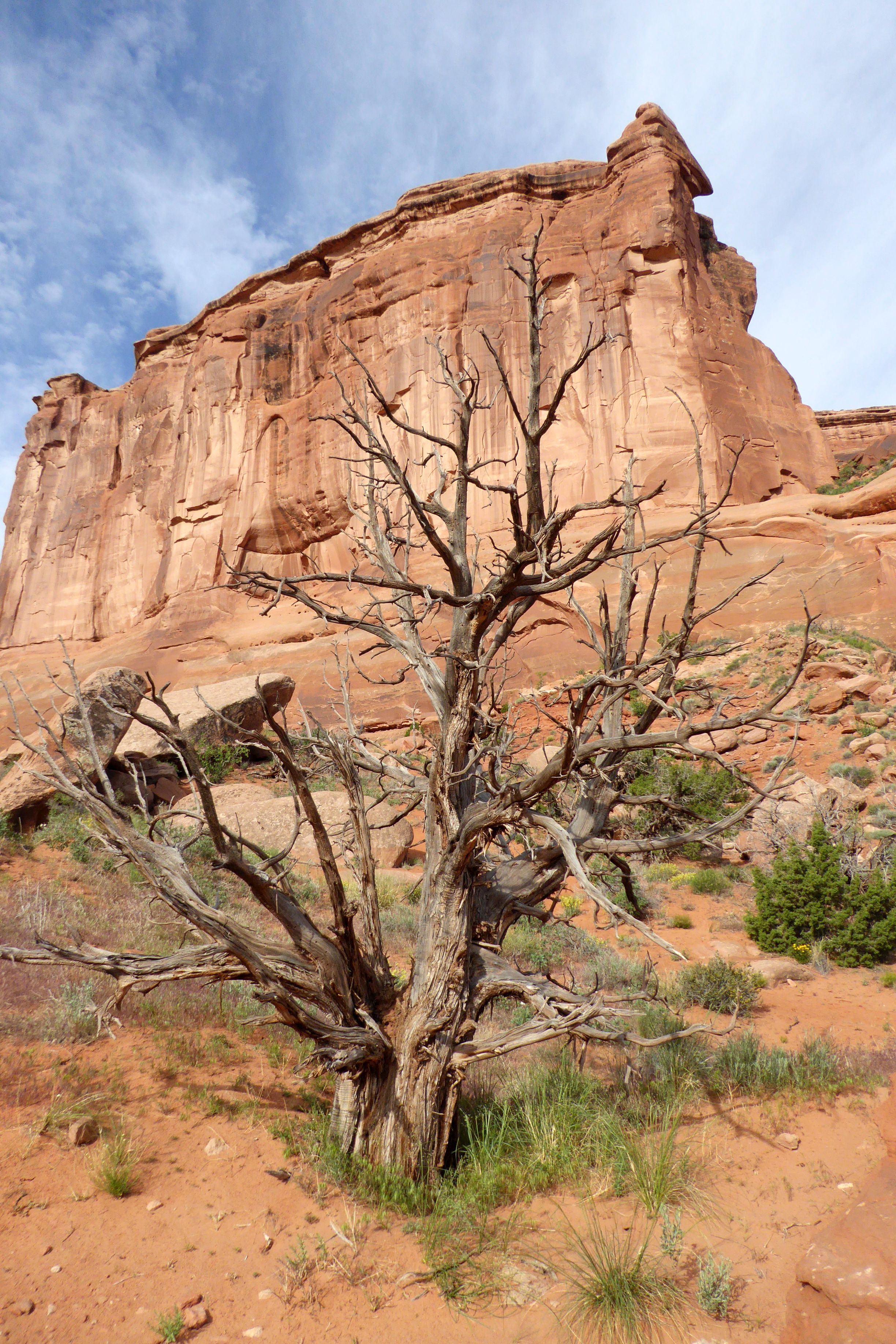
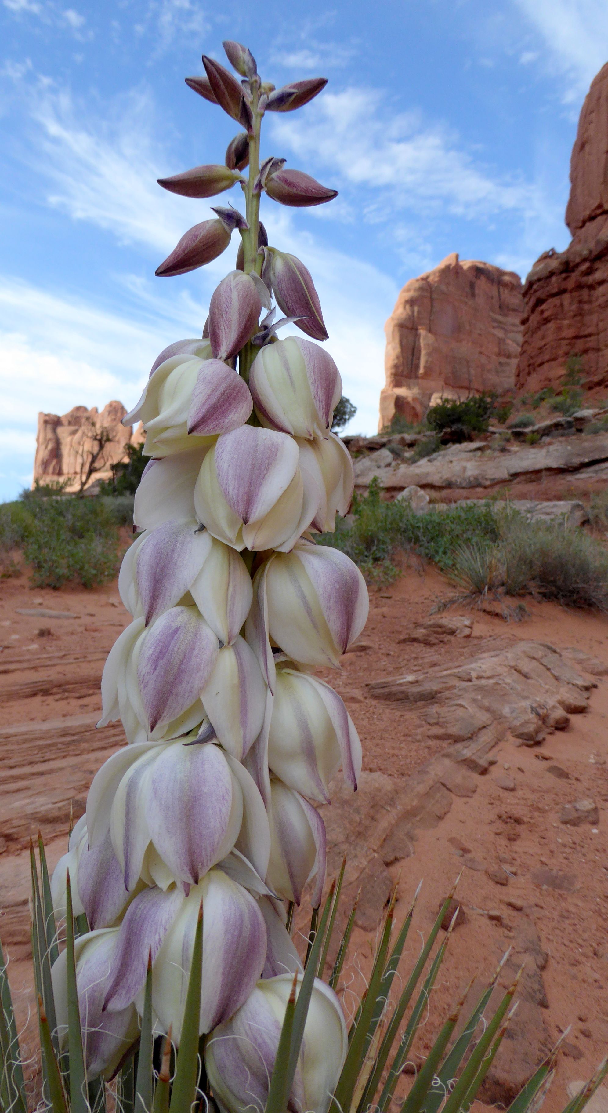
For now, I will just leave you with my favorite photos from the day, beginning with a hike we did on Park Avenue. No, not that Park Avenue!
(For all pictures, click on the image to see full screen view.)
This was the most unique bathroom stop ever! And, yes, it really is carved into real rock.
Continuing on our journey, we stopped to see John Wesley Powell Museum, in Green River, Utah. Powell first explored and mapped the area in the 1870’s. The museumis located on the river, and they had a lovely walking path we wandered along to take in the views of the river.
(For all pictures, click on the image to see full screen view.)
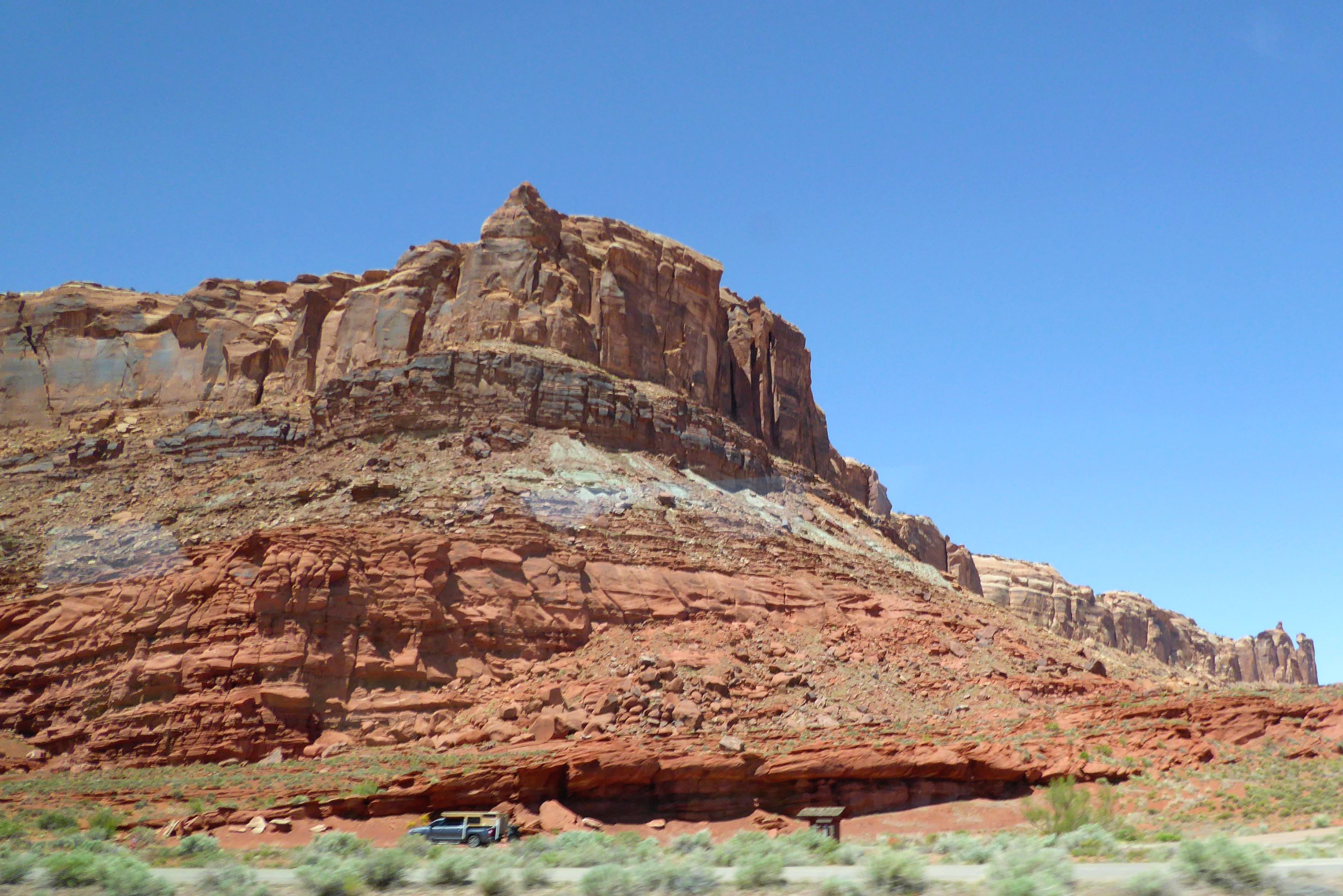
Shot from the bus window on the way to Dead Horse Point State Park
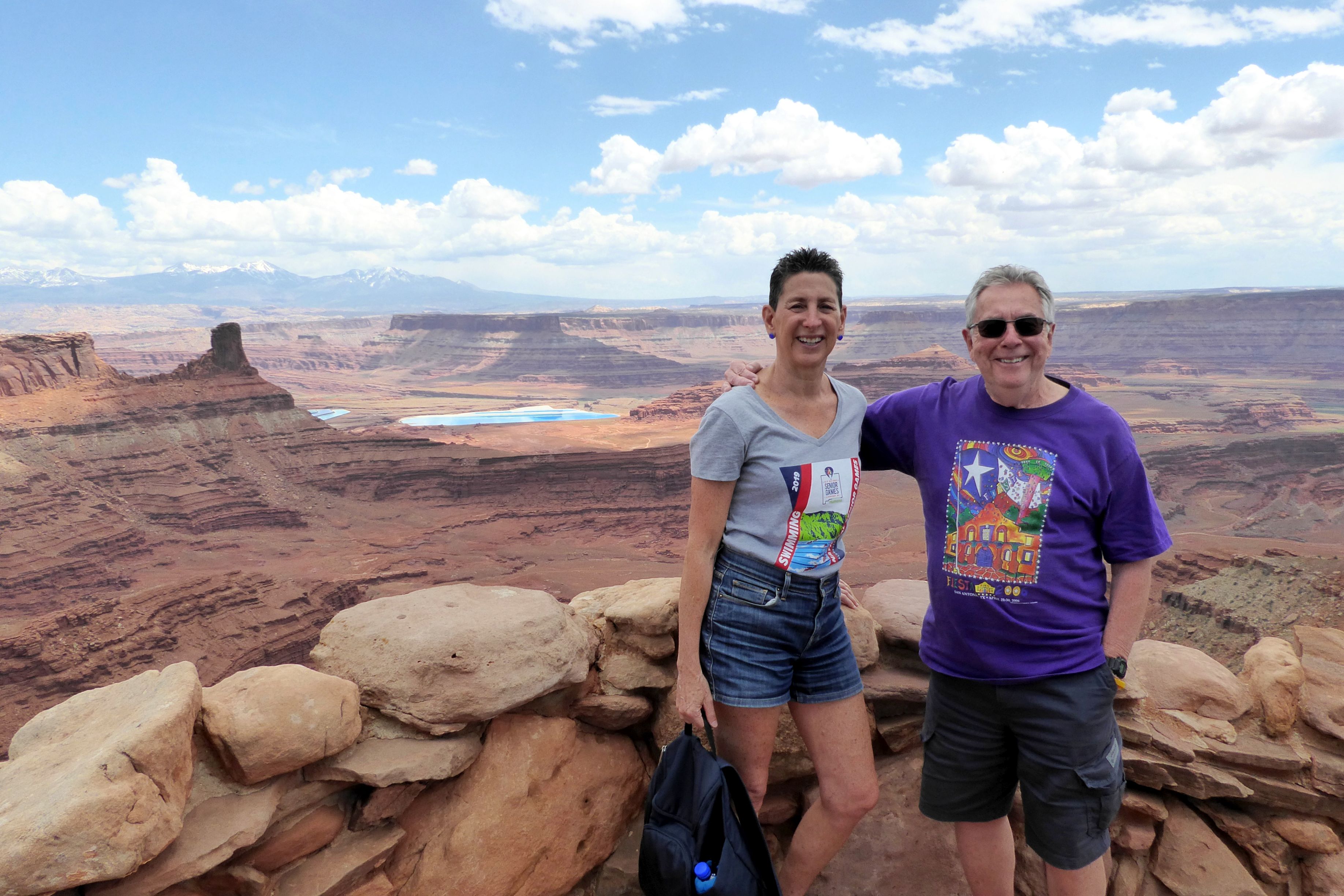
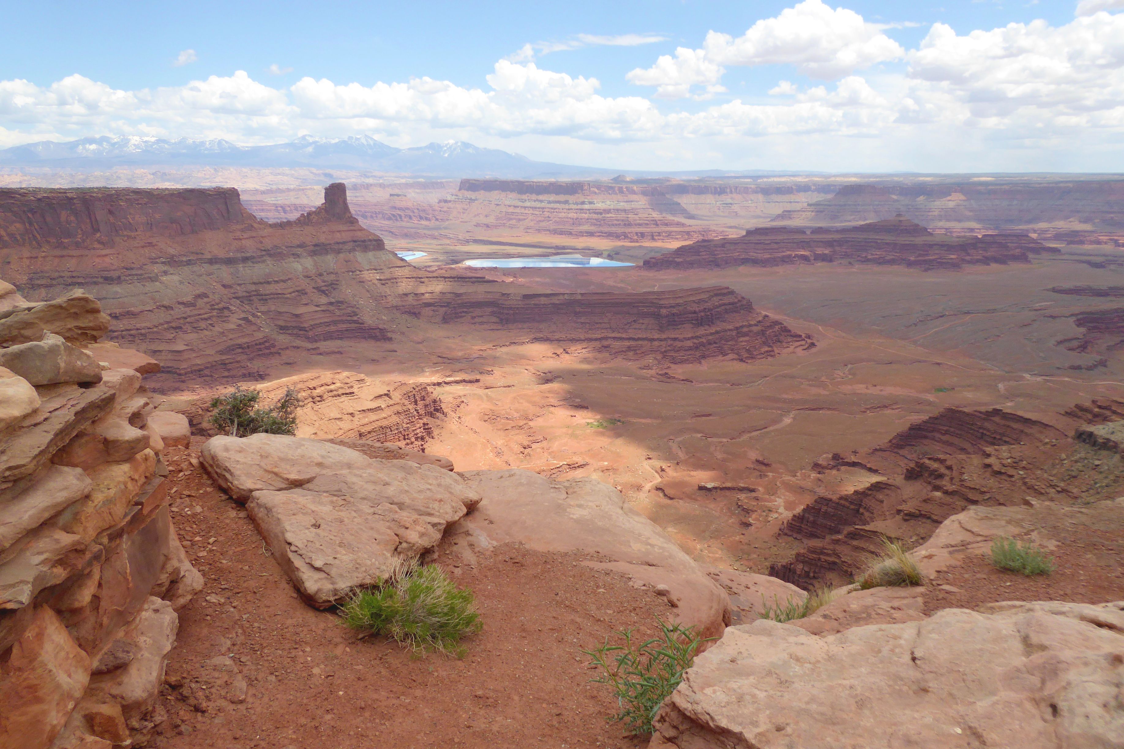
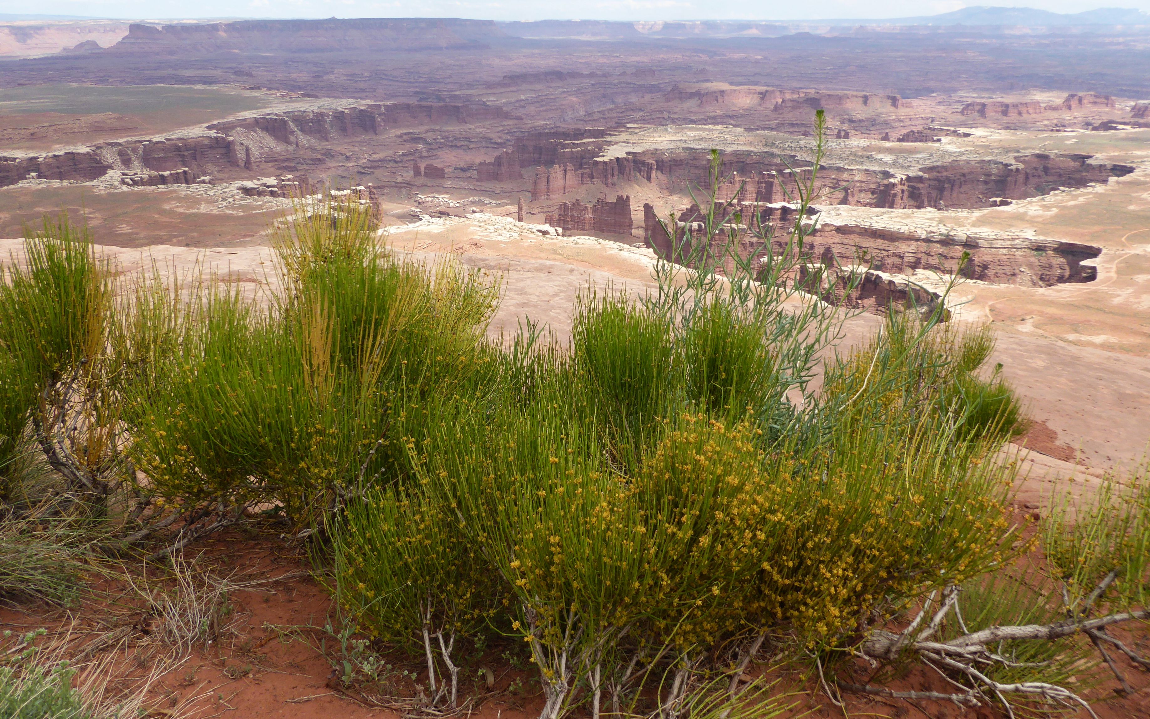
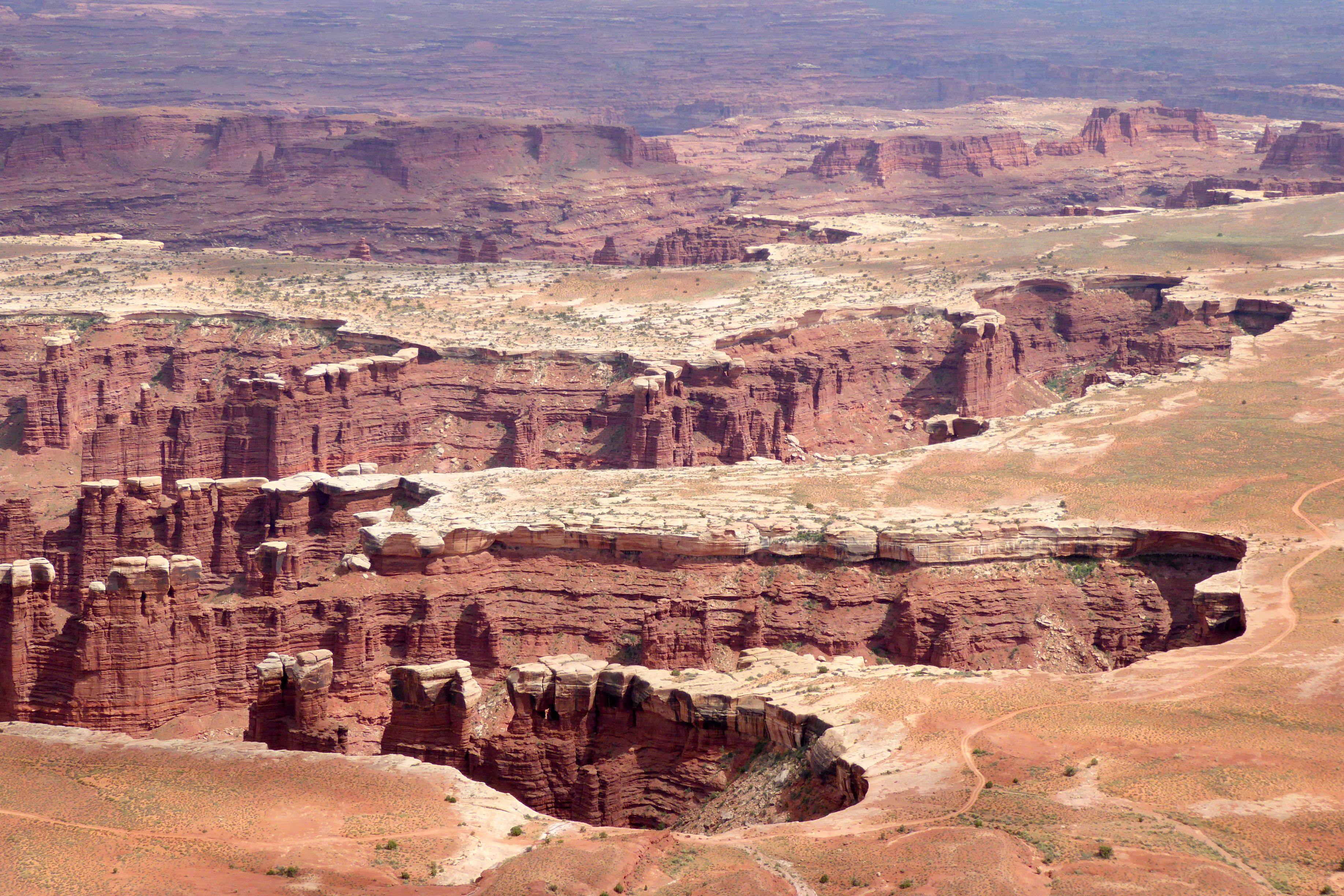
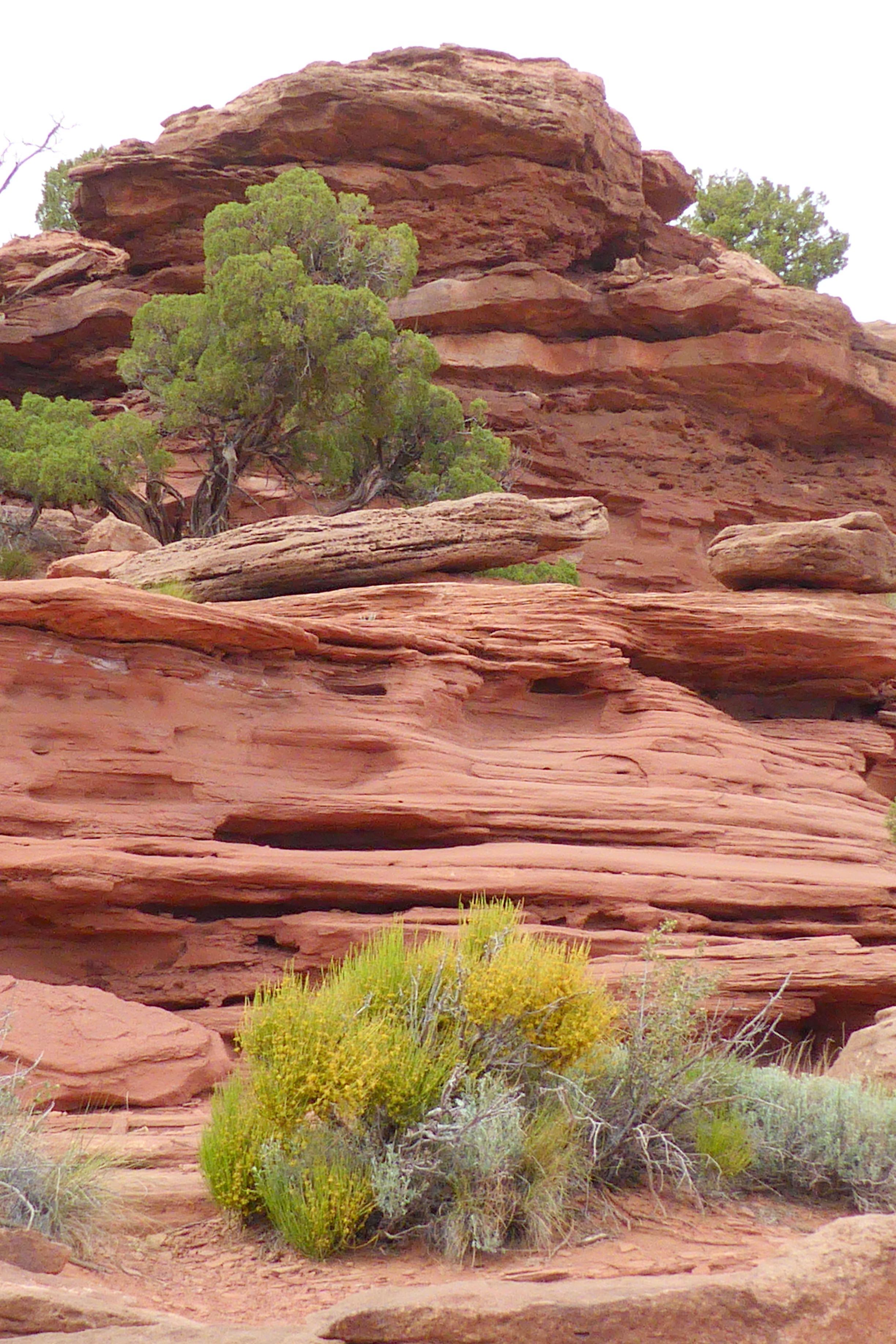
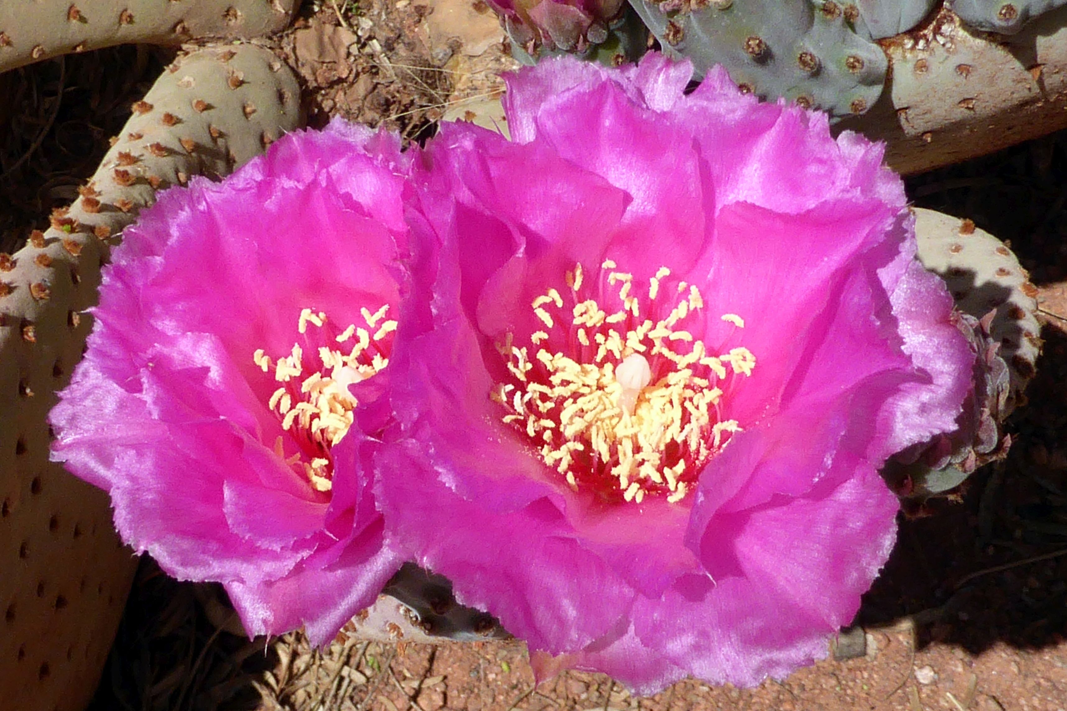
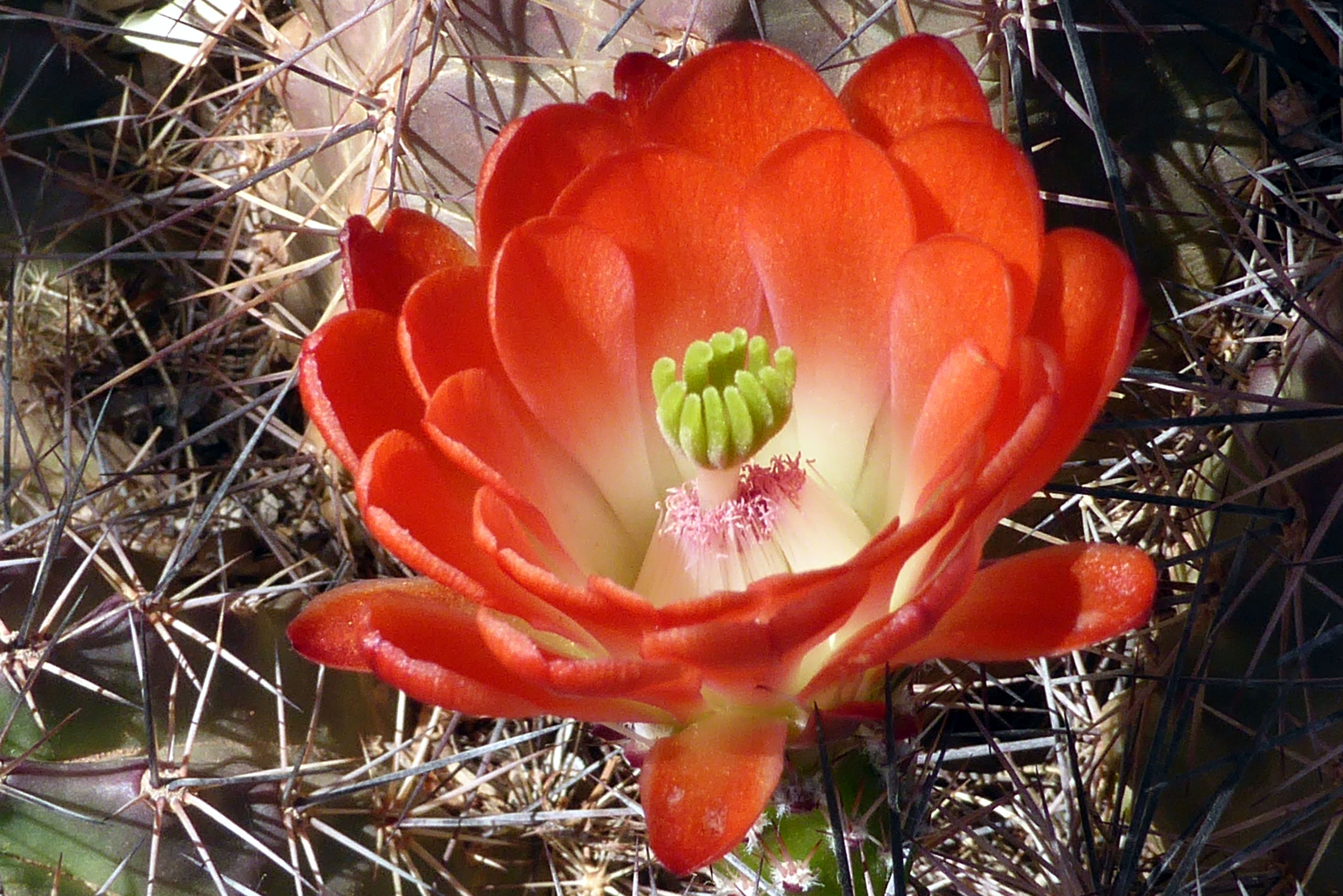
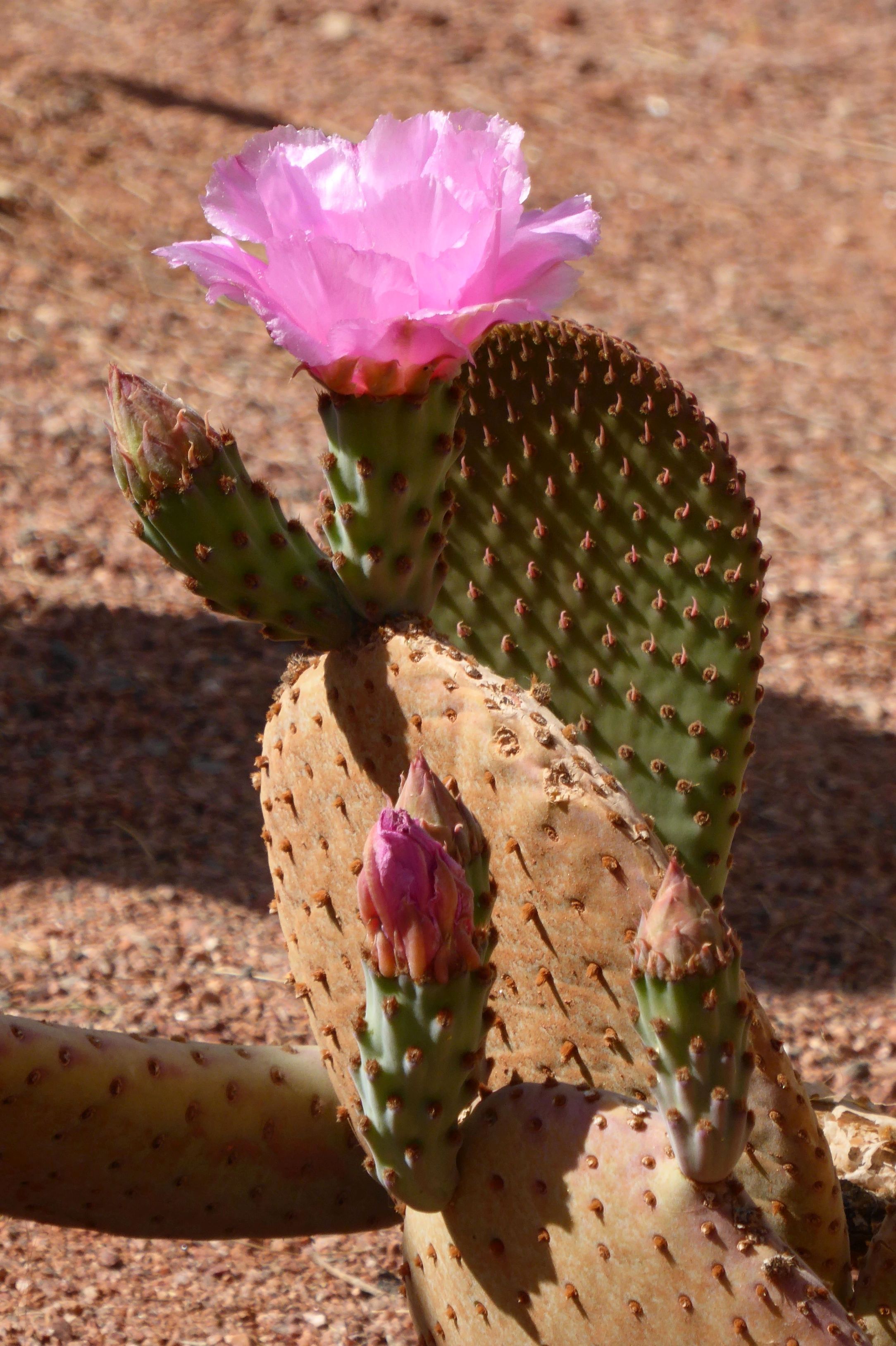
Dead Horse Point State Park was our next stop; and, yes, the “dead horse” was delightful! The park gets its name from a rock formation that looks like a horse, when viewed from up above at a distance. We took in the spectacular views from the visitor center, which had an attractive walking path with beautiful blooming cacti and trees all around.
Can you see the horse? It’s a profile, and the ear is in the upper left quadrant.
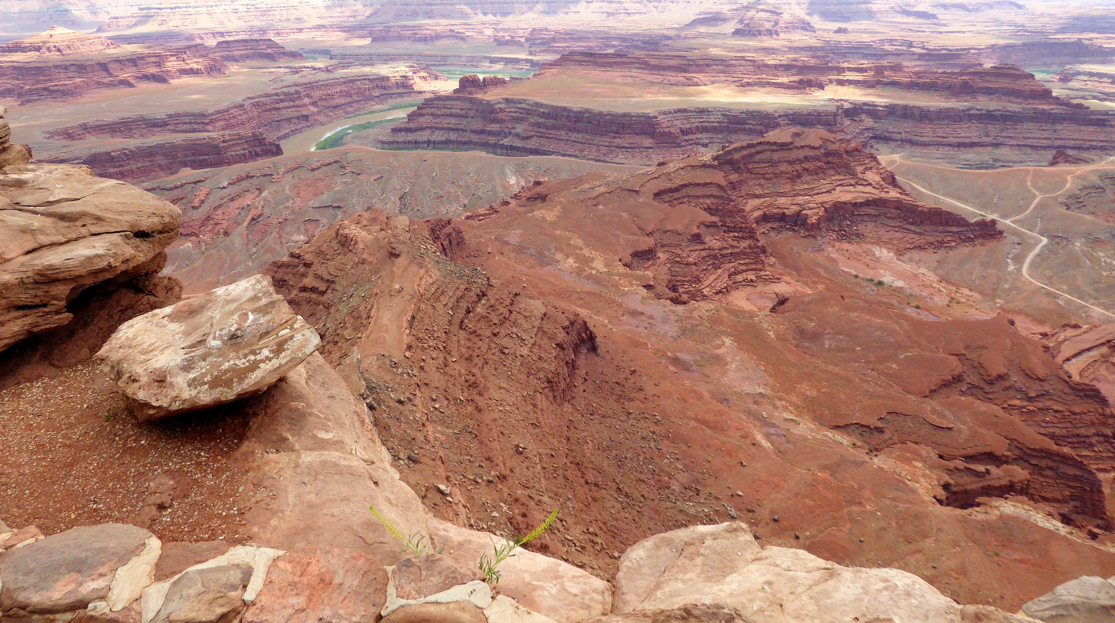
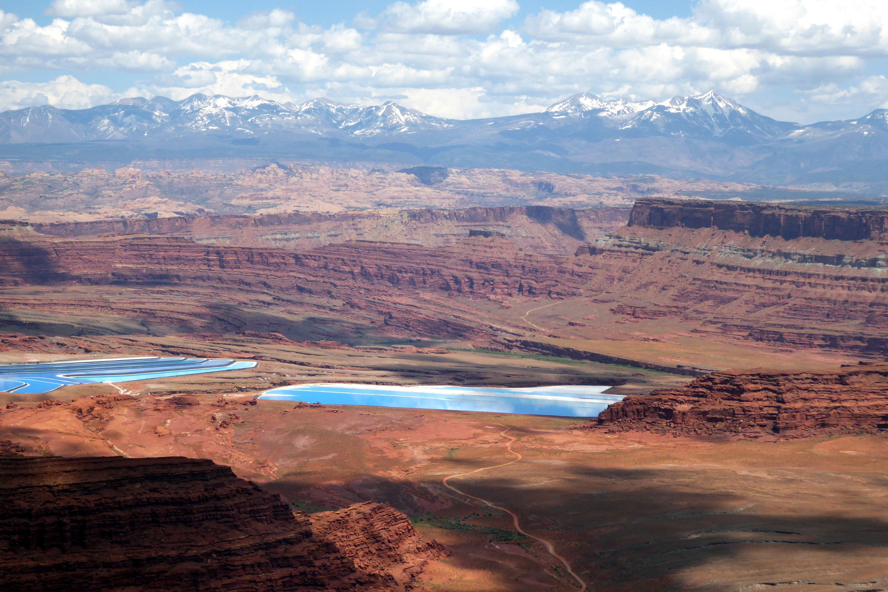
On a clear day, the visibility from the viewpoint can reach nearly 100 miles. It was hazy off in the distance, but we could see snow on the mountain tops. There were also a couple of bright blue pools that seemed completely out of place. They were solar evaporation ponds for a mine owned by Intrepid Potash, Inc. Potash is potassium chloride, a salt found in the Paradox Formation. Salt deposited from ancient seas made up this formation as it evaporated and was buried by other sediments.
Off in the distance, you can see the bright blue pools.
Water is pumped down into the formation to dissolve the salt. This salt water is then pumped into the shallow, vinyl-lined ponds. A blue dye is added to speed up evaporation.
Finally, twenty-ton scrapers, guided by lasers, harvest the dry salt. A local refinery transforms this concentrated form of potassium chloride into plant fertilizer.
I was truly baffled, seeing this in the middle of a state park. I didn’t know what to think…
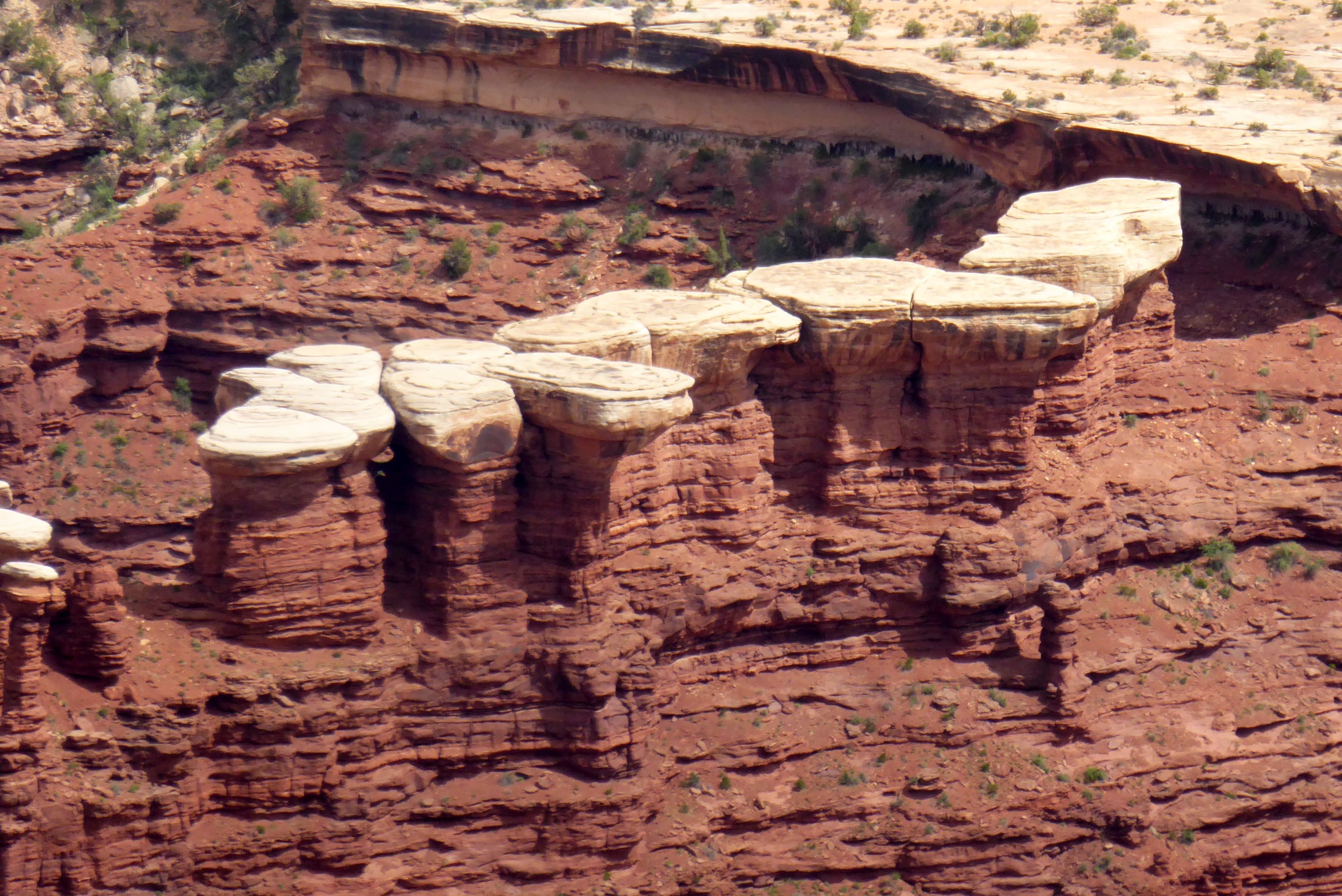
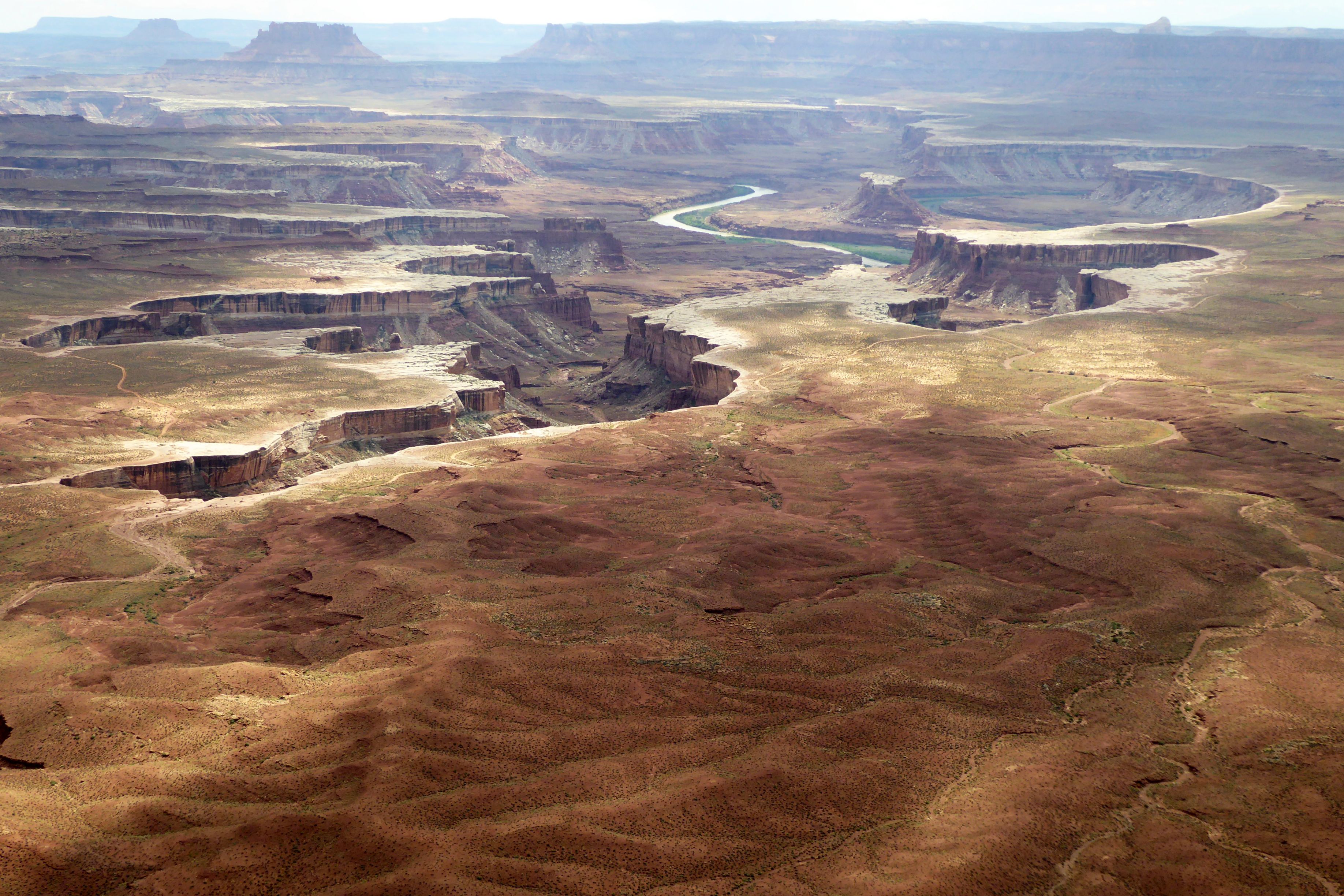
Green River Overlook was our last stop in Canyonlands. At 6,000 feet elevation, it provided a great perspective of Green River down below – especially since we had walked along the riverbank earlier in the day.
We continued on to Moab, our base for the next two nights. Moab Diner had good ratings on Trip Advisor, and I enjoyed a tasty, fresh salad there; so, it deserves a shout-out and my last photo of the day.
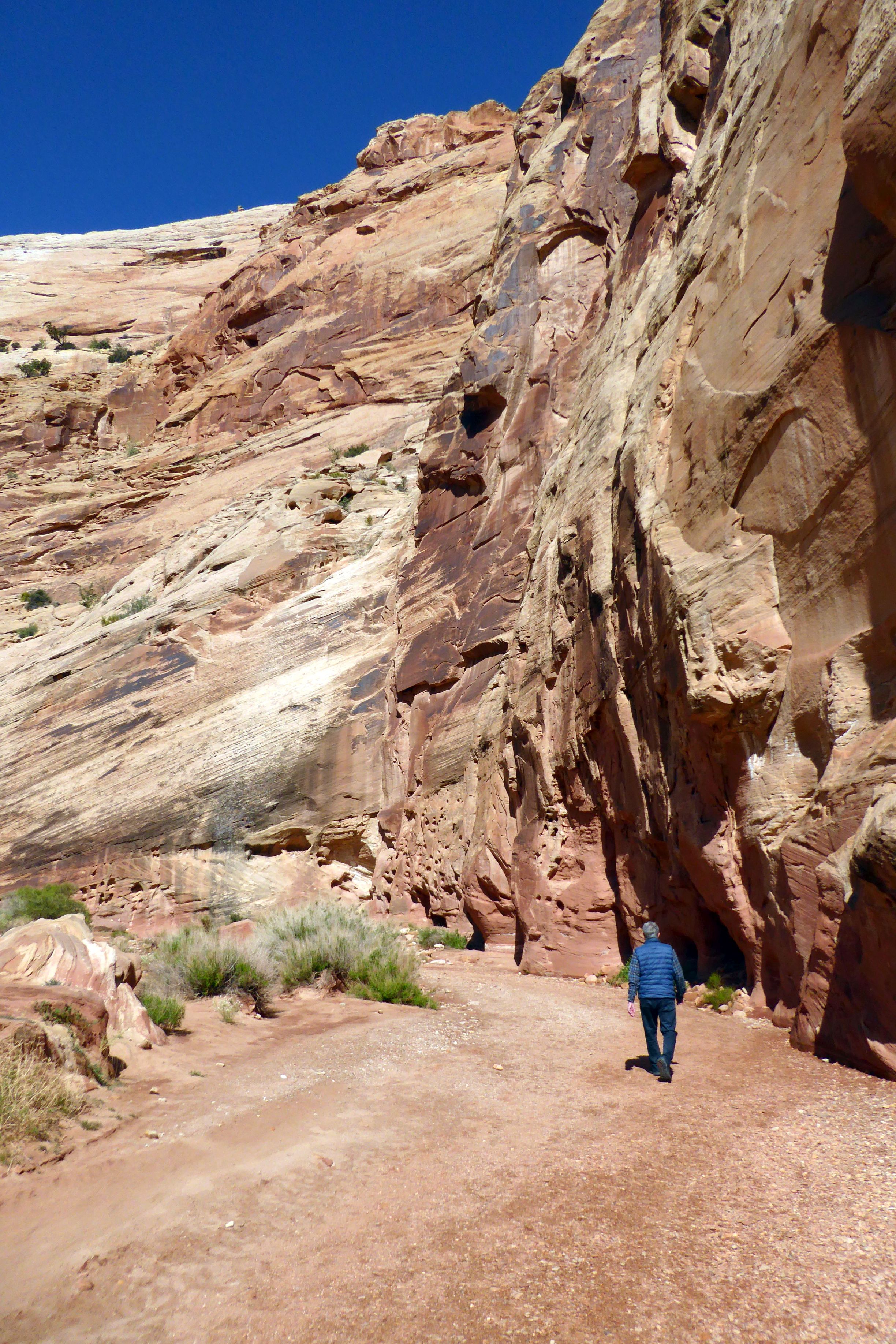
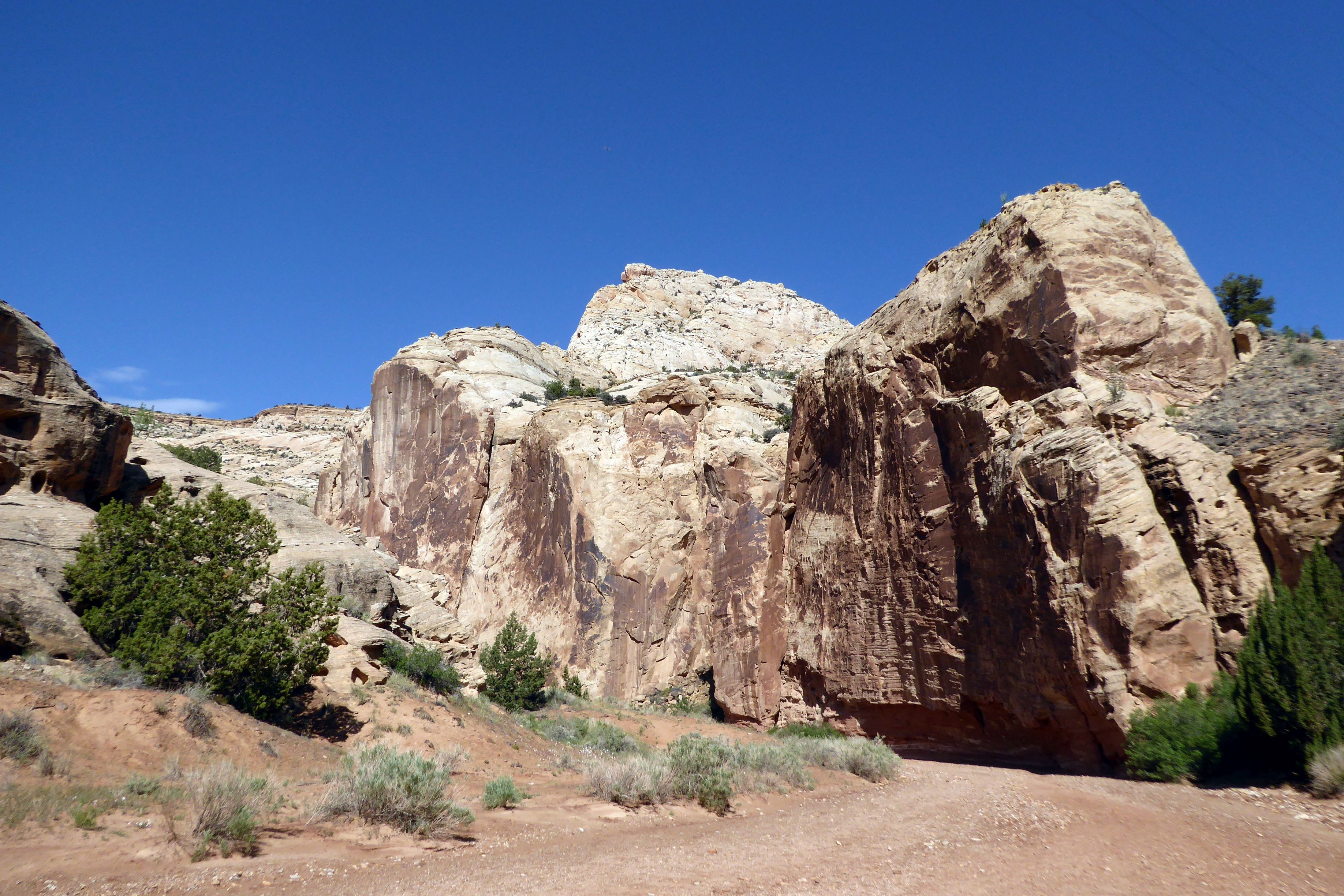
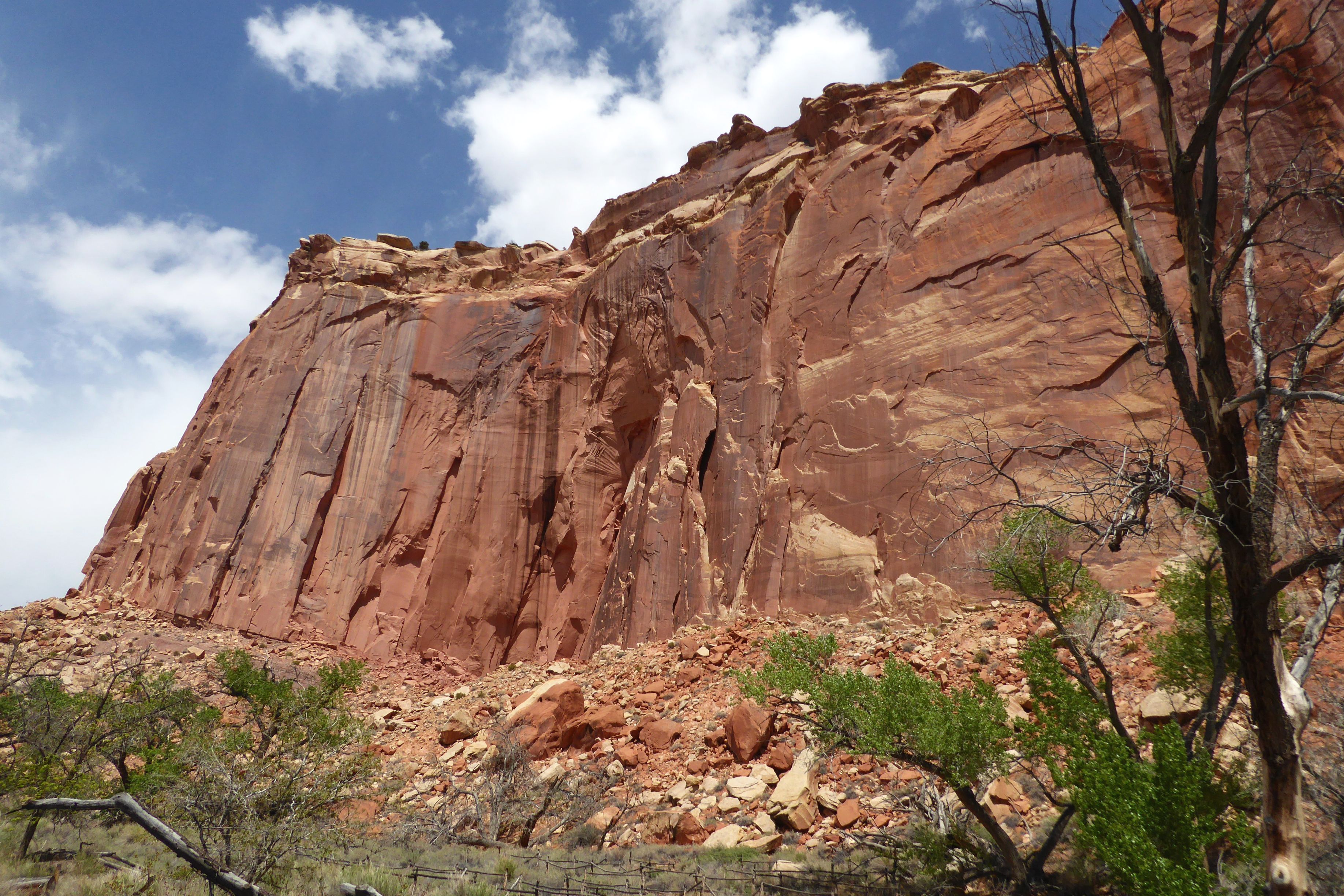
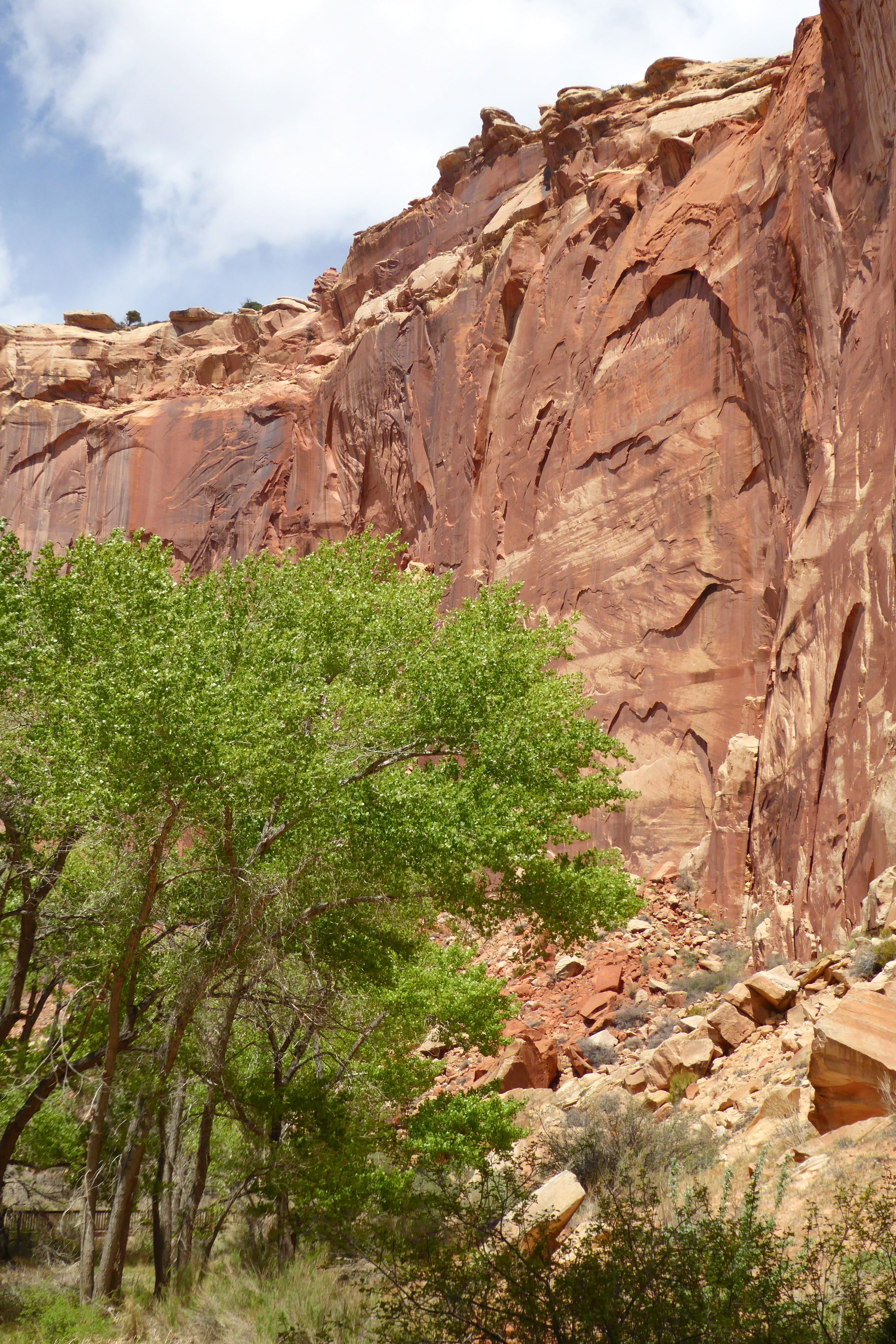
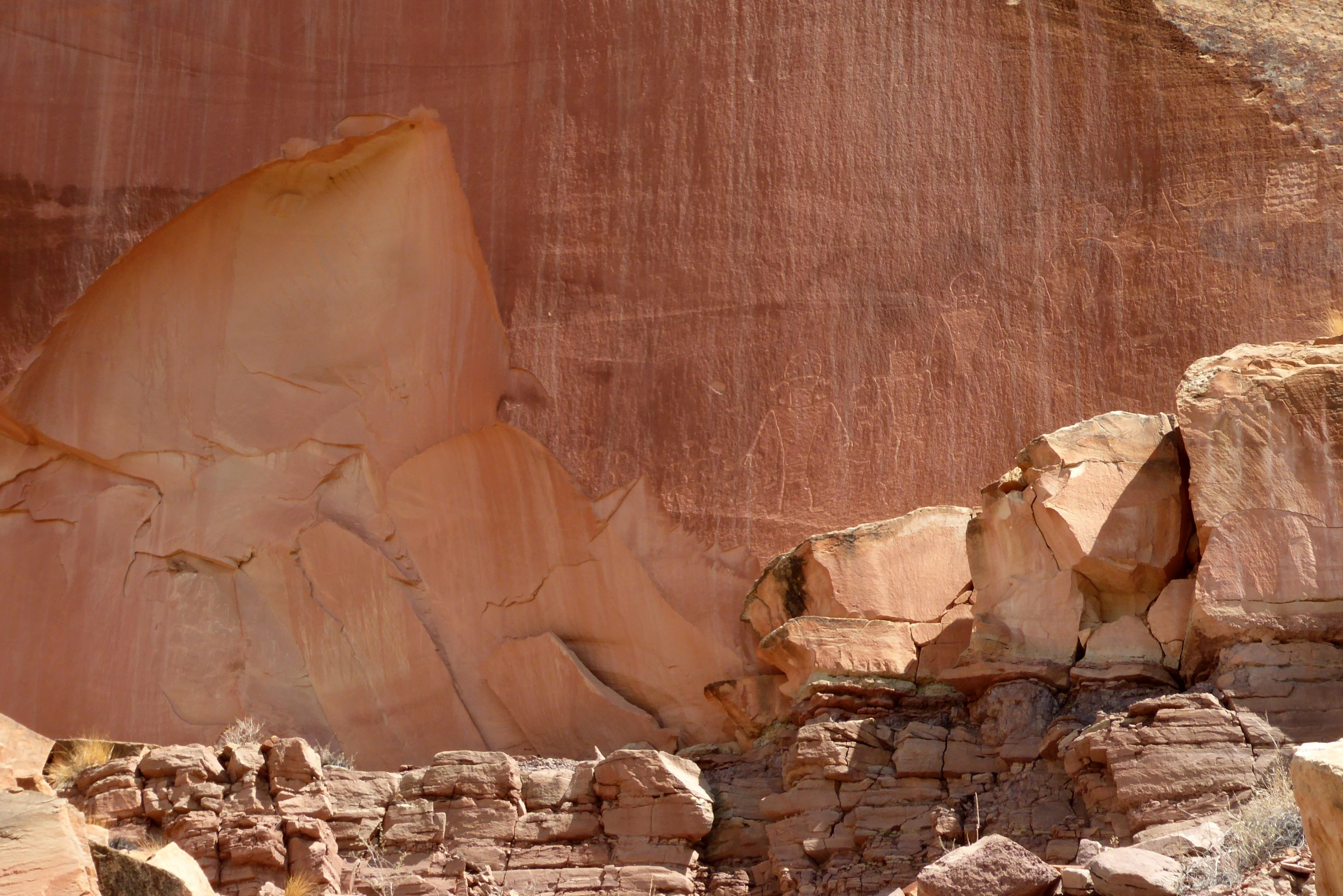
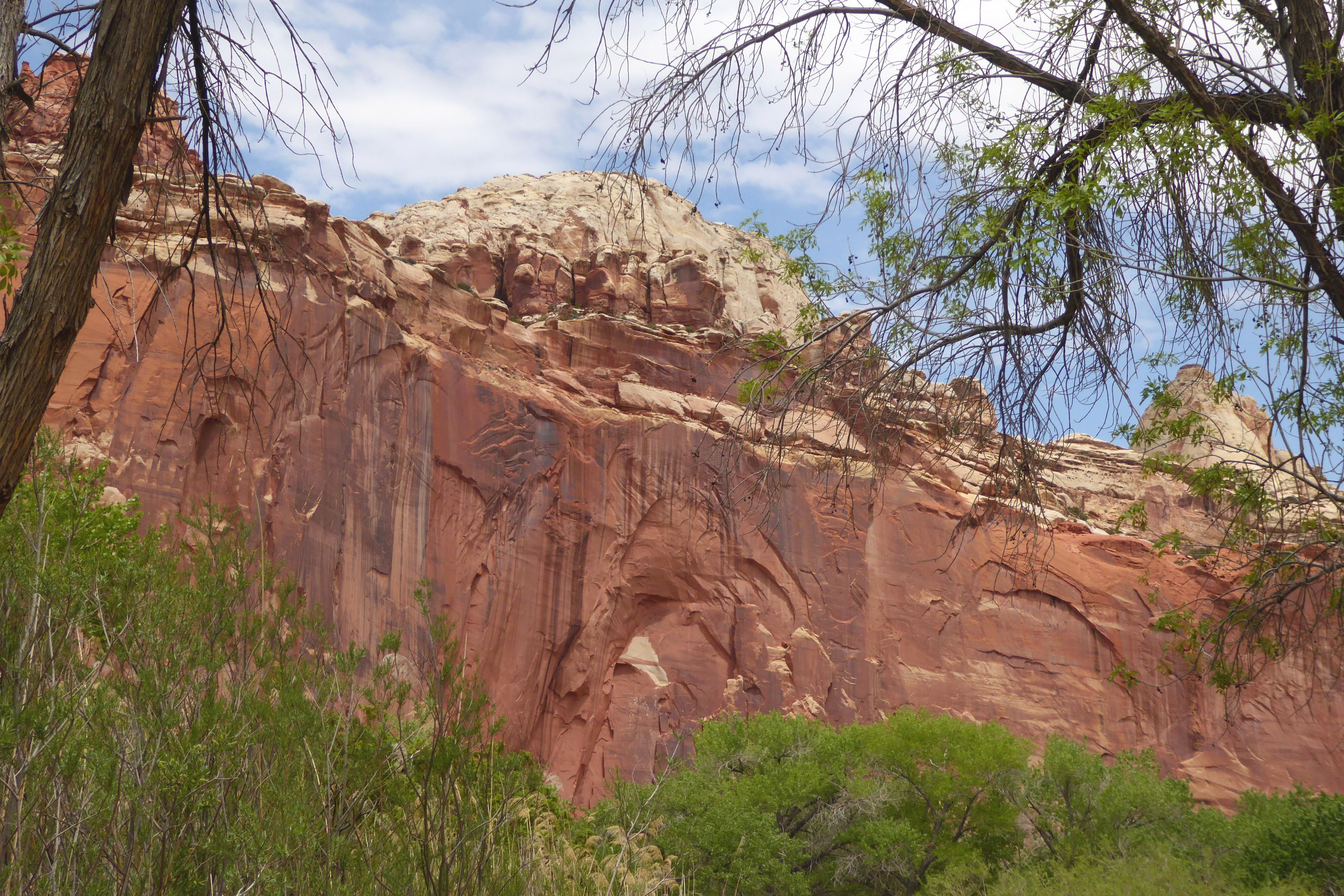
Following a morning greeting (and feeding) to my new friend in back of our hotel, we were off for an easy hike in Grand Wash at Capitol Reef National Park. The gorge cuts through Waterpocket Fold, a nearly 100-mile-long fold in the Earth’s surface. This uplift contains numerous eroded basins or pockets that hold rainwater and snowmelt.
Early pioneers provided the park’s namesake — “capitol” for the white domes of Navajo Sandstone that resemble the capitol dome in Washington, D.C., and “reef” for the rocky cliffs that are a barrier to travel, like an ocean reef.
We hiked through the Grand Wash Narrows portion, where we were surrounded by massive rock formations. The only way to grasp the size was to give it some sense of scale. Thanks, Bruce!
(For all pictures, click on the image to see full screen view.)
That’s Bruce, way off in the distance.
Since Bruce and I were the fastest walkers in the group, we were able to get far ahead, which, because of time constraints, was to our advantage. We really wanted to see the Narrows portion of the basin, and some of our group didn’t make it that far before having to turn back. Most of the time, we were by ourselves, taking in the beauty of the colors and textures all around us. It was such a peaceful and beautiful walk.
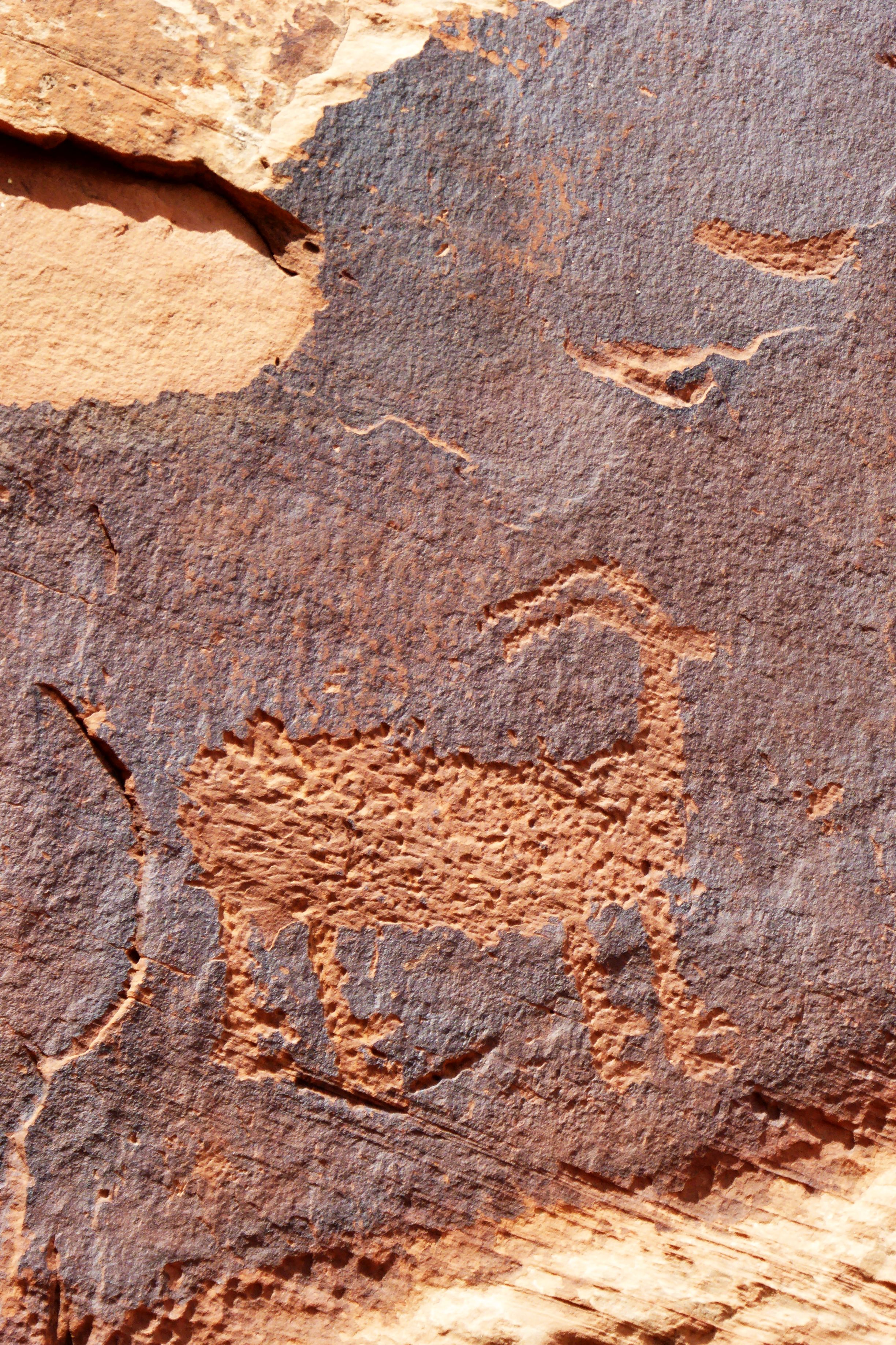
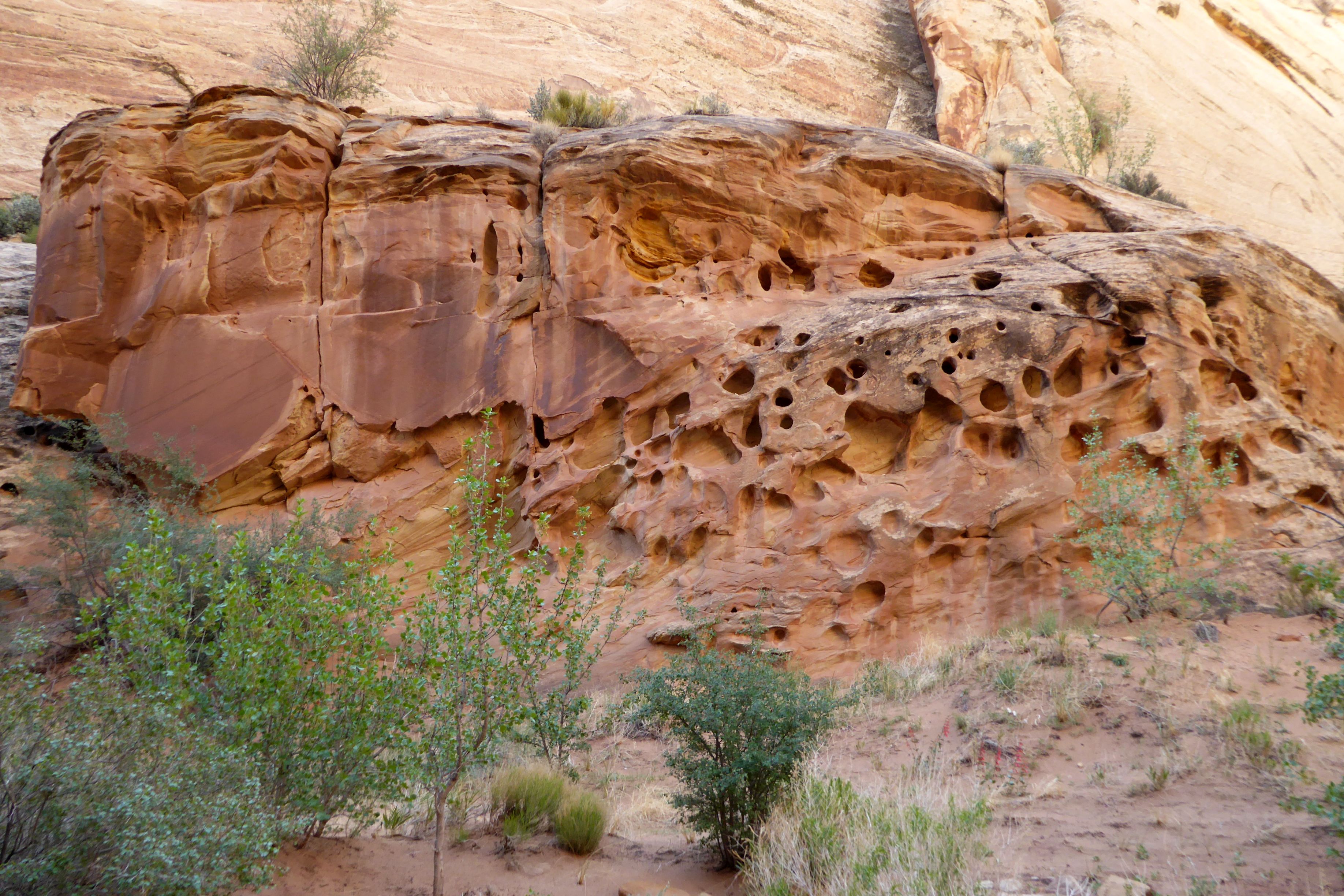
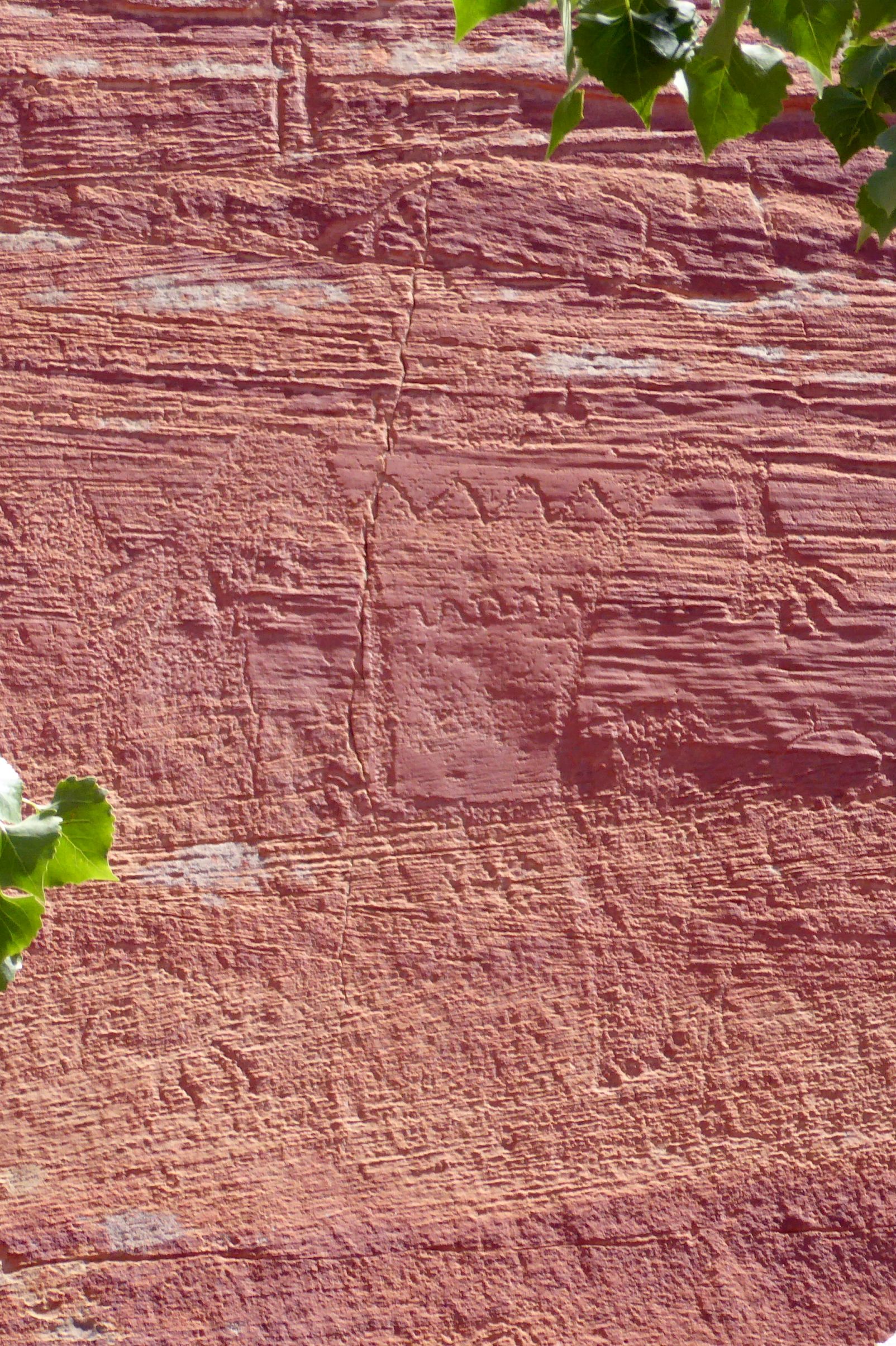
We also visited Petroglyph Panel to view ancient rock art attributed to the Fremont Culture, which existed in this area of Utah from approximately 300-1300 C.E. (Common Era).
There are petroglyphs of human figures in a diagonal, above the jagged rocks, going up towards the right corner of the photo.
We had lunch in the park near the Capitol Reef Visitors Center, and I went for a walk afterward.
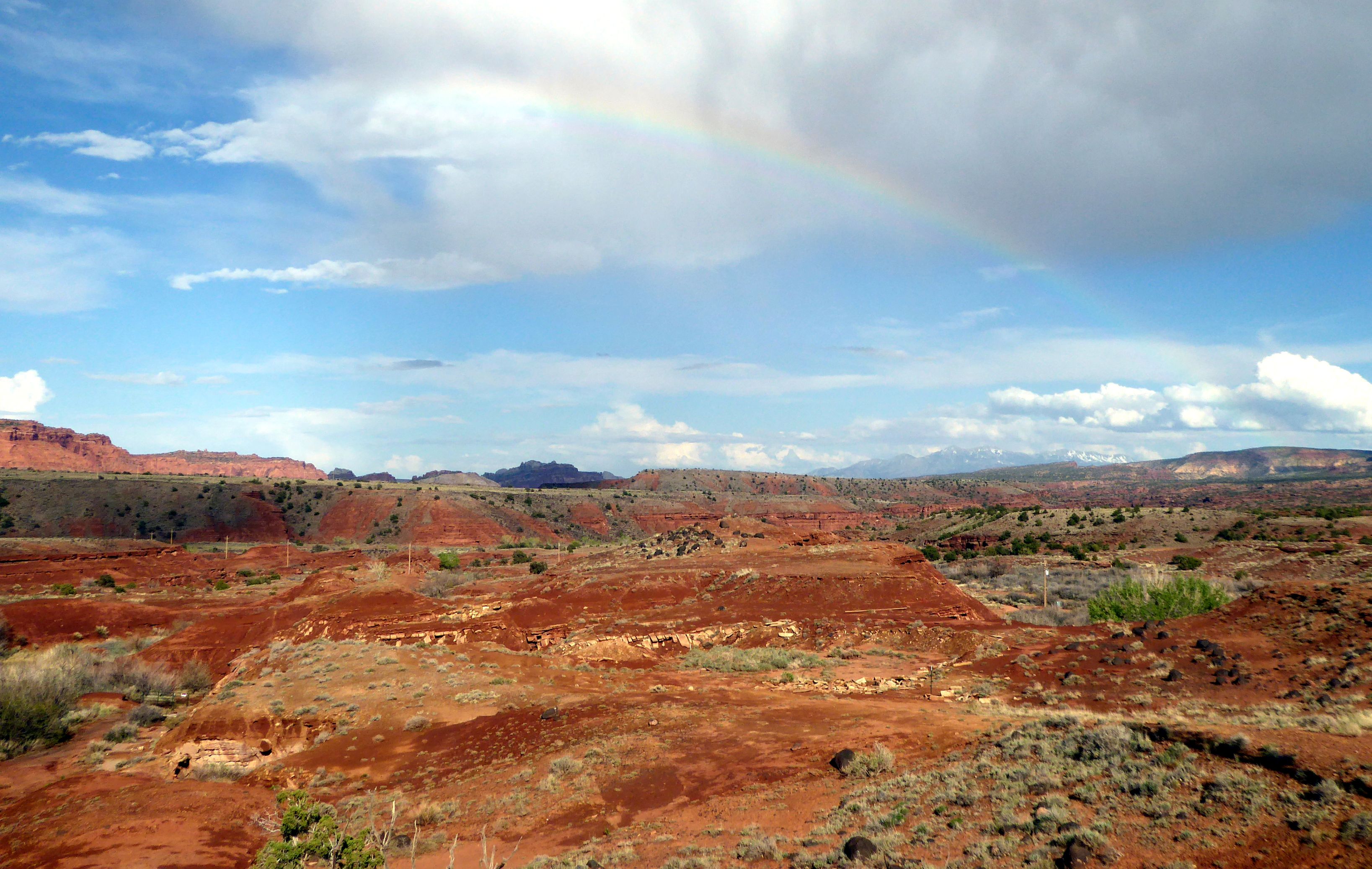
Fortunately, the blue skies stayed with us until we were on the bus heading back. Our good weather luck was with us once again!
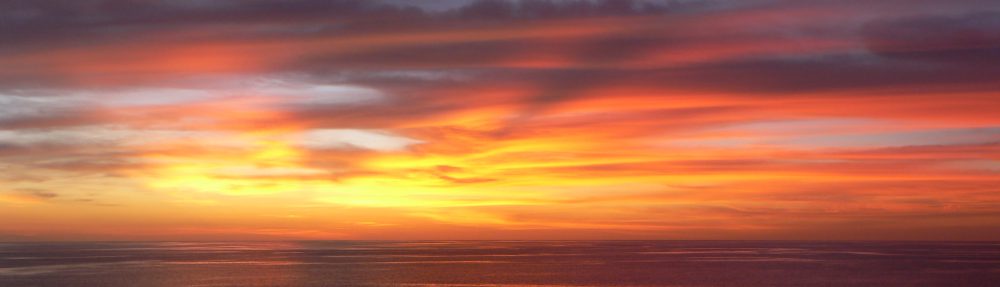
This was shot from the bus window on the way back to Torrey.A beautiful rainbow to end a beautiful day!
Coming up next: Delightful Dead Horse Point State Park & Colorful Canyonlands National Park
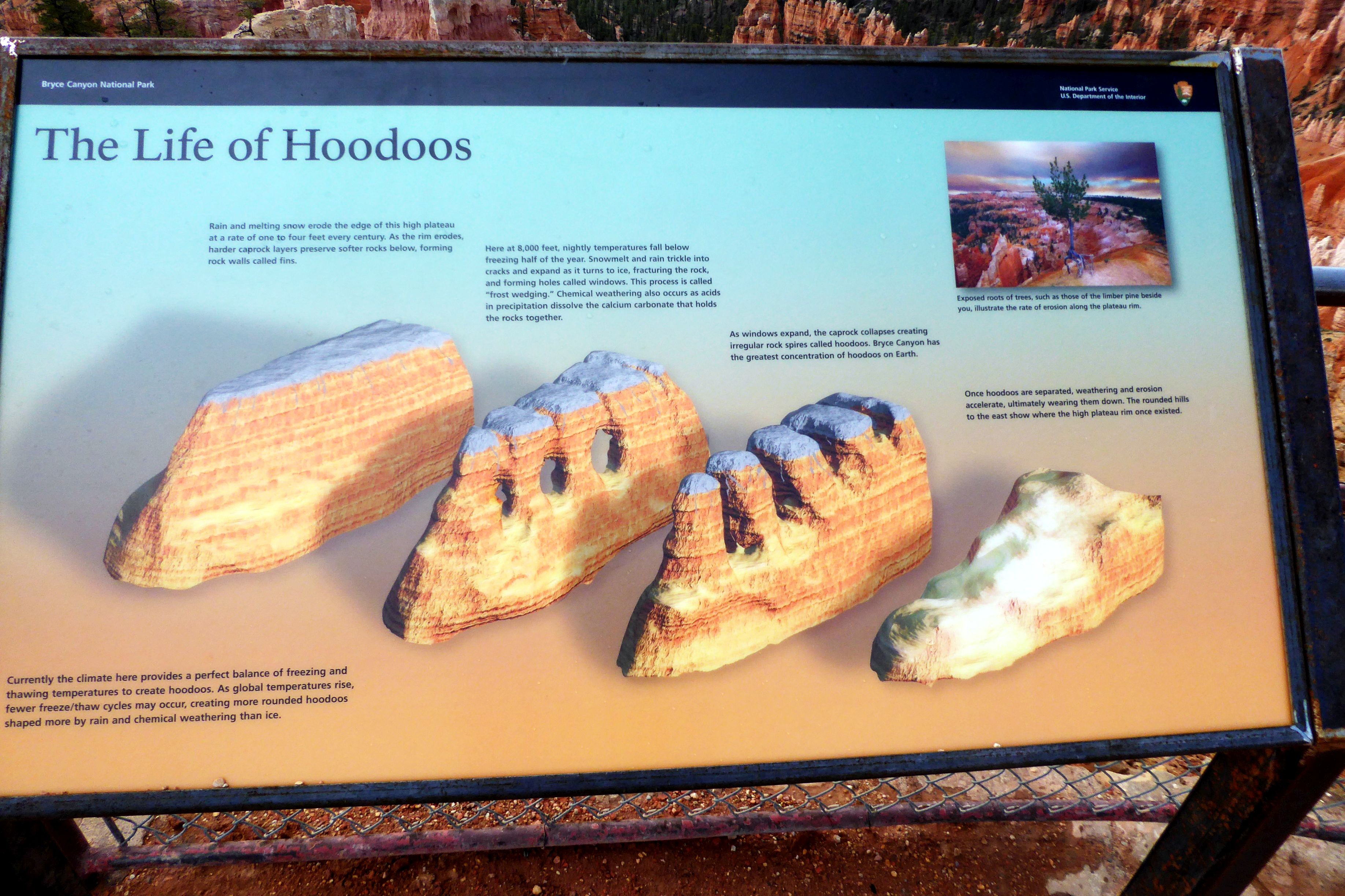
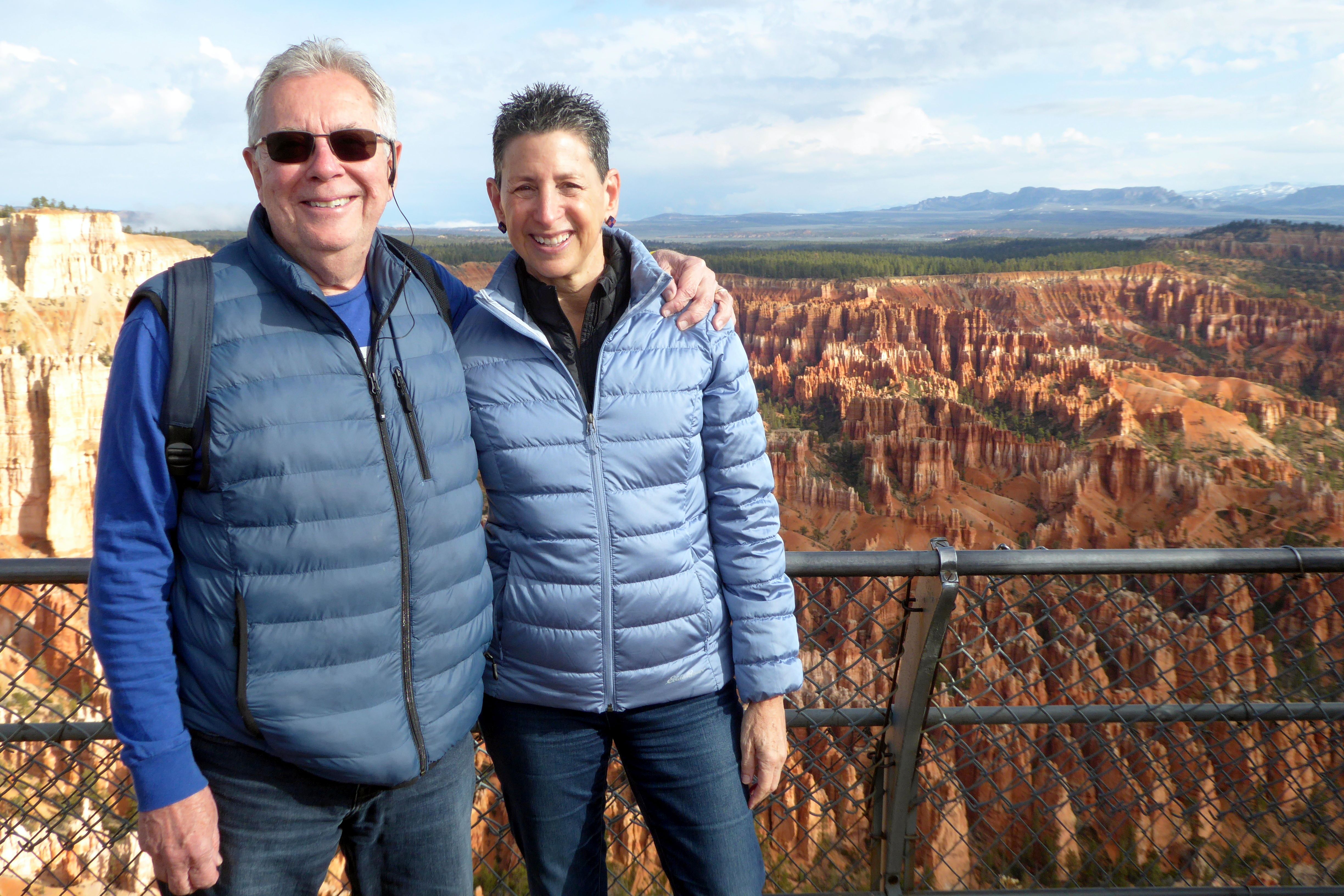
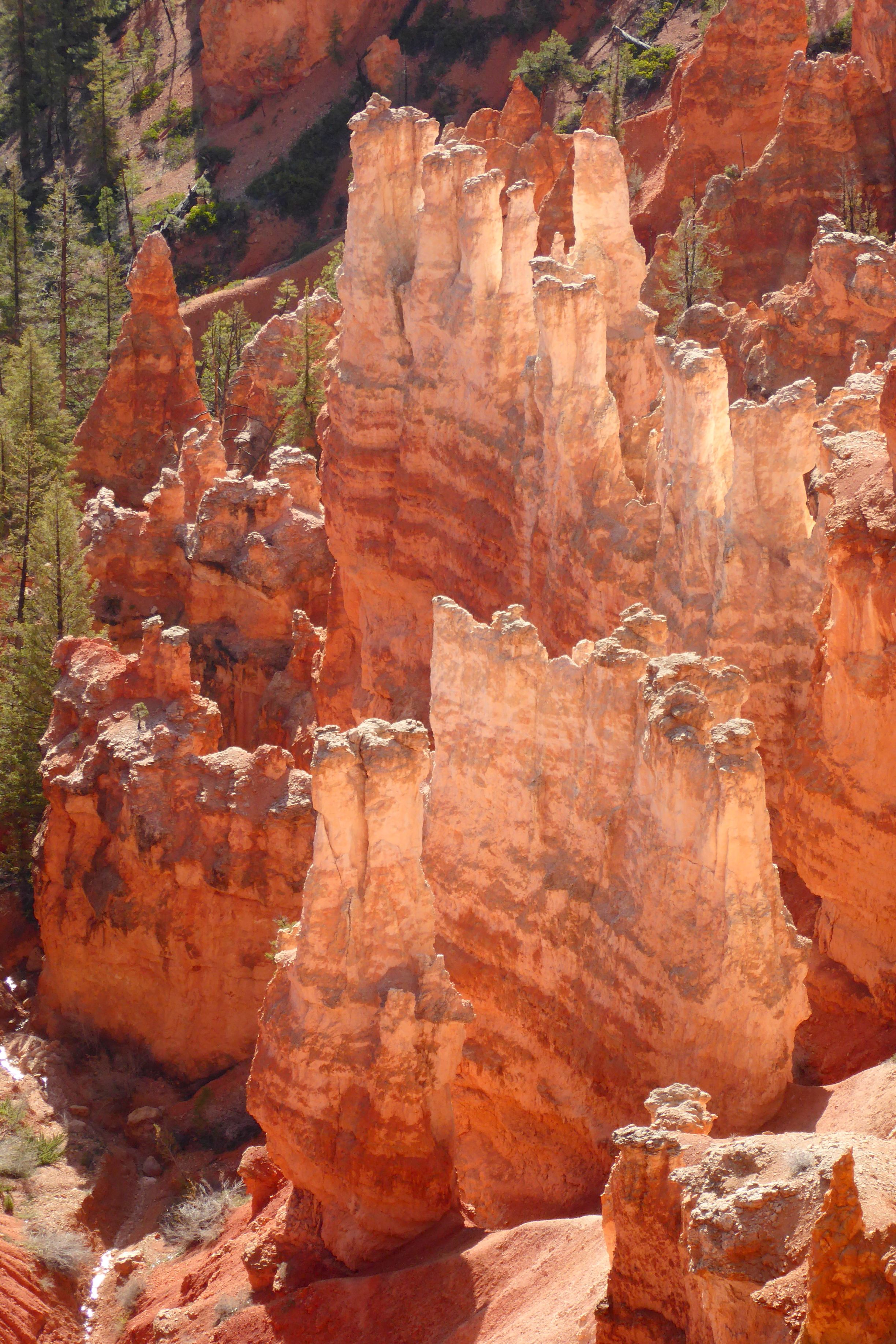
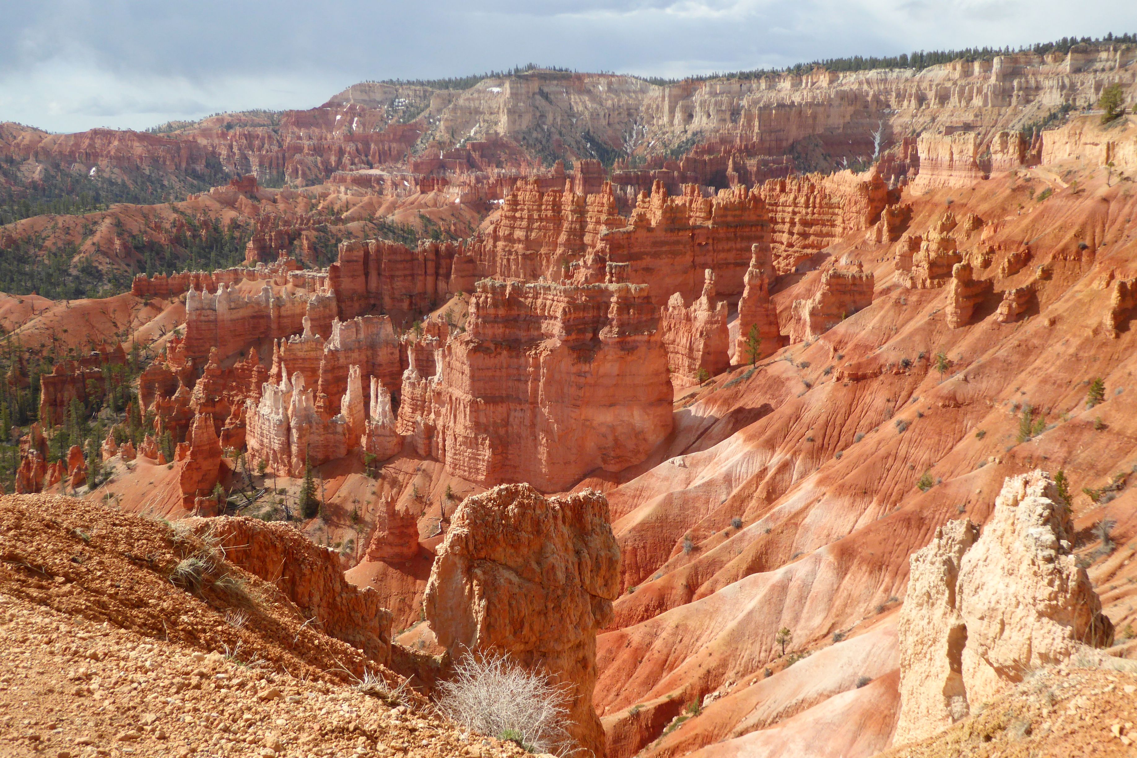
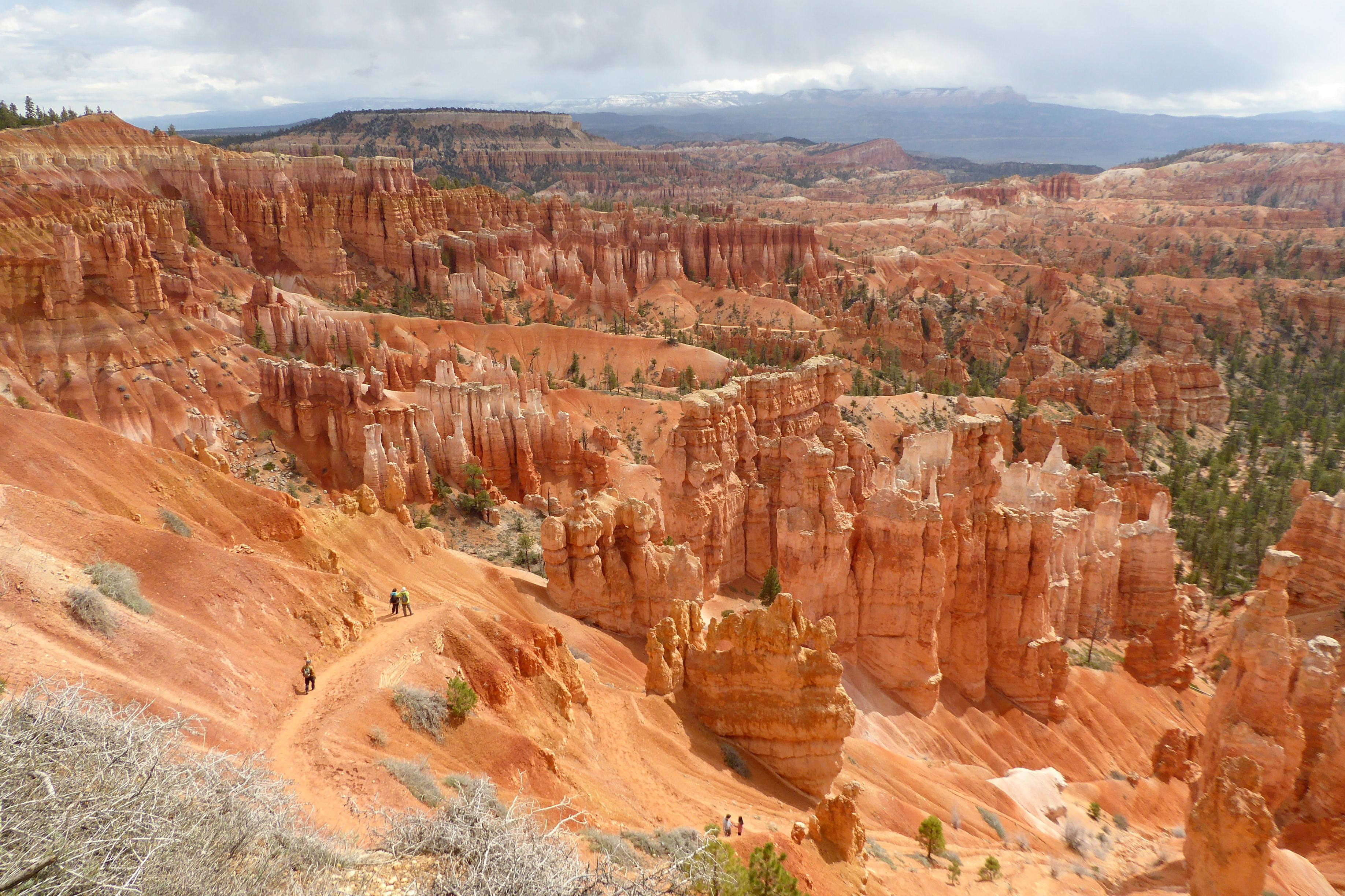
We were really looking forward to seeing Bryce Canyon National Park in person after seeing so many beautiful photos of its colorful and bizarre-looking rock formations called “hoodoos.” I can’t even type that word without immediately hearing Paul Simon’s, “Love Me Like a Rock” in my head (“Who-do, who-do you think you’re fooling?”). Bruce and I spontaneously broke out with that song when we saw hoodoos during our Canadian Rockies trip, and it happened again in Bryce. We just can’t help ourselves.
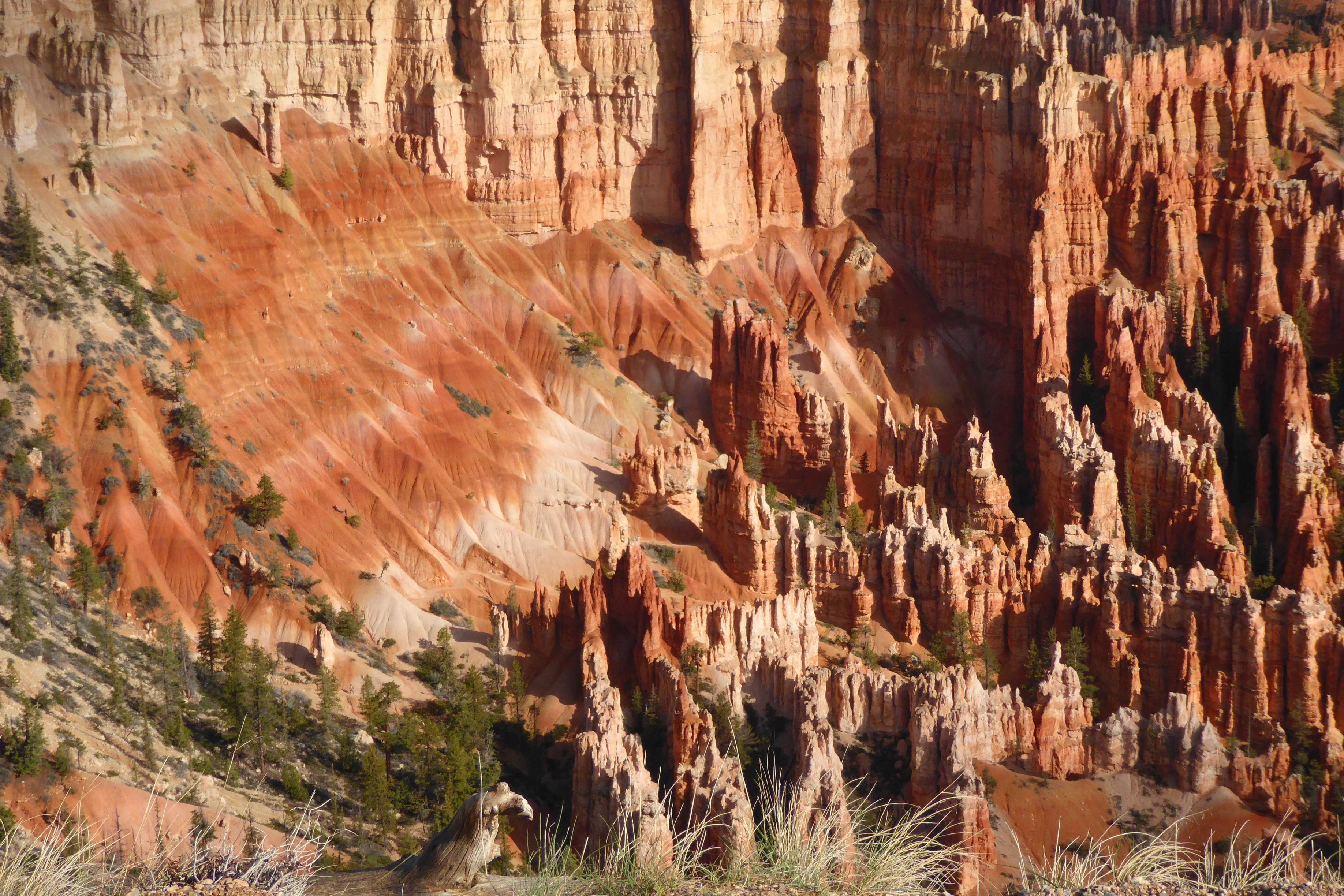
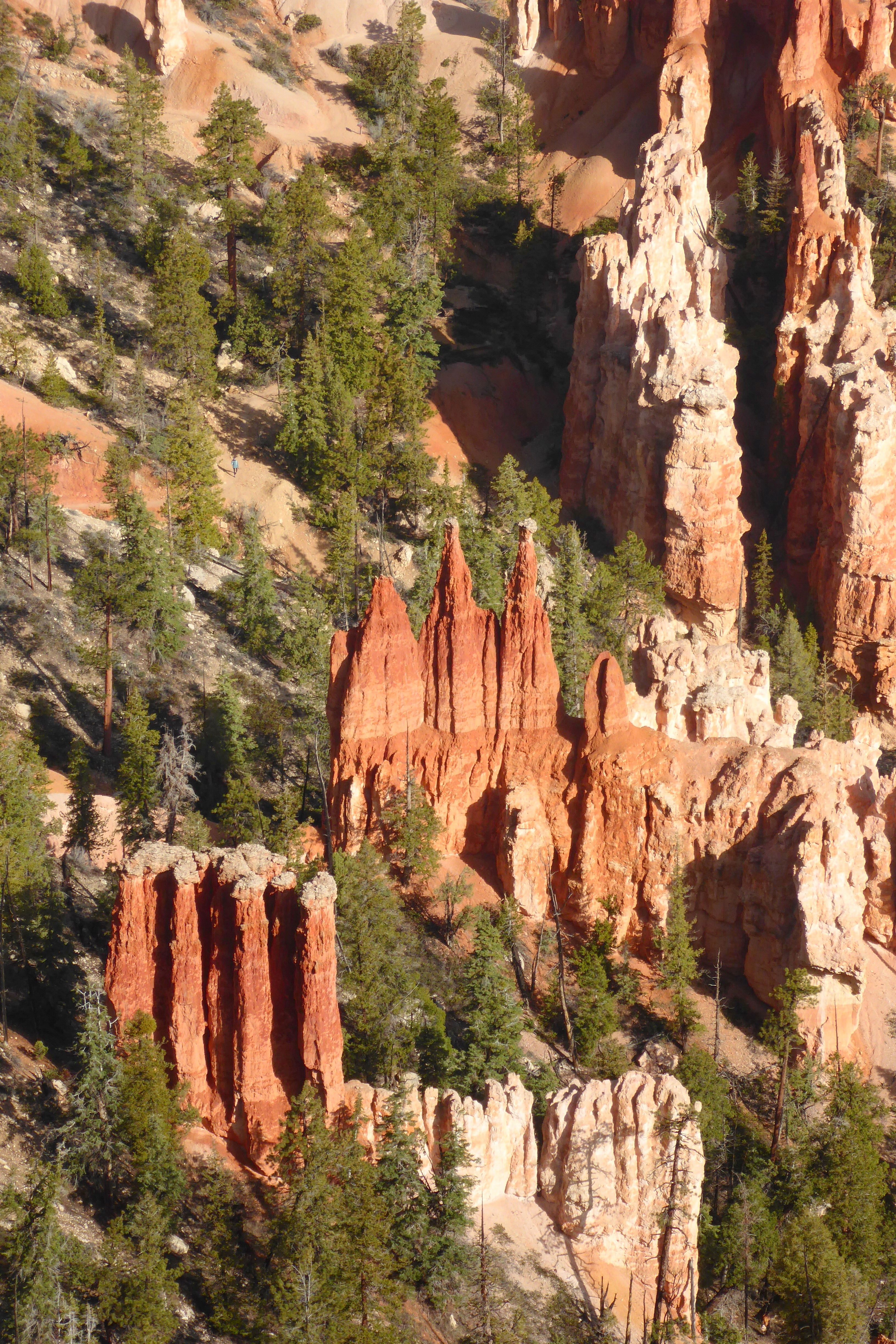
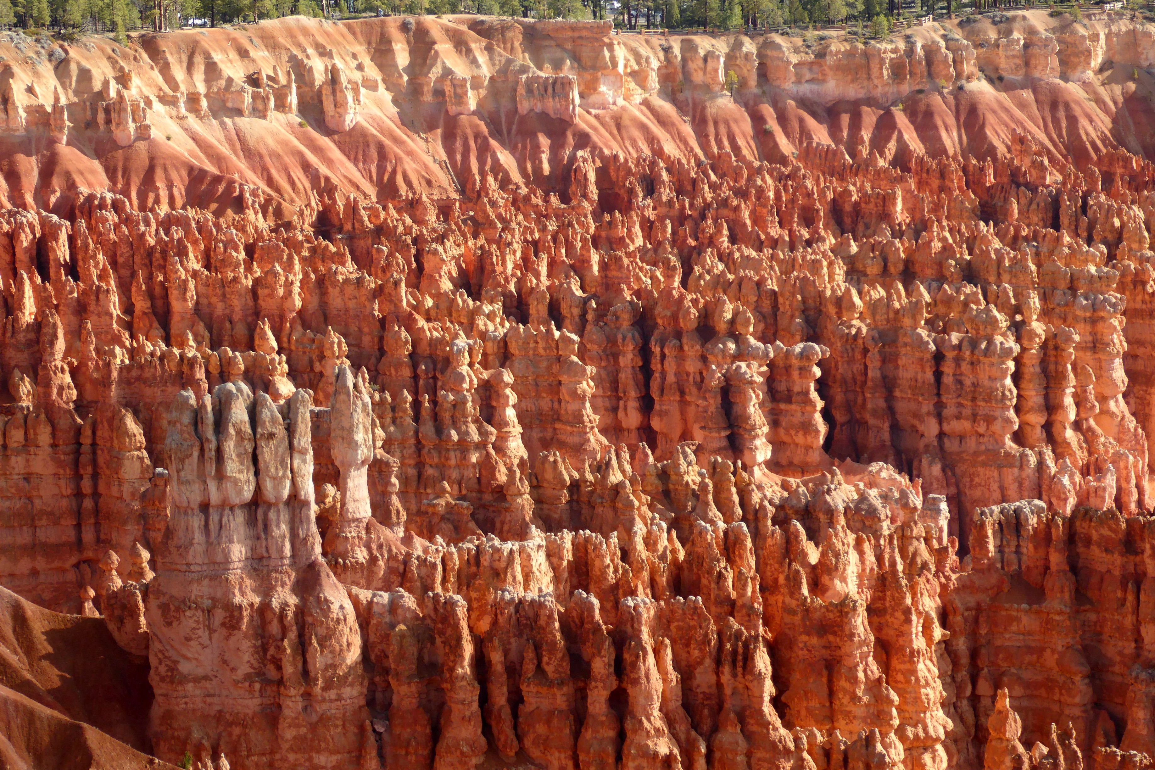
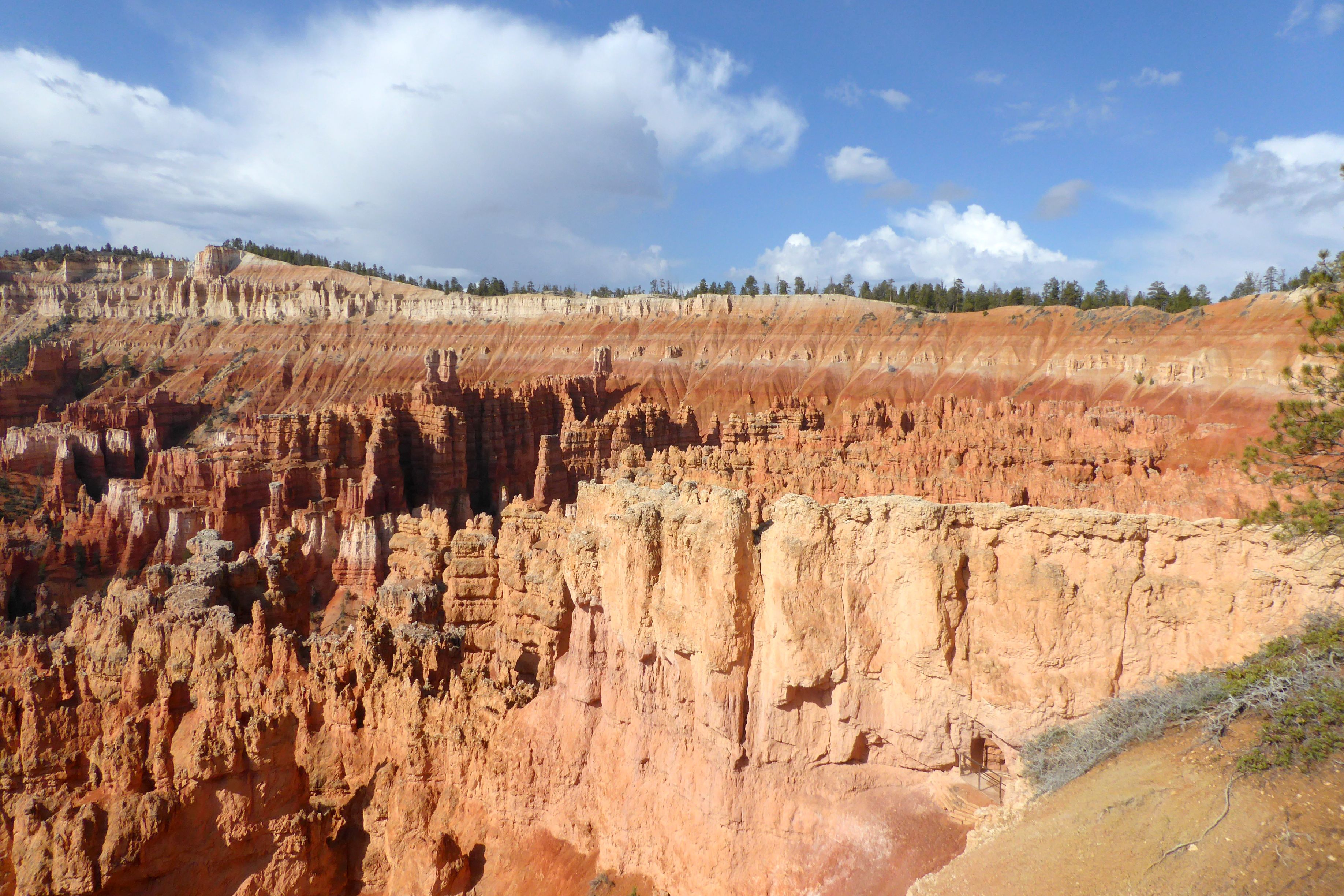
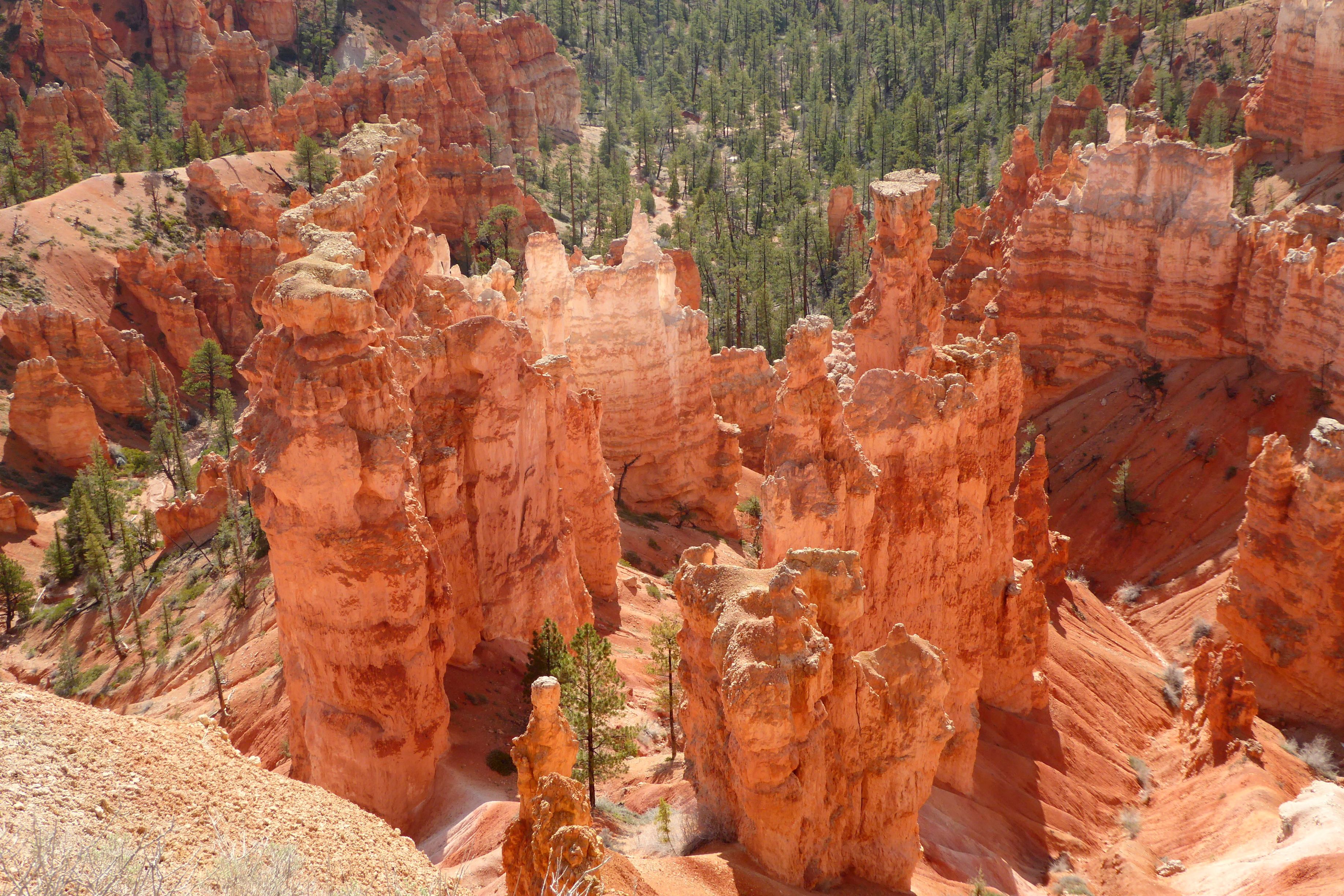
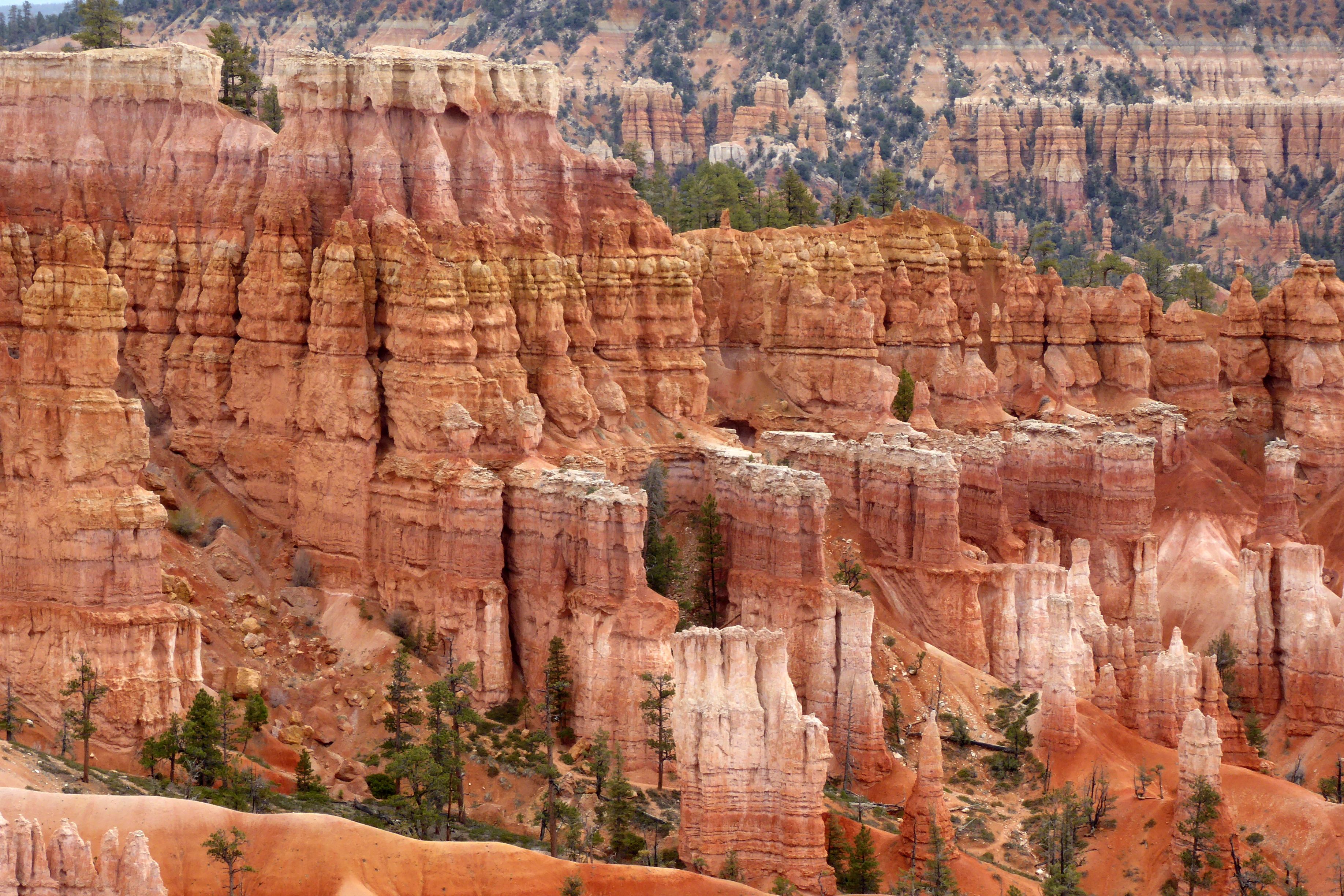
You’ve got to see it to believe it! It truly is an amazing sight, standing at the top of Bryce’s Amphitheaterand looking down into a bowl of hoodoos! These irregular-shaped rock spires consist of relatively soft rock topped by harder, less easily eroded stone that protects each column from the elements. These spires range in size from the height of an average human to heights exceeding a 10-story building.
Knowing we would be at high elevation during this trip, I came prepared, so I wouldn’t have a repeat of 2019’s huffing-and-puffing at the National Senior Games, in Albuquerque, New Mexico, elevation 5,312 feet. Competing in the 200 Yard Butterfly and 400 Yard Individual Medley, my two most difficult races, was an exercise in futility. Never had I clung to the walls in the middle of a “race” like that before; it was usually reserved for the end, after the clock had stopped. It wasn’t a pretty sight; all of us low-elevation dwellers suffered at that meet, logging in personal worst times.
After the meet concluded, we went to play tourist in Santa Fe, where I attempted a nice, relaxing, recovery workout. During my first lap, I couldn’t even make the turn. I literally clung to the wall to catch my breath—and, I was in the best condition of my life! The 7,198-foot elevation just about killed me.
Fast forward to researching and booking this trip and learning that Bryce Canyon’s elevation is at 8-9,000 feet. I knew I would be in trouble if I wasn’t prepared, so I had an idea: Train with a KN95 mask! After training hard in the pool and doing my dryland workout on deck for 2 to 2-1/2 hours each day, I would put on my mask and head up to the indoor track and hoof it at my fastest walking pace for a mile or more, if I met up with a friend for conversation. (Try walking fast while wearing a KN95 mask AND carrying on a conversation!). I have been doing that six day per week since the beginning of the year, and it made all the difference. Hiking in Bryce was a breeze, and I jogged back up the steep trail to the top with my breath intact. (I’m still walking daily with my KN95’s!)
(For all pictures, click on the image to see full screen view.)
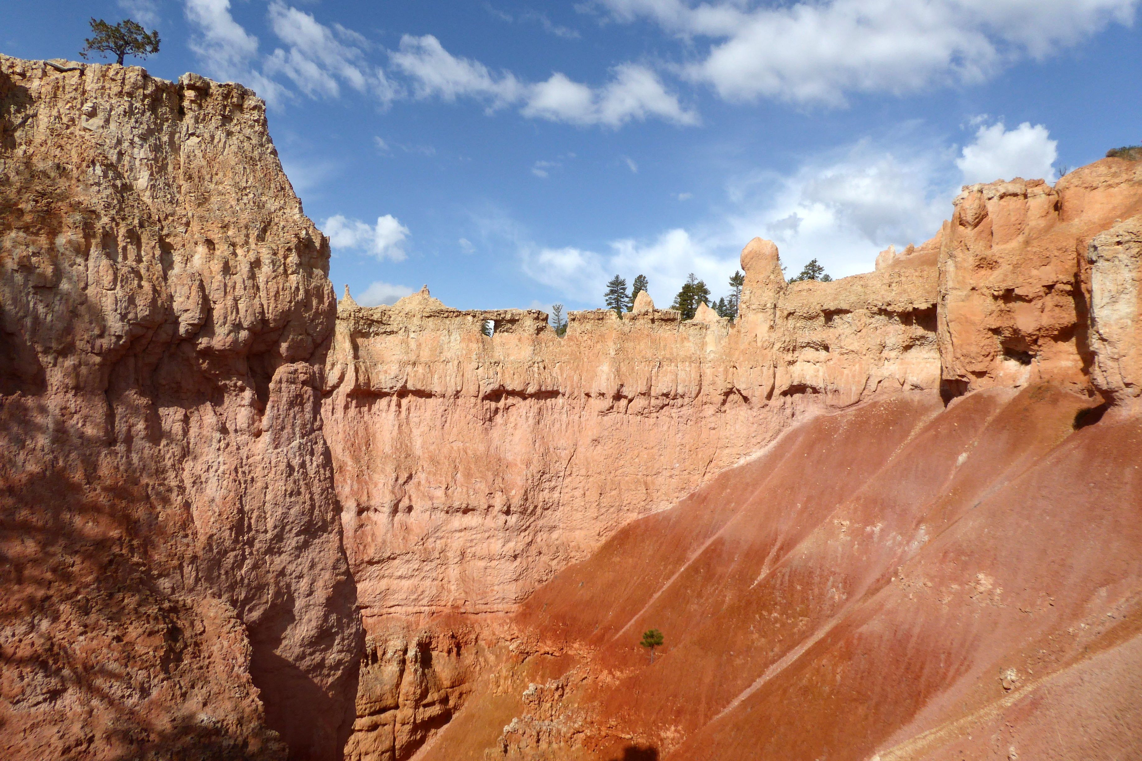
Bryce Point Inspiration Point
View from Sunset Point
Looking out from the other side of Sunset Point
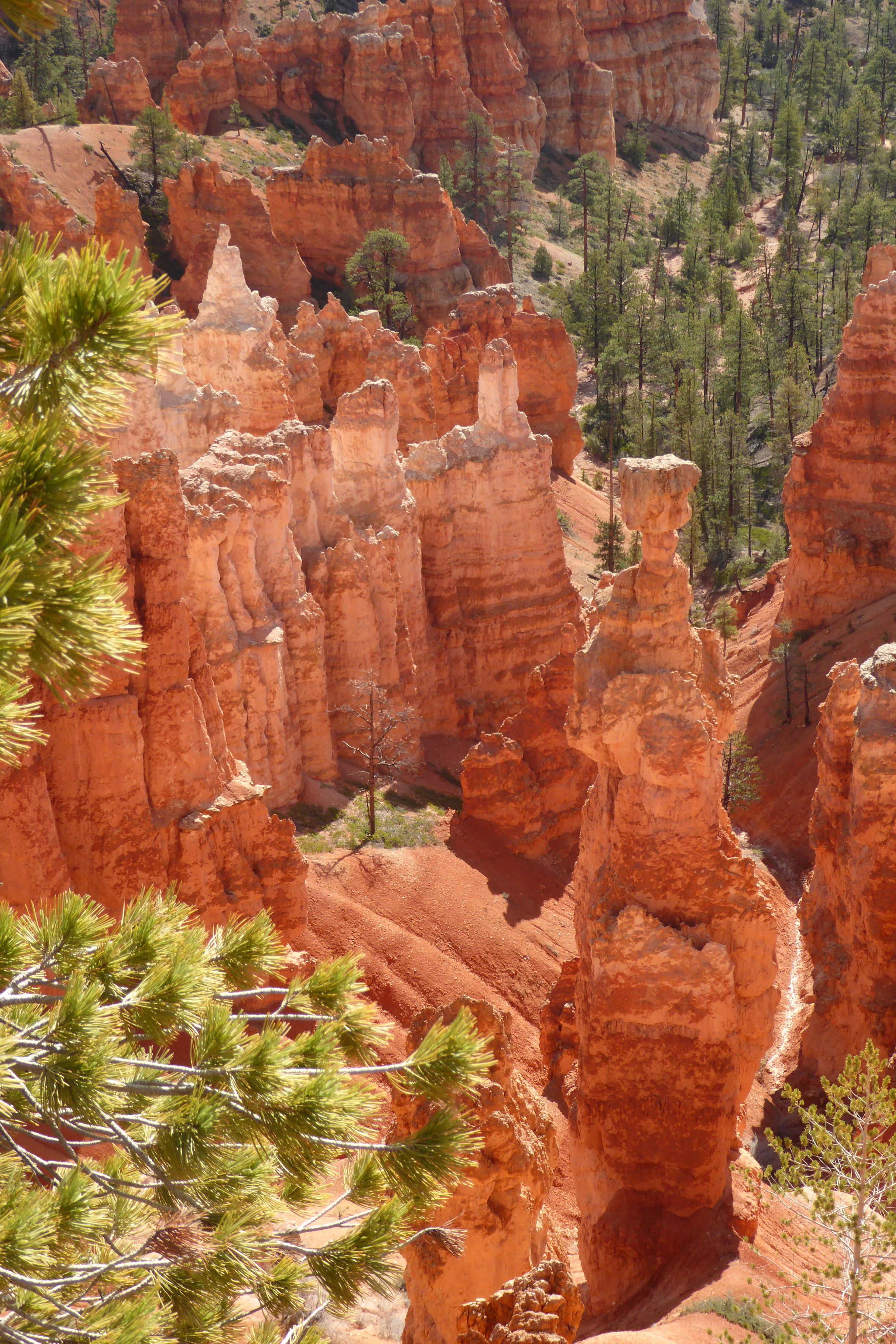
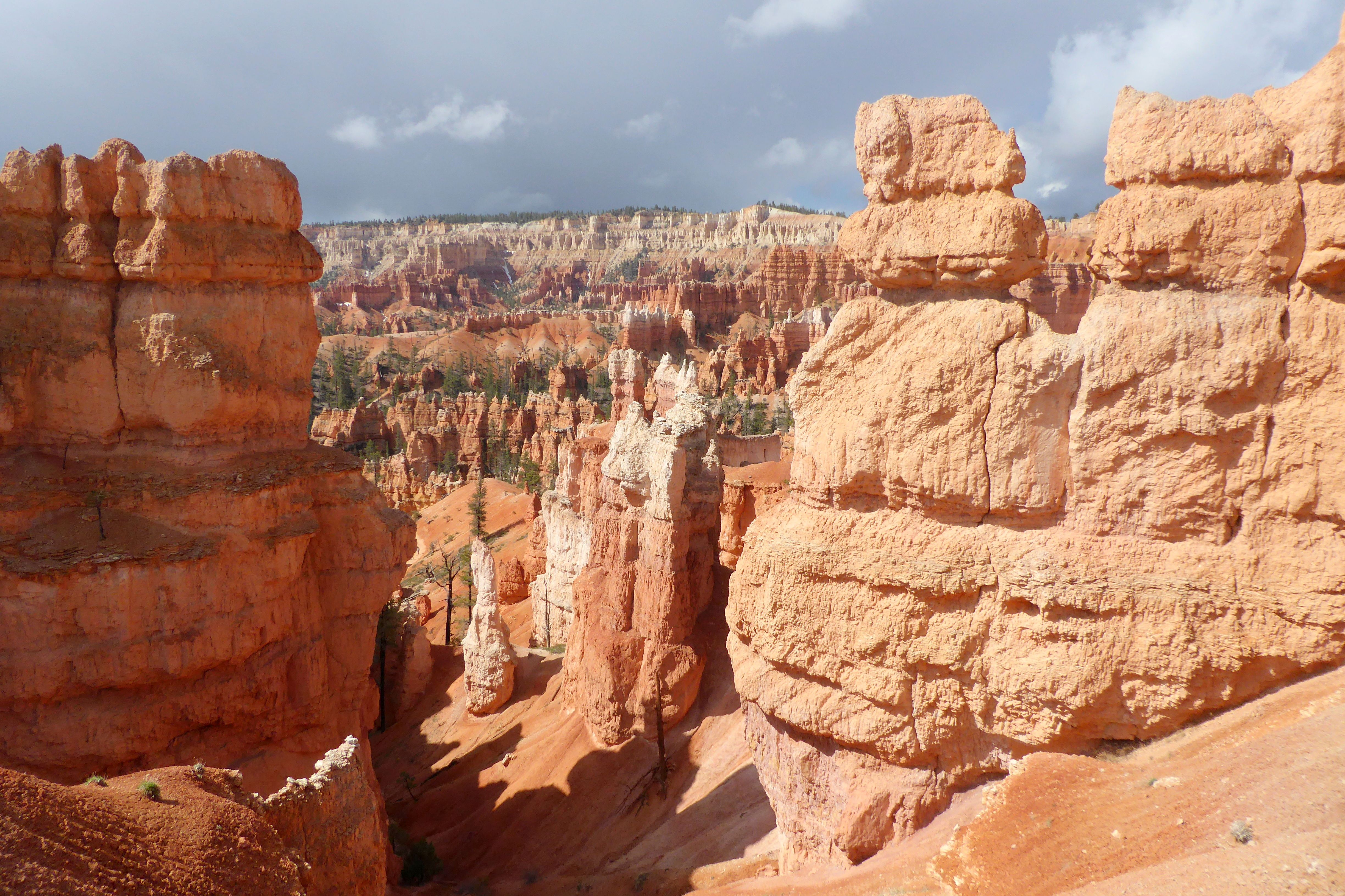
The hoodoo on the right with the flat top is “Thor’s Hammer,” a symbol in Norse mythology.
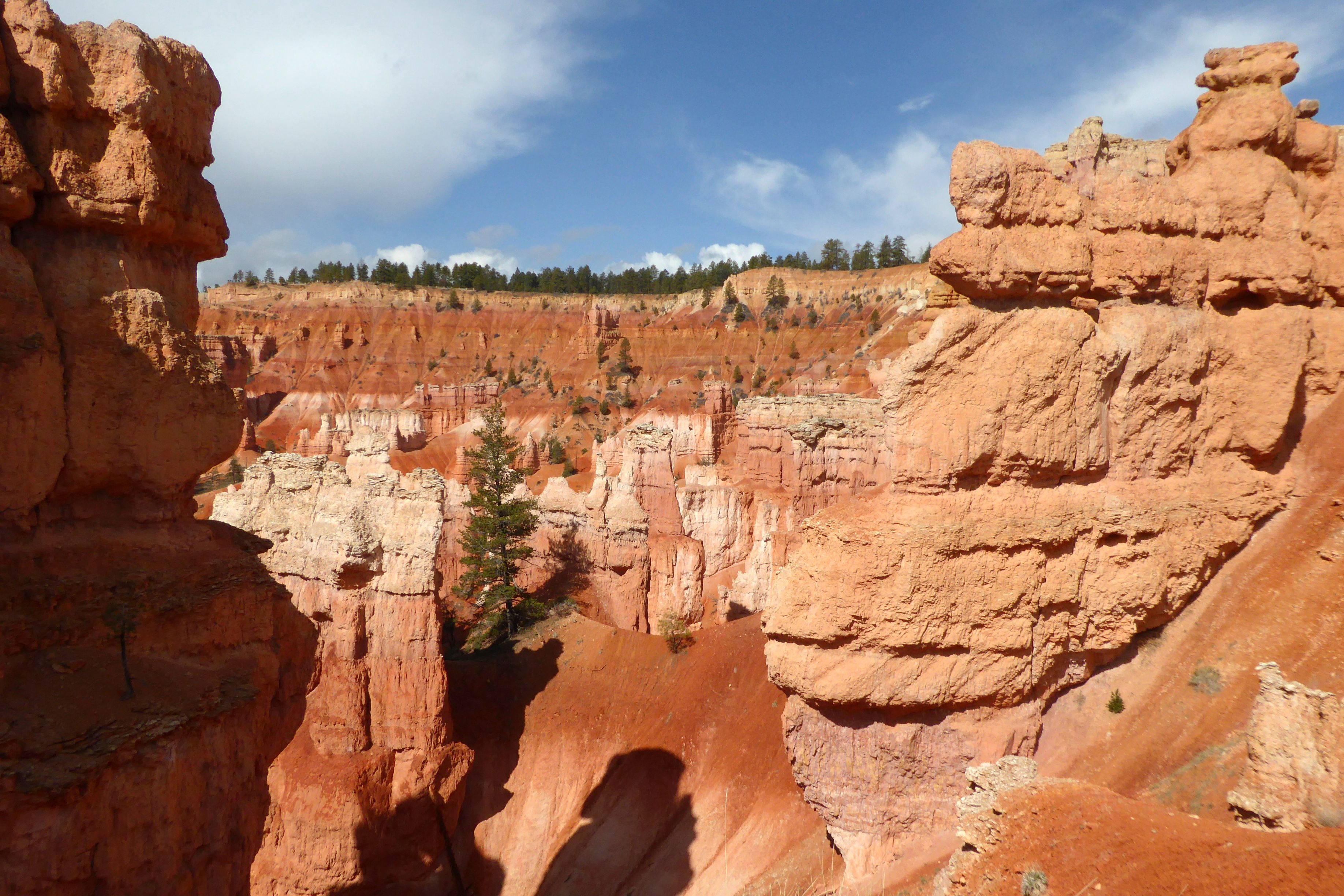
A walkway rims the top of Bryce Amphitheater, providing spectacular views of the hoodoos.Descending Queen’s Garden Trail provided a different viewing perspective of the hoodoos. As you can see from the photos, the weather kept changing drastically! It went from cloudy, to sunny, to cloudy, several times with some added precipitation sprinkled in! My day pack came in handy for cramming in and pulling out my vest and jacket several times.The view from the top of the rim after hiking back up. The mountains in the background were still topped with snow.
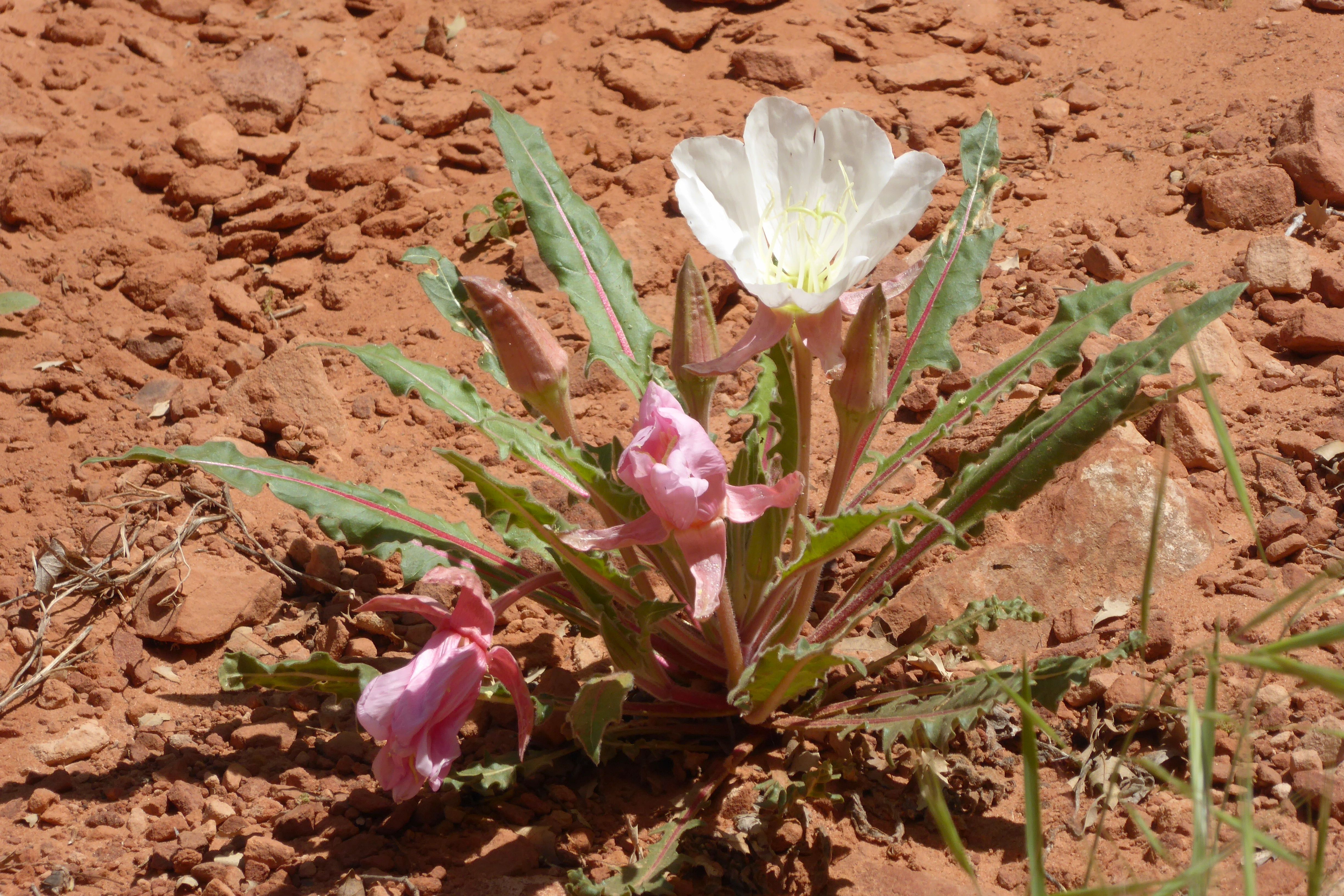
Bronze evening primrose
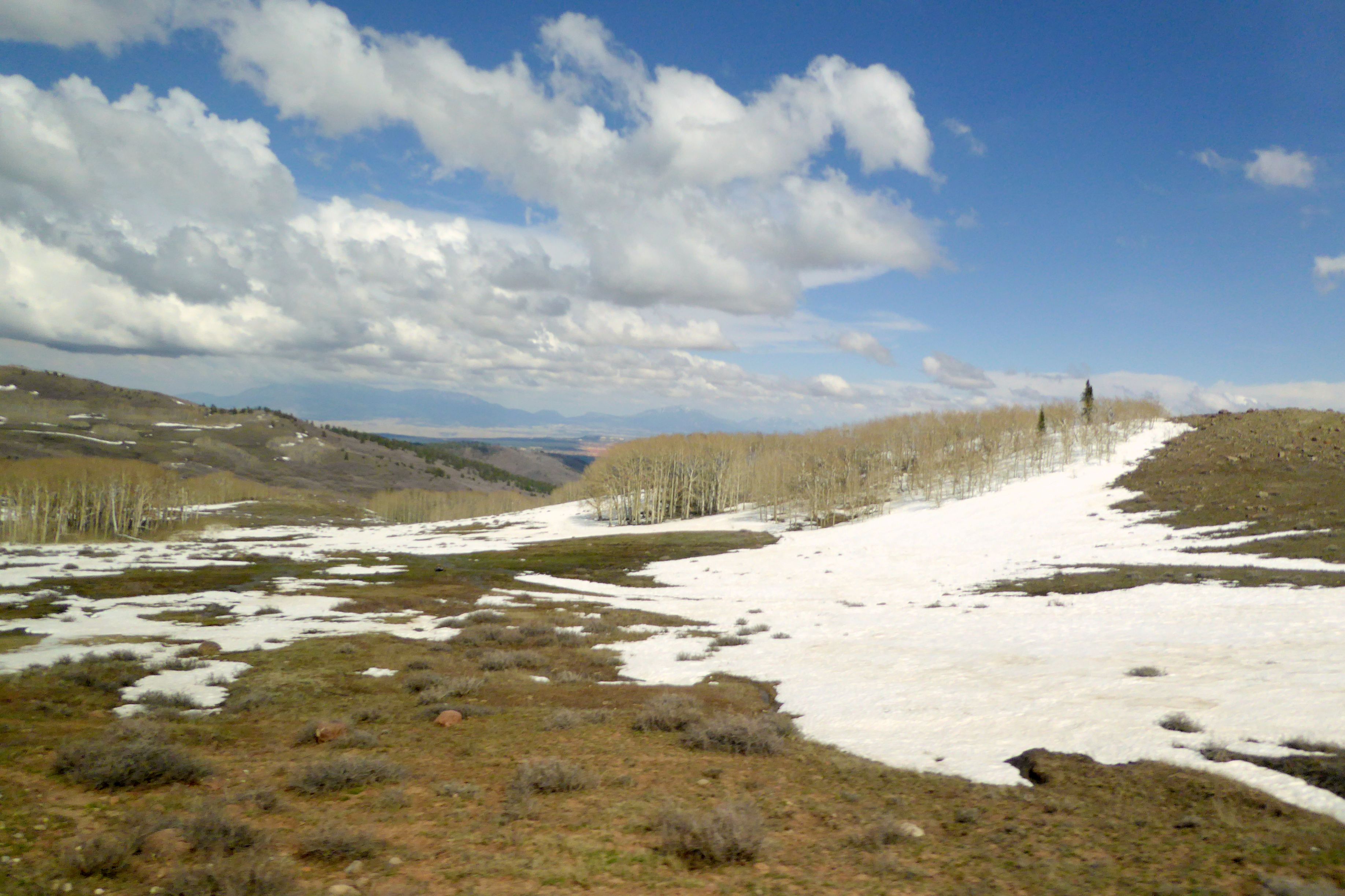
After we left Bryce, we enjoyed the views of Grand Staircase Escalante National Monument before driving through Boulder at 9,600-feet elevation. We made a brief photo stop, and I immediately ran down to pack a snowball. Nobody wanted to play catch with me, though.
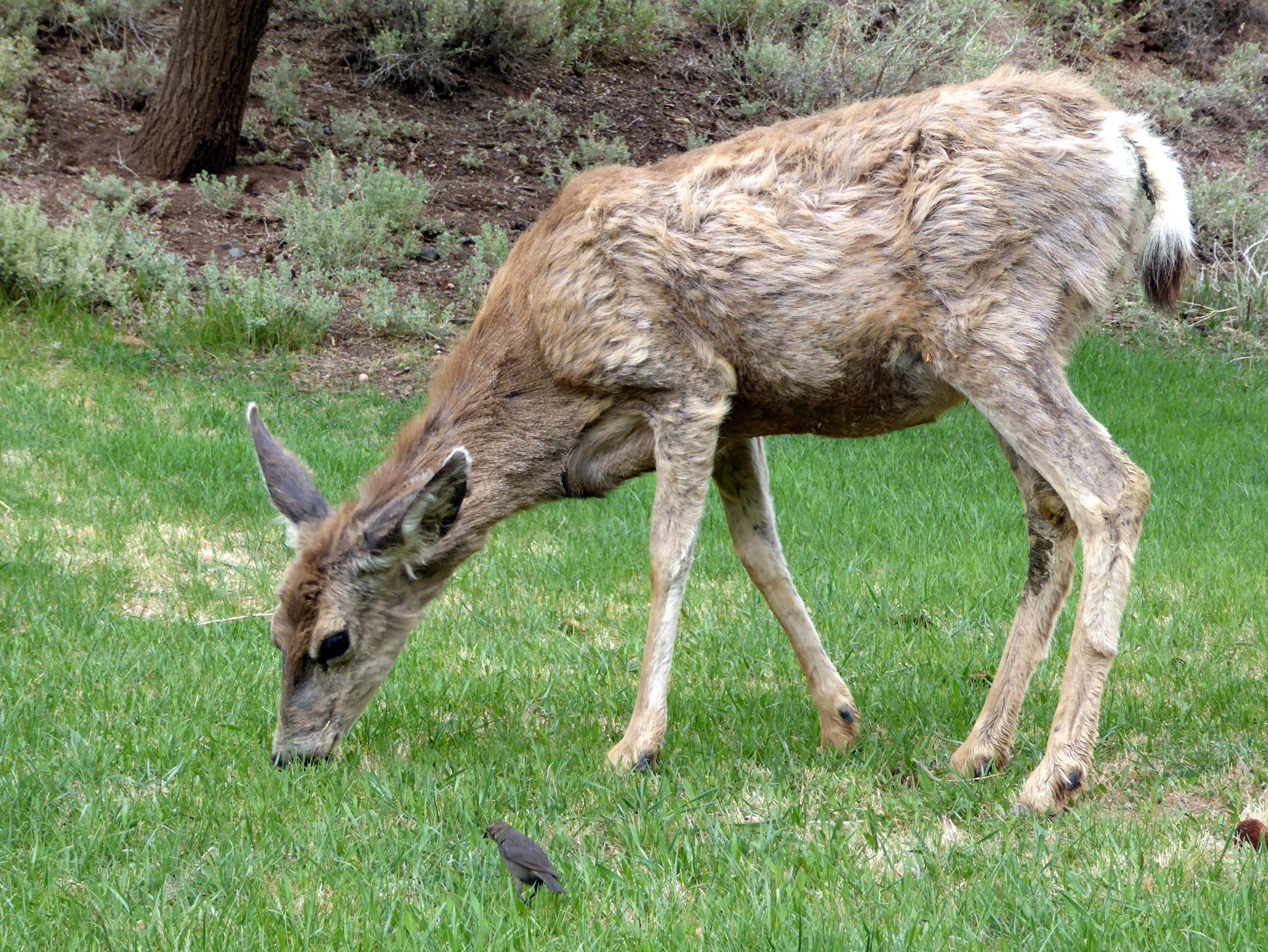
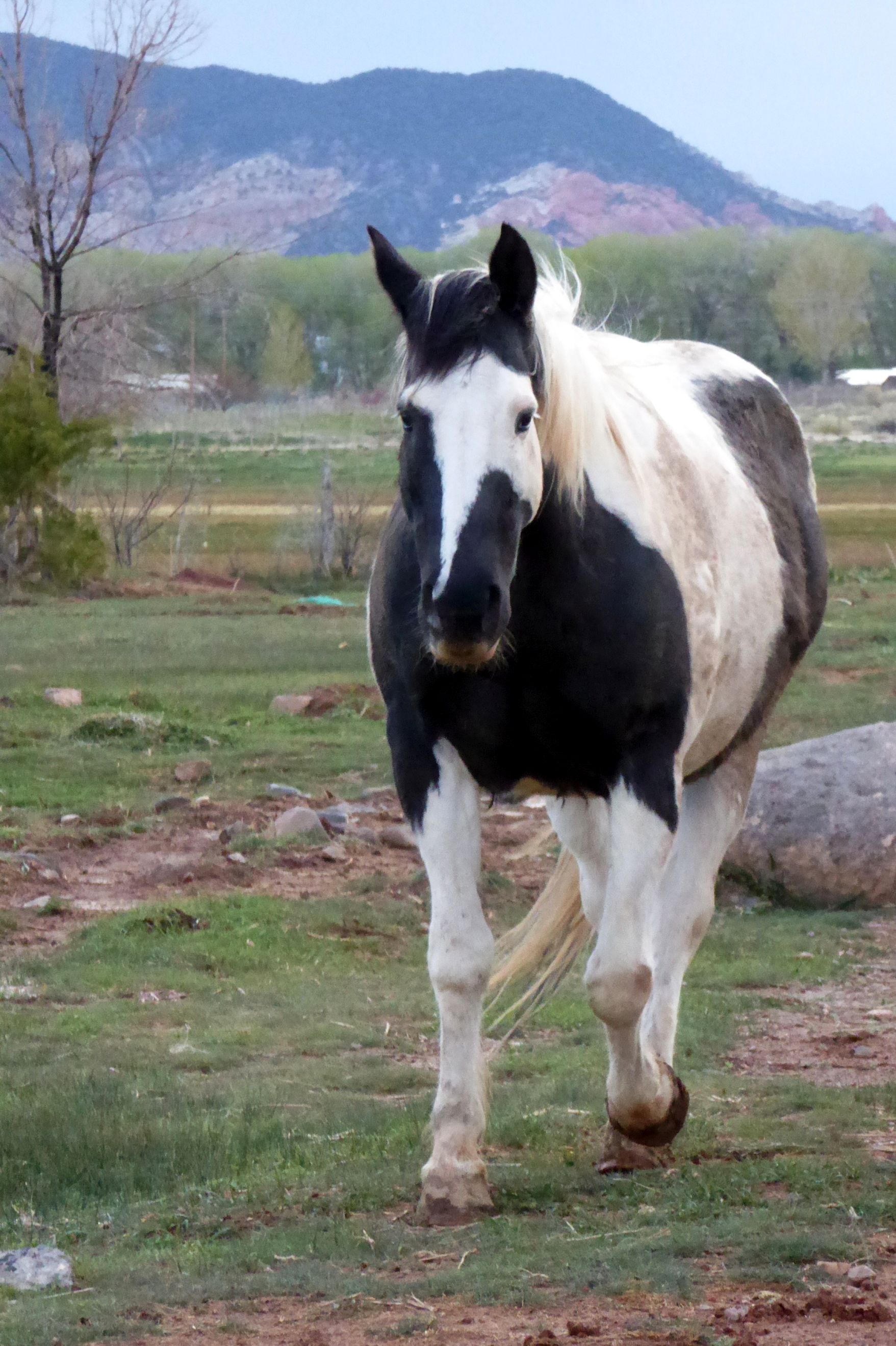
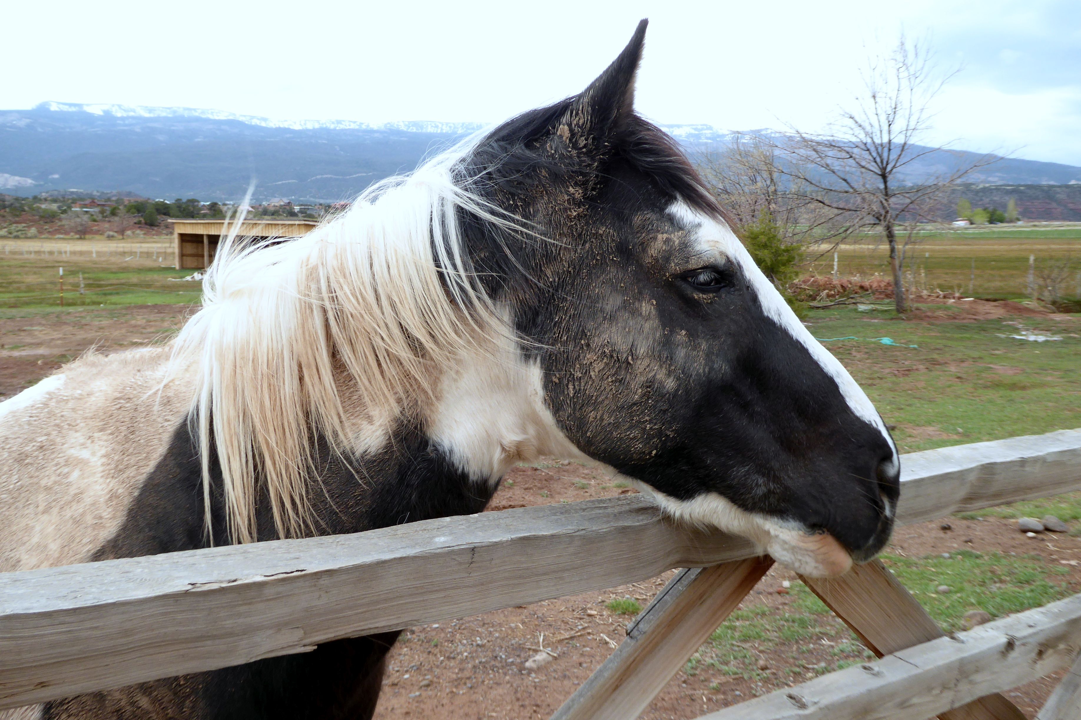
After checking in at the Red Sands Hotel, in Torrey, I gazed out the window and noticed cows and a bison off to the left, and this beautiful horse straight ahead. I went out to make a new friend.
What makes Utah so special is the miles and miles of wide open, unspoiled land. 80% of Utah is owned by the state or Bureau of Land Management, so it is mostly undeveloped.
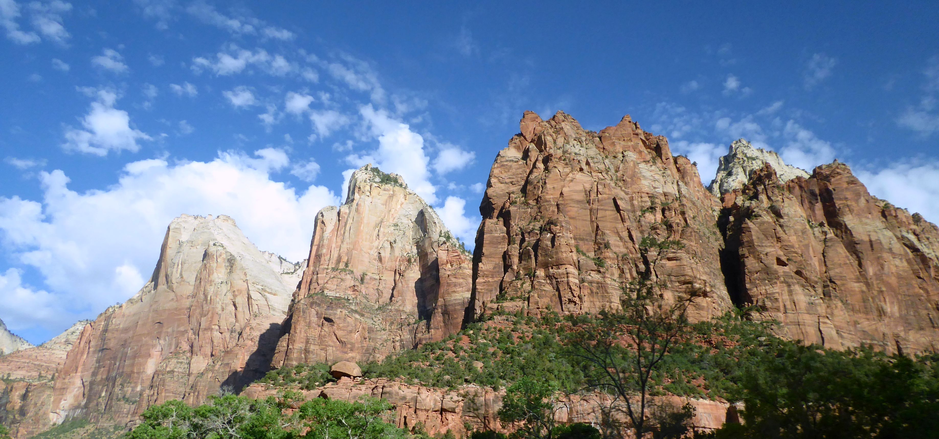
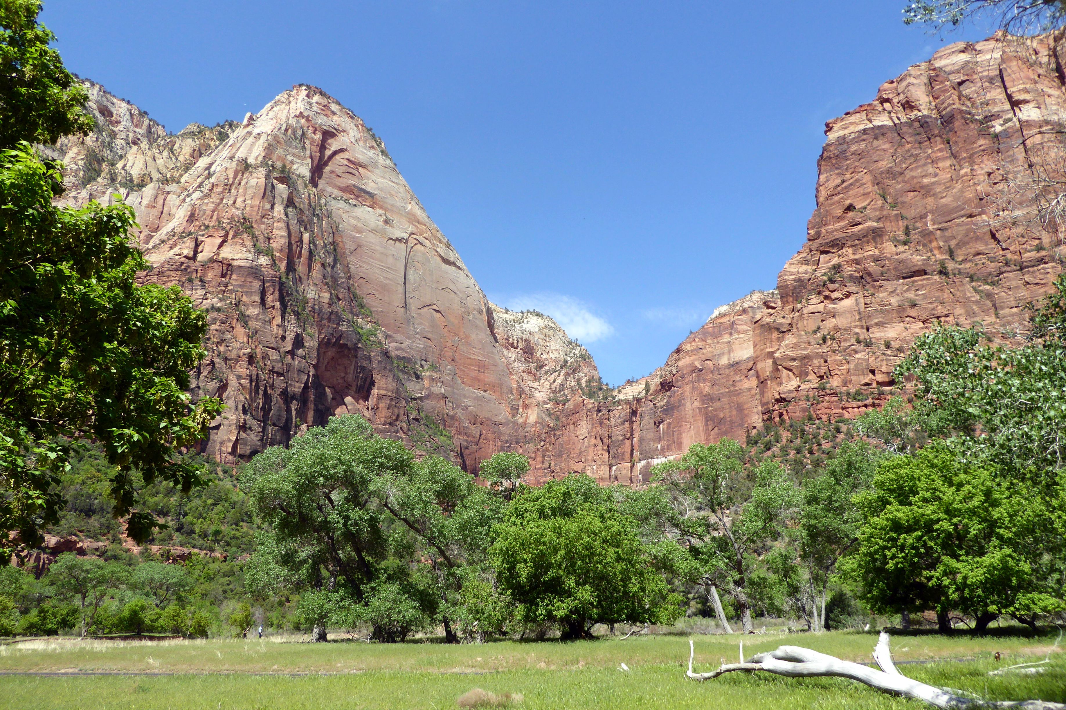
To begin our journey of the Grand Circle of Utah’s National Parks, the first national park we visited was Zion, Utah’s first national park, established in 1919. It is located in Southwestern Utah, and is characterized by deep sandstone canyons, a maze of narrow, and striking rock towers and mesas.
Native Americans were the first to inhabit the area about 8,000 yeas ago. Mormons started coming in during the late 1850’s, and called the area Zion; however, President Taft named it Mukuntuweap National Monument in order to protect the canyon. In 1918, Horace Albright, the acting director of the newly created National Park Service changed the park’s name to Zion National Park. (So much for the Native Americans being there first…)
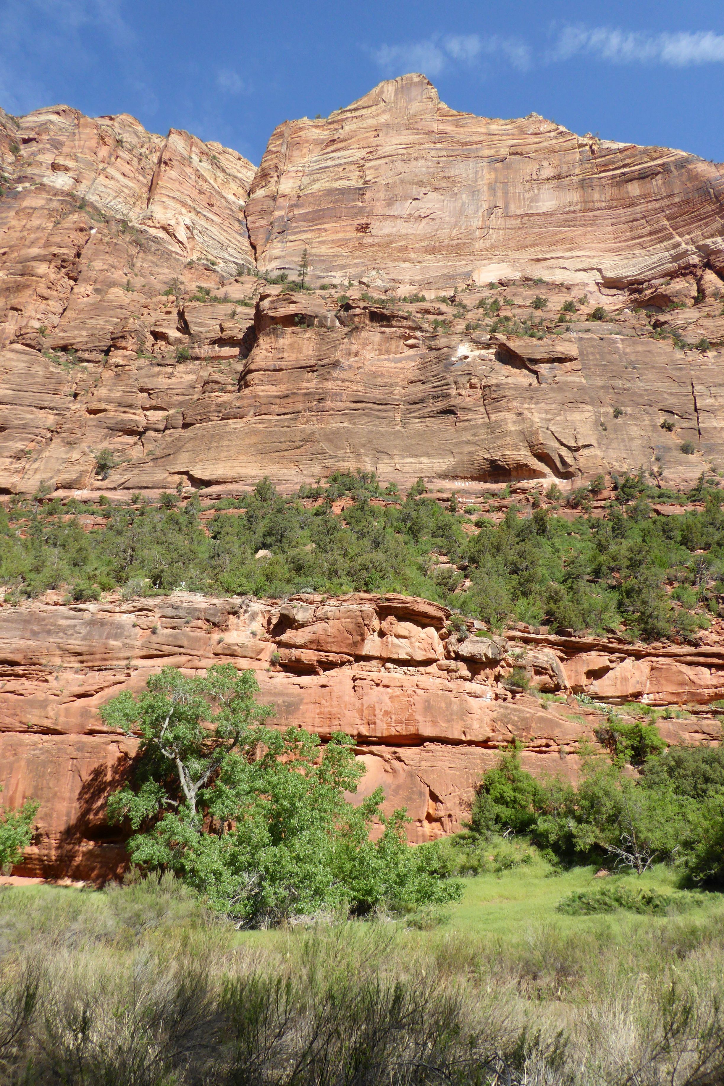
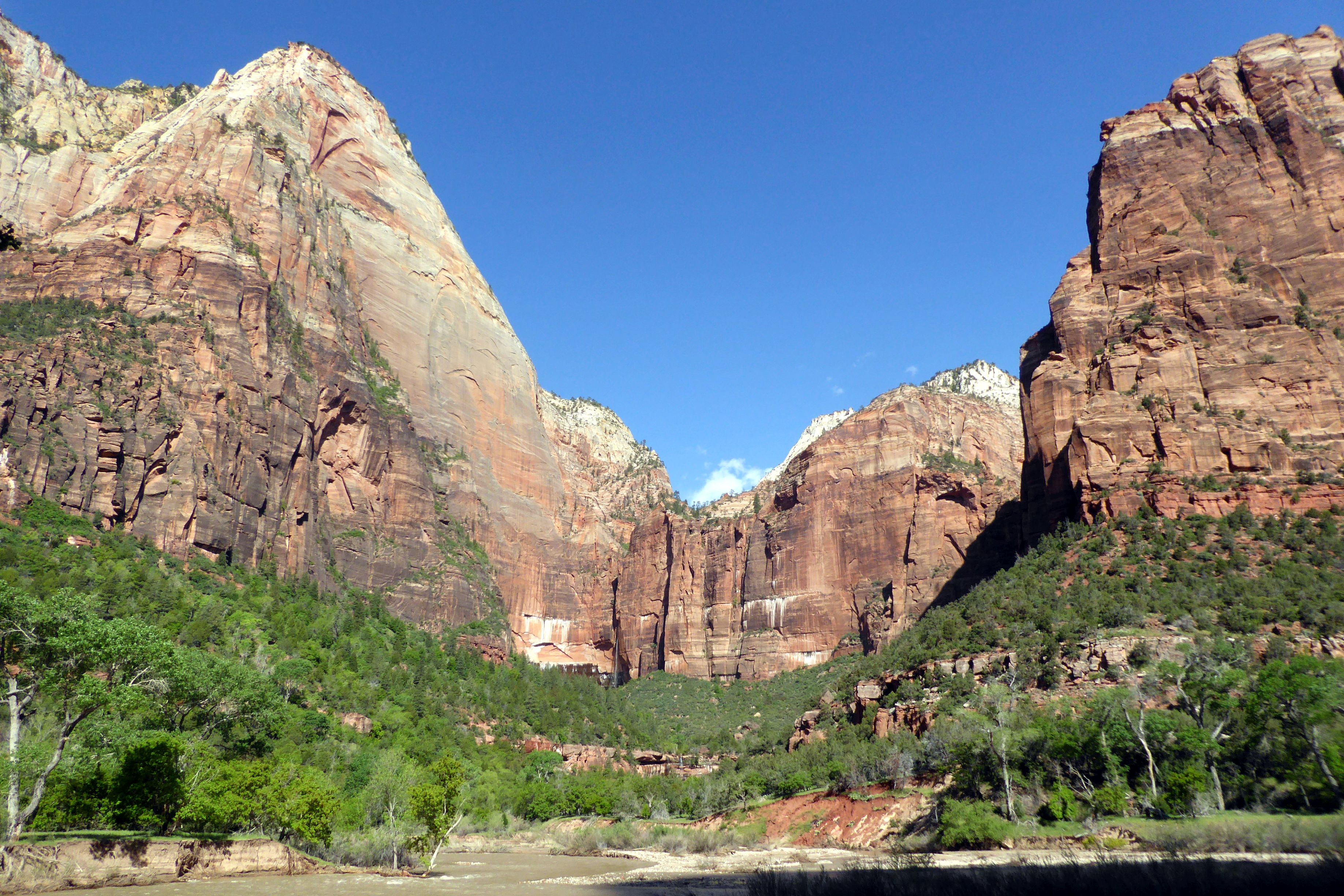
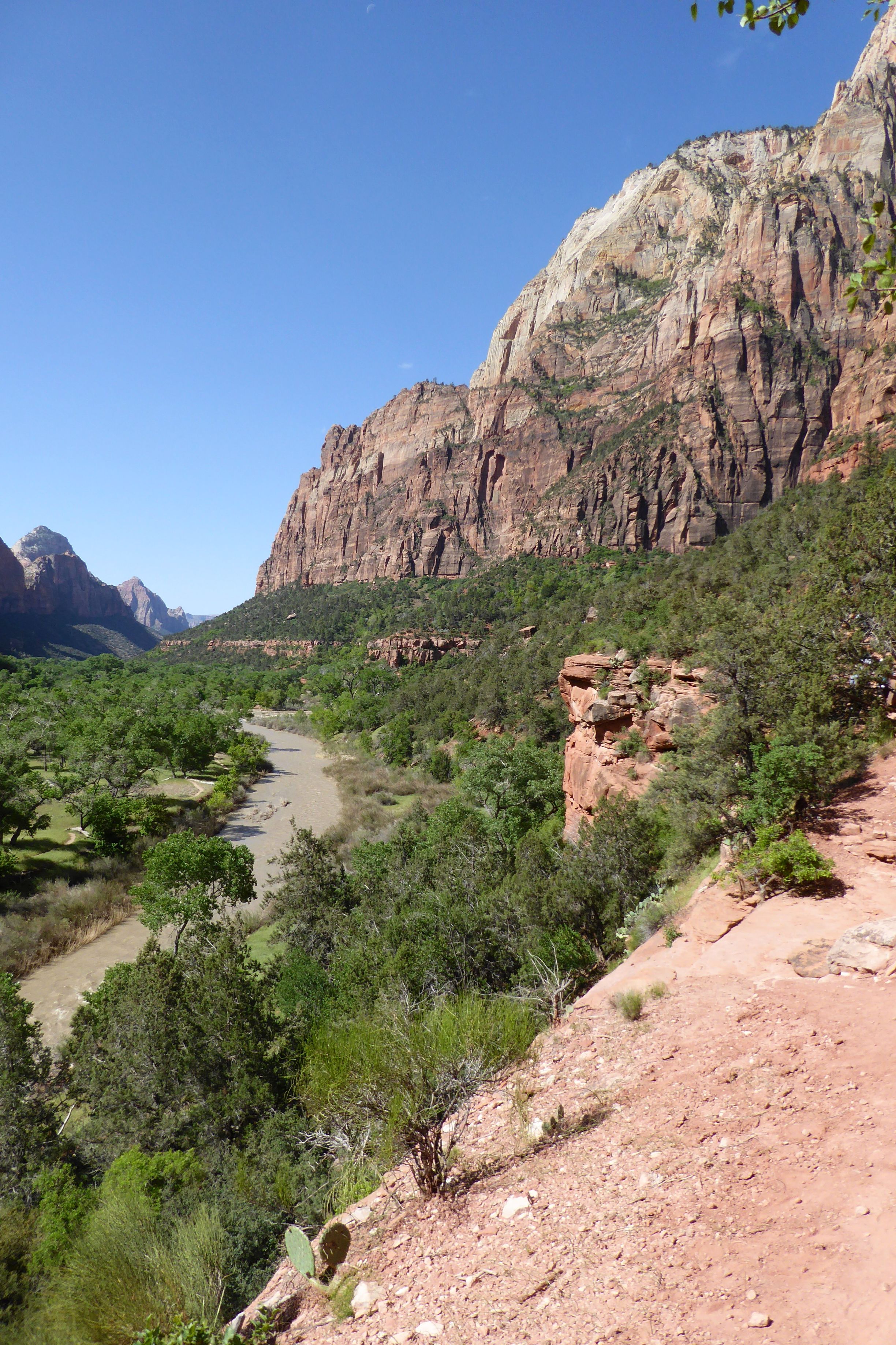
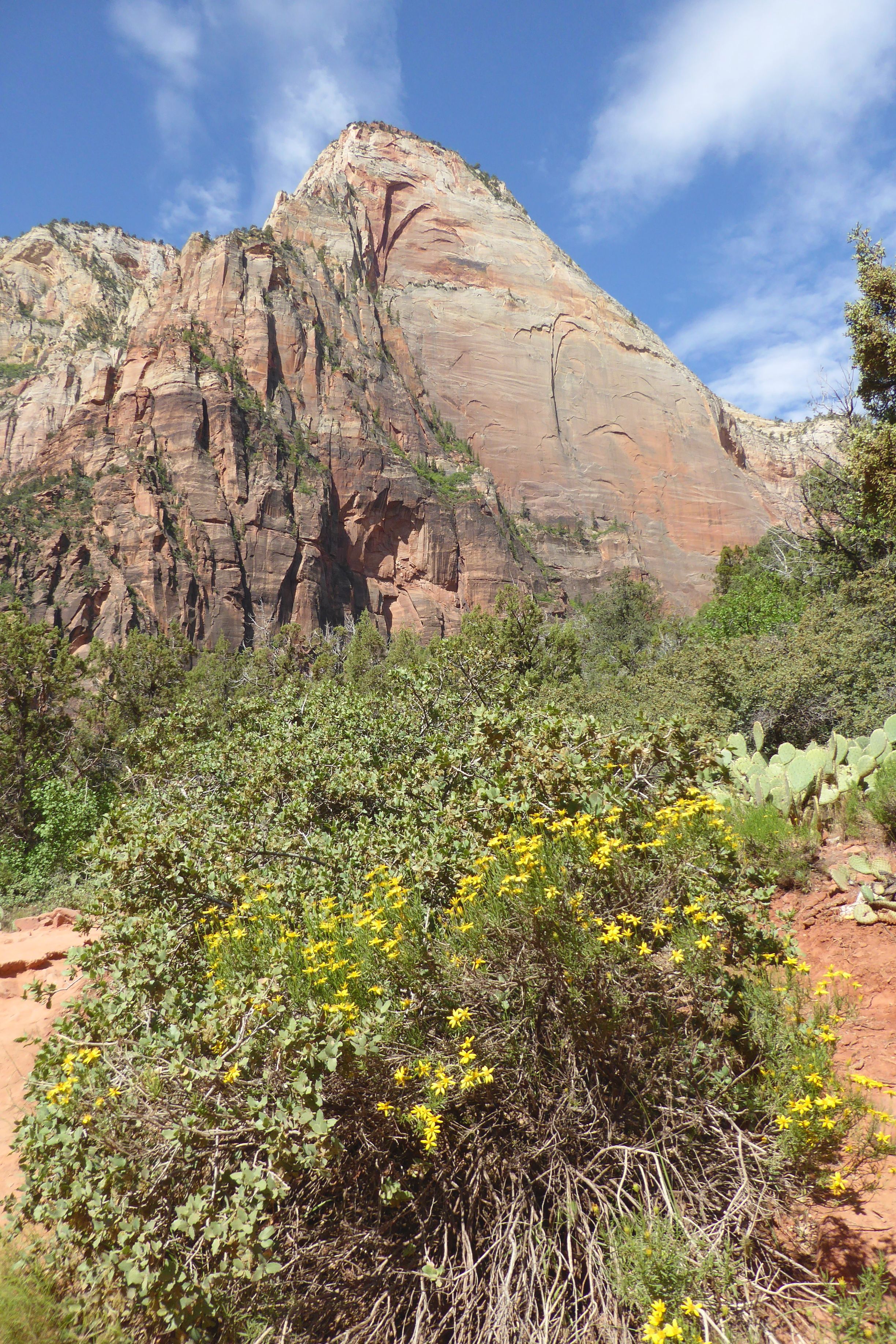
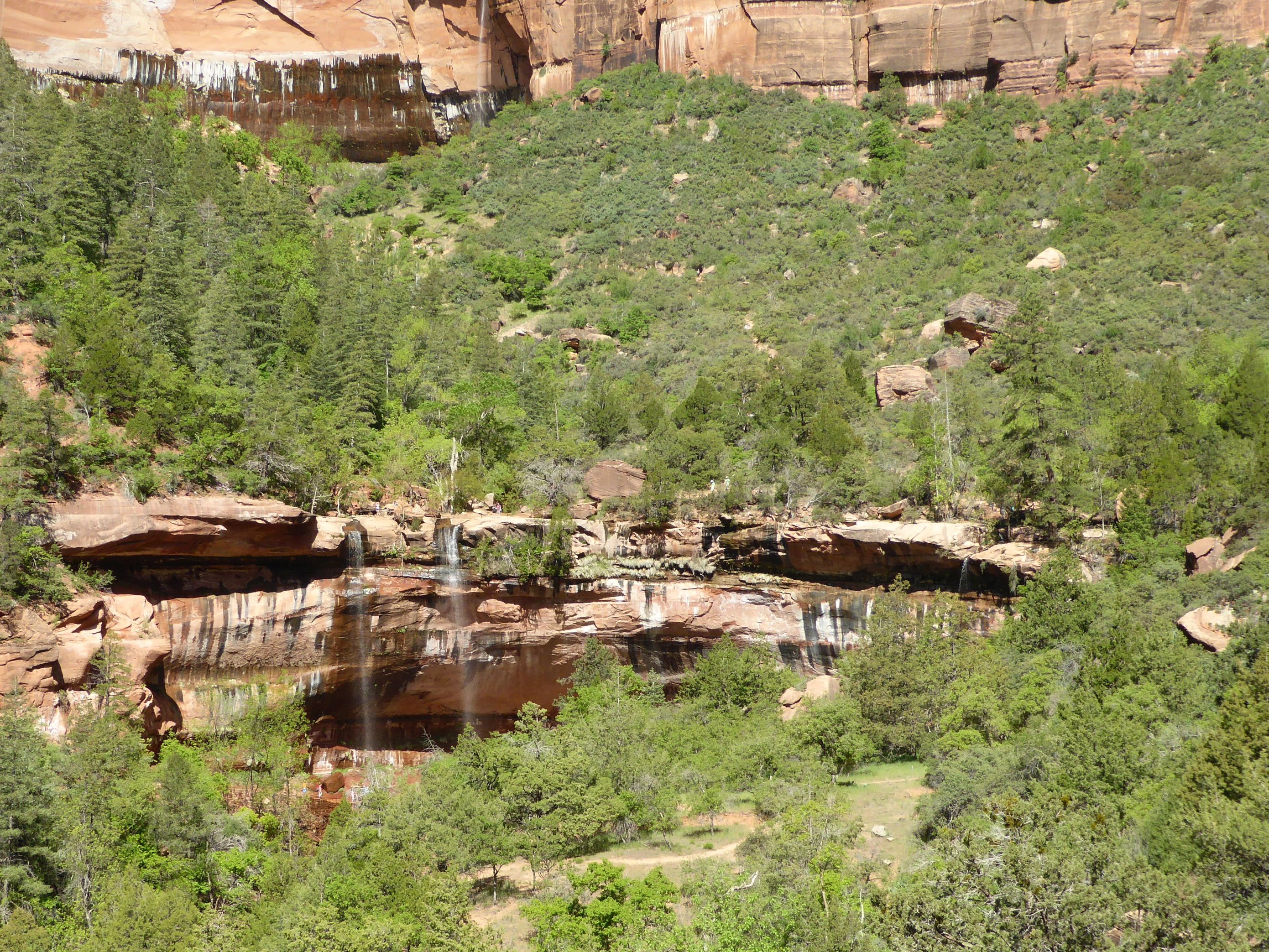
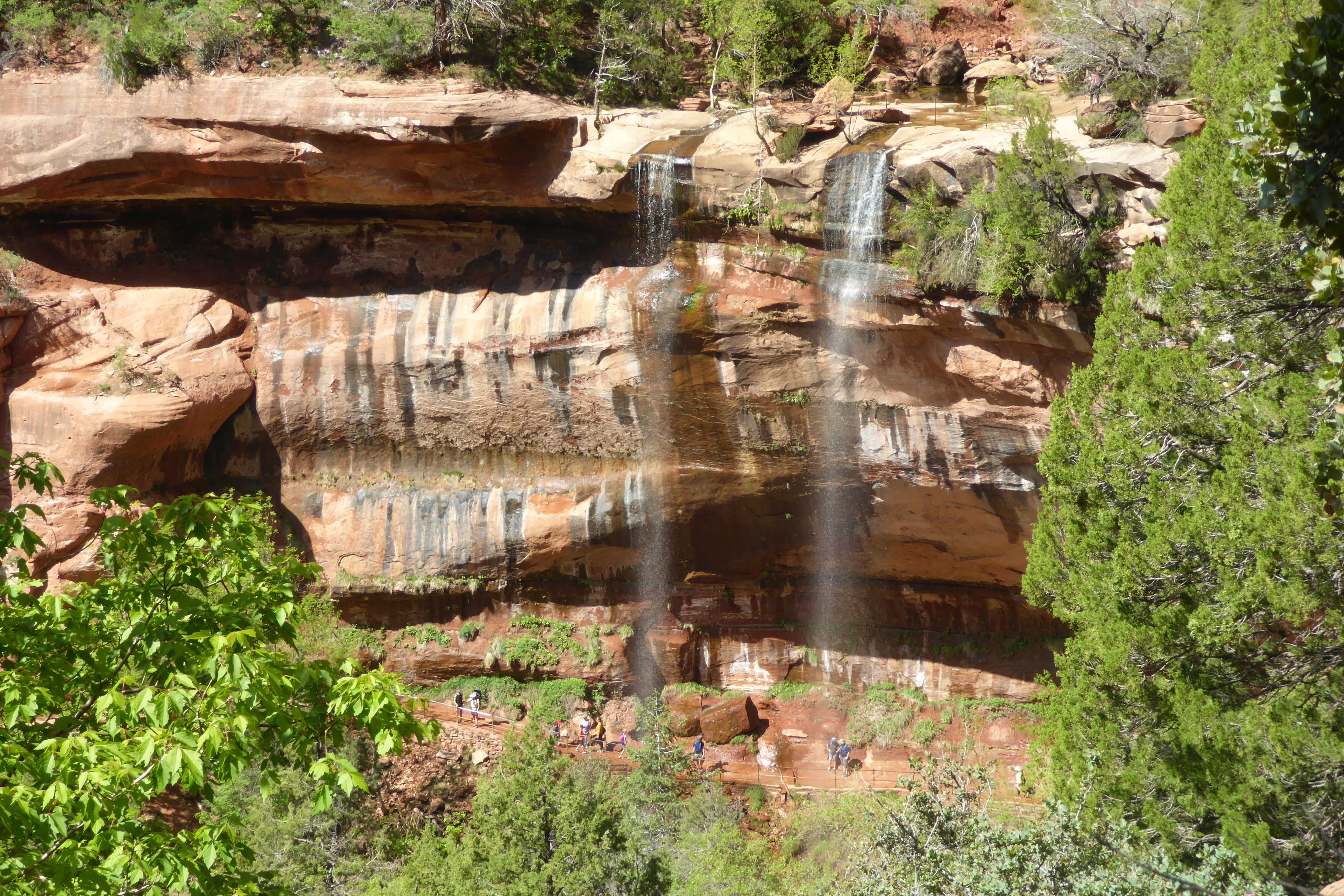
The Navajo sandstone in the rock formations is gorgeous; beautiful, rich shades of red. A Wikipedia article about Zion describes the geology as, “… nine formations that together represent 150 million years of mostly Mesozoic-aged sedimentation. At various periods in that time warm, shallow seas, streams ponds and lakes, vast deserts, and dry near-shore environments covered the area. Uplift associated with the creation of the Colorado Plateau lifted the region 10,000 feet (3,000 m) starting 13 million years ago.” I’ll take the author’s word for it. All I know is that it was gorgeous, the sky was a beautiful shade of blue, and the Navajo sandstone formations set against the blue sky was spectacularly colorful! It made for an inspiring day of photography, as we hiked to the Emerald Pools and back.
(For all pictures, click on the image to see full screen view.)
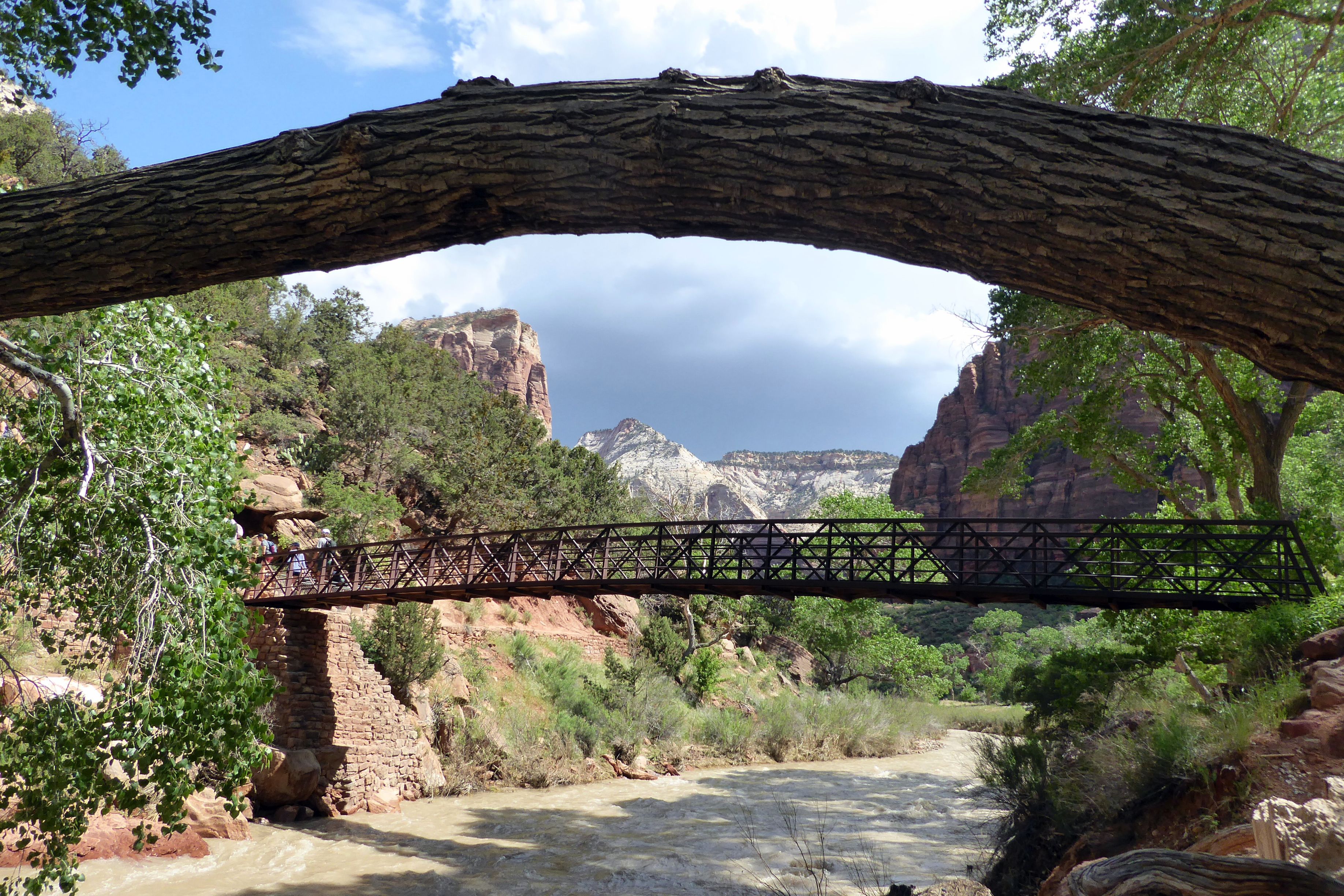
We crossed over this bridge to continue our hike to the Emerald Pools.
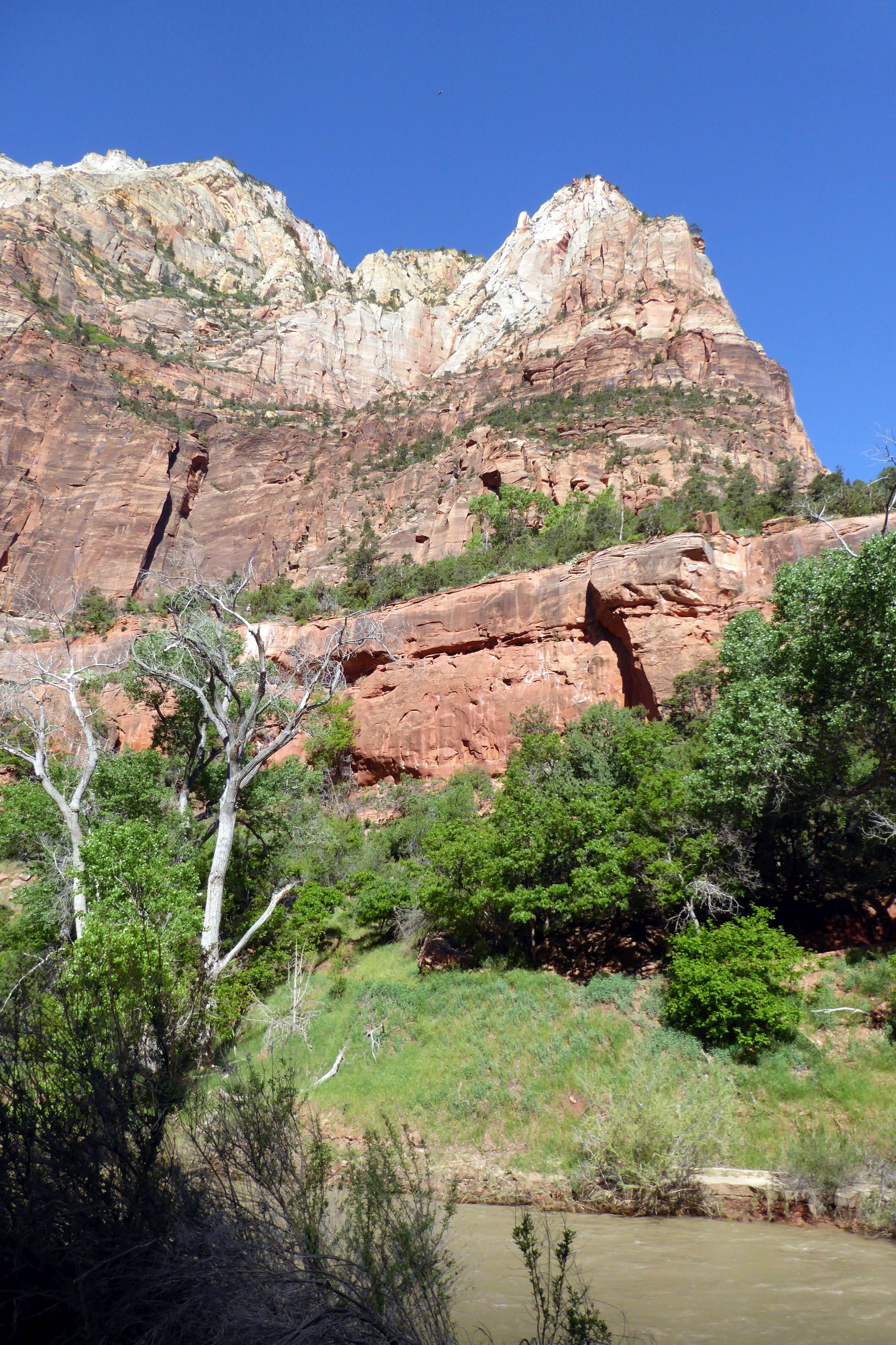
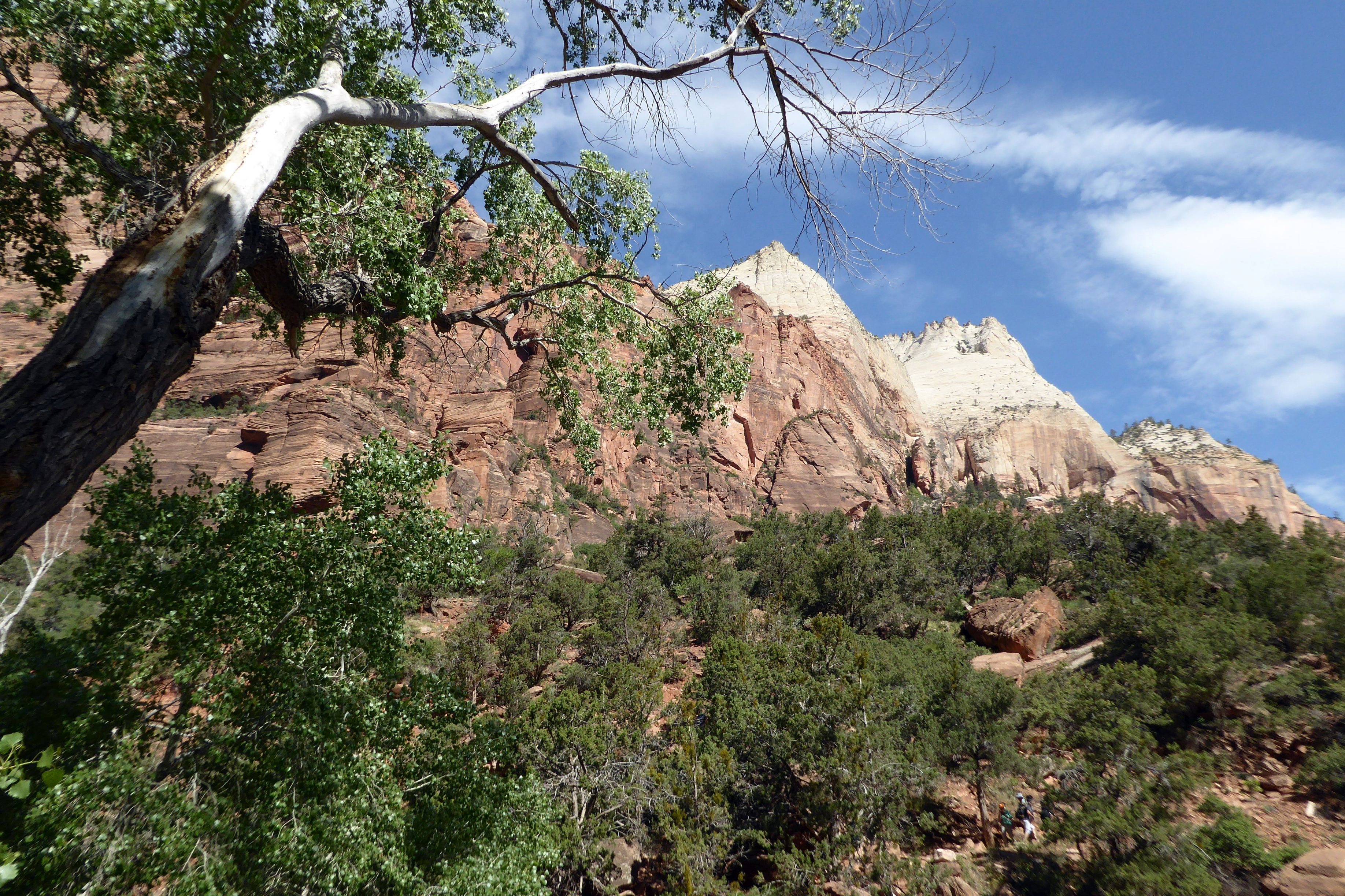
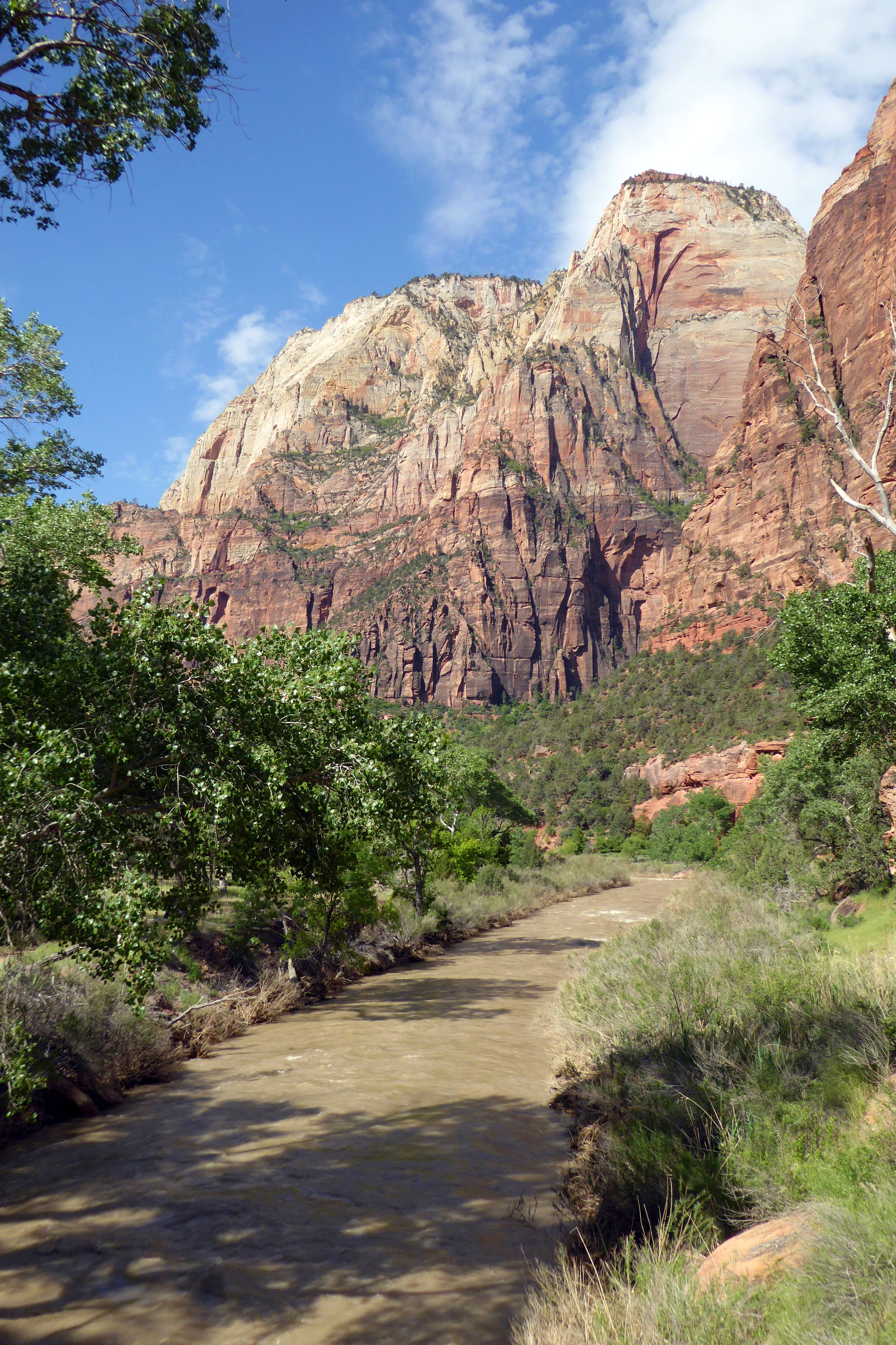
As we increased elevation, the vistas of the canyon were beautiful.
Our first sight of the Emerald Pools and waterfalls
After seeing the Emerald Pools, we took the path back down to the river, crossed the bridge, and headed back to the lodge.
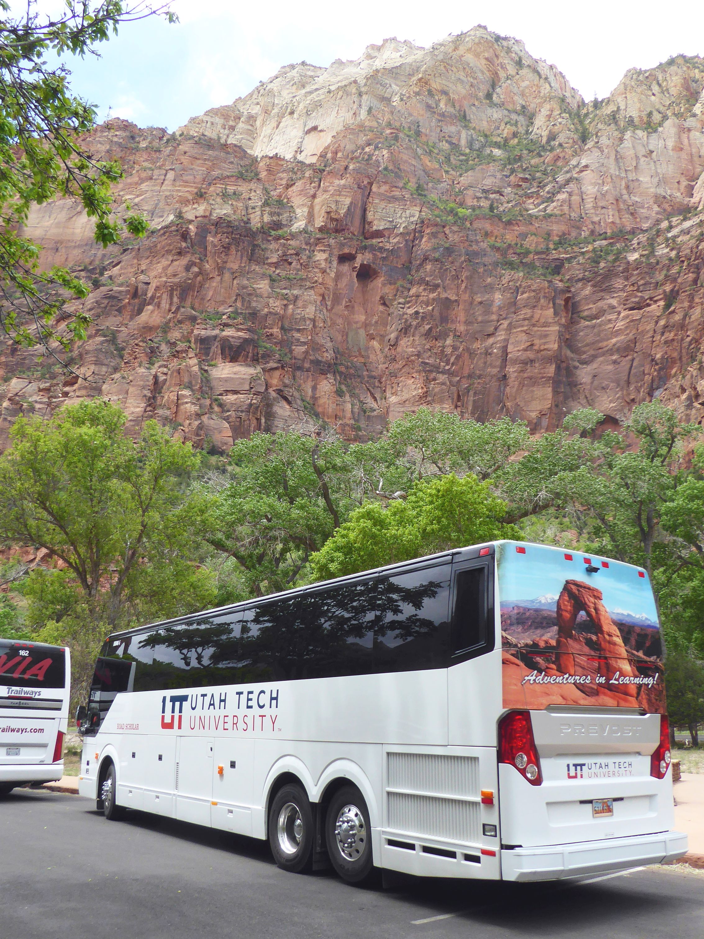
The sky clouded over after we finished our lunch and headed out– perfect timing! This was our Road Scholar tour bus for our group of 24 plus a tour leader. There was plenty of room to spread out in the back of this 45-seater.
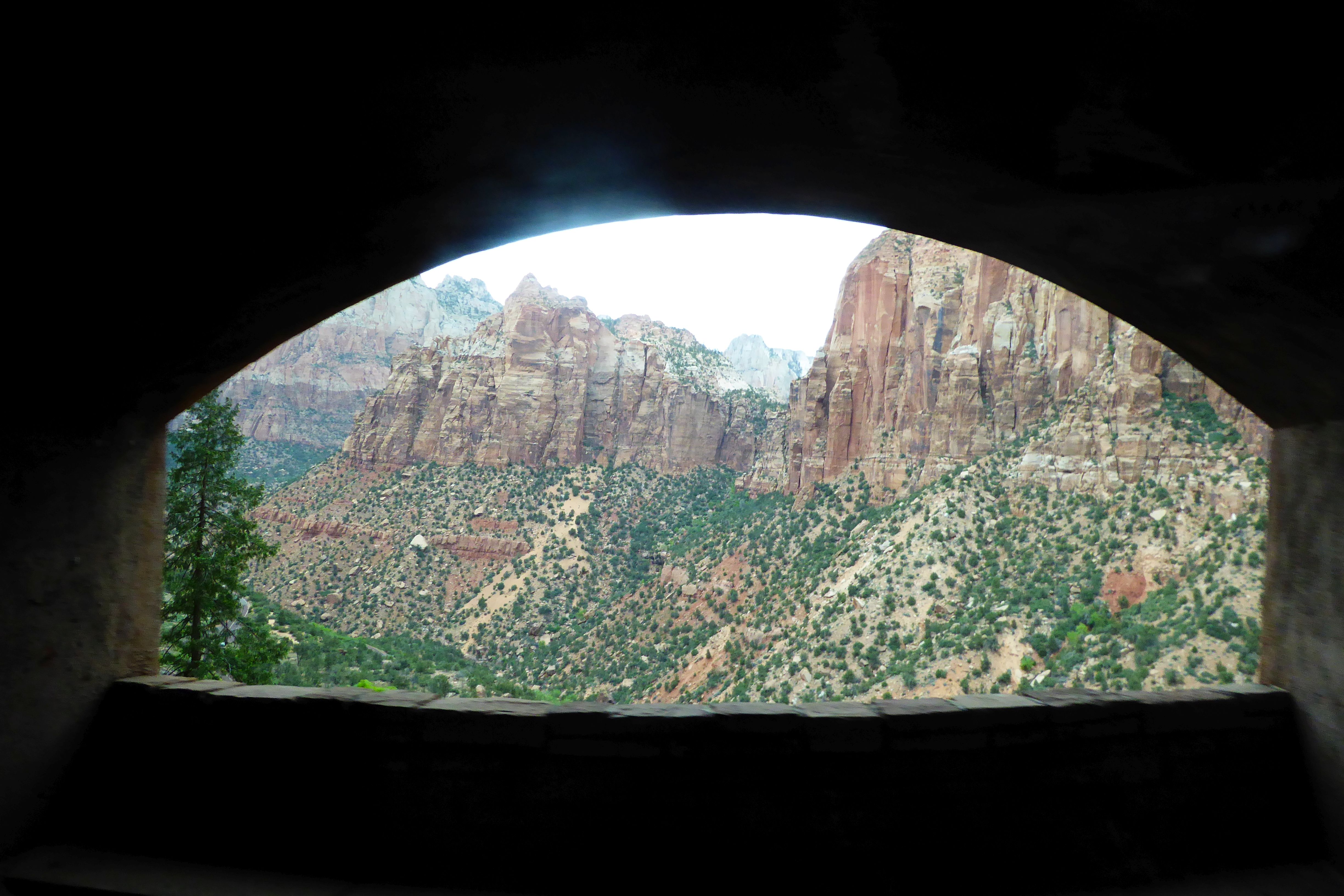
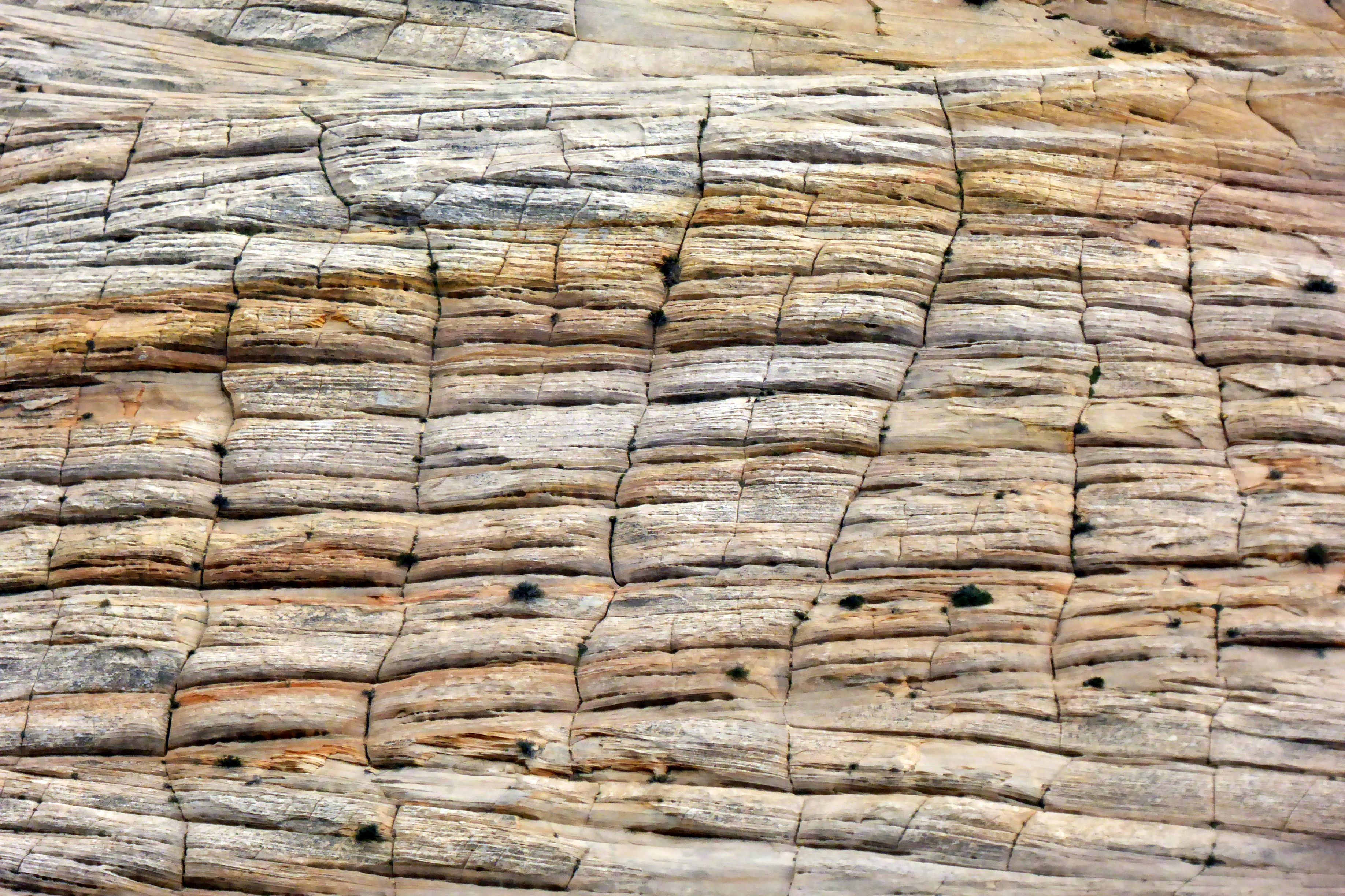
On our way to our next hotel at Bryce Canyon, we traveled through the Zion tunnel. I was able to grab this shot in the tunnel, shooting out the bus window, and through an opening. Checkerboard Mesa is at the east entrance of Zion, after leaving the tunnel. This is naturally sculpted rock. The horizontal lines is evidence of ancient sand dunes, and the vertical lines are fractures that have been enlarged over the years by runoff from rain and melting snow.
Coming up next: Beautiful Bryce Canyon National Park
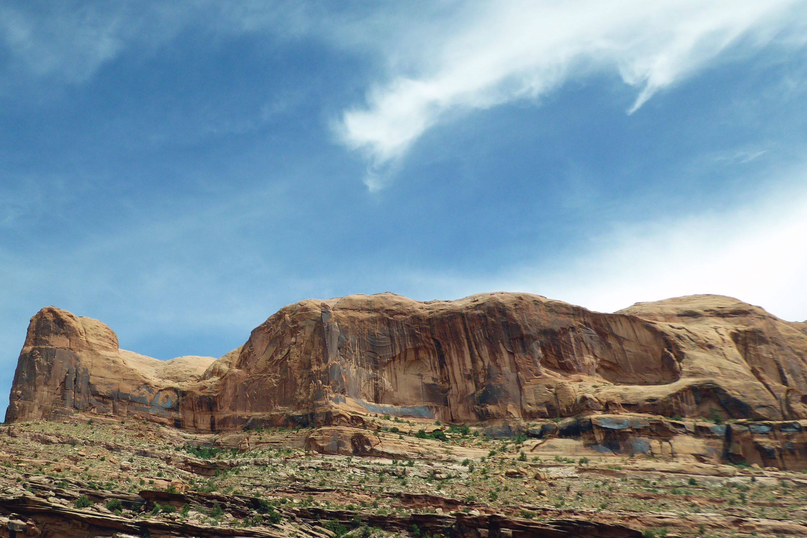
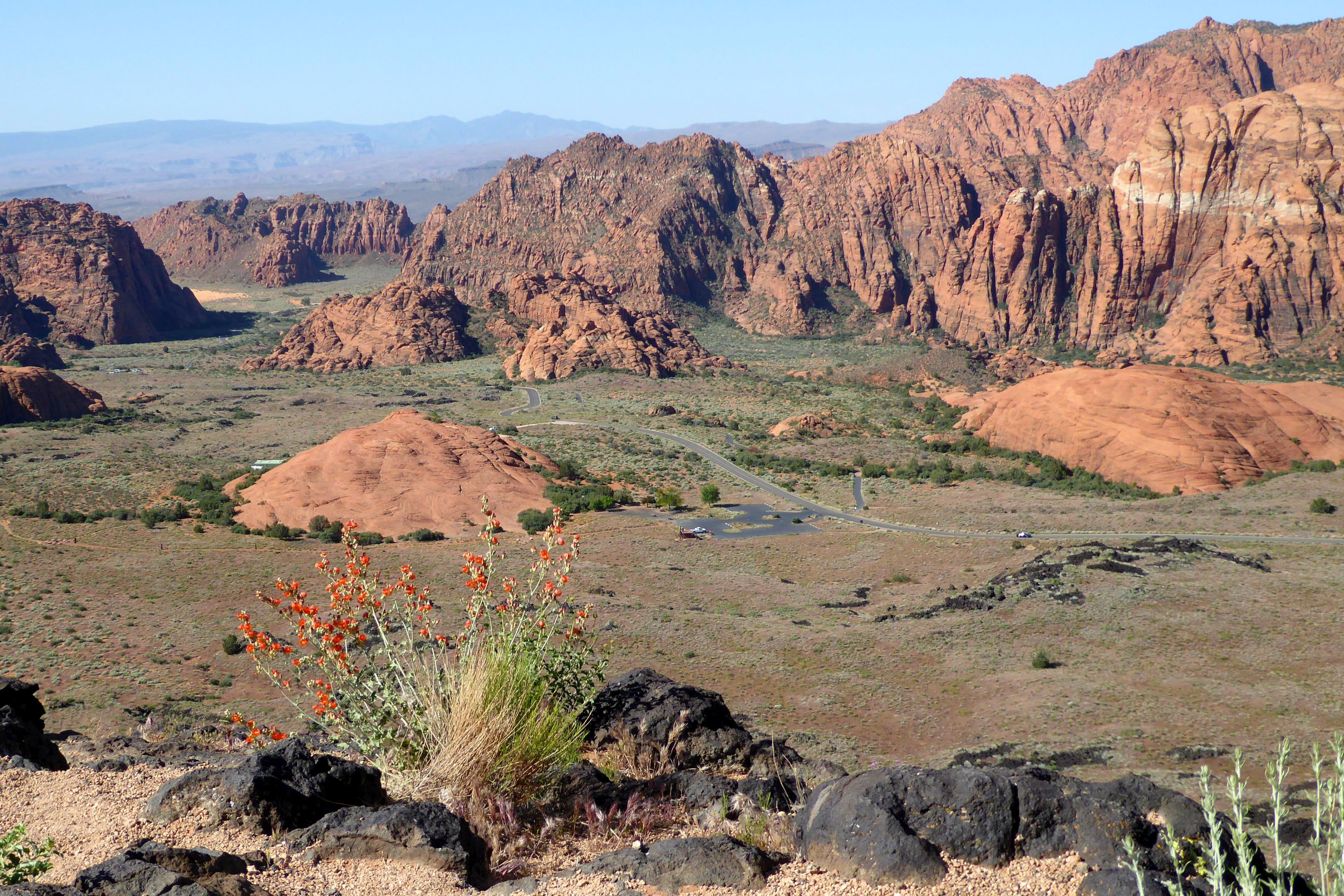
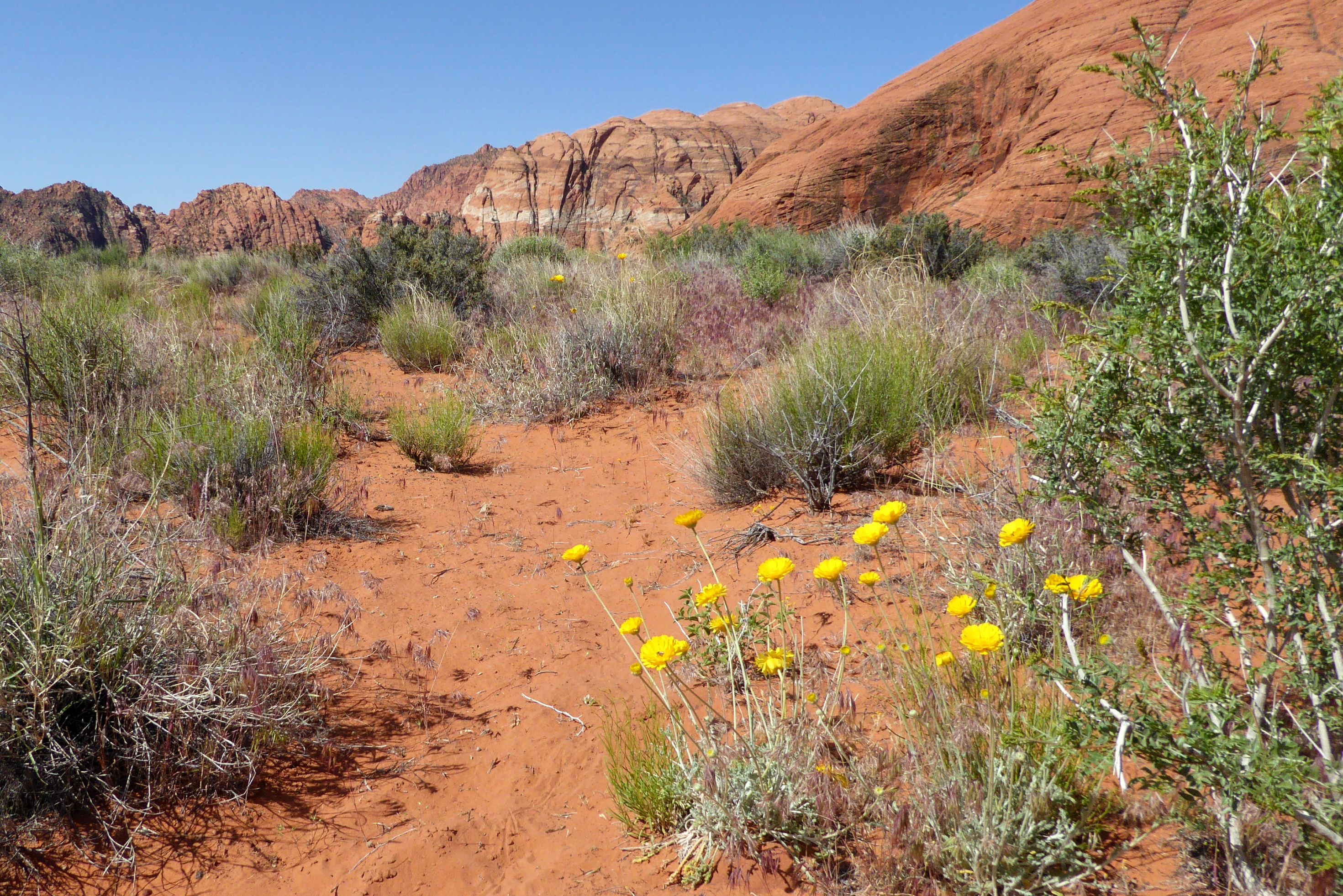
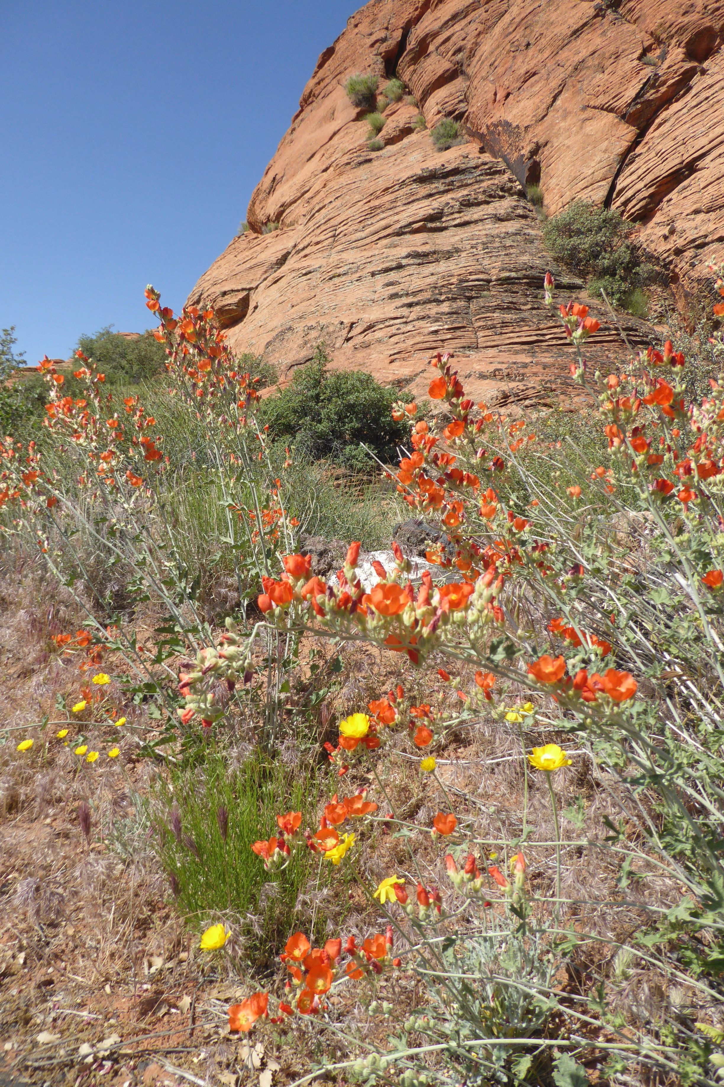
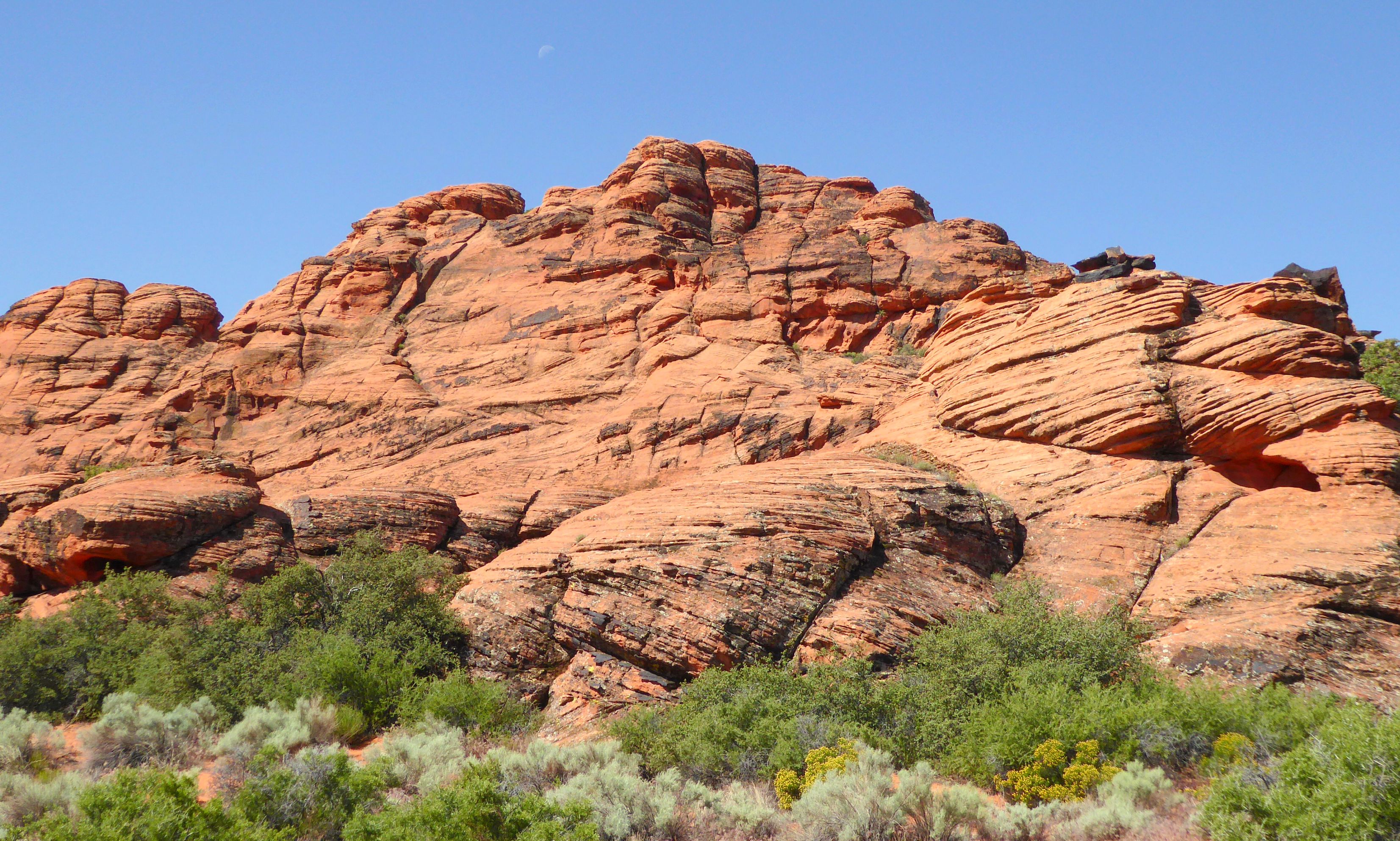
On our first full day of the tour, we learned about the geology of the parks we would be visiting, and then went to see our first park: Snow Canyon State Park, located near St. George, in the Red Cliffs Desert Reserve. The red you will see in the photos below is Navajo Sandstone.
Snow Canyon sits at the junction of Mojave Desert, Great Basin, and Colorado Plateau; so, the climate is very sunny and dry. The average rainfall is about 7.5 inches per year, and the summers can get extremely hot.
(For all pictures, click on the image to see full screen view.)
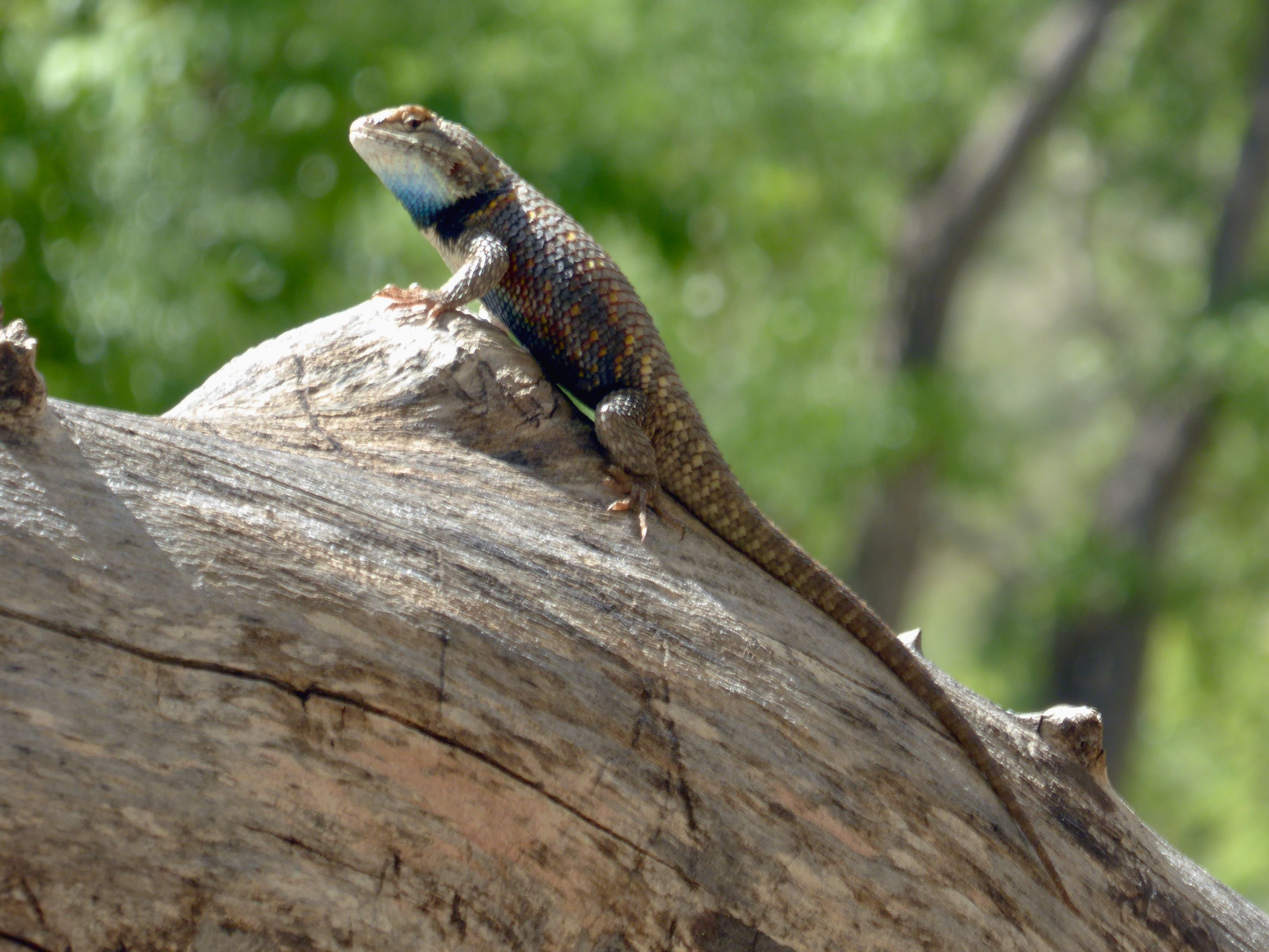
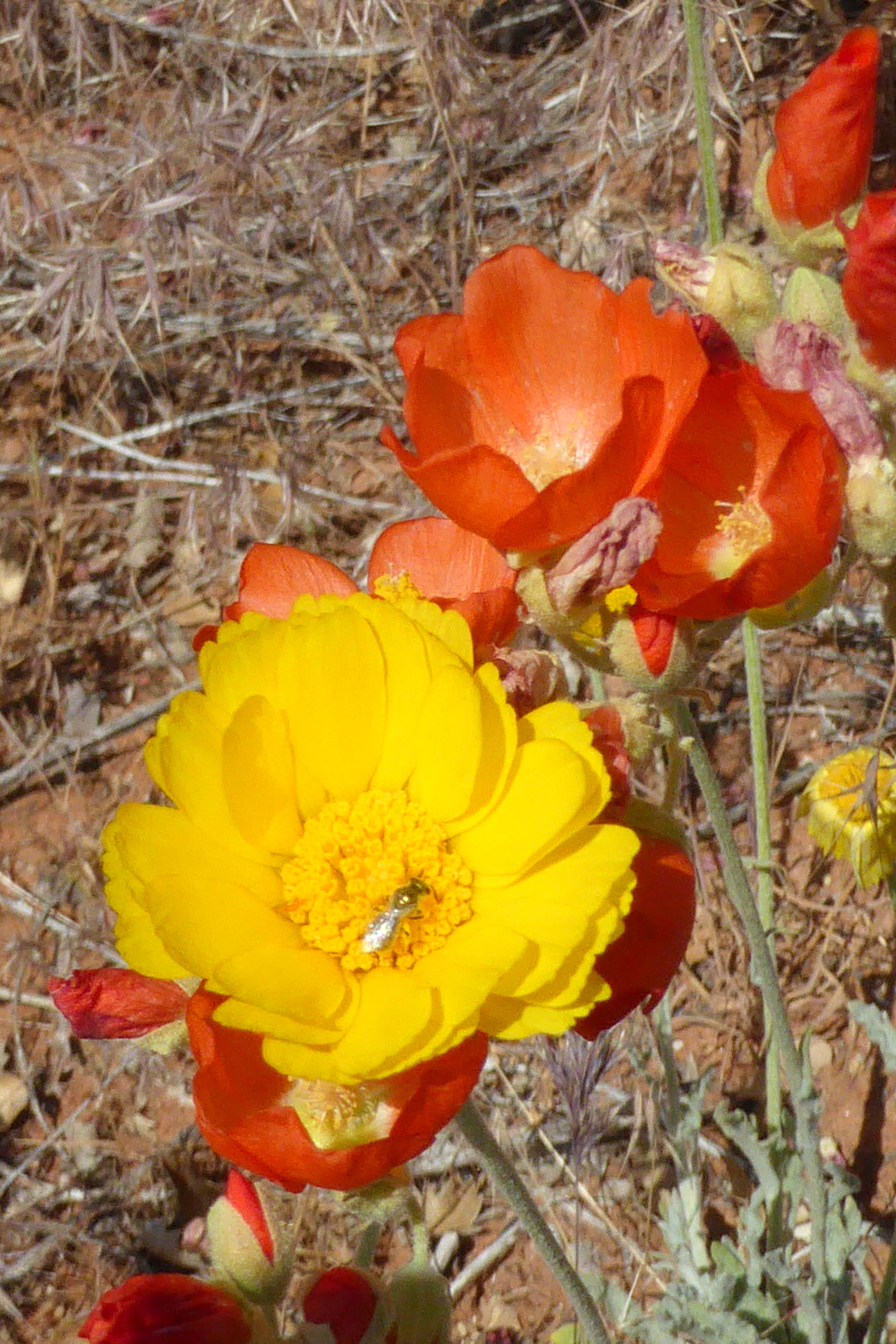
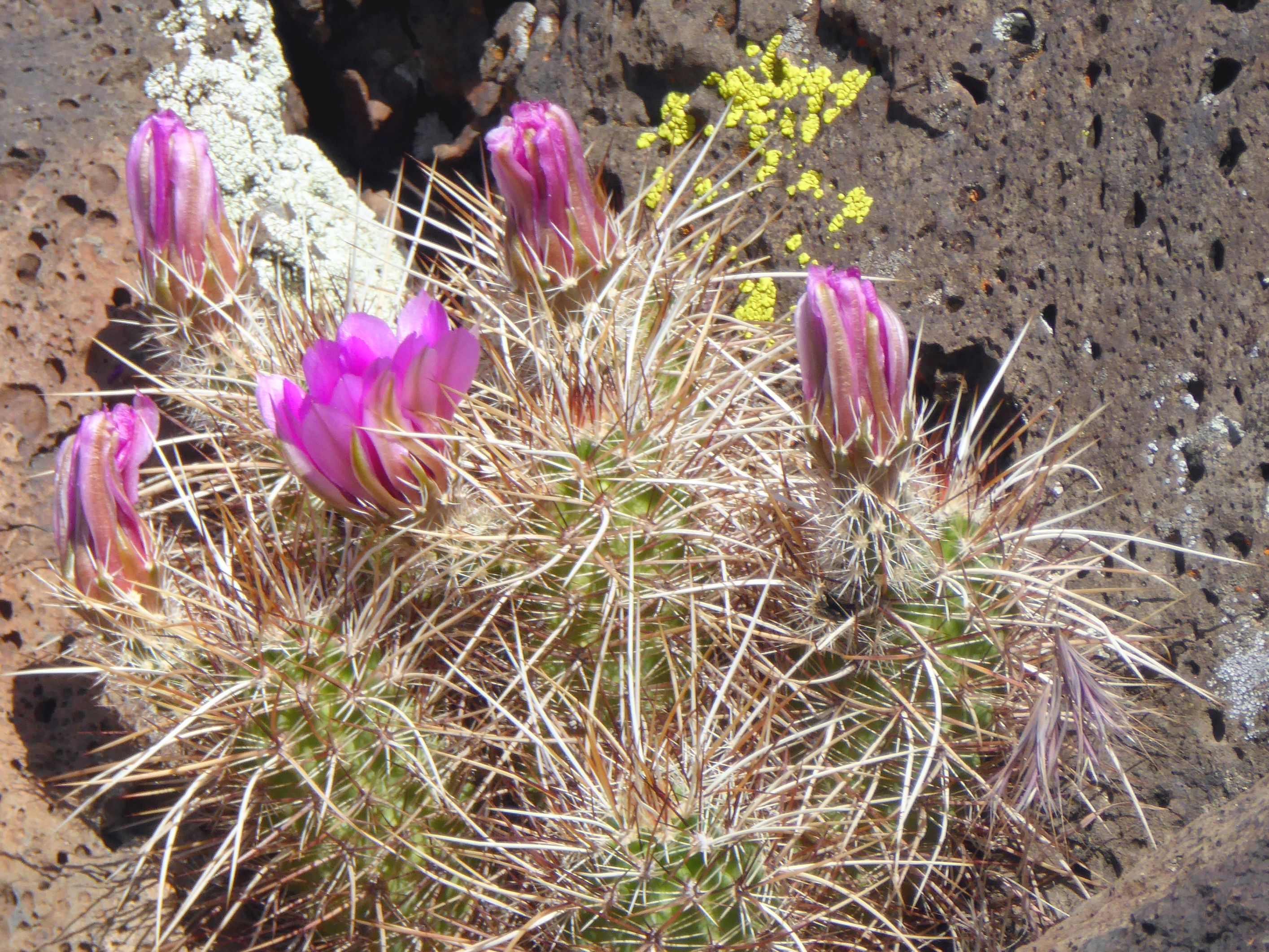
After getting a birds-eye view of the park, we went to the floor of the park’s canyon to walk a path and get close-up views of the beautiful spring desert flowers and sandstone formations. The moon was still visible against the clear blue sky, so the group enjoyed taking strategically framed photos along the way.
The black is volcanic rock.
The moon is just above the rock formation on the left.
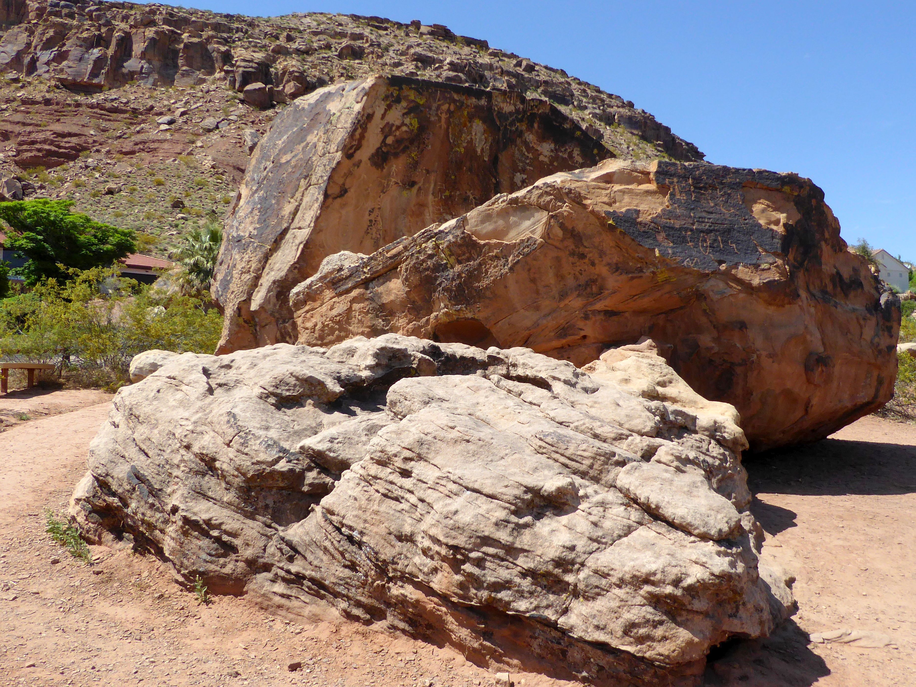
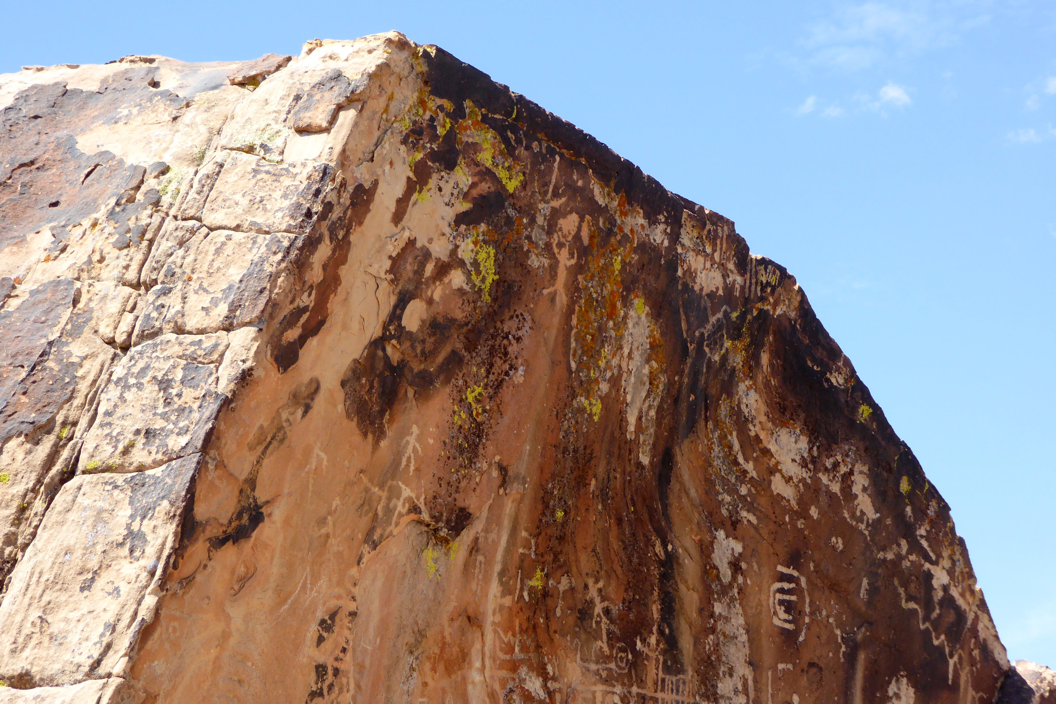
We also visited Bloomington Petroglyph Park, a very small park located in the middle of a subdivision! It was sad to me to see houses surrounding such a historical site!
You can see a small section of a roof of one of the houses surrounding the park. I did my best to cut them out of my photos!
The ½ acre park highlights large boulders with petroglyphs. These carved images tell the stories of ancient peoples. Many of these carved images are of humans and animals as well as what is believed to be early trail maps. The history of these petroglyphs is unknown; however, other petroglyphs in Utah are around 2,000 years old.
(Unfortunately, the petroglyphs have been vandalized, so there are also initials carved into the rocks.)
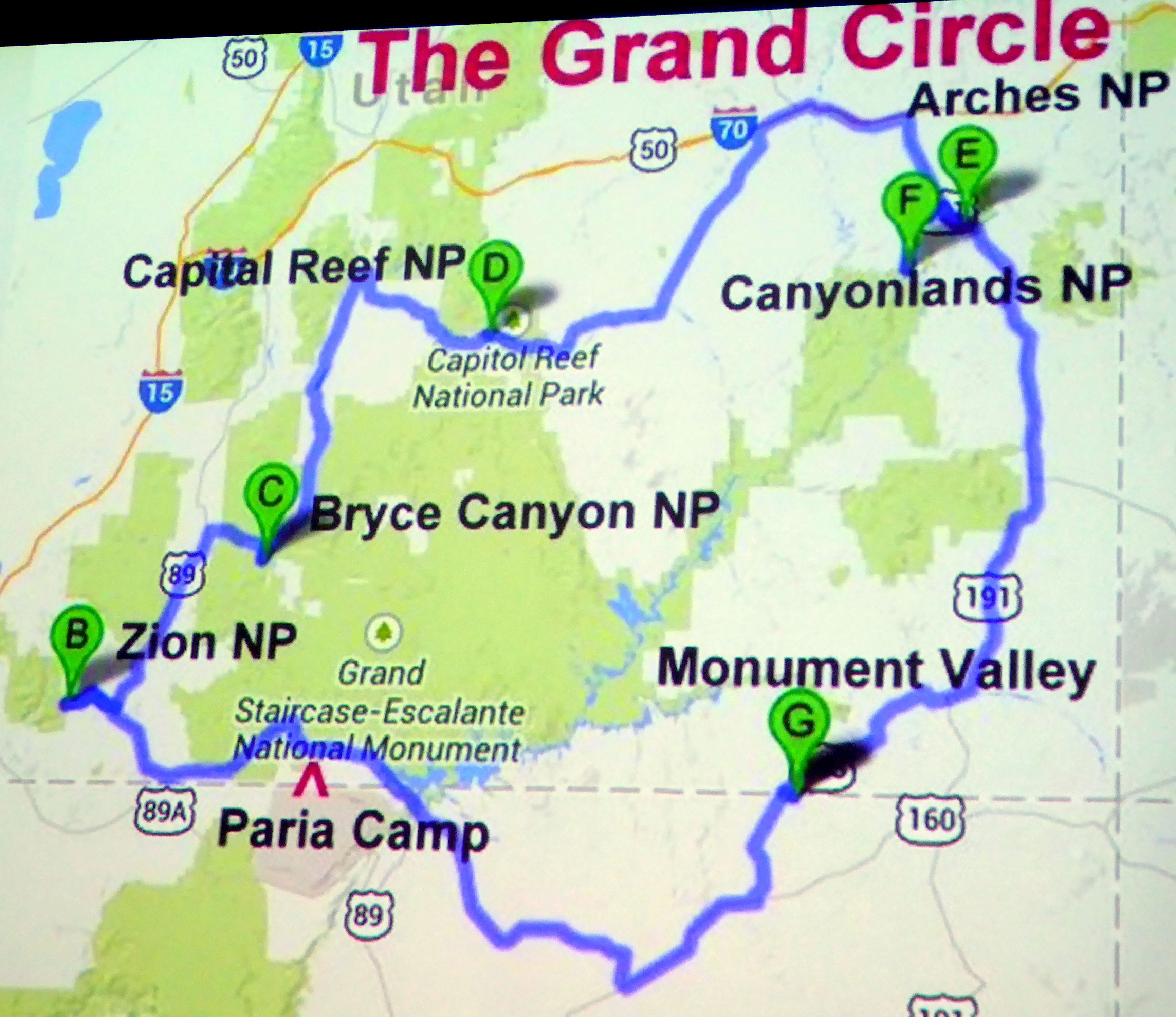
Less than three weeks after returning from Italy, we were off again to see the Grand Circle of Utah’s National Parks, along with a few state parks and monuments. This time, we did a small group tour with Road Scholar, although “small group” amounted to 24, instead of 16 like we had in Italy with Overseas Adventure Travel.
This was a completely different type of trip than Italy. Instead of a focus on the culture, cultural connections with the locals, connections with our tour leaders, incredible food, and beautiful historic sites; Utah was all about the gorgeous scenery and photography. If you would like to see more pictures and read less stories, join me for a tour of Utah’s most beautiful parks.
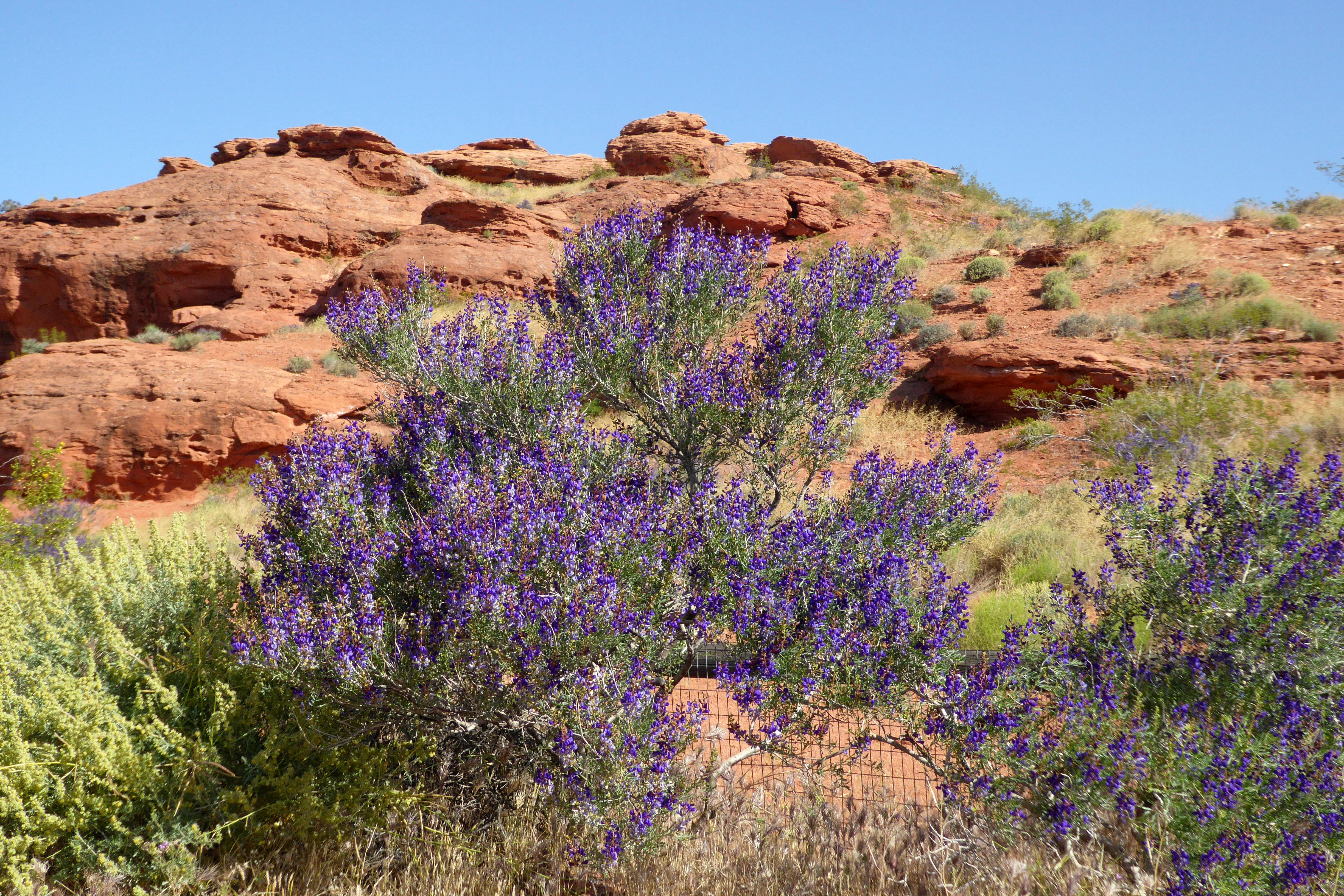
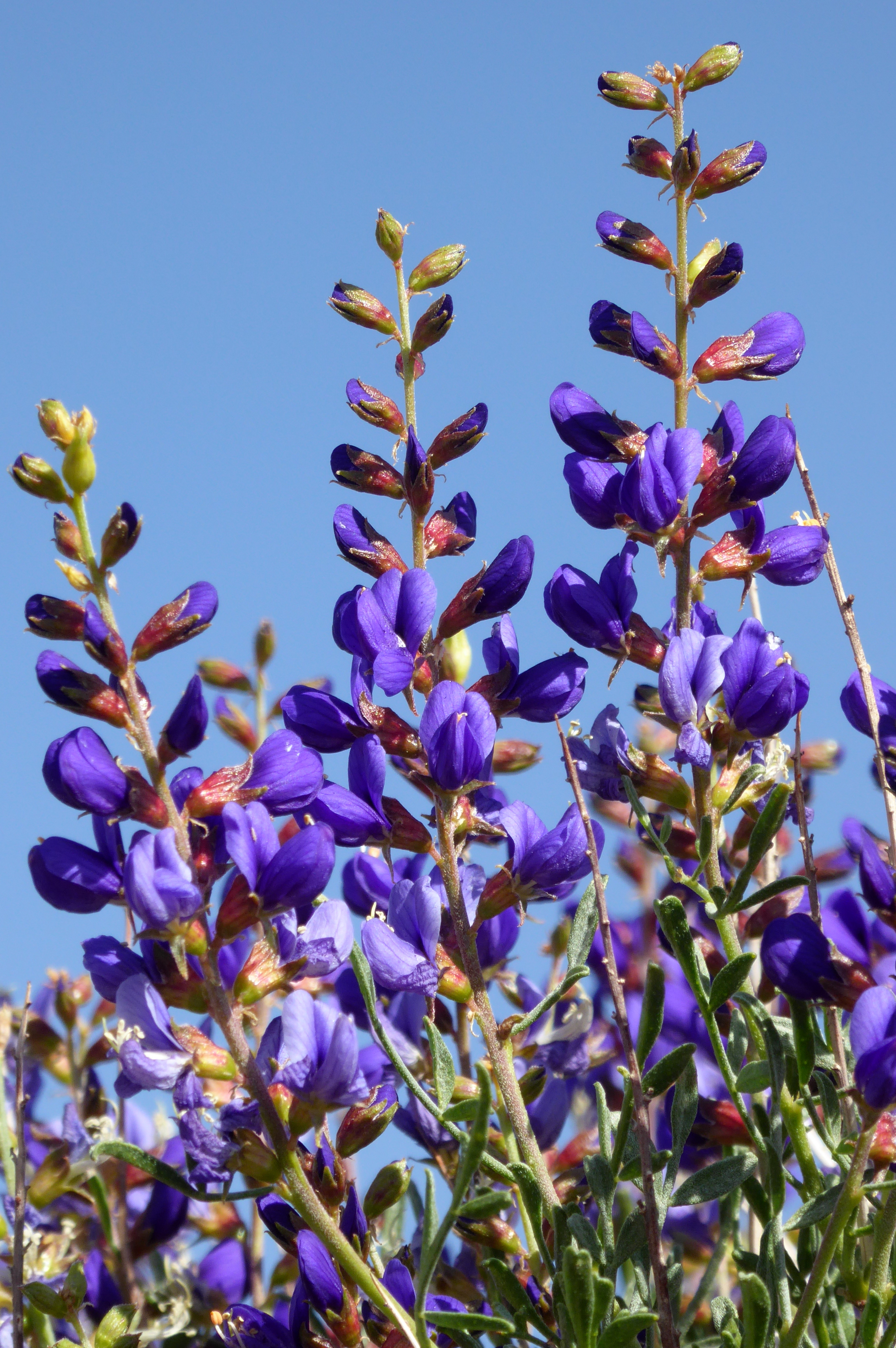
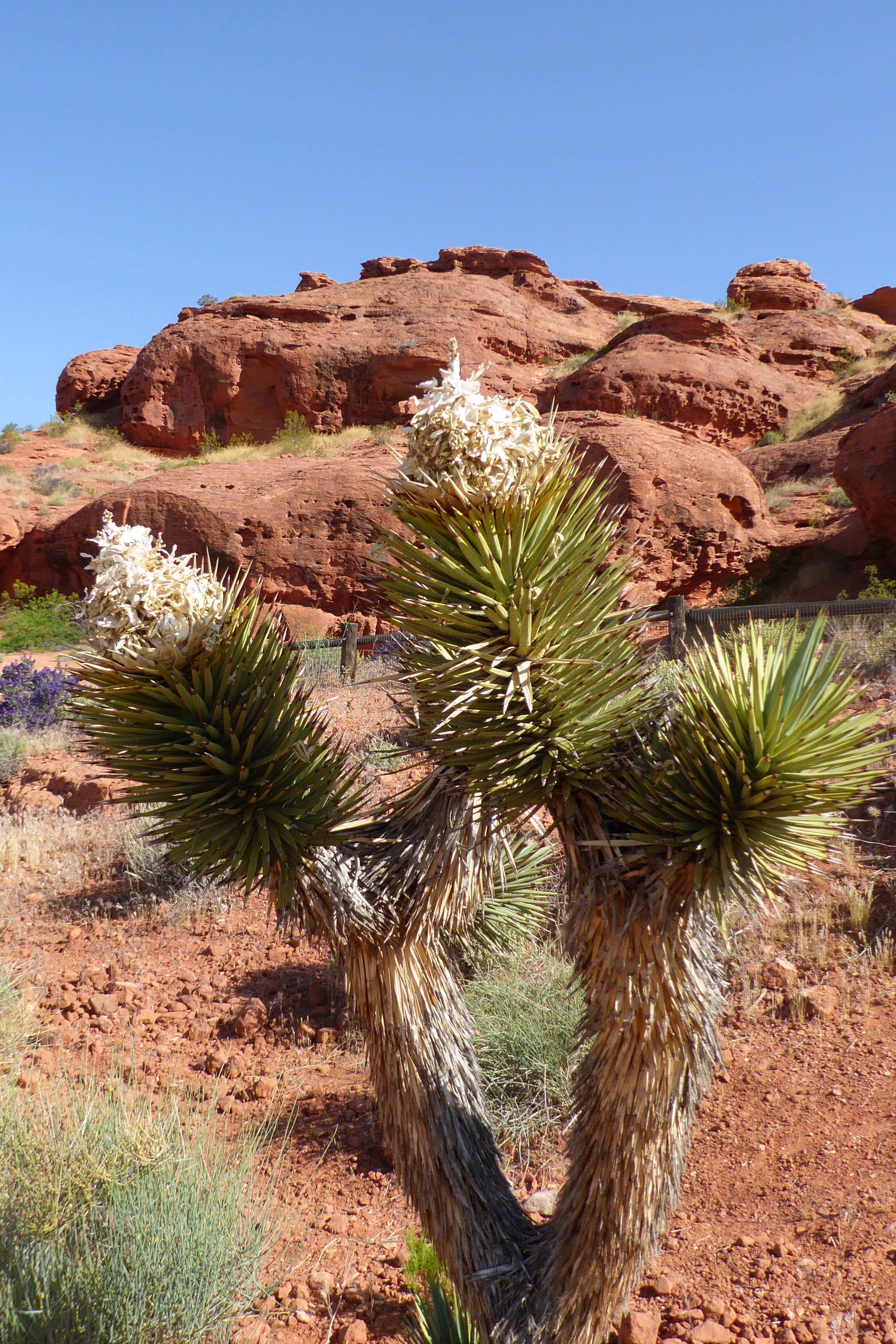
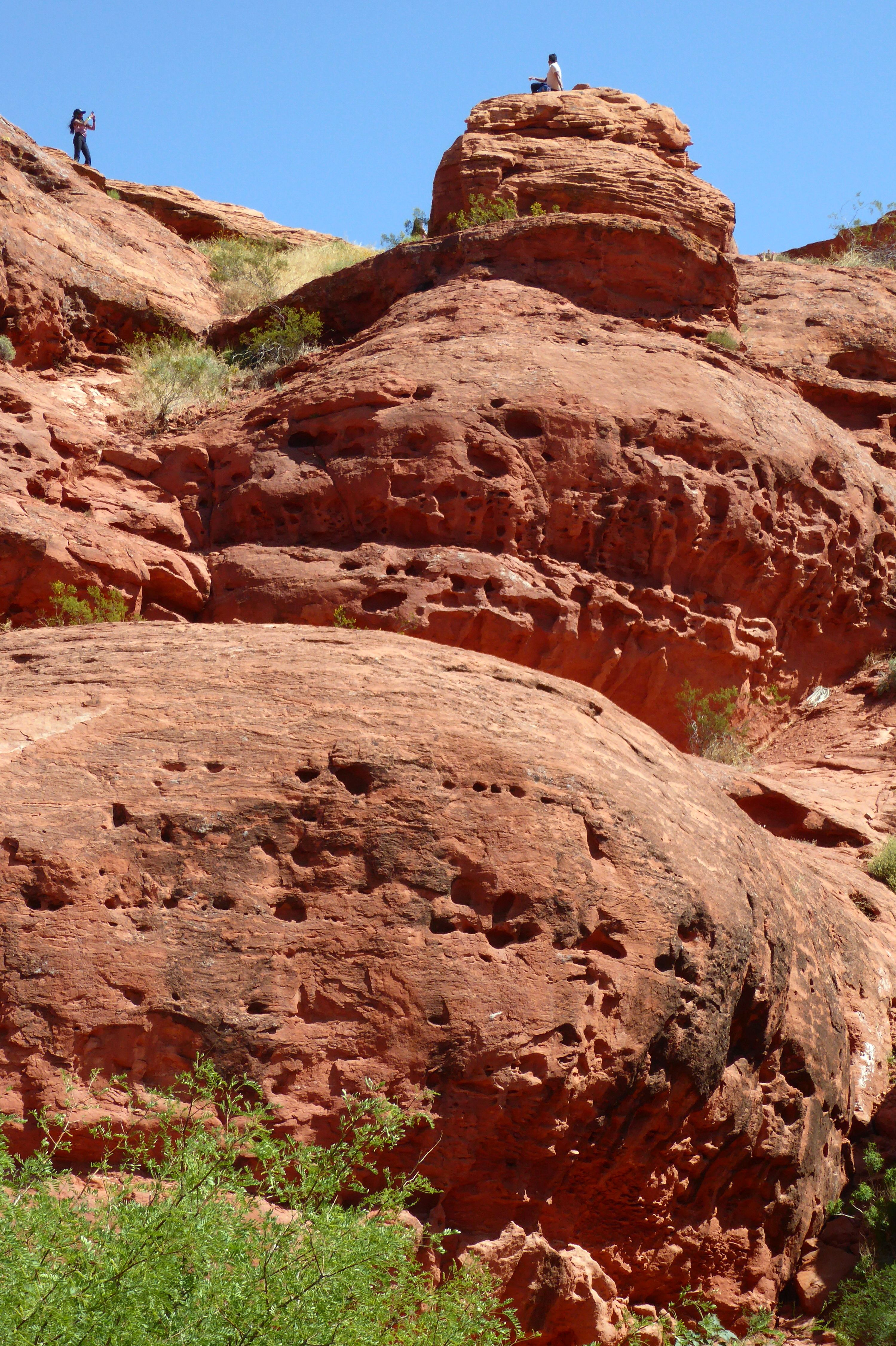
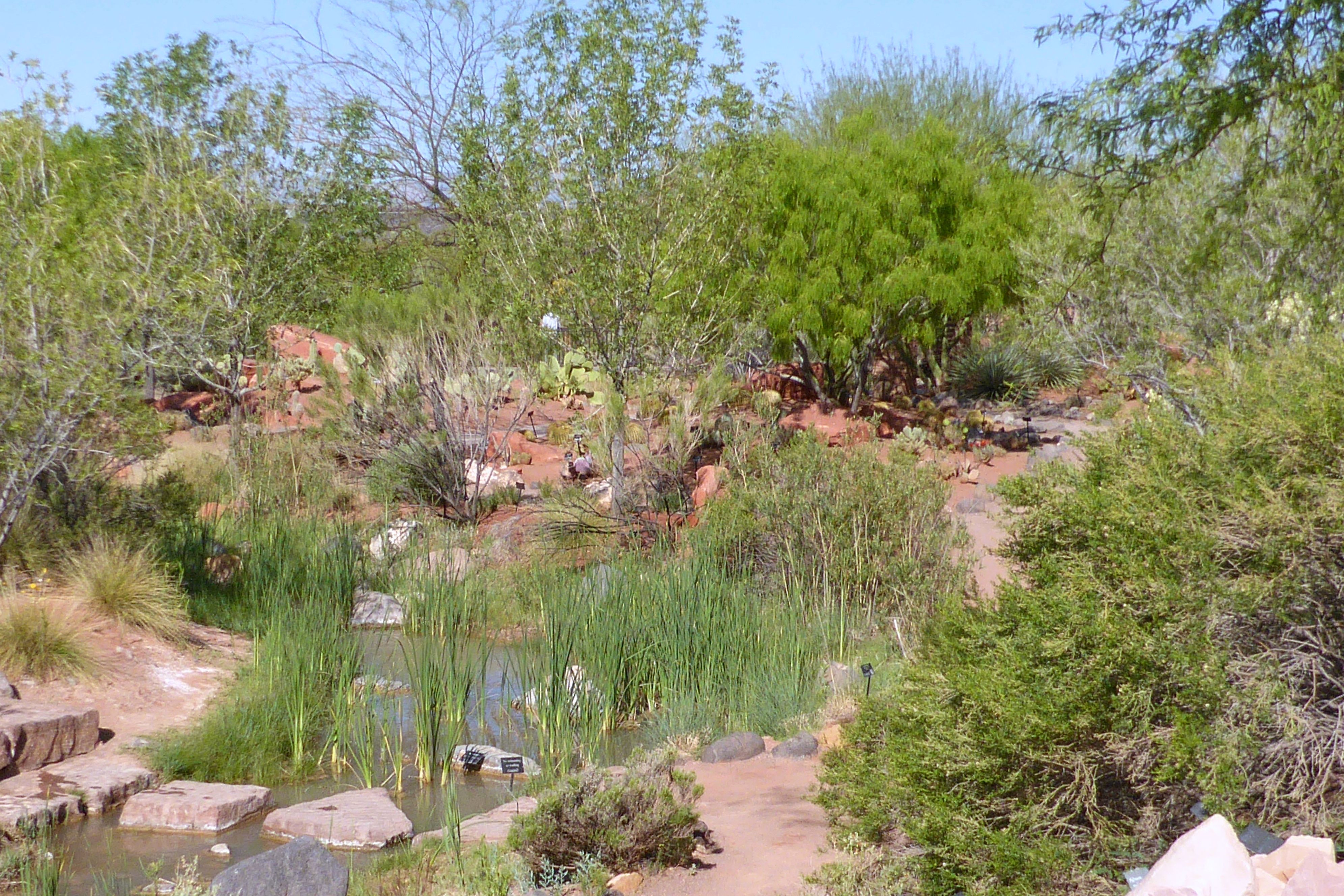
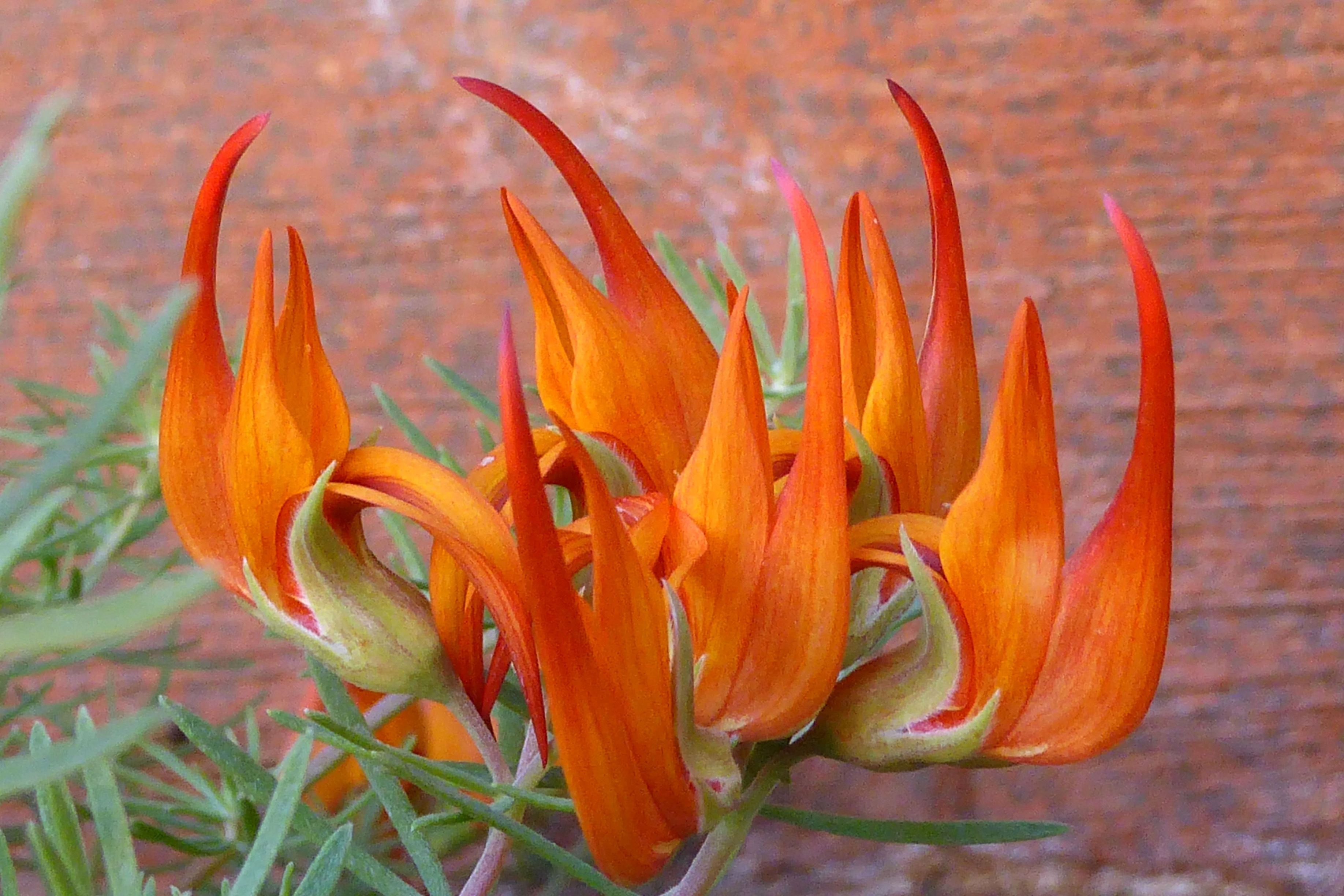
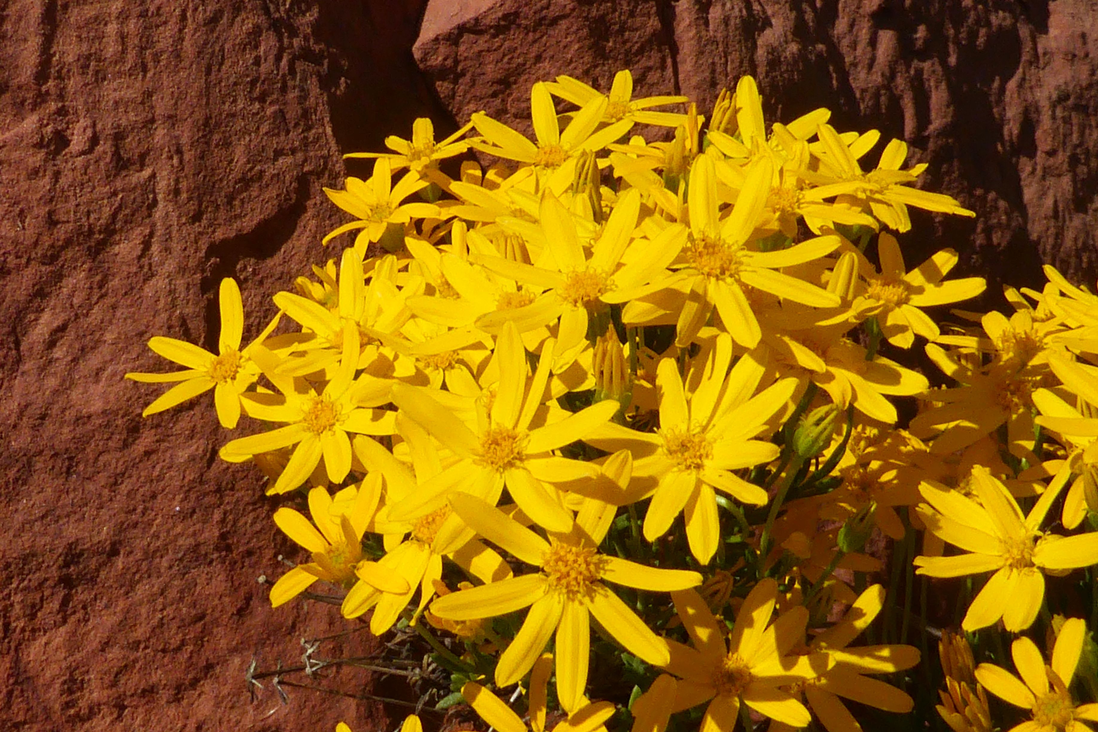
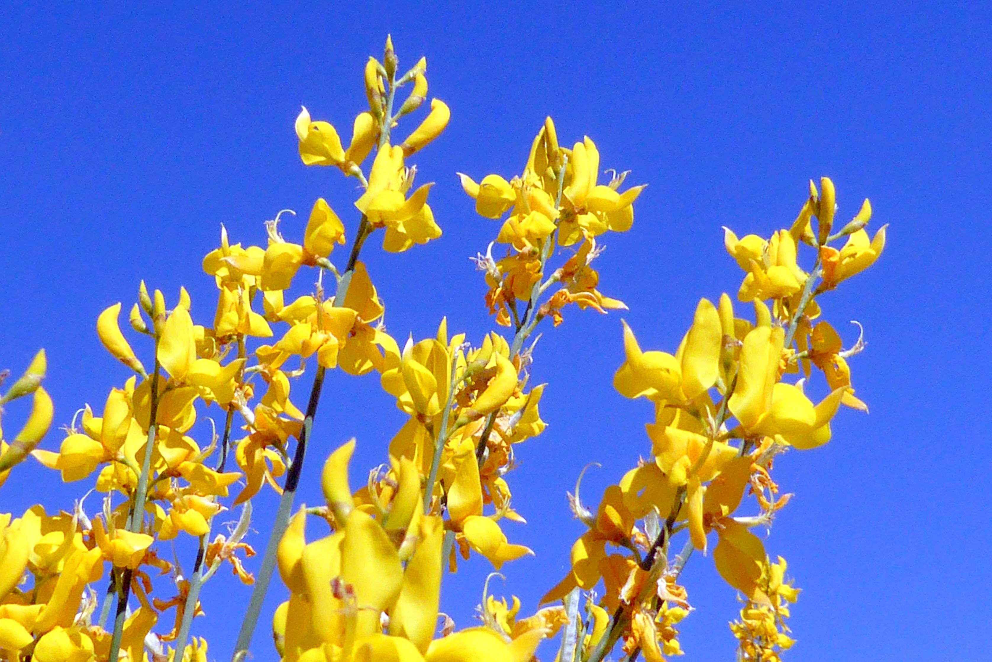
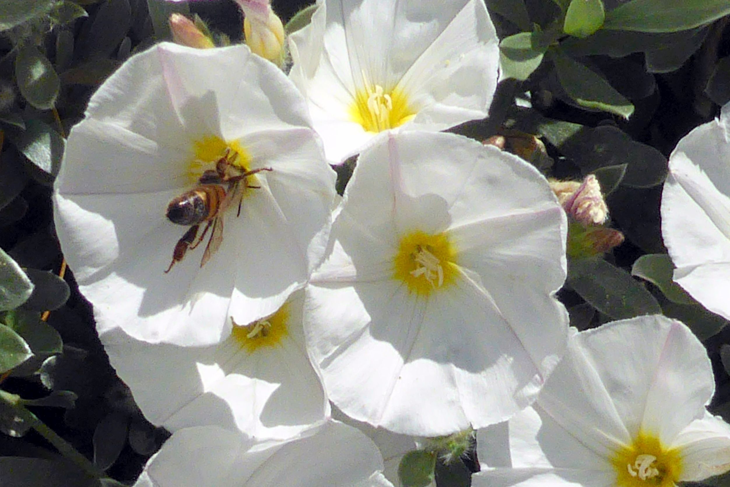
We arrived a day early ahead of the tour, so we could explore a little on our own and relax before joining what would be a busy tour. The first flight out got us in early to St. George, so we checked in at our hotel (which, thankfully, was happy to accommodate us ahead of check-in time), and hopped on a bus to town. From there, we walked up to Red Hills Desert Garden, which was ranked #1 on Trip Advisoras a “Traveler Favorites” for St. George. It was a free attraction, the weather was gorgeous, the spring flowers were in bloom, and we were up for a walk after the flight; so, what could be better than that?
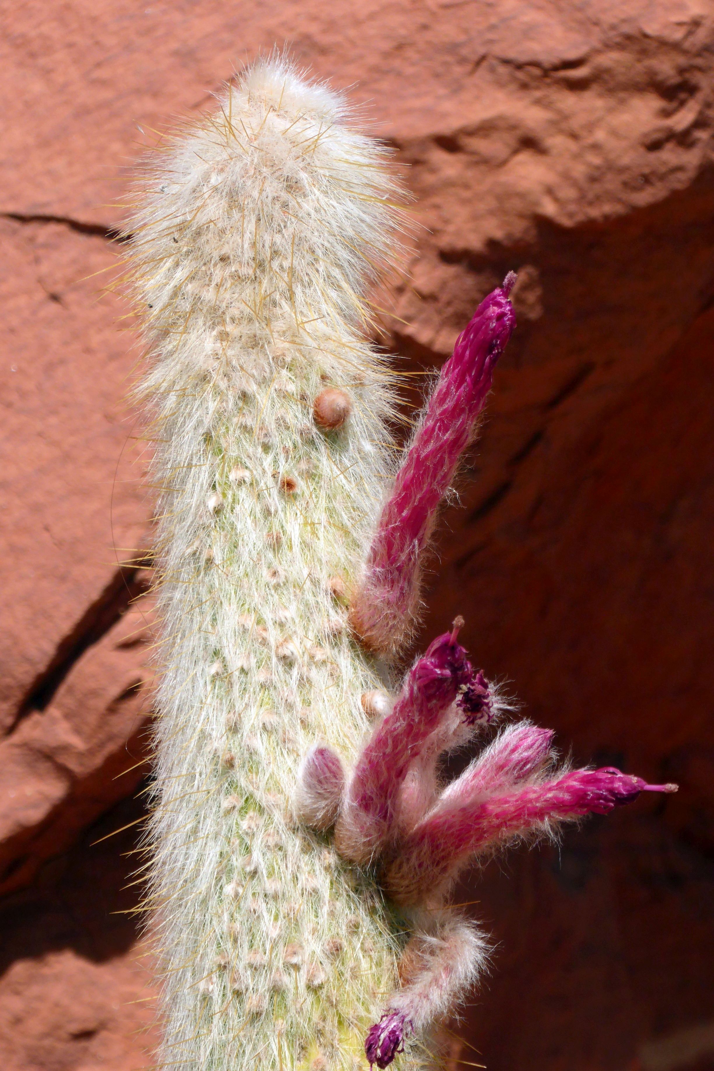
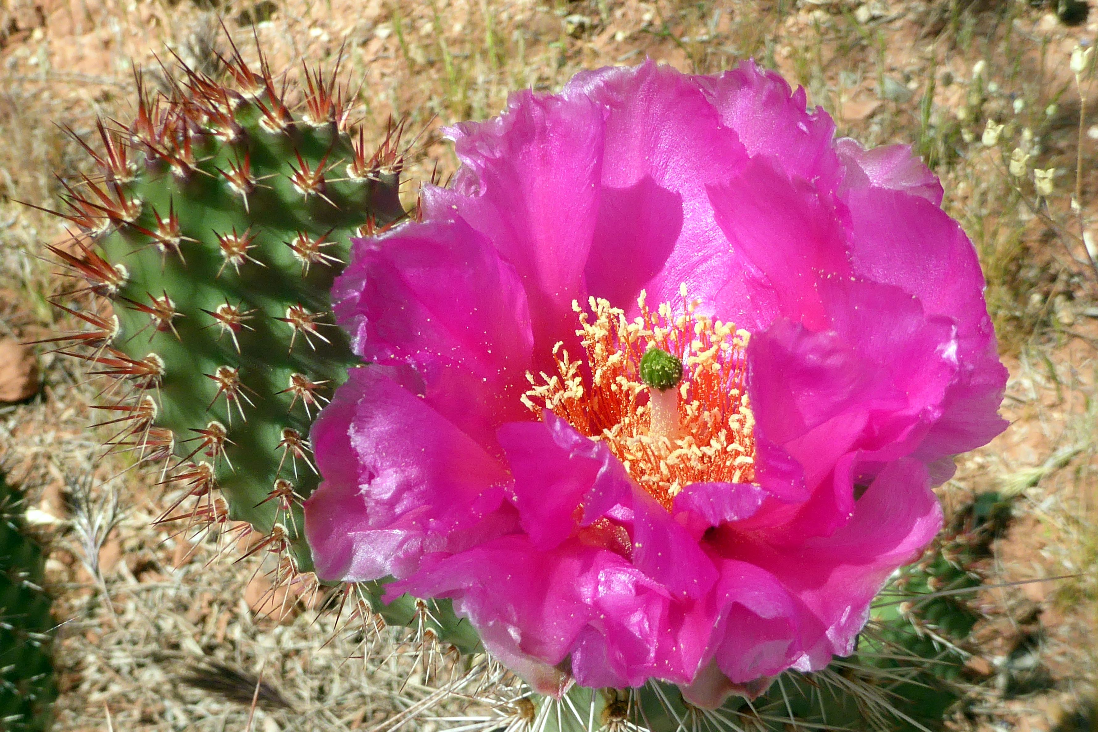
Trip Advisor rarely disappoints, and the reviews were spot-on this time. It was gorgeous there! It was such a beautiful and peaceful place to wander around or sit on a porch swing and relax. I chose to put my camera in action:
(For all pictures, click on the image to see full screen view.)
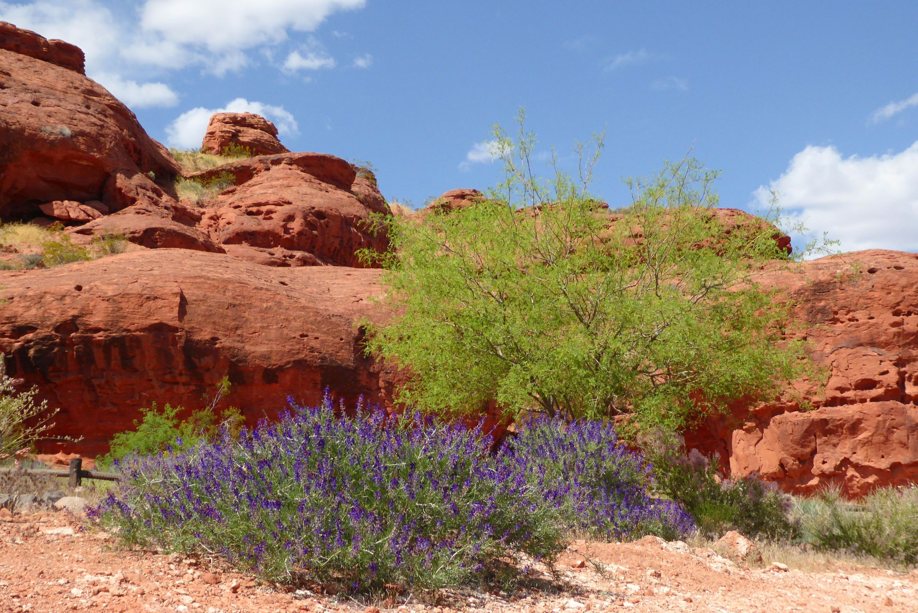
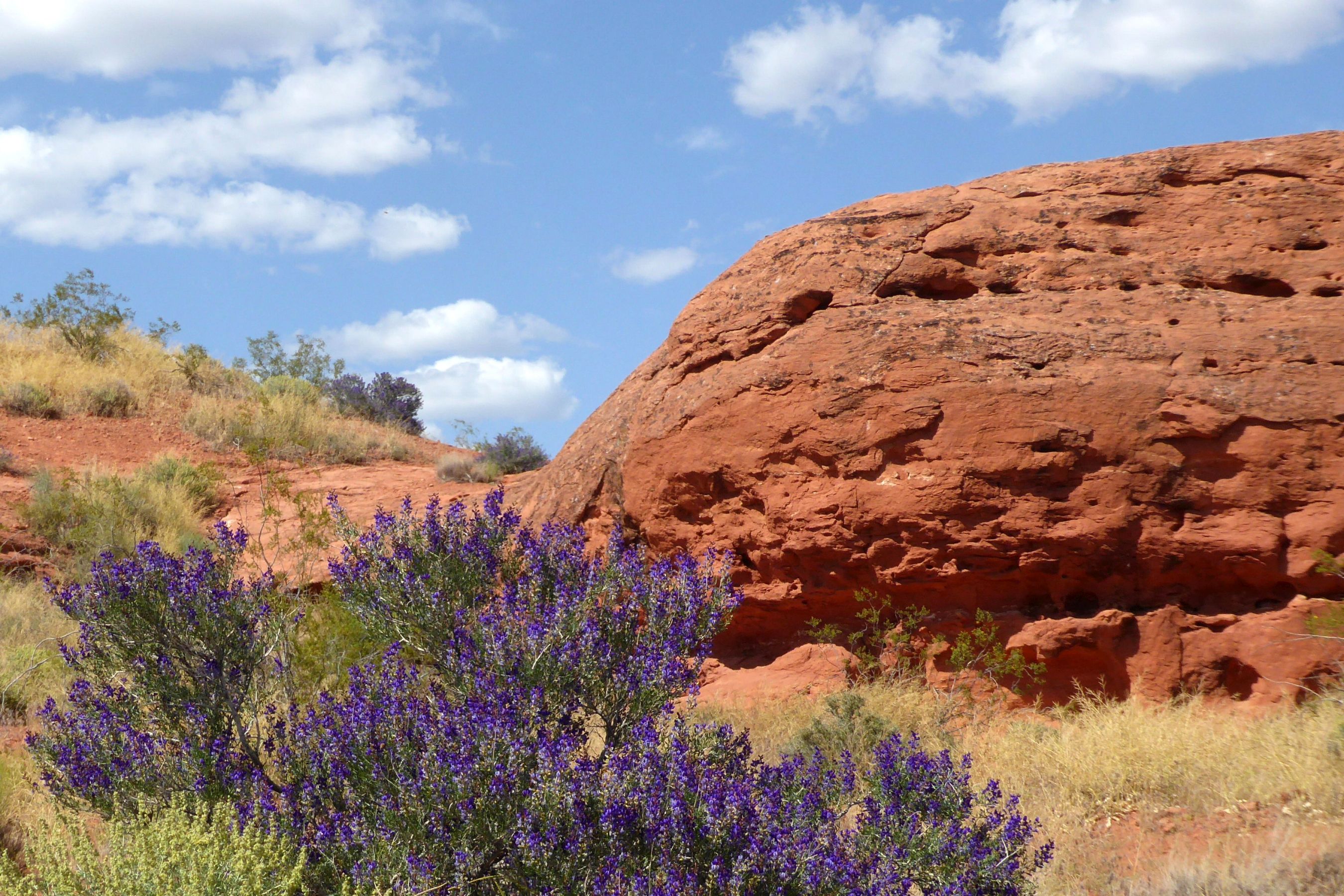
This is behind Red Hills Desert Garden, a beautiful backdrop!
This, Allen, is for you, King Frog!
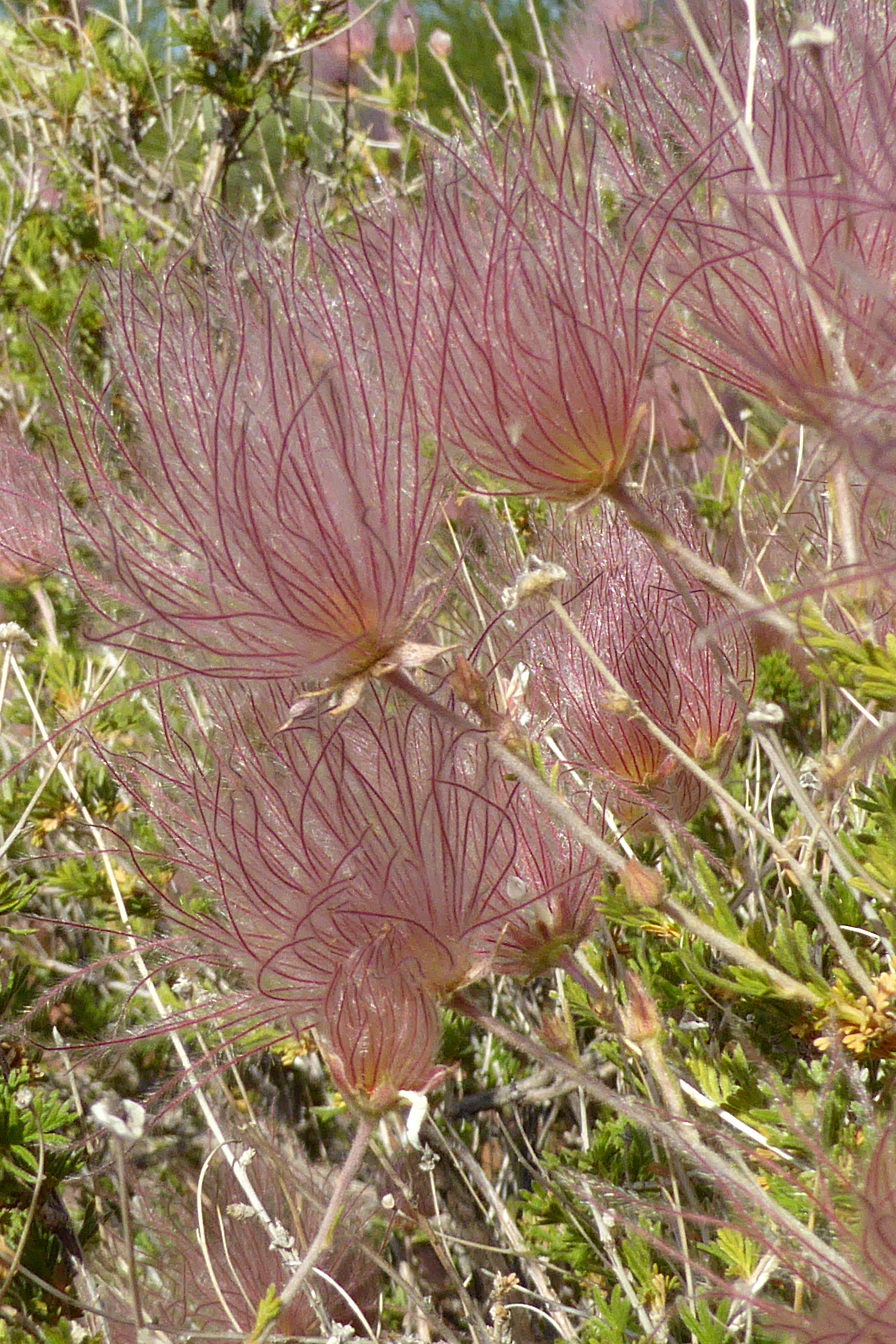
Apache Plume
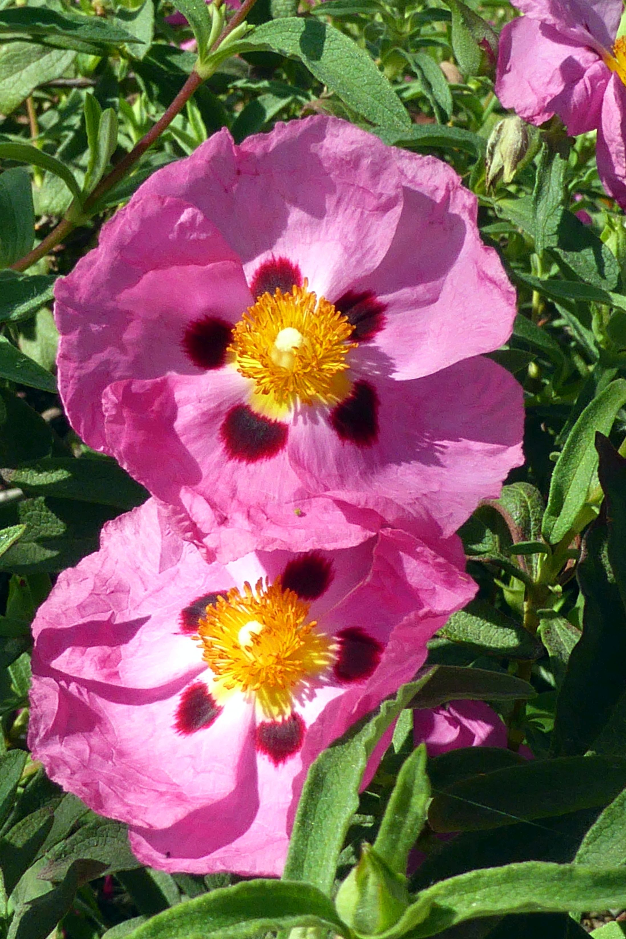
Desert Museum Palo Verde
On our way back to the bus terminal, we passed by the power station and saw this “linesman” made out of parts used on power lines. Clever!
Mee-meep! Watch out for Roadrunner! This guy was out in the parking lot of the hotel.
Little did I know, the garden was on the program for the following afternoon with the group, so we returned for another visit. These are my afternoon photos:
Coming up next: Snow Canyon State Park and Bloomington Petroglyph Park