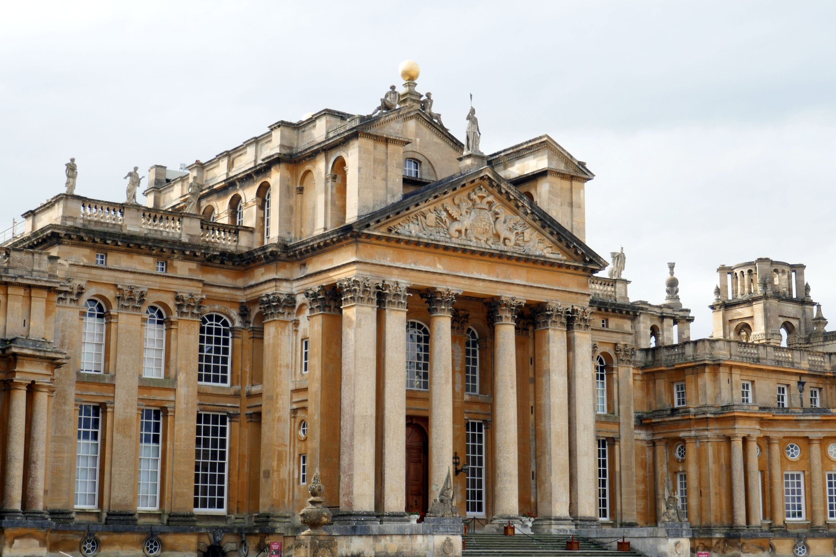
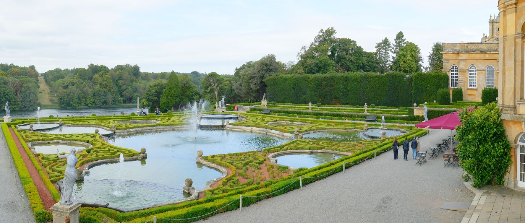
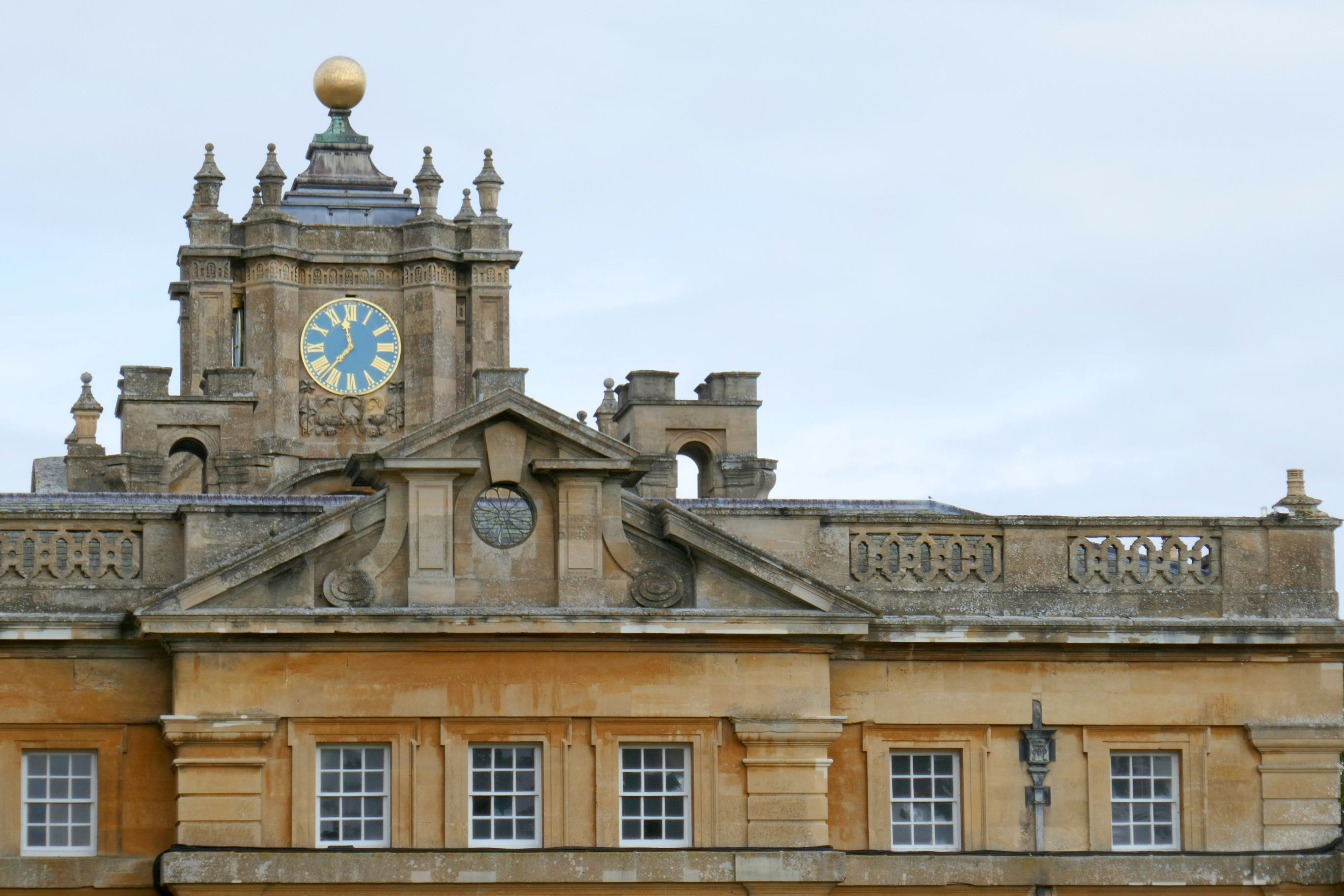
The palace was built between 1705 and 1722, and it is massive. We spent the morning visiting this enormous palace as well as the beautiful gardens.
(For all photos, click on the image for a full screen view.)
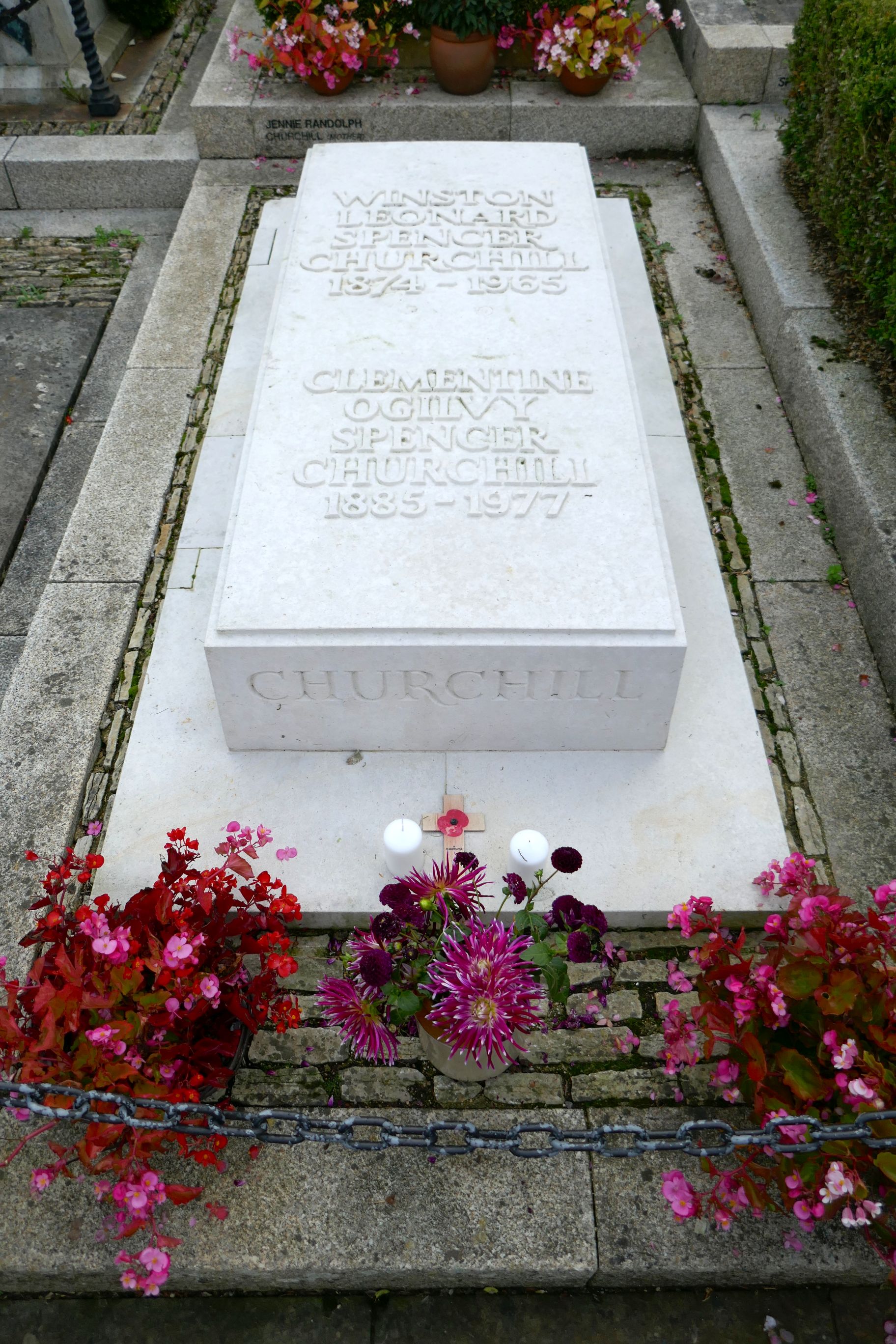
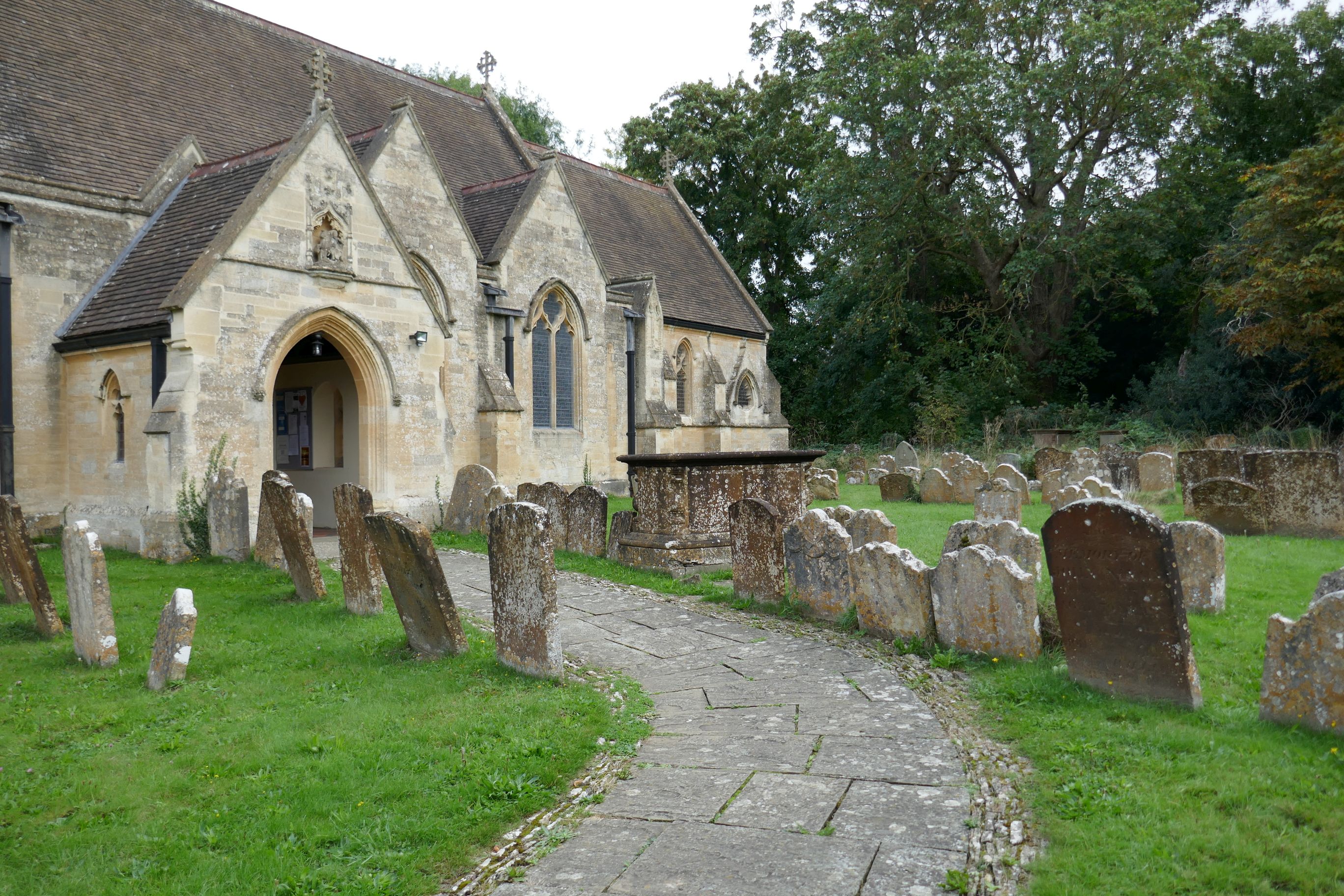
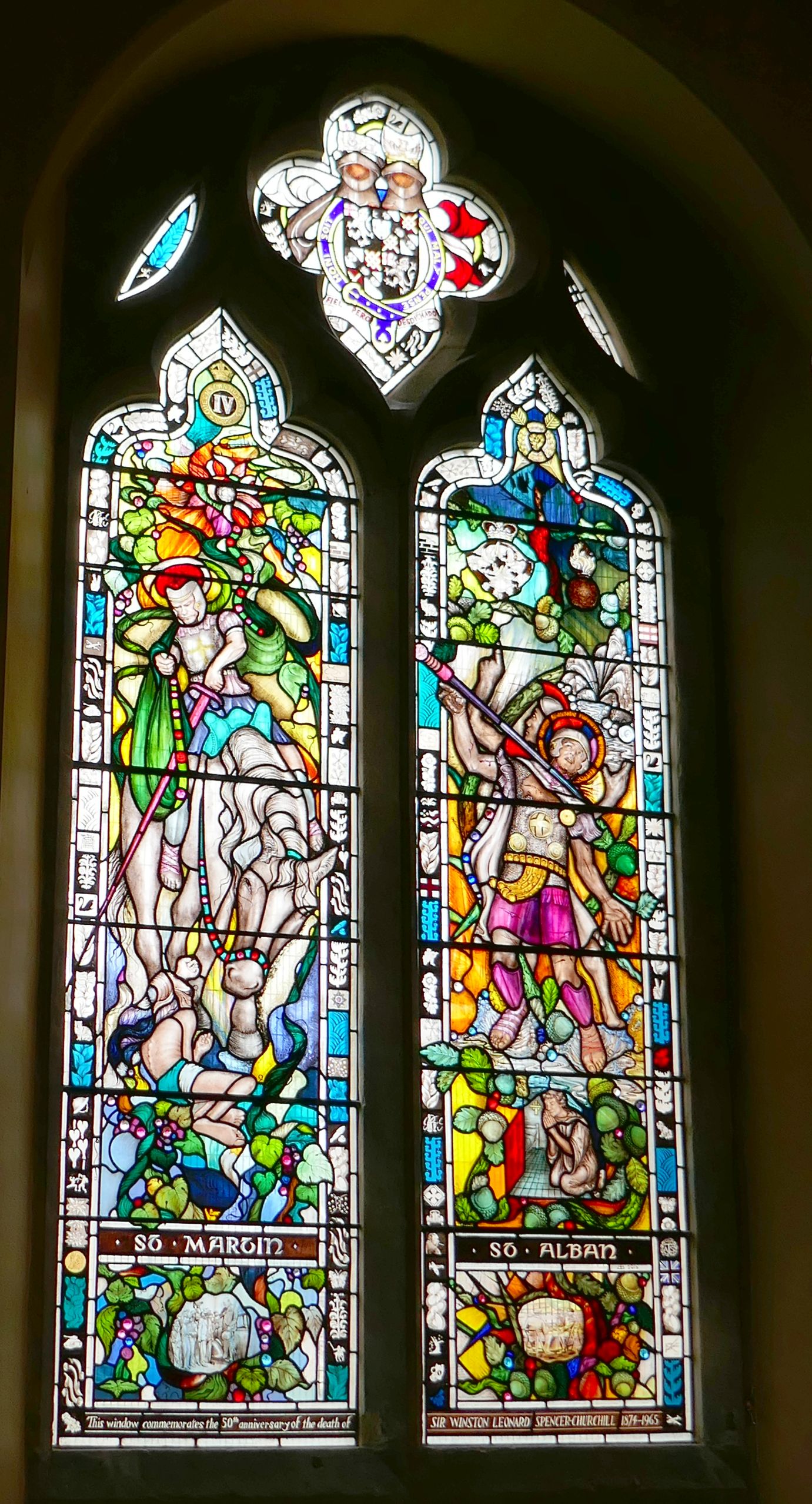
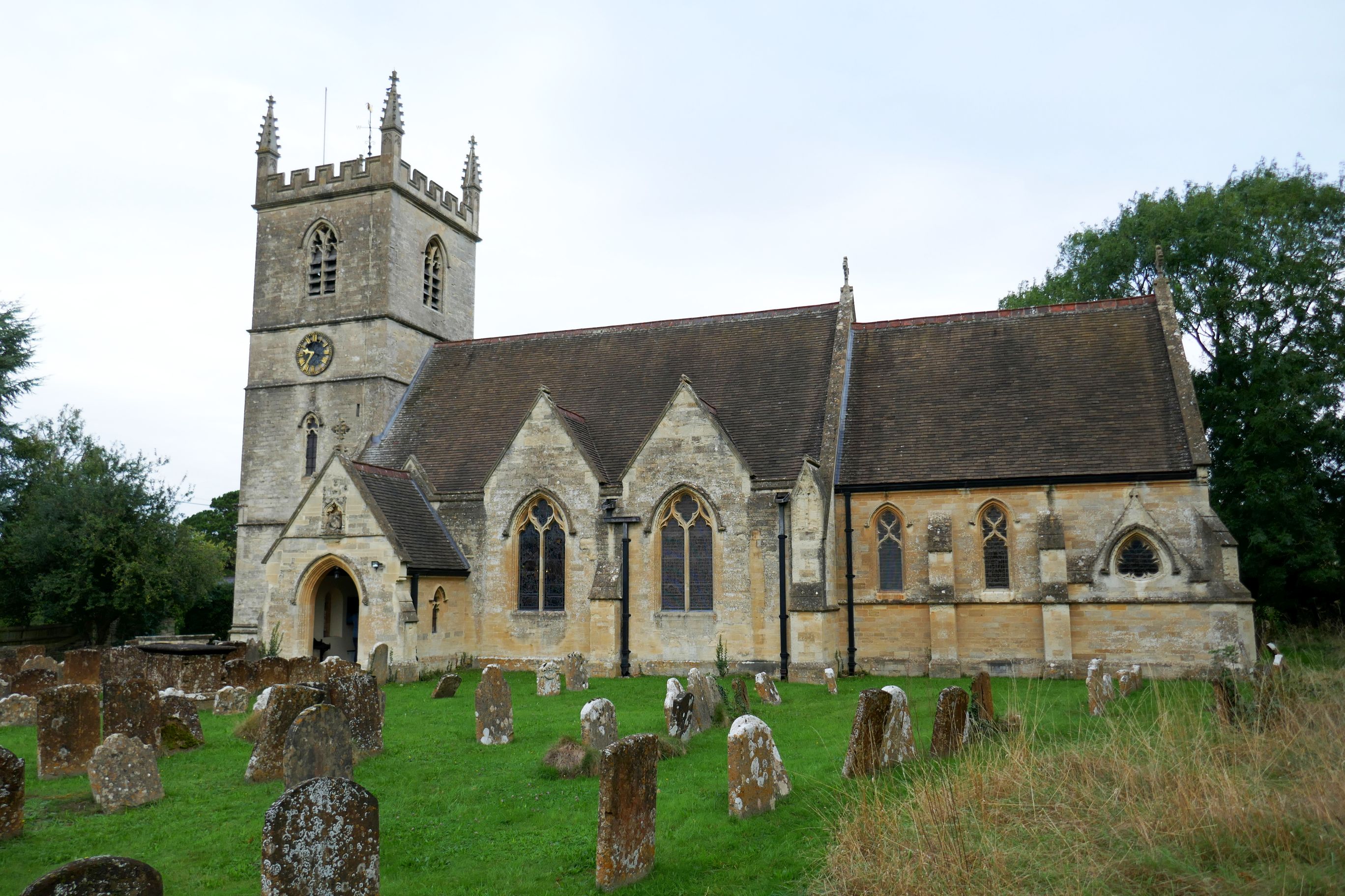
Before visiting the palace, we stopped to see Winston Churchill’s grave site at The Church of St. Martin Bladon.
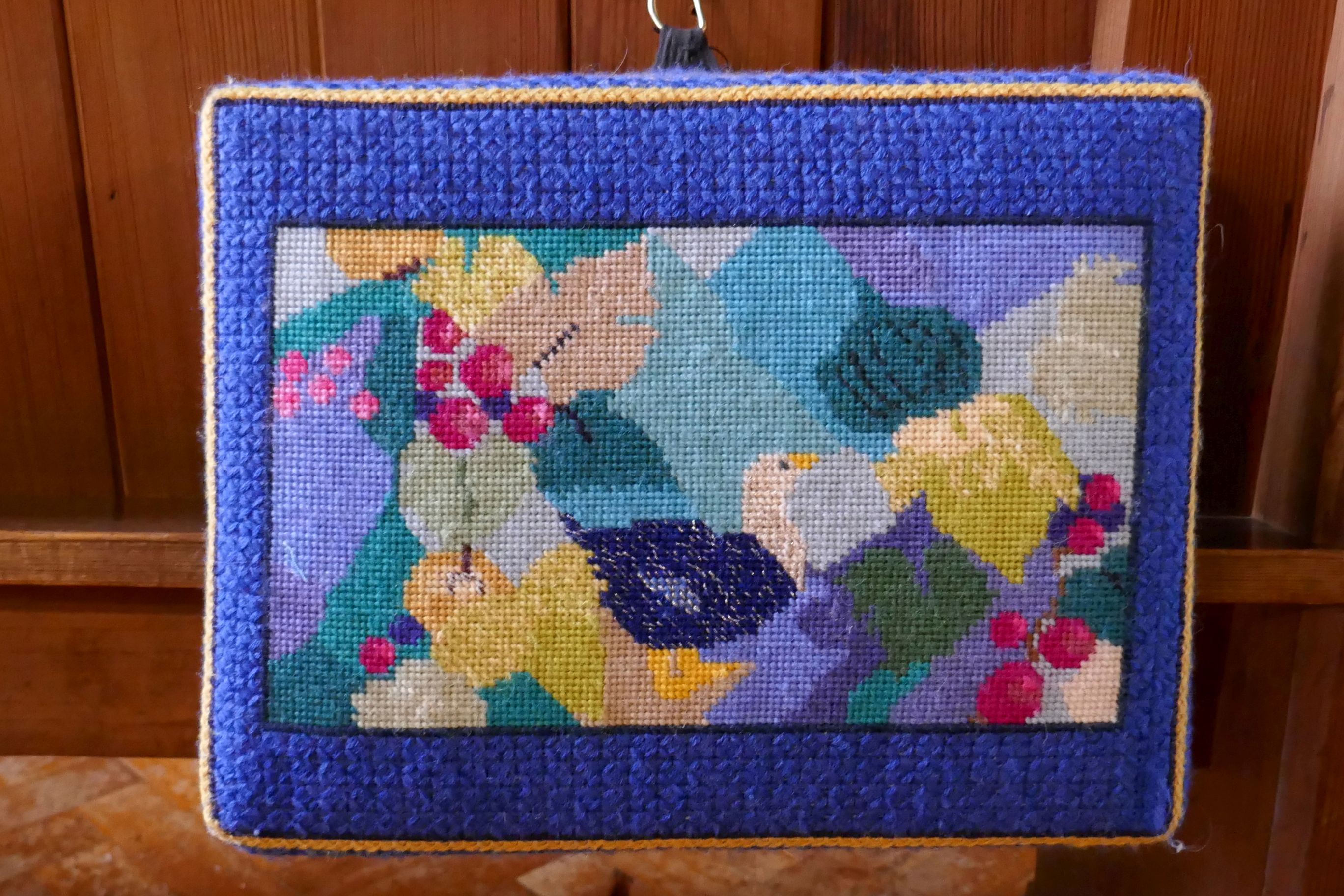
Handmade pew pillow
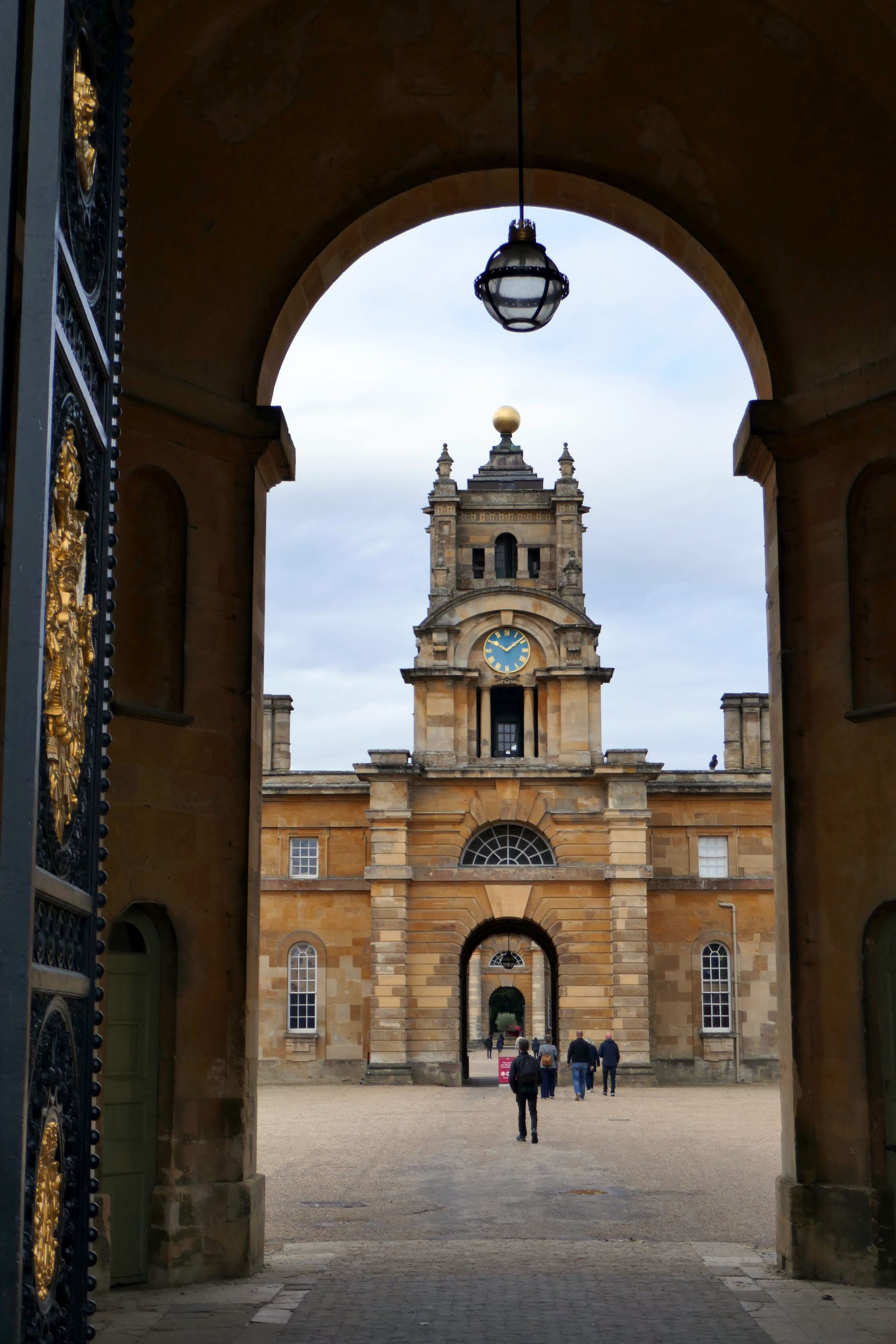
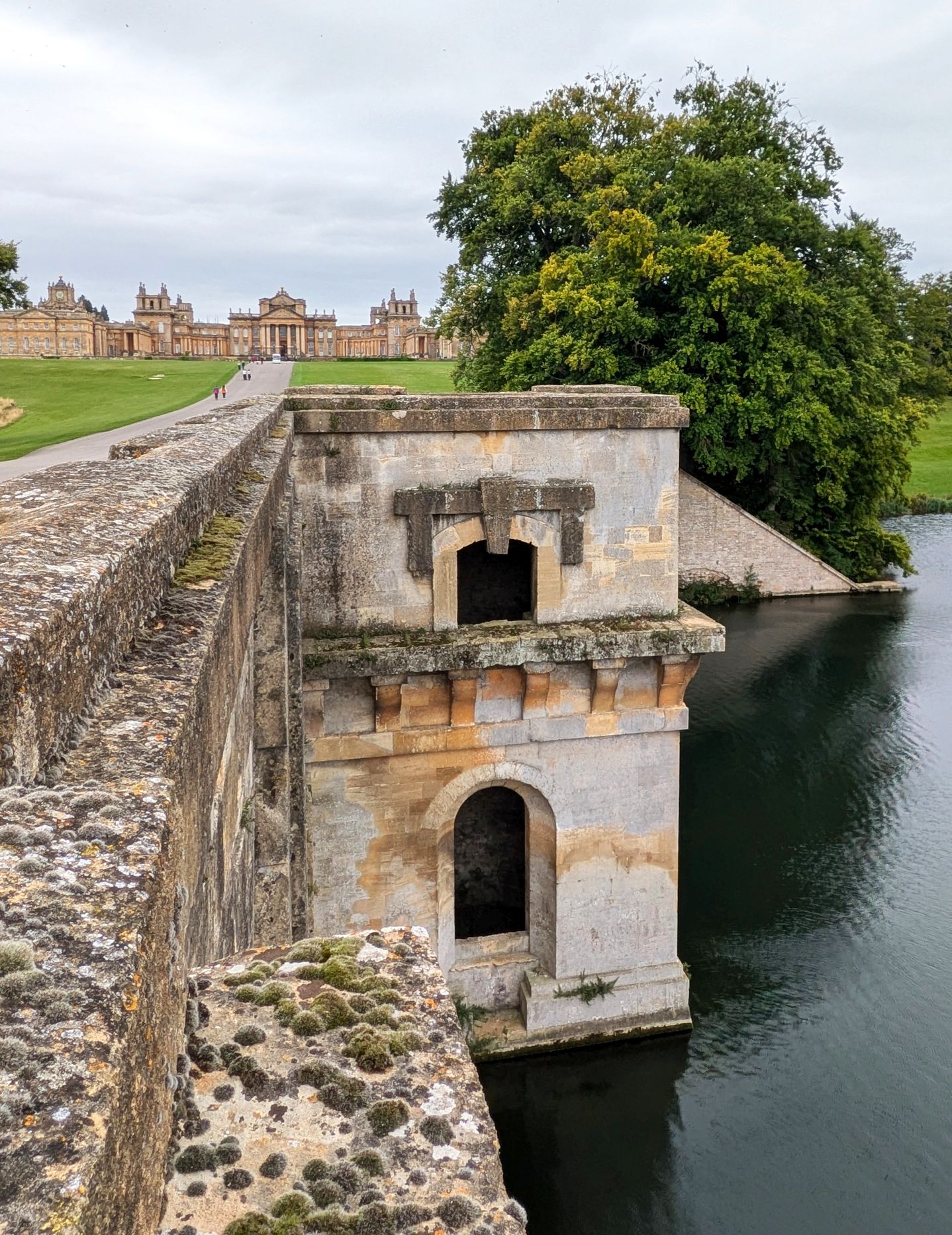
Entrance to Blenheim Palace
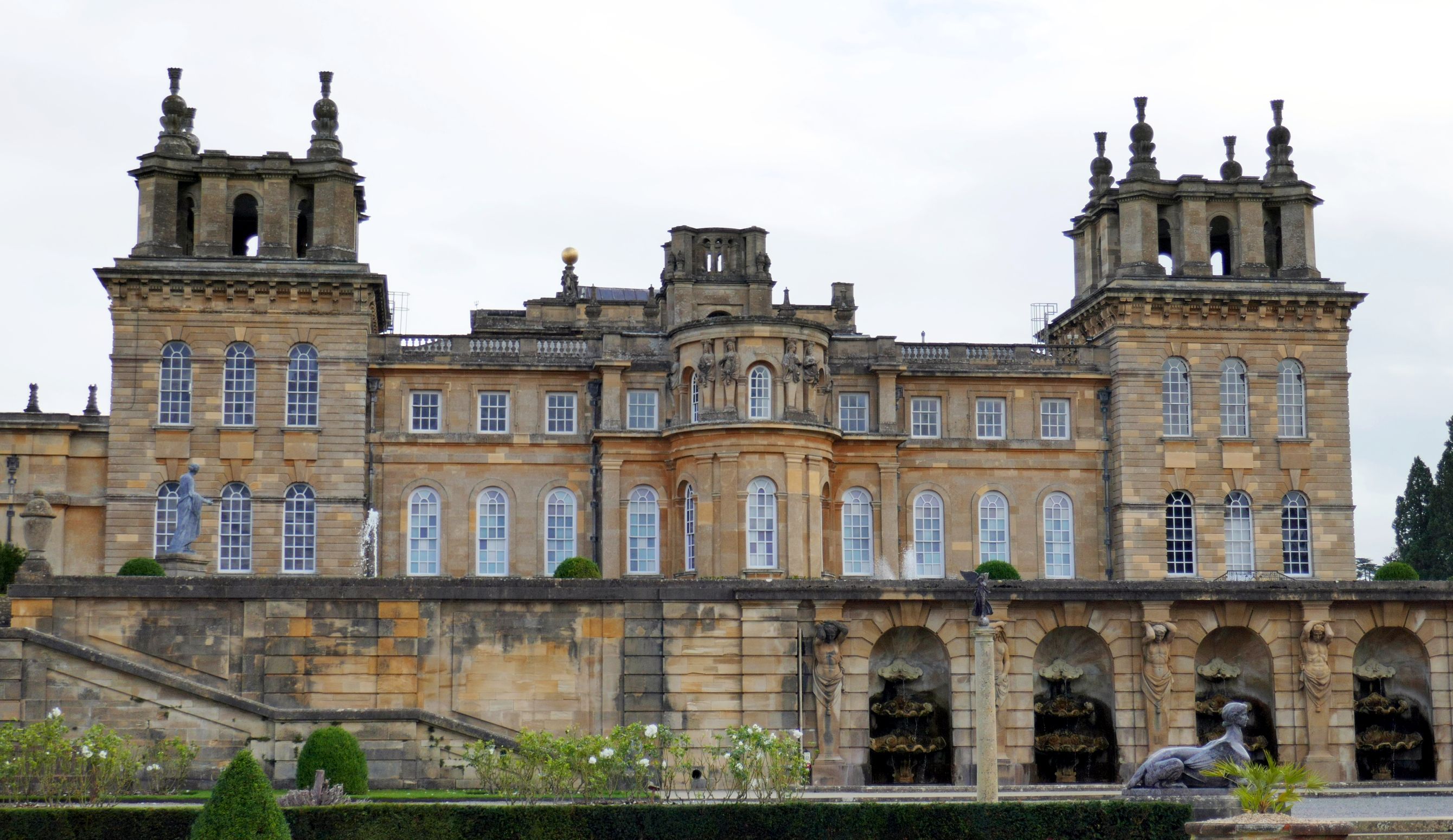
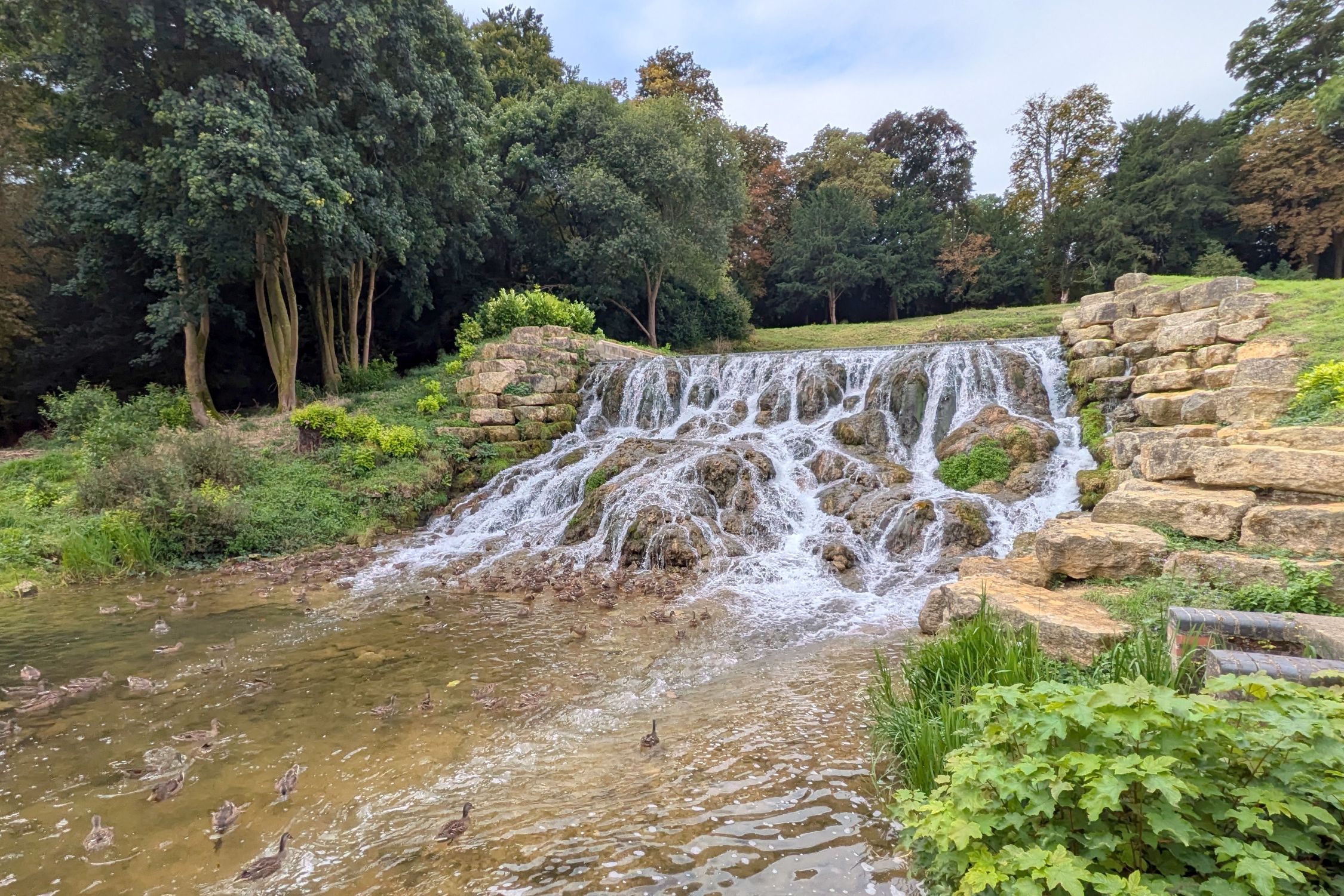
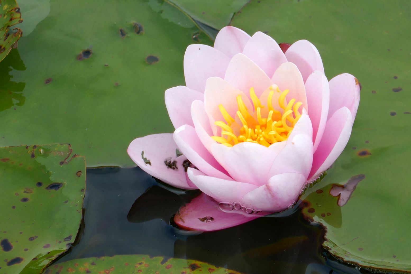
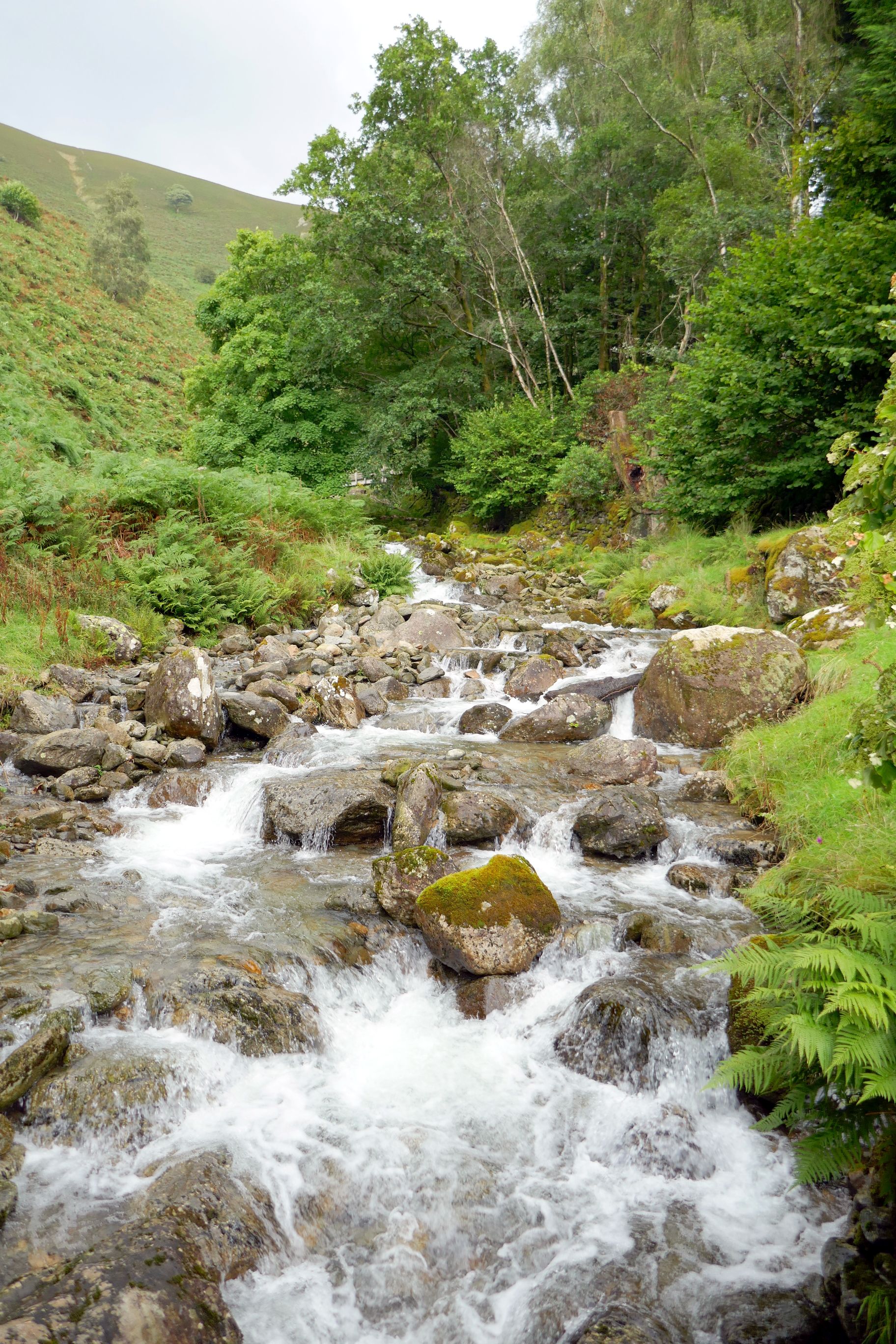
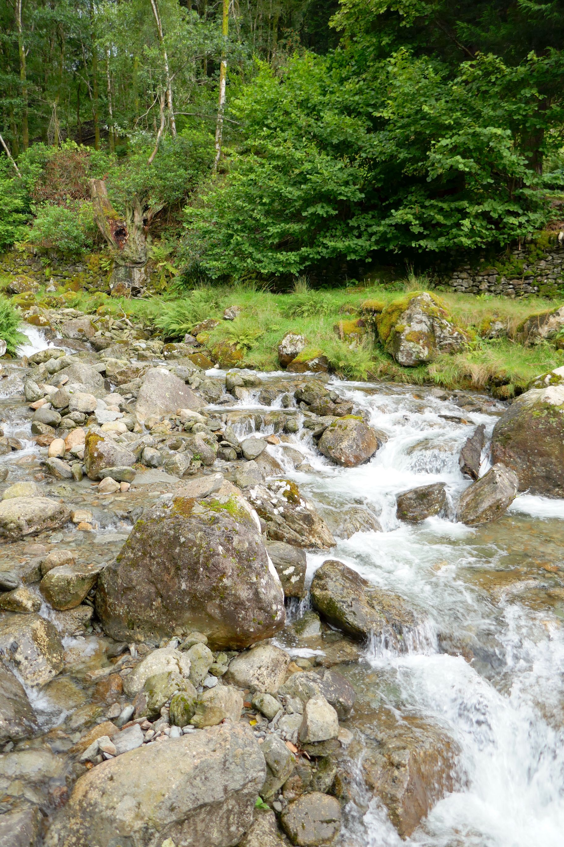
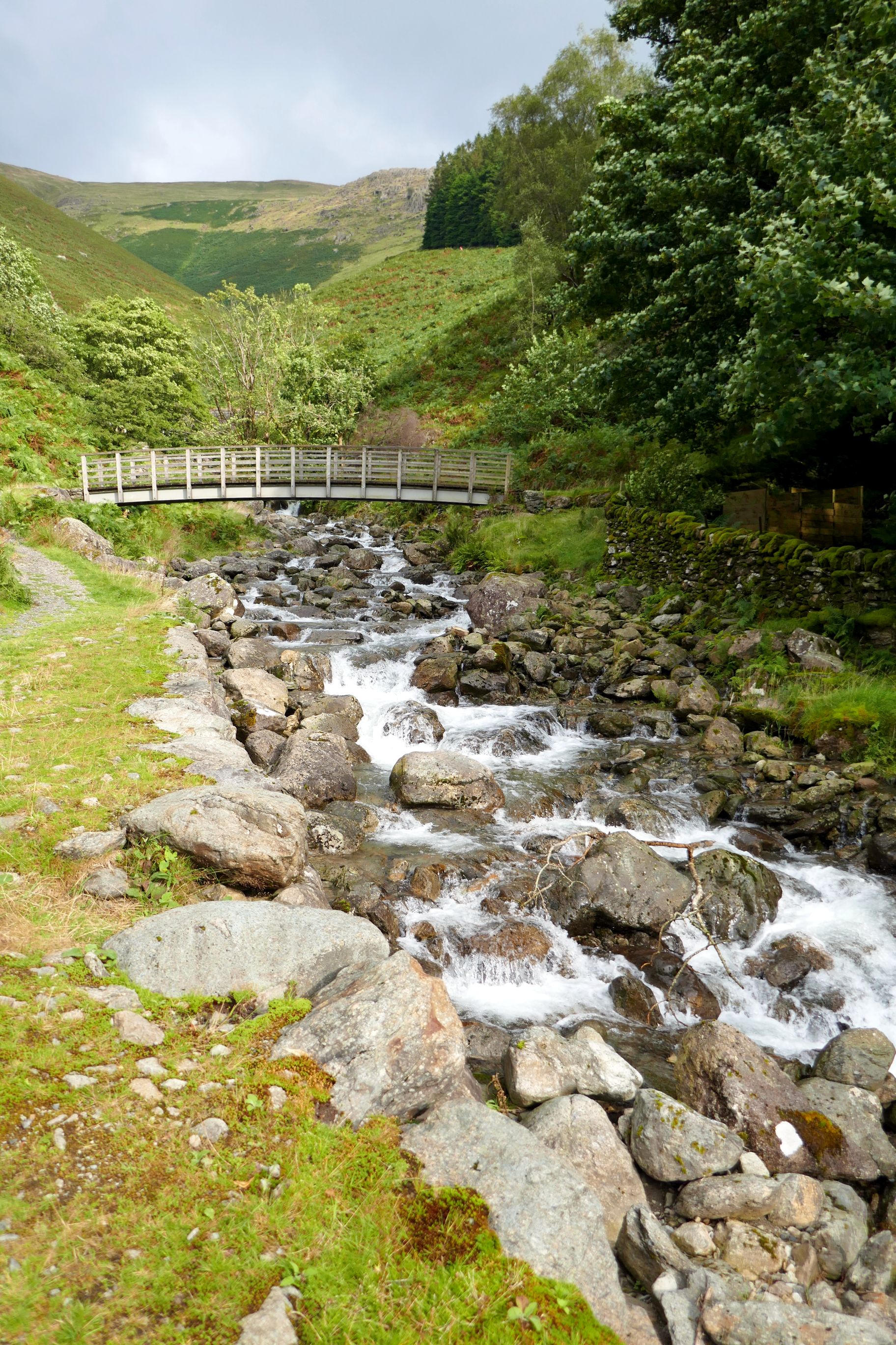
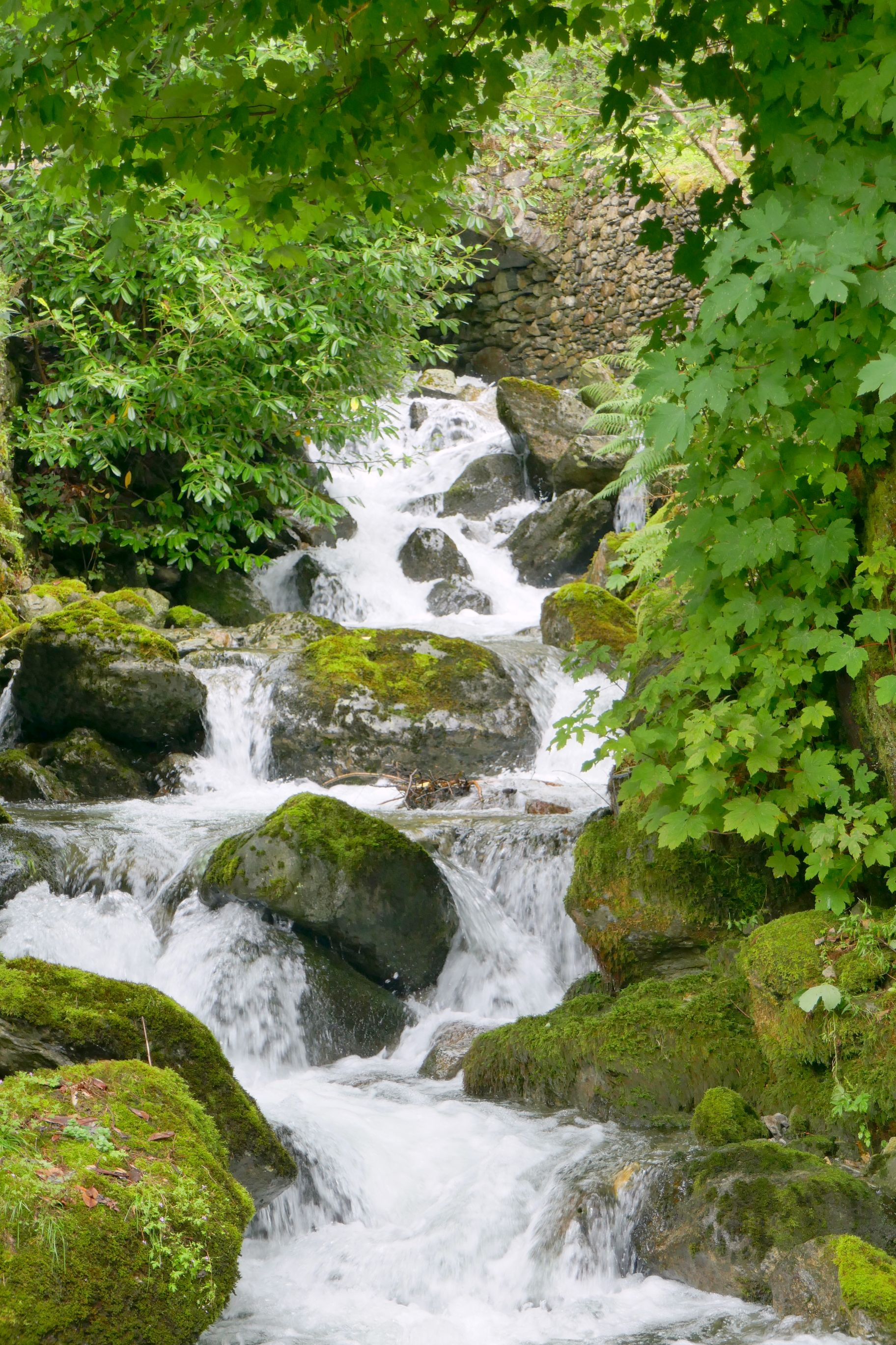
We first made our way behind the palace to see the gardens, and then walk the trails surrounding the massive estate.
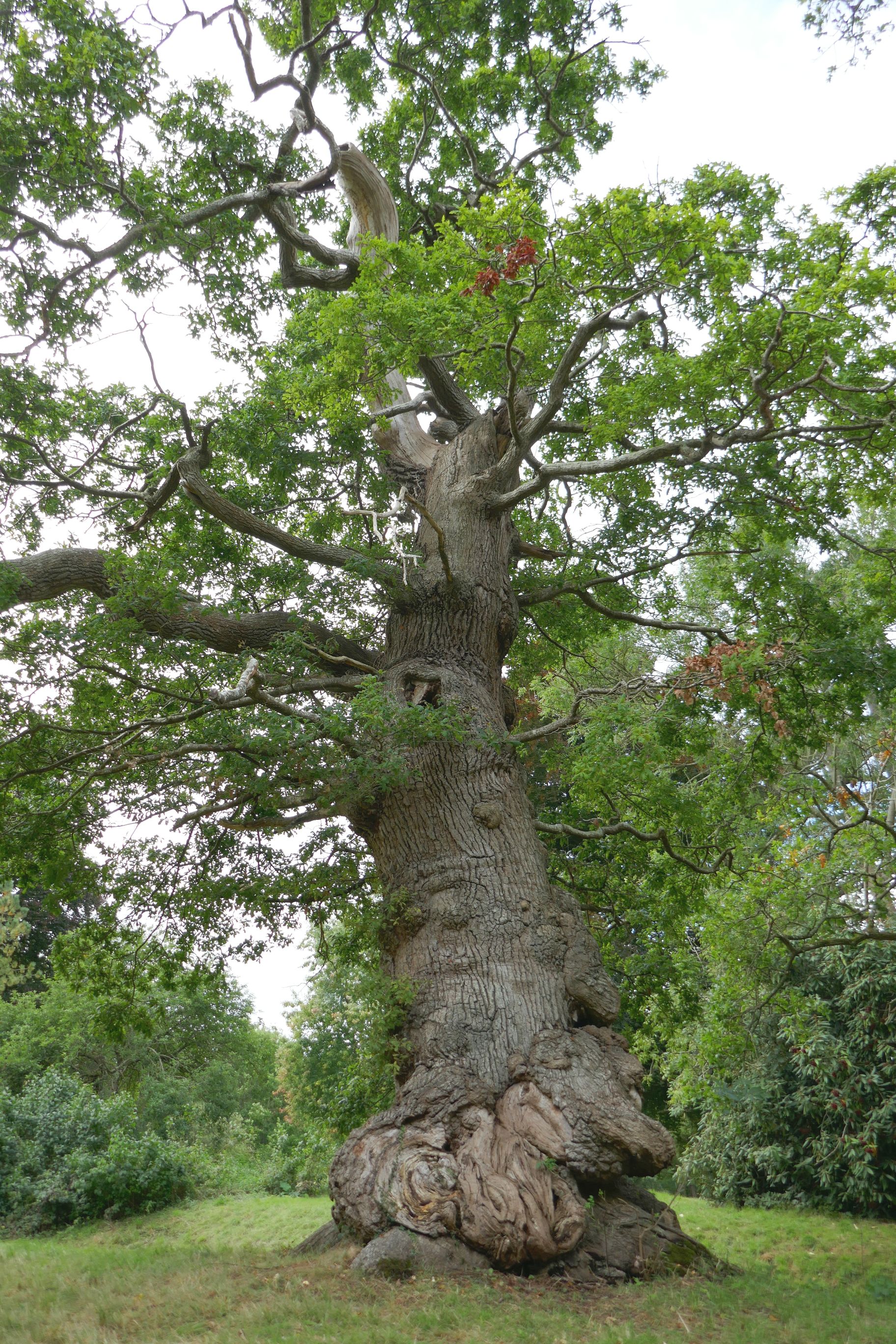
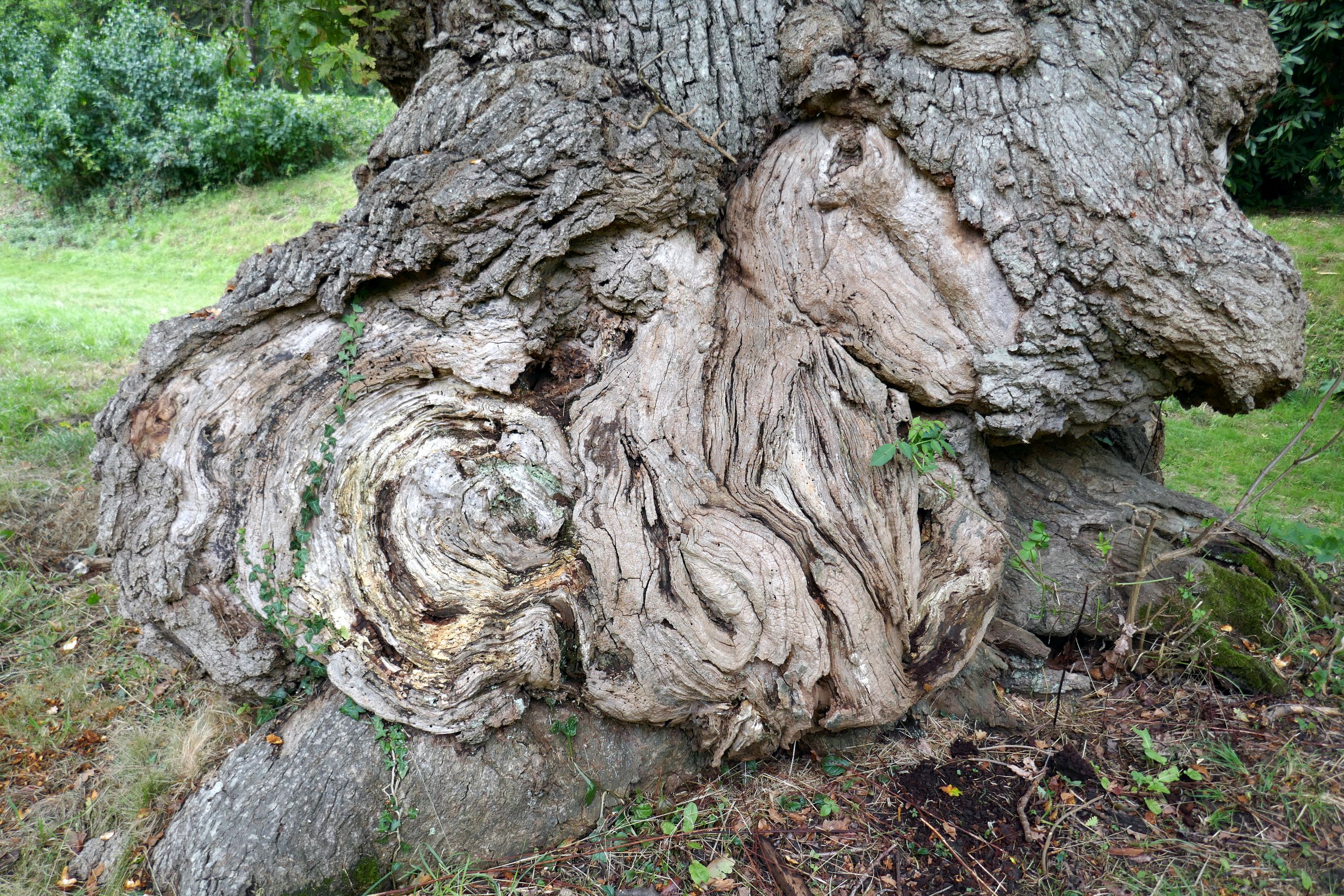
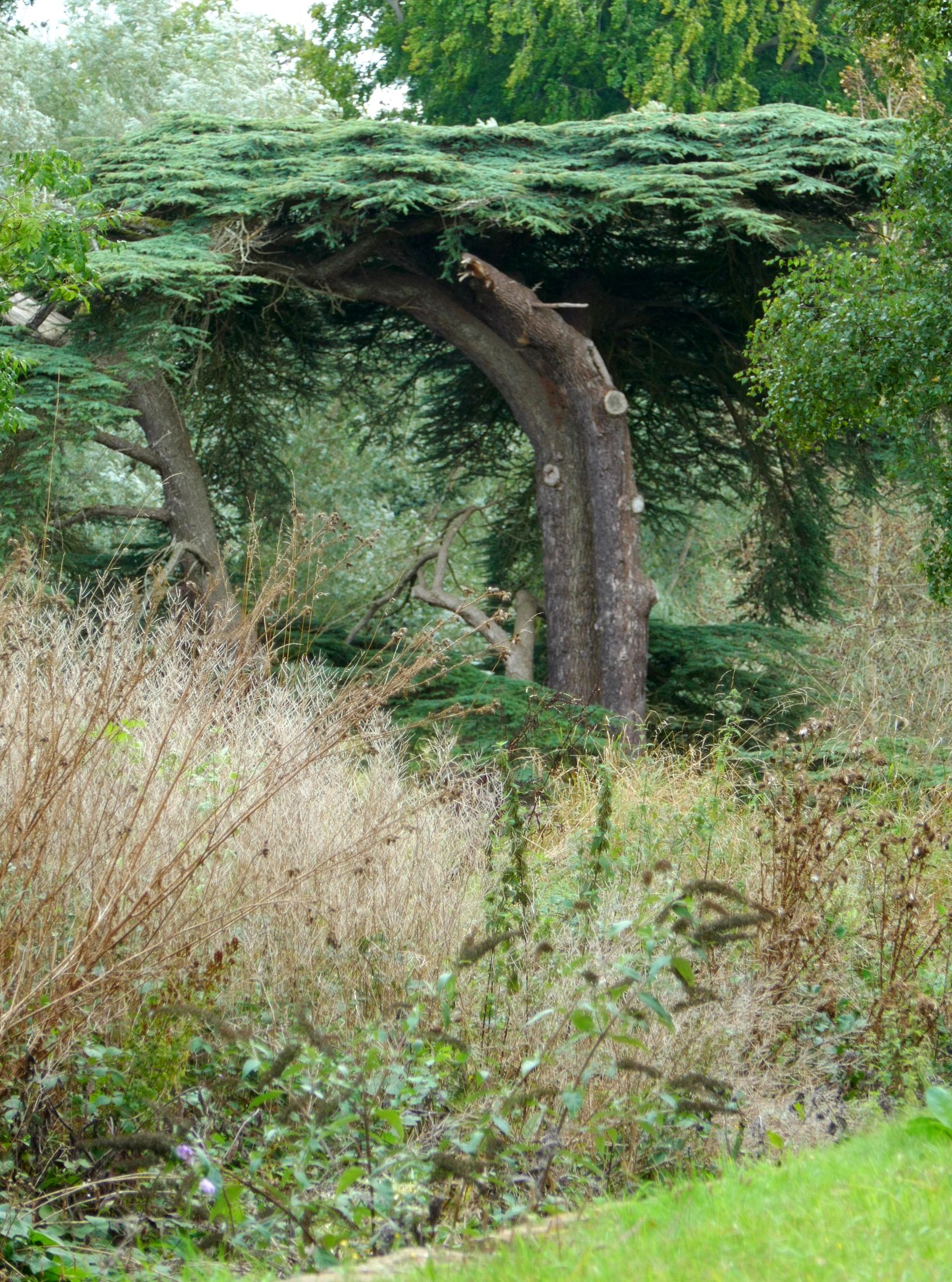
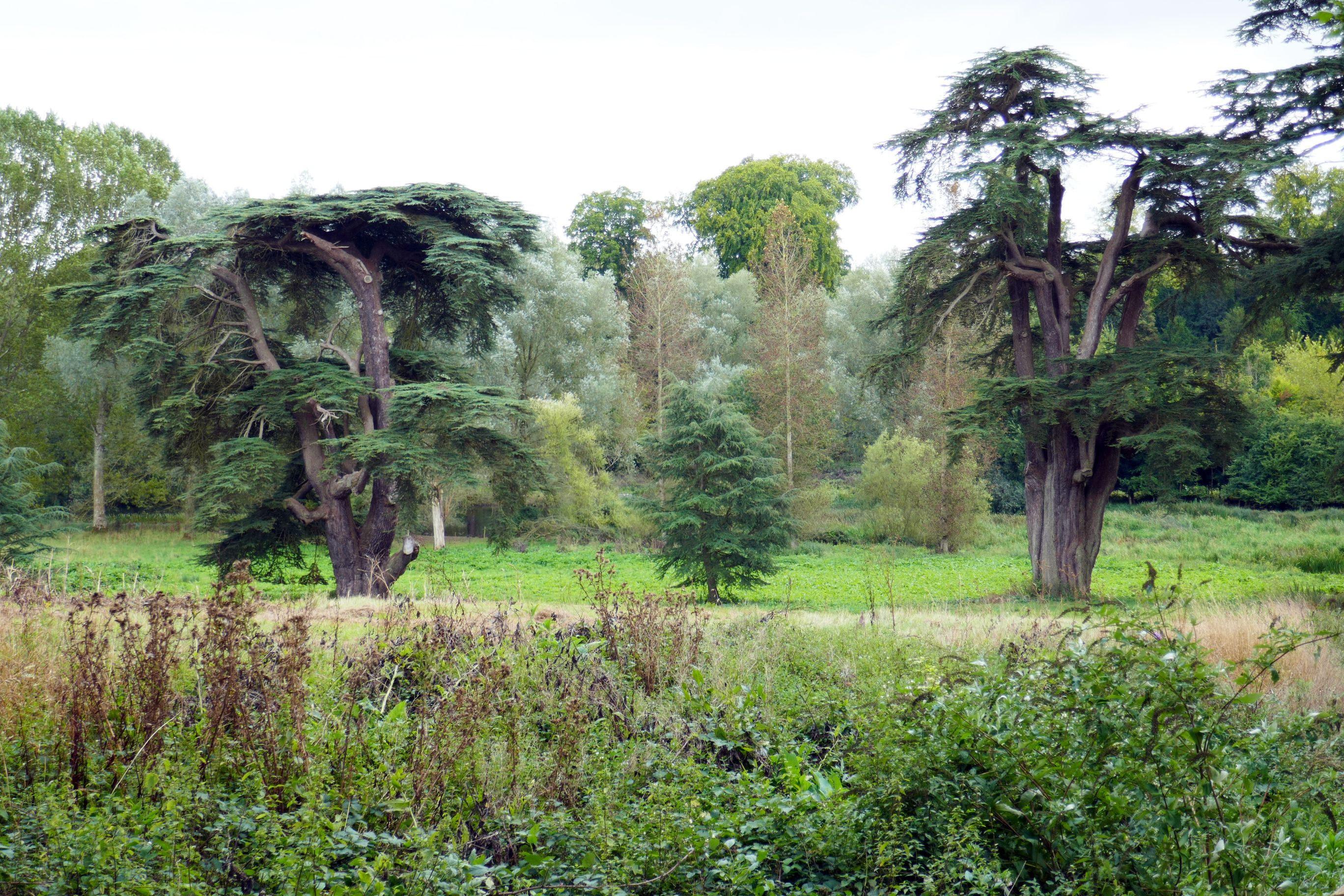
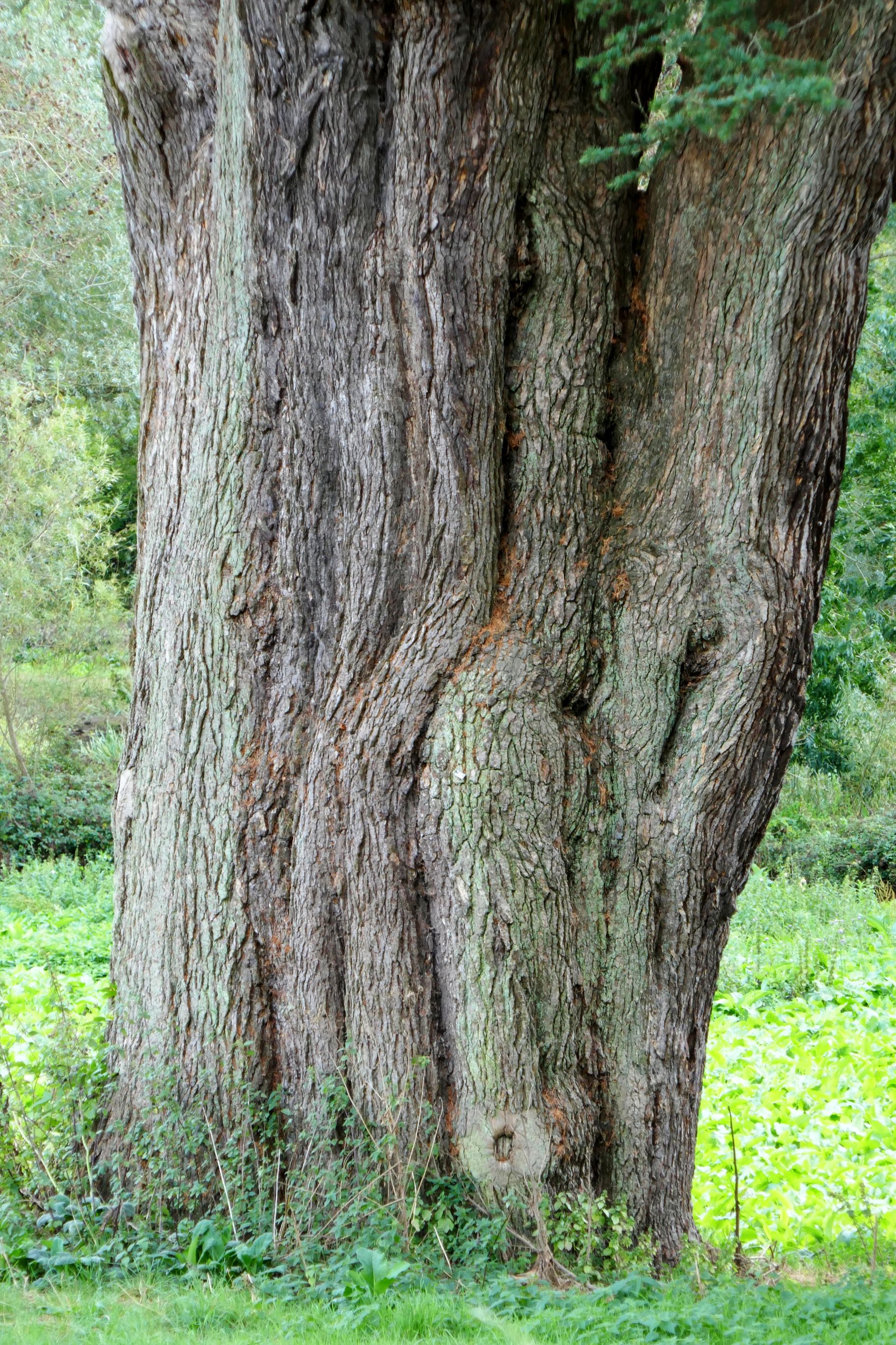
We saw an amazing collection of trees on the property.
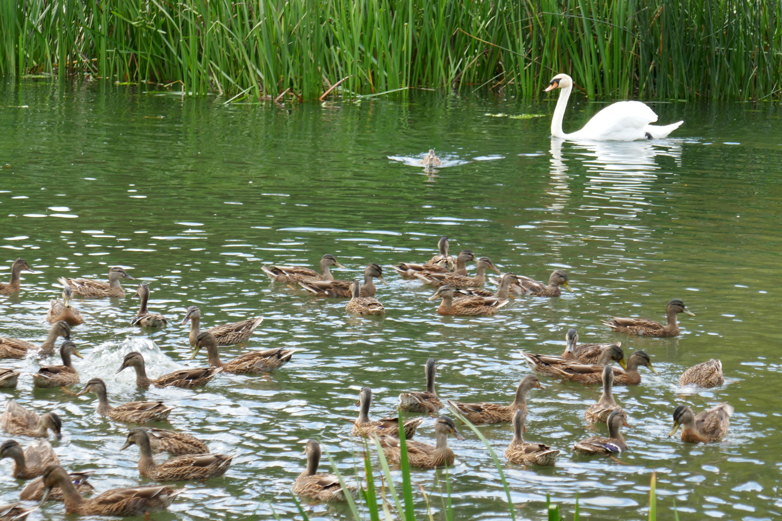
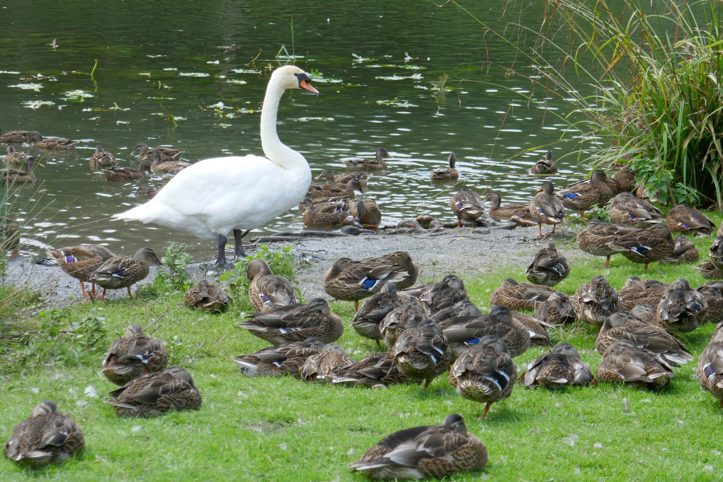
This is just a fraction of the ducks here. I have never seen so many ducks in one place in all my life!
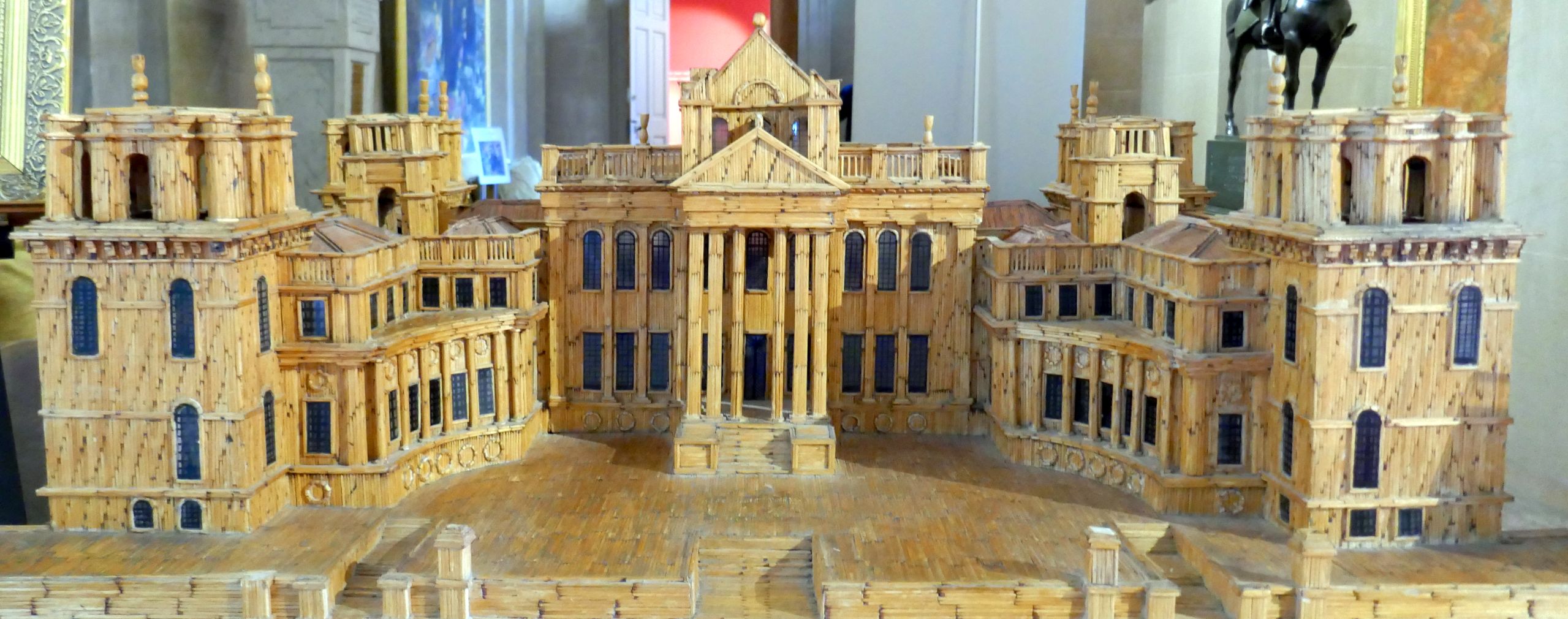
We returned to see more of the gardens and tour the palace.This model, constructed in 1990 with 100,000 matchsticks was made by Jean Donadel of Amiens, France. He had never visited, basing his work entirely on photographs.
Splish splash, I was taking a bath! If you are a Gen X, Y, Z or whatever, you probably don’t have a clue about that reference. The song, Splish Splash was even before my time! The story about Bobby Darin’s novelty record is funny, though. Back in 1958, DJ Murray Kaufman bet that Darin couldn’t write a song that began with the that first sentence (above), as suggested by Murray’s mother, Jean Kaufman. Darin won that bet, so the song was credited to Darin and “Jean Murray,” (a combination of their names) to avoid any hint of payola. The song was a big hit.
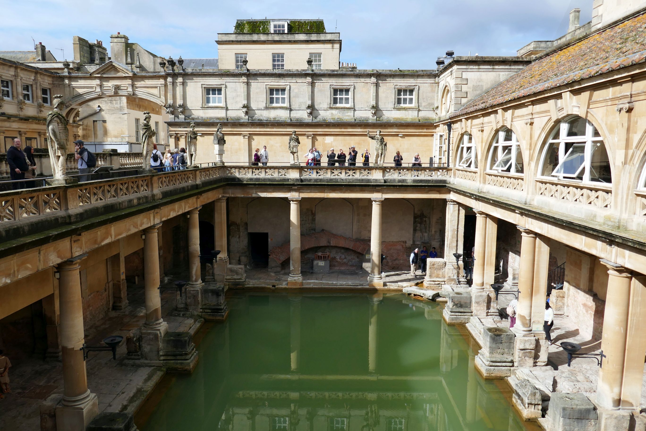
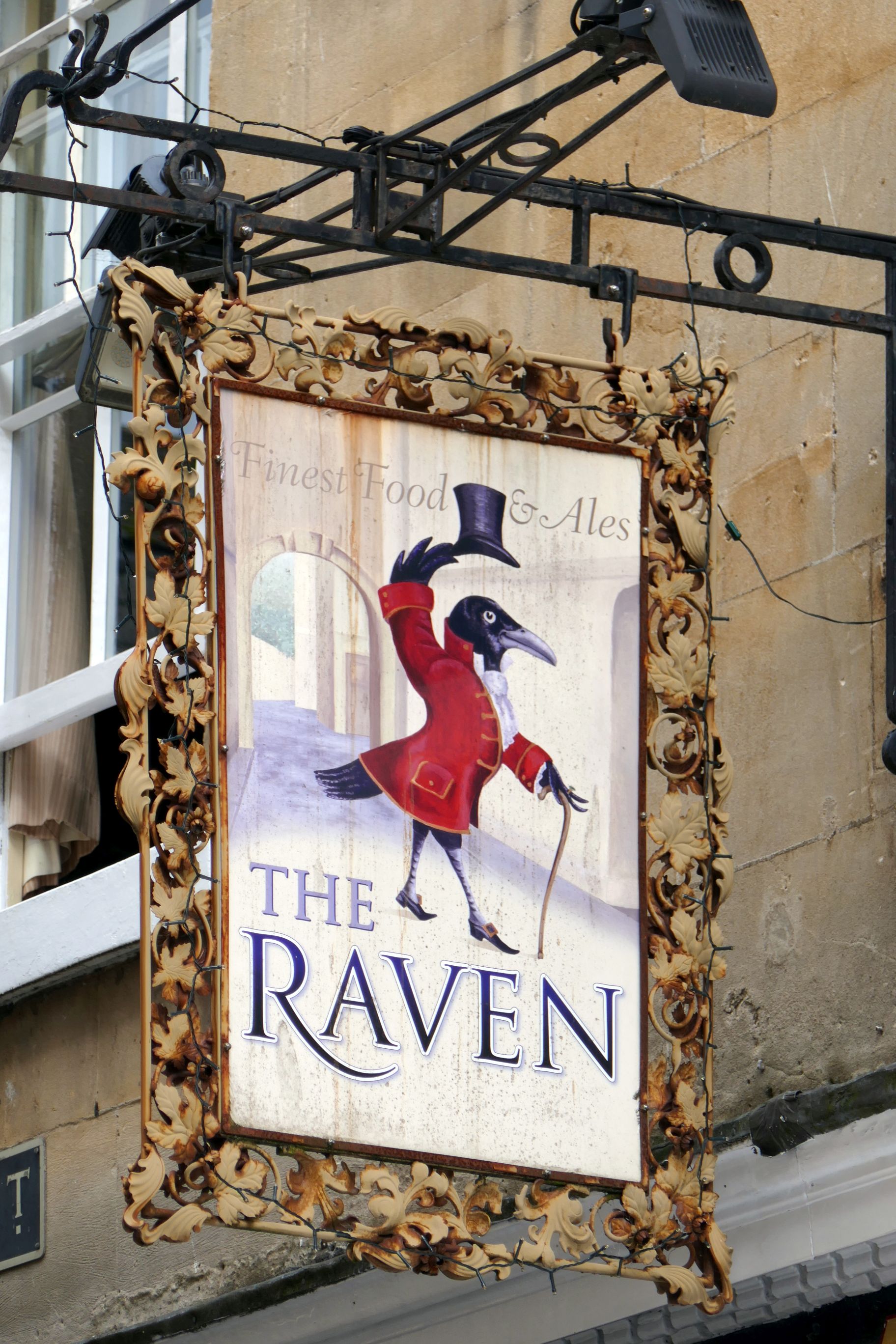
But I digress. This post is about Bath, the lovely city in Somerset, England, near the southern edge of the Cotswolds, named for its Roman-built baths.
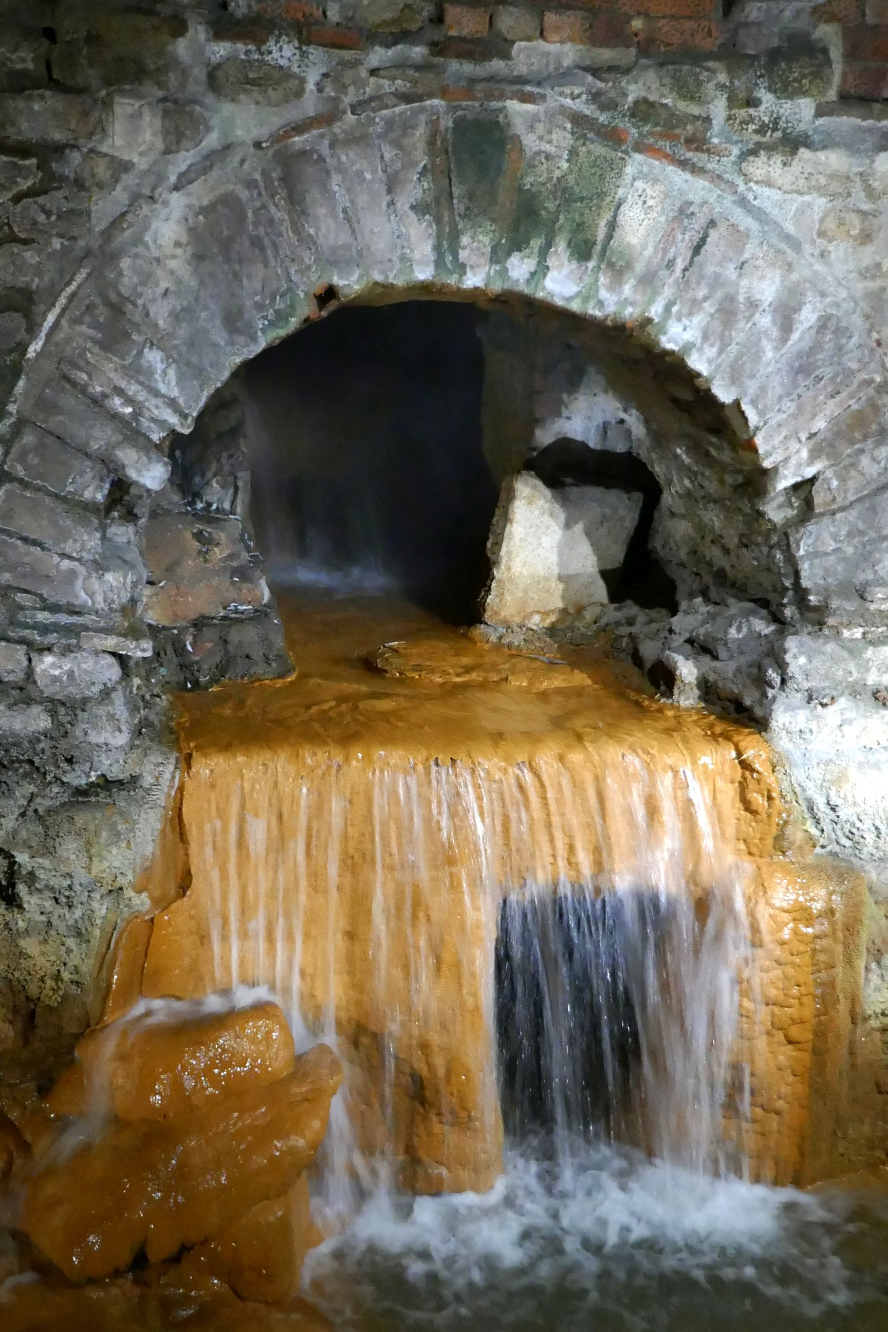
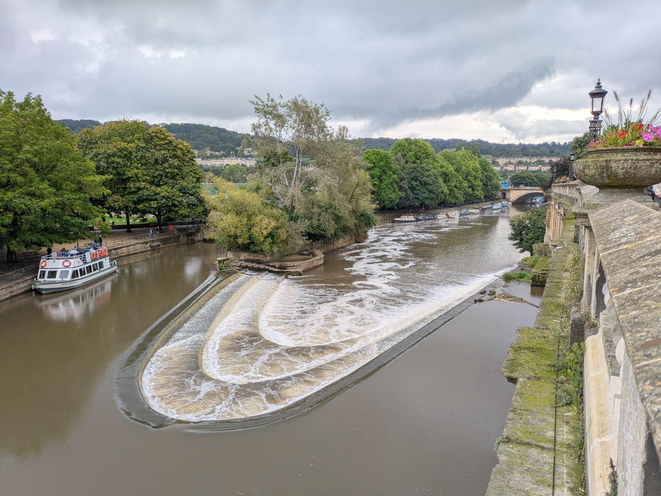
The baths are THE main attraction, so our group toured the complex. We learned that before the Romans invaded in 43 AD, the hot water spring was a sacred place of worship for the local people. The Romans came in and harnessed the hot water to supply a new bath house. They built a temple and dedicated it to a new goddess, Sulis Minerva. People visited the baths, Sacred Spring, and temple from around the Roman world.
The 114-degree (Fahrenheit) water in the spring bubbles up into the King’s Bath, which was built in the 12th century. Beneath the King’s Bath is a reservoir built by Roman engineers who used the hot water to supply the baths. Studies have shown that the “magical waters” are full of minerals and have antibiotic properties.
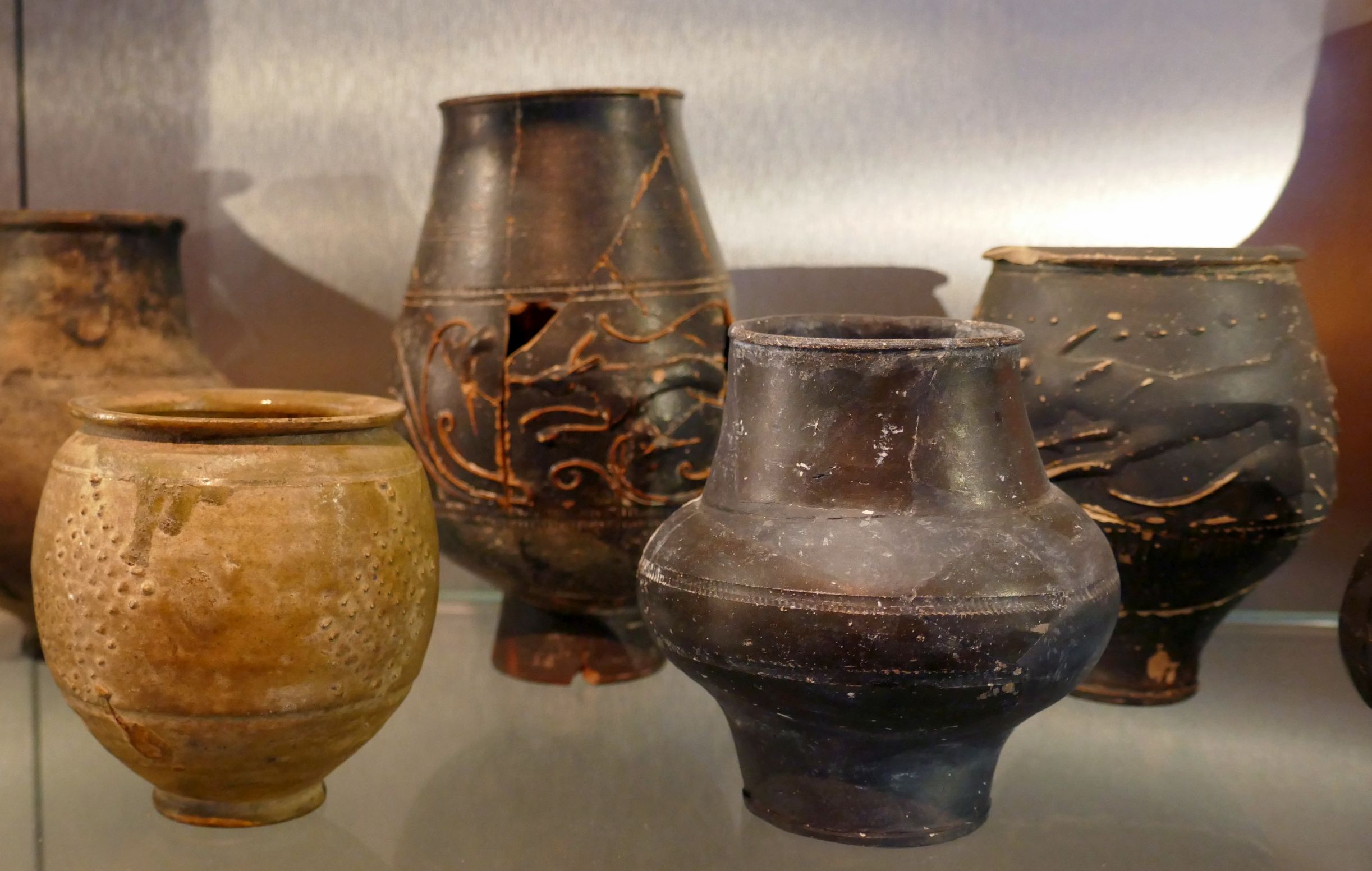
The baths have quite a history. They were designed for public bathing and were used until the end of the Roman rule in Britain in the 5th century. A century later, they were in ruins and then redeveloped several times after that. Today, it is a huge tourist attraction with a museum that houses artefacts from the Roman period, including objects that were thrown into the Sacred Spring as offerings to the goddess.
(For all photos, click on the image for a full screen view.)
Hot spring overflow
Recovered coins that had been thrown into the hot spring as an offering to goddess Sulis Minerva
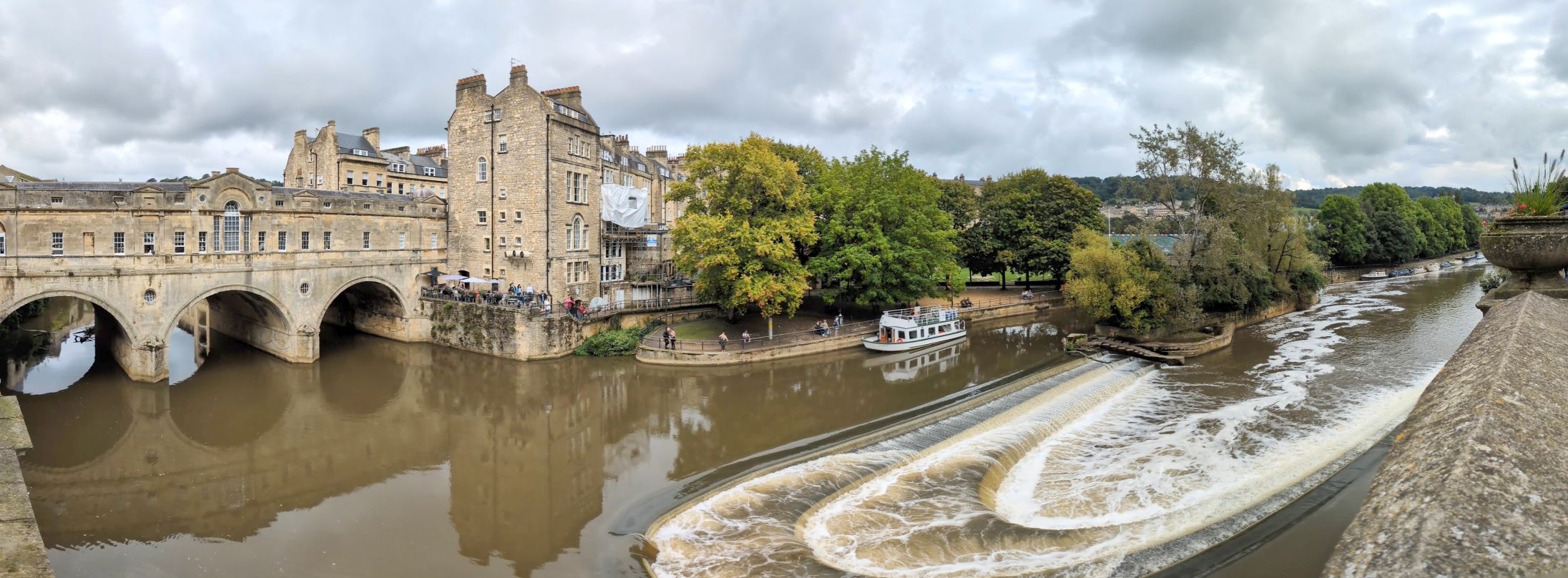
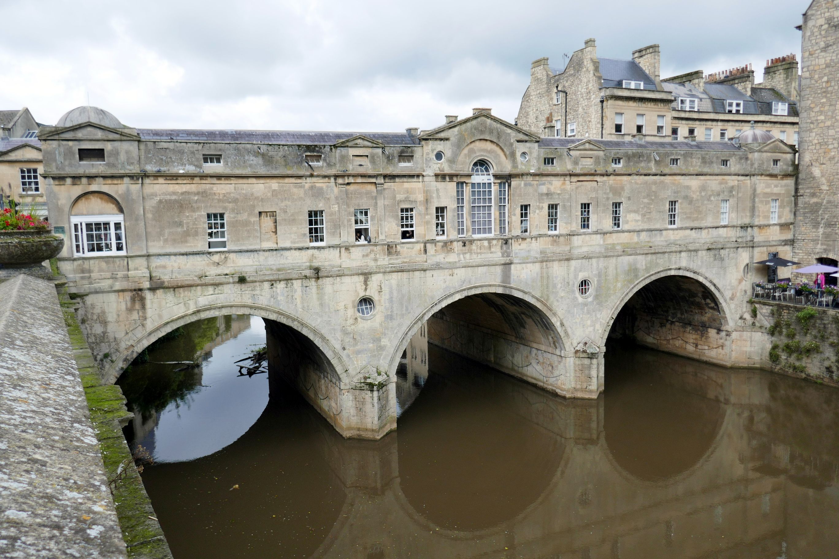
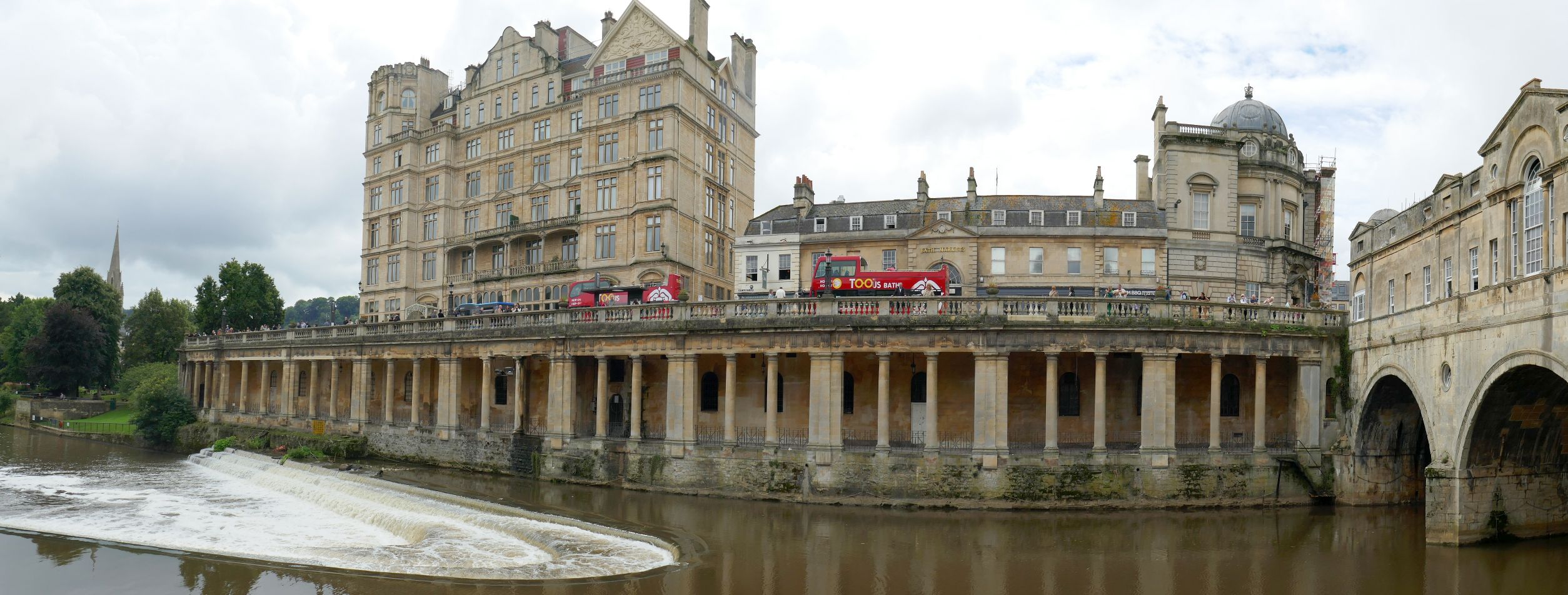
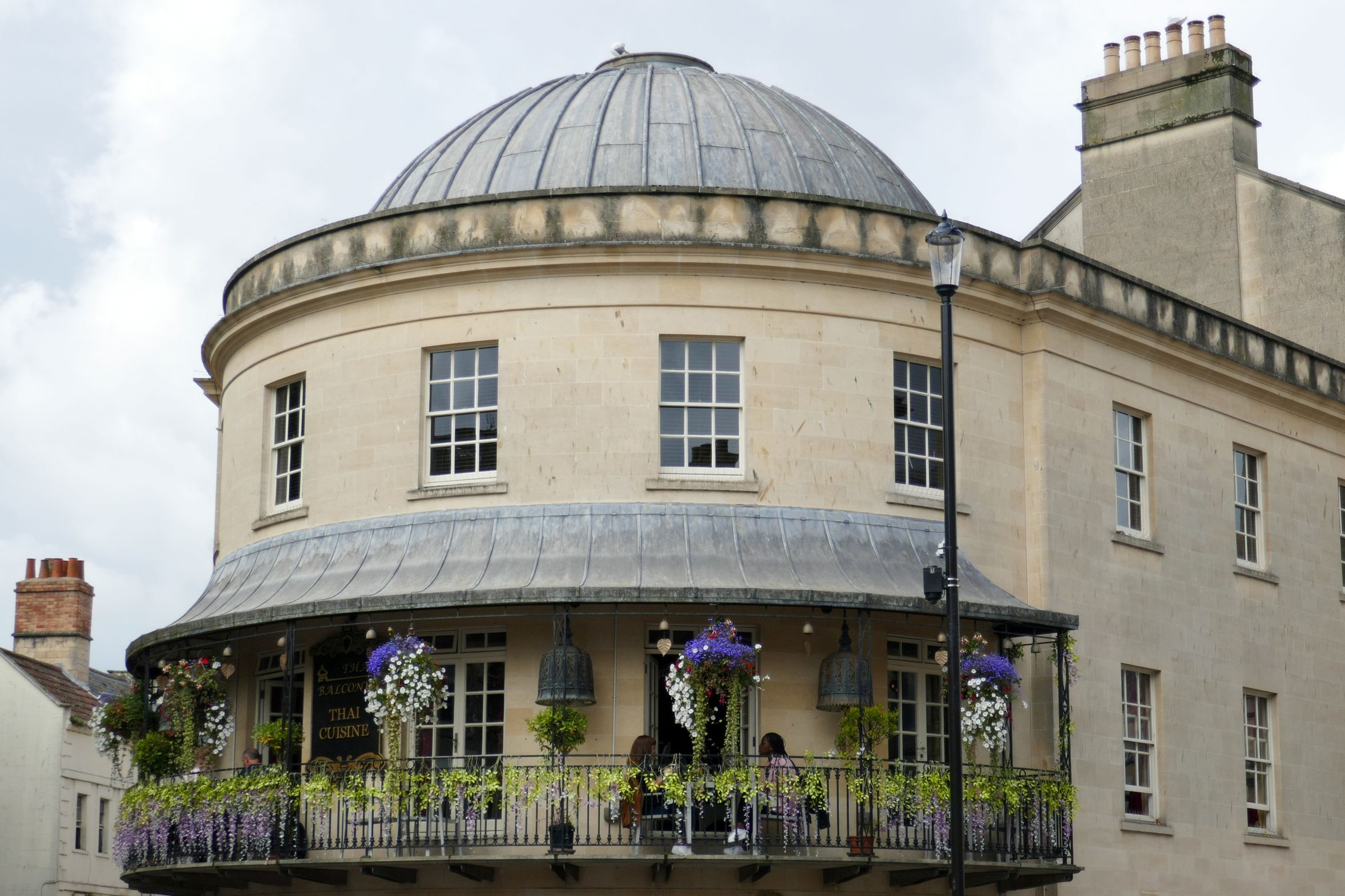
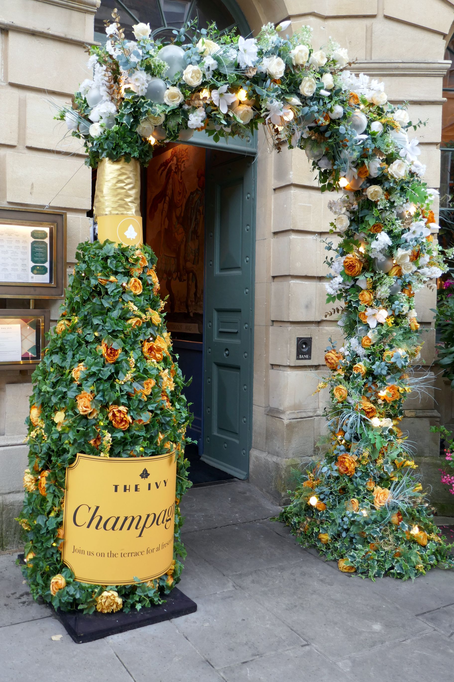
Following our visit to the baths, we had time on our own to explore this city of around 94,000 people before joining a local guide for a walking tour. We enjoyed spending our free time seeing the picturesque Pulteney Bridge that crosses over the River Avon. Built in 1774, it has shops and a restaurant across its span.
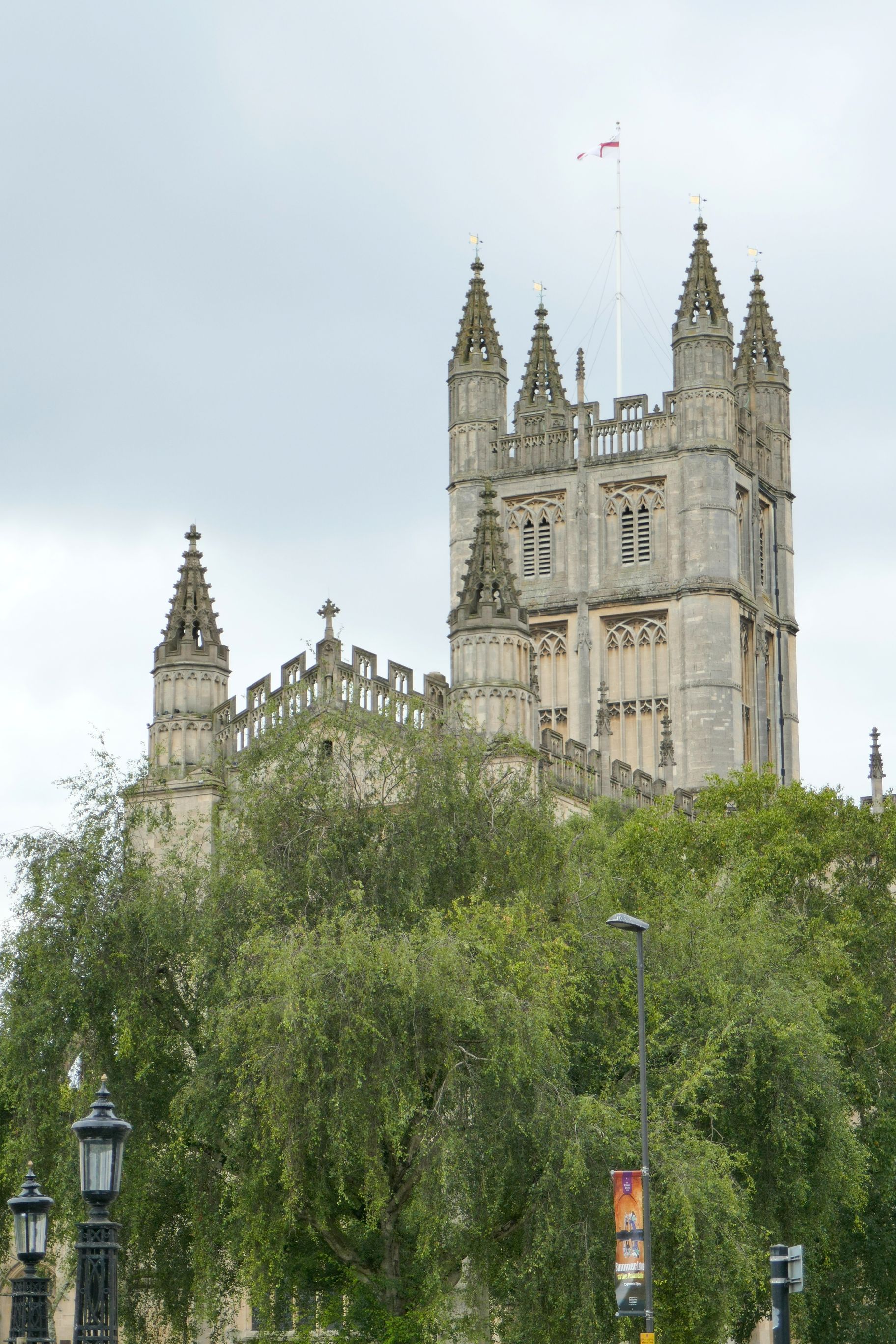
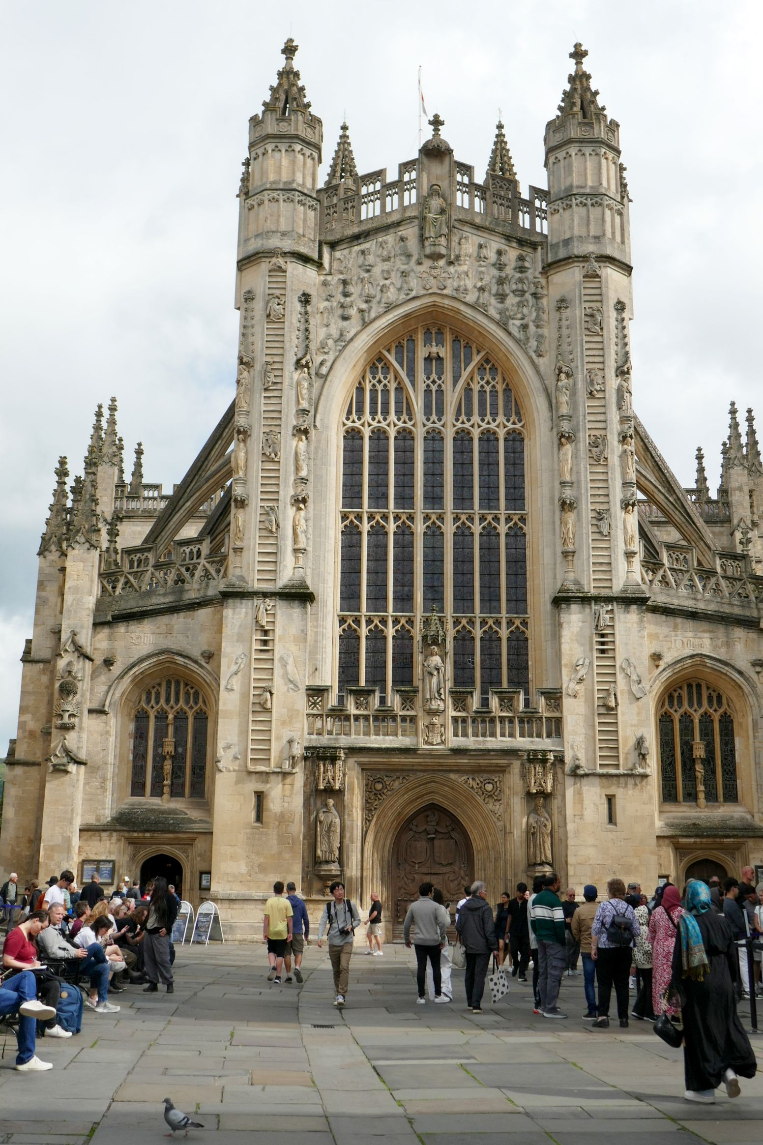
A UNESCO World Heritage Site city, Bath is also known for Bath Abbey, founded in the 7th century and rebuilt in the 12th and 16th centuries. We didn’t see the interior; however, the exterior is quite a centerpiece of the town, along with the baths.
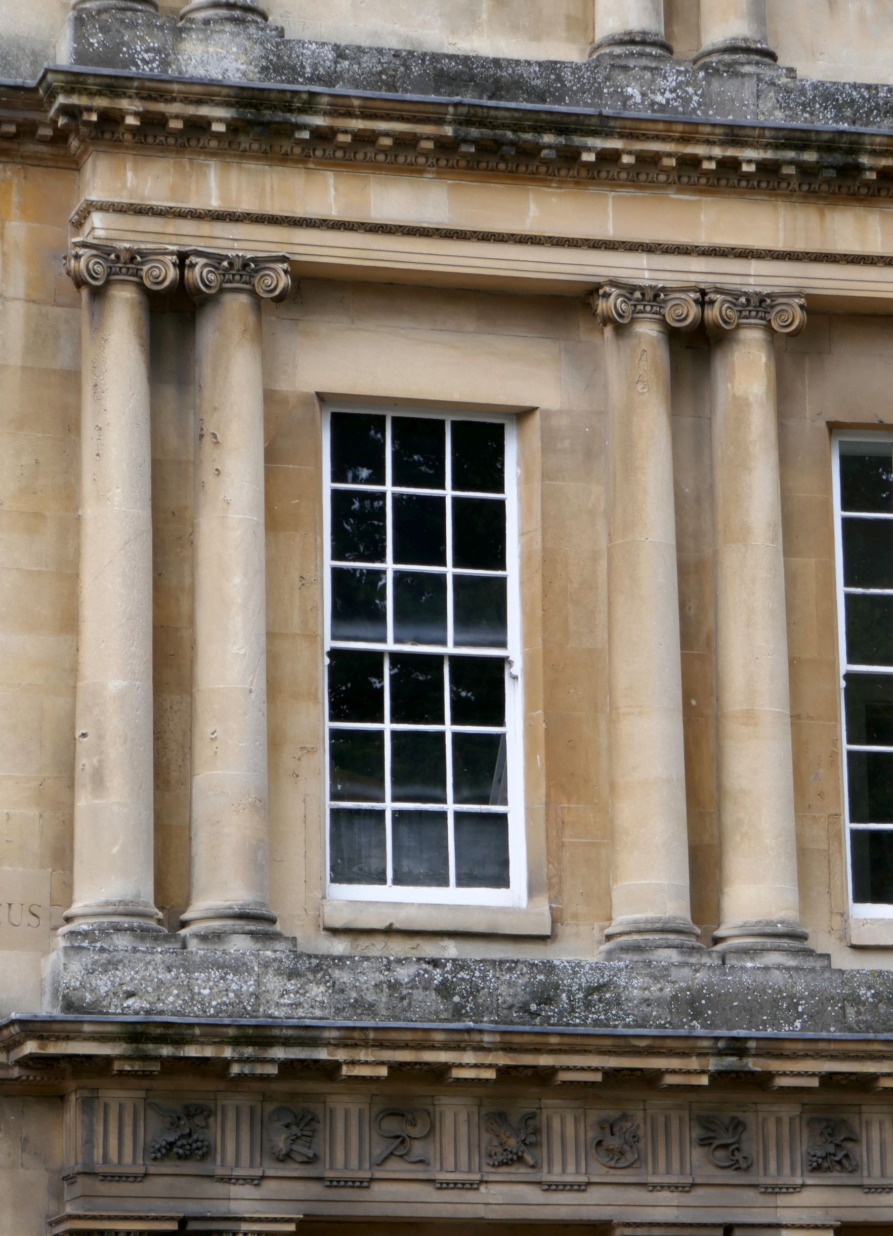
Our walking tour covered the highlights of Bath, most notably the Royal Crescent, a row of 30 terraced houses. Completed in the same year as the Pulteney Bridge, it is considered one of the greatest examples of Georgian architecture in the United Kingdom. The 500-foot-long crescent has been home to many rich and famous people, and it has appeared in several films.
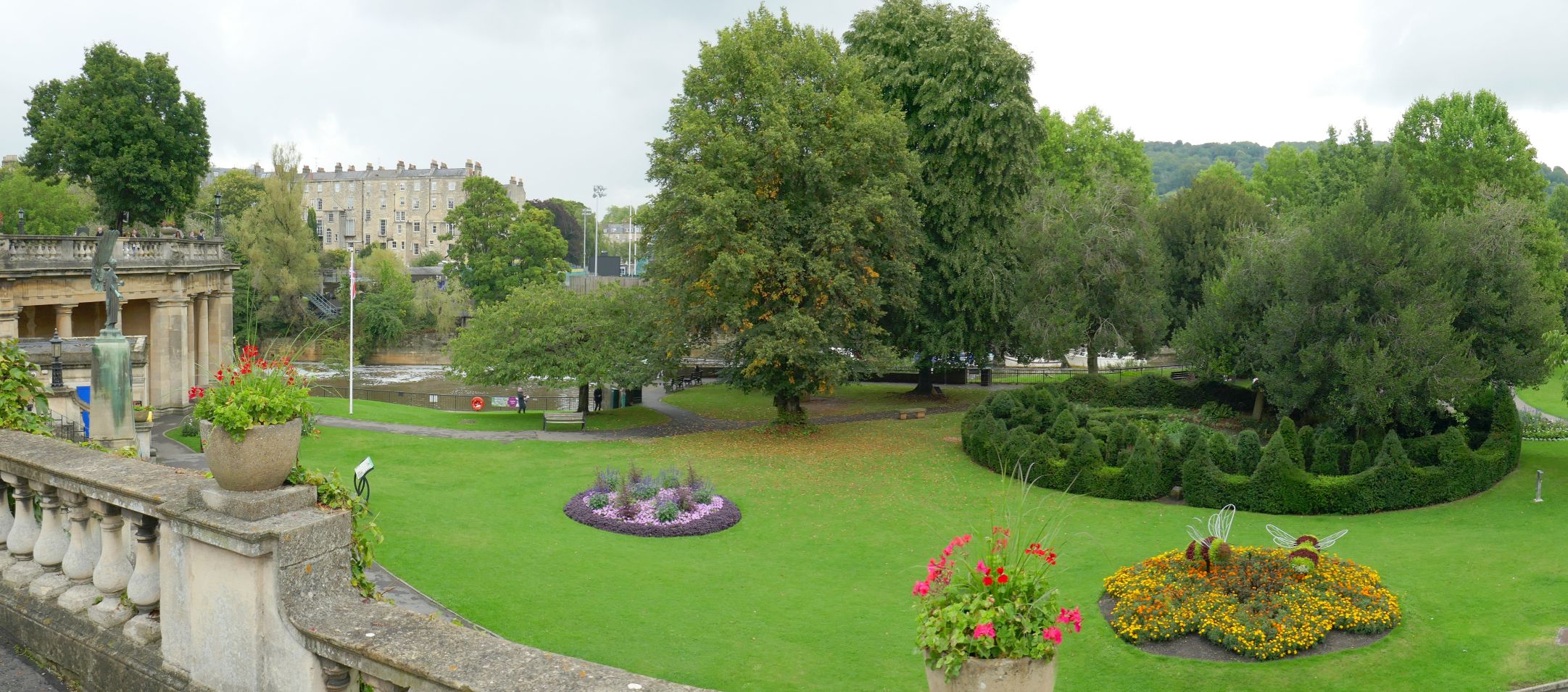
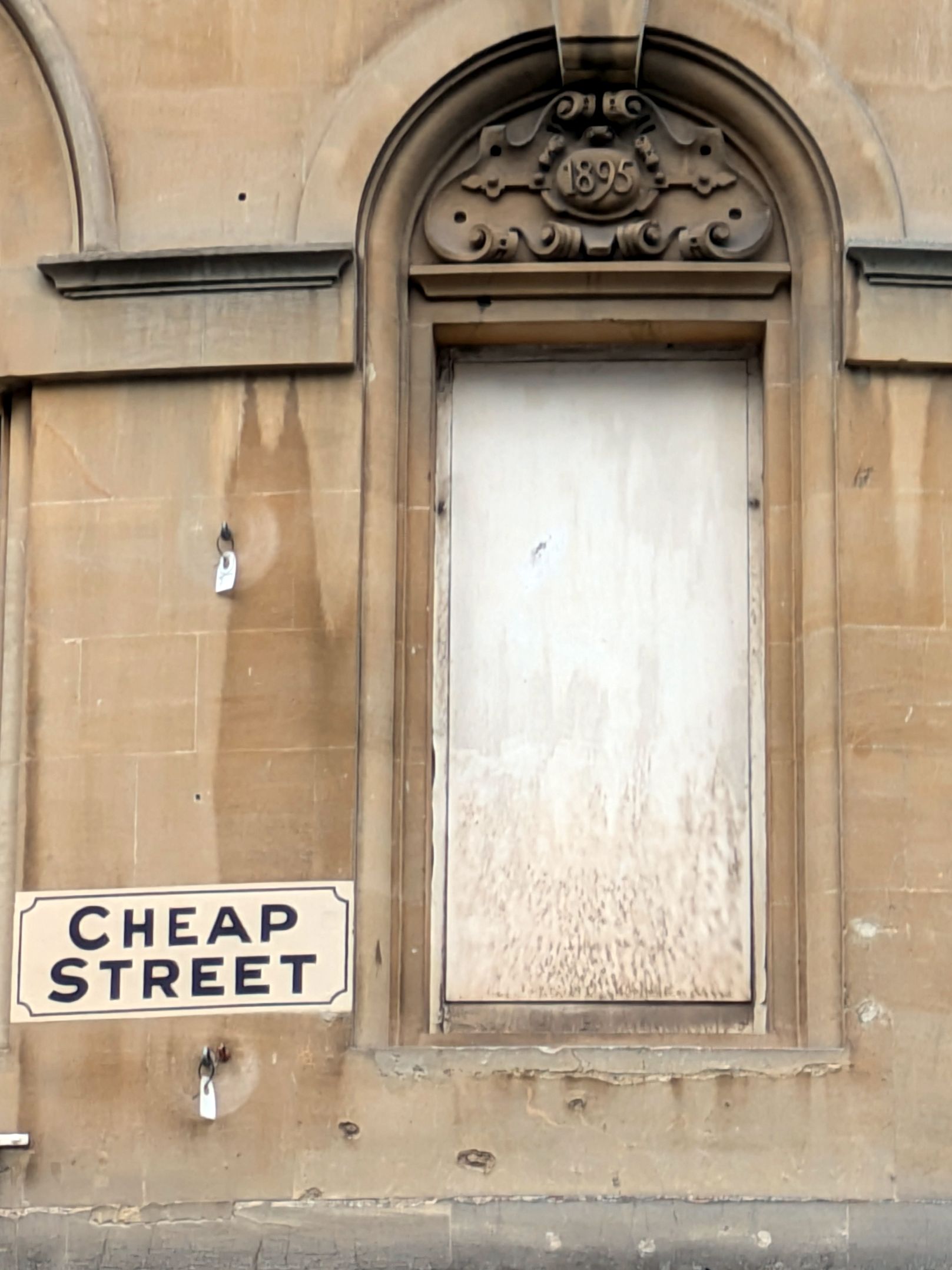
Here are more scenes around Bath:
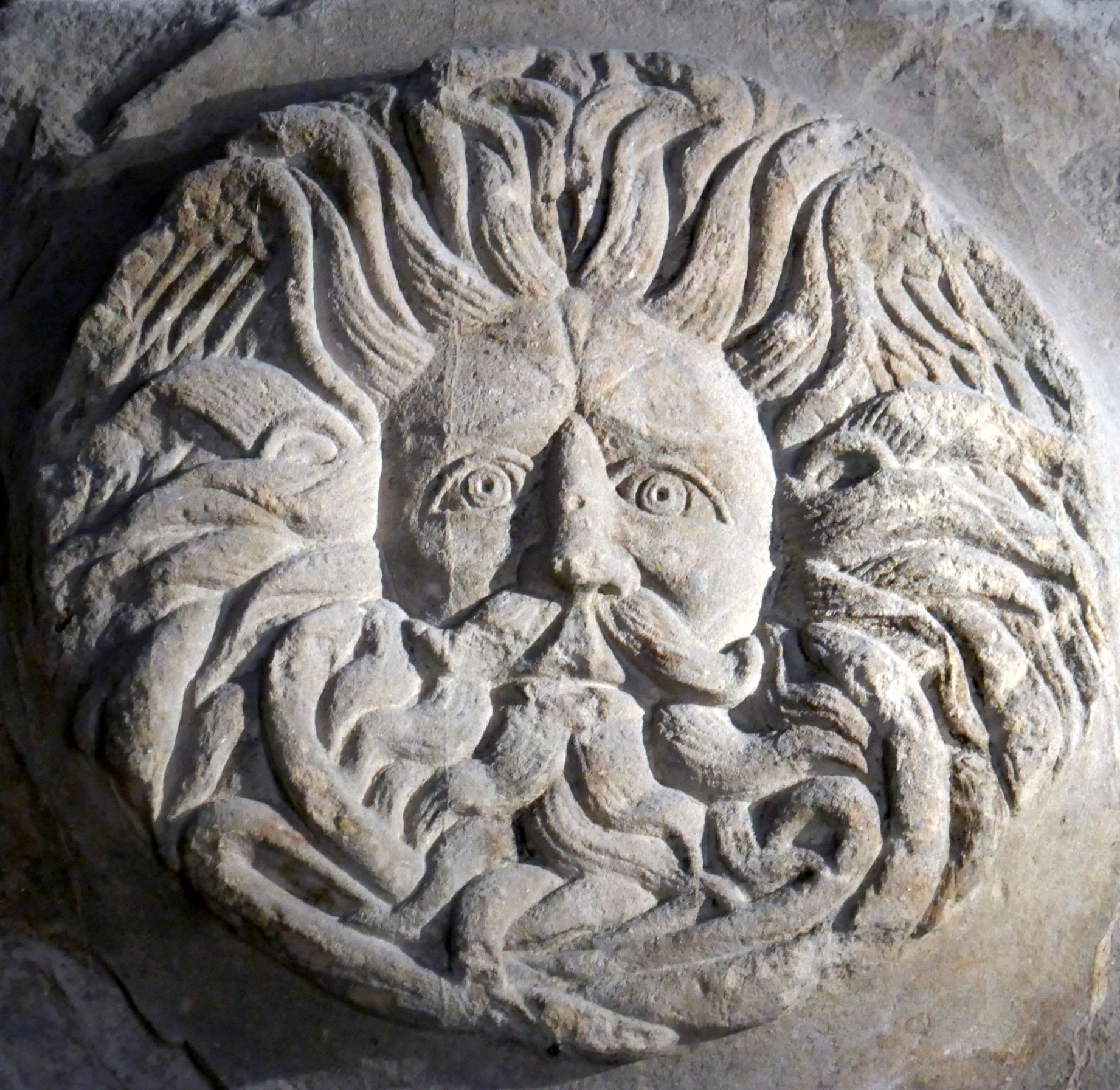
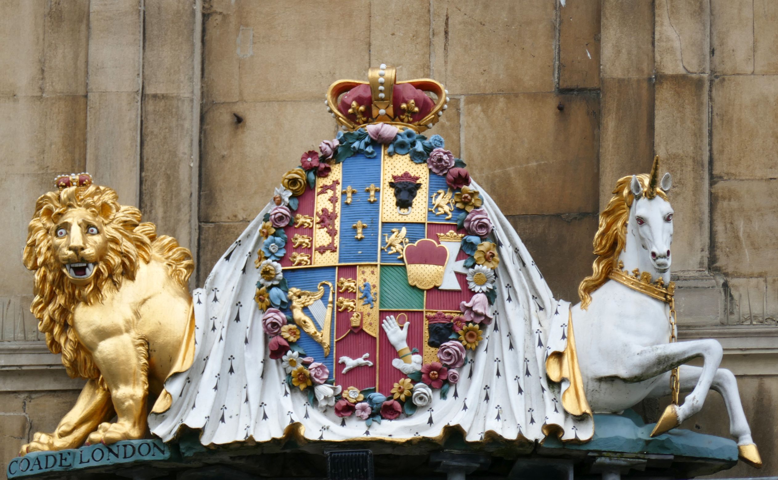
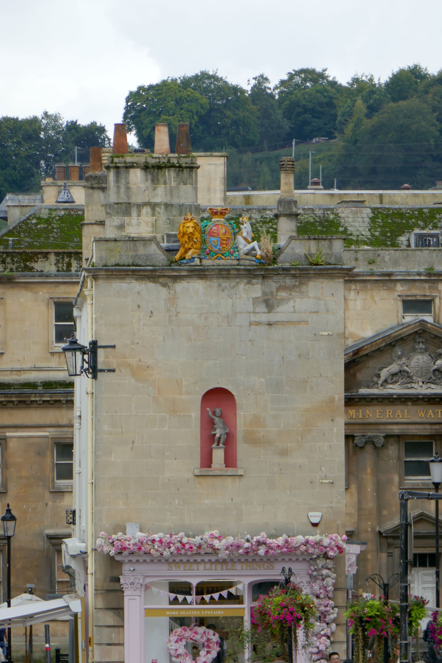
The lion and unicorn are symbols of the United Kingdom and appear in the royal coat of arms. The lion stands for England and the unicorn for Scotland.
Re: The robe. Are you kidding me??? Love the shirt!
Next up: UNITED KINGDOM #19: BREATHTAKING BLENHEIM PALACE
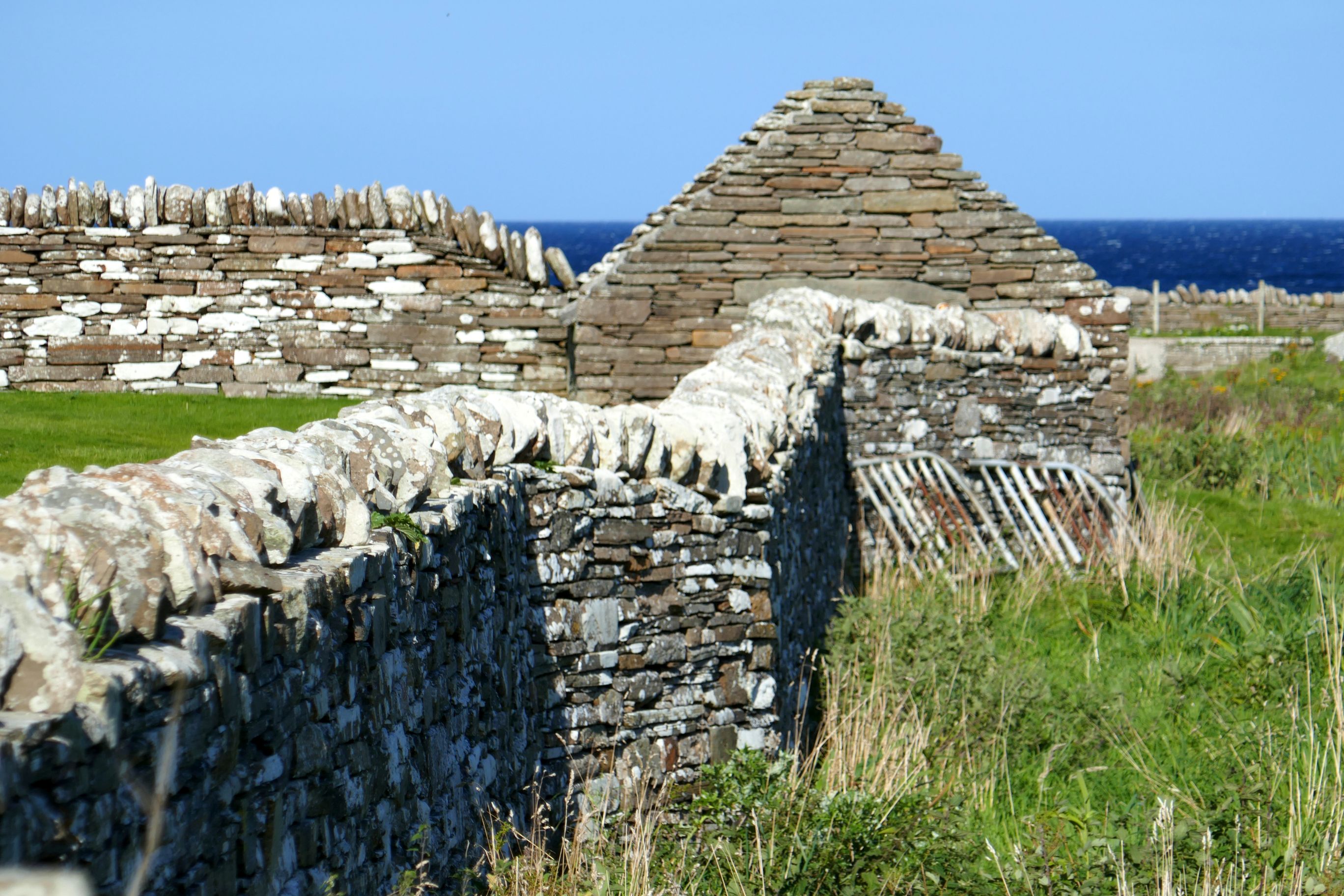
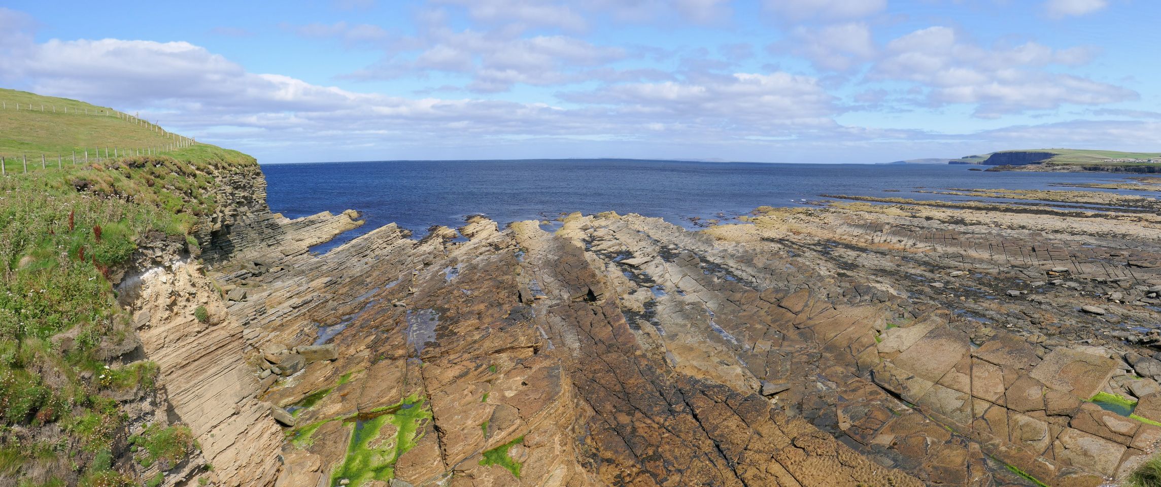
This was a day of seeing stones and rocks- and lots of them! We began at the Stones of Stennes, a stone circle raised about 5,000 years ago, thought to be used as a ceremonial site.
(For all photos, click on the image for a full screen view.)
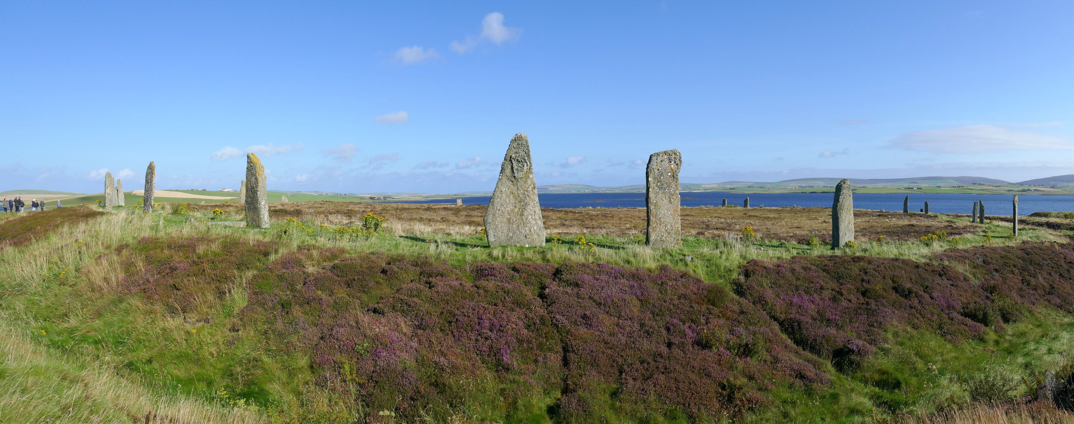
Thankfully, it was another gorgeous day, because the views from the Stones of Stennes and our next stop, the Ring of Brodgar, were beautiful. This Neolithic henge and stone circle is thought to be between 4,400 and 4,600 years old and is a UNESCO World Heritage Site.
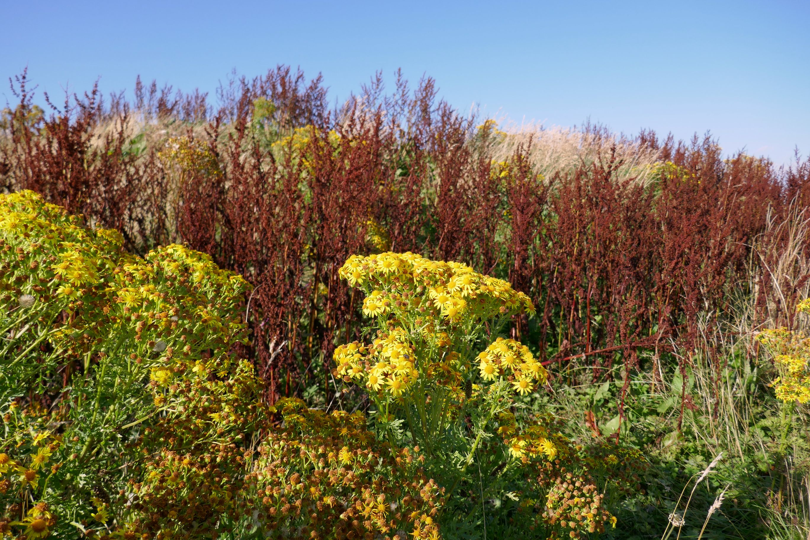
Not being a big stone circle history buff, I just enjoyed walking around the circle, taking photographs, and enjoying the views.
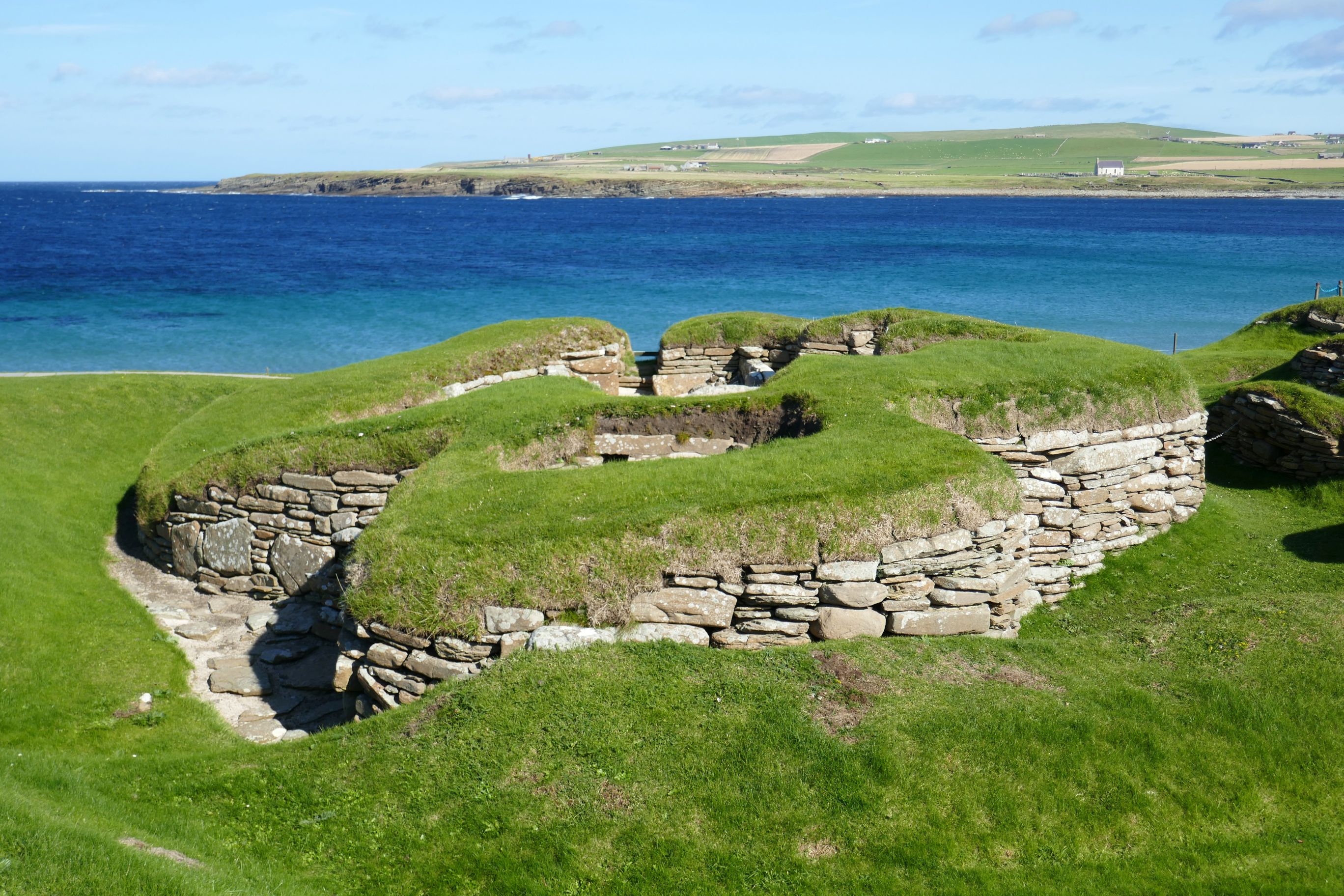
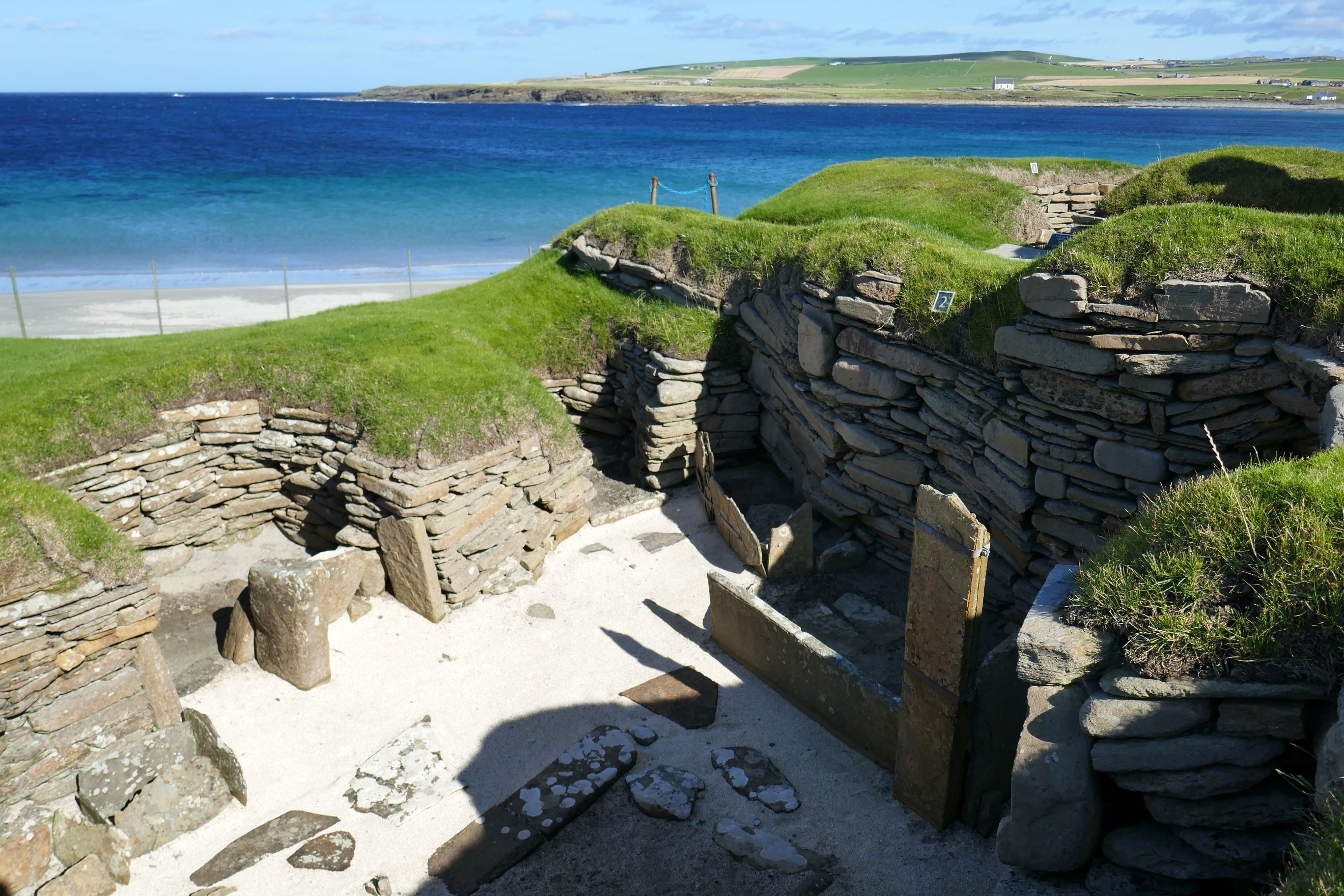
Skara Brae was a fascinating archaeological site with more amazing views! This 5,000-year-old settlement is so fragile, we were only permitted to view it from the walkway above.
Archaeologists think that a small community of 50-100 people lived on this site, and that it was inhabited for several centuries. Ten structures remain, and it is Europe’s most complete Neolithic village. Another UNESCO World Heritage Site, it is older than Stonehenge and was discovered when a historic storm scoured away sand revealing the site.
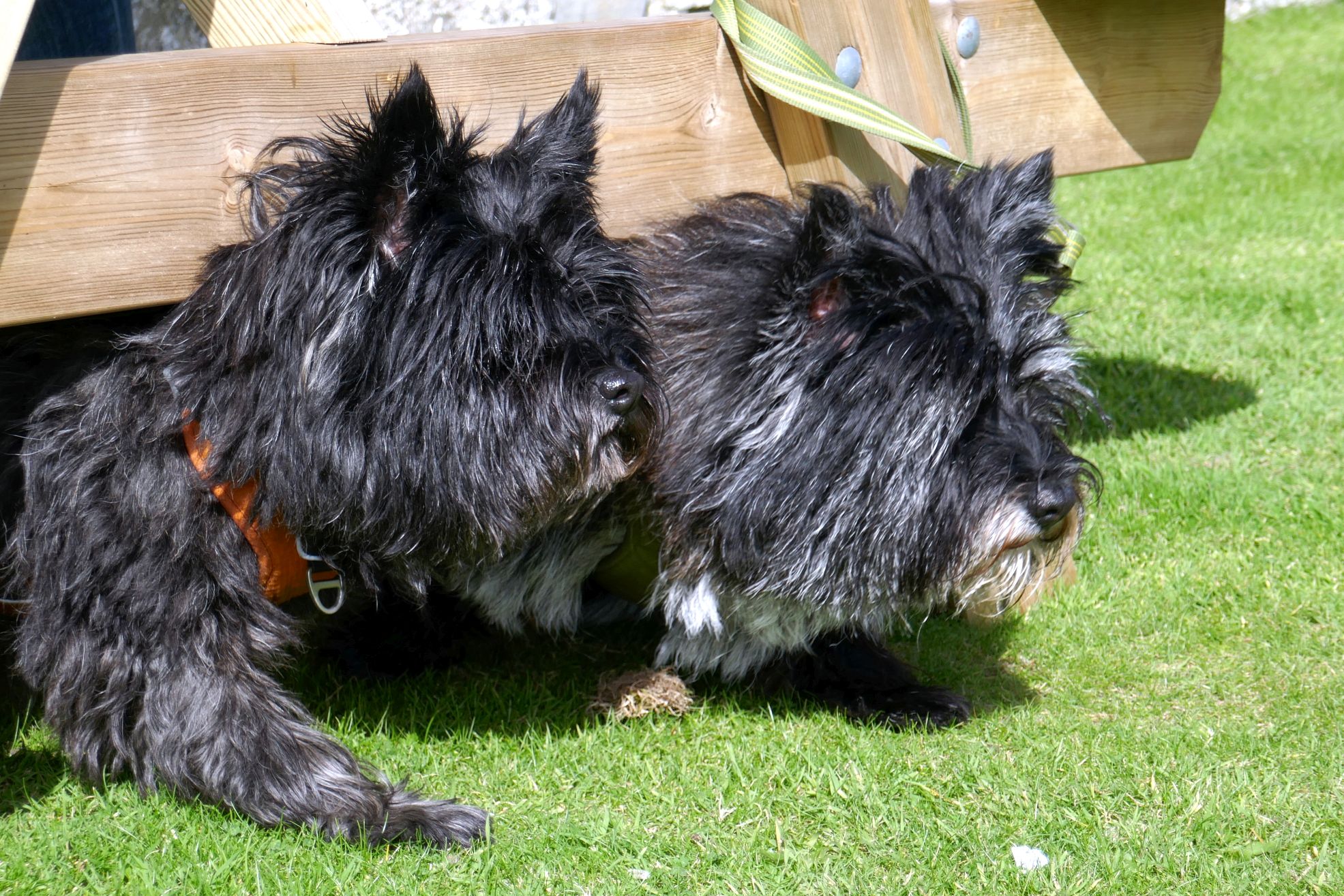
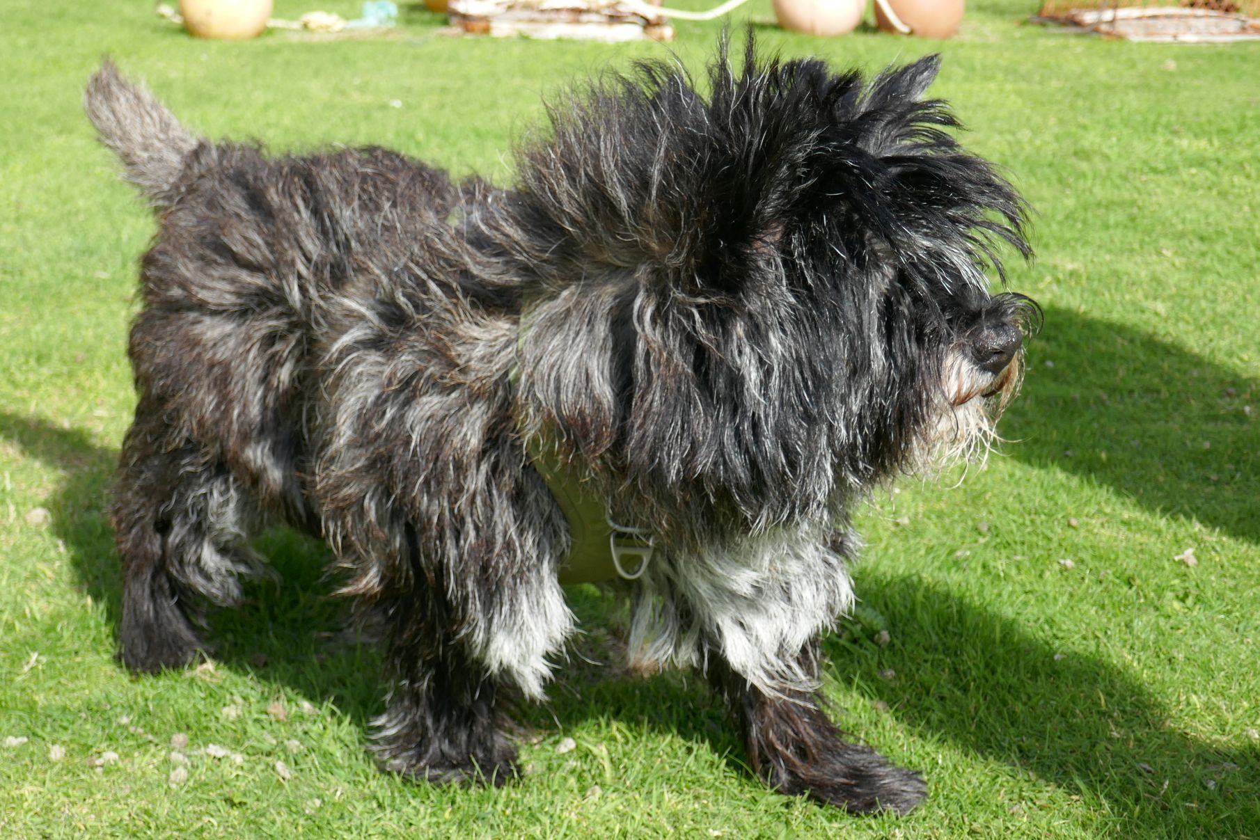
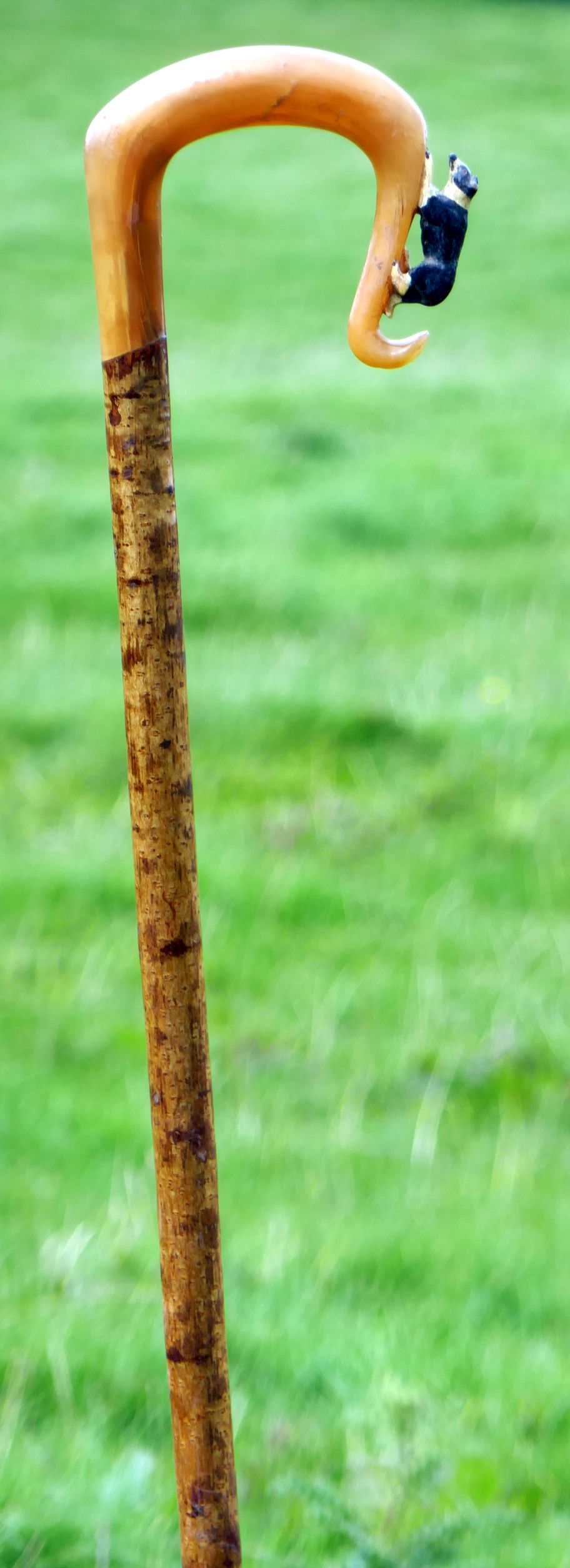
Two new friends I made at our lunch stop:
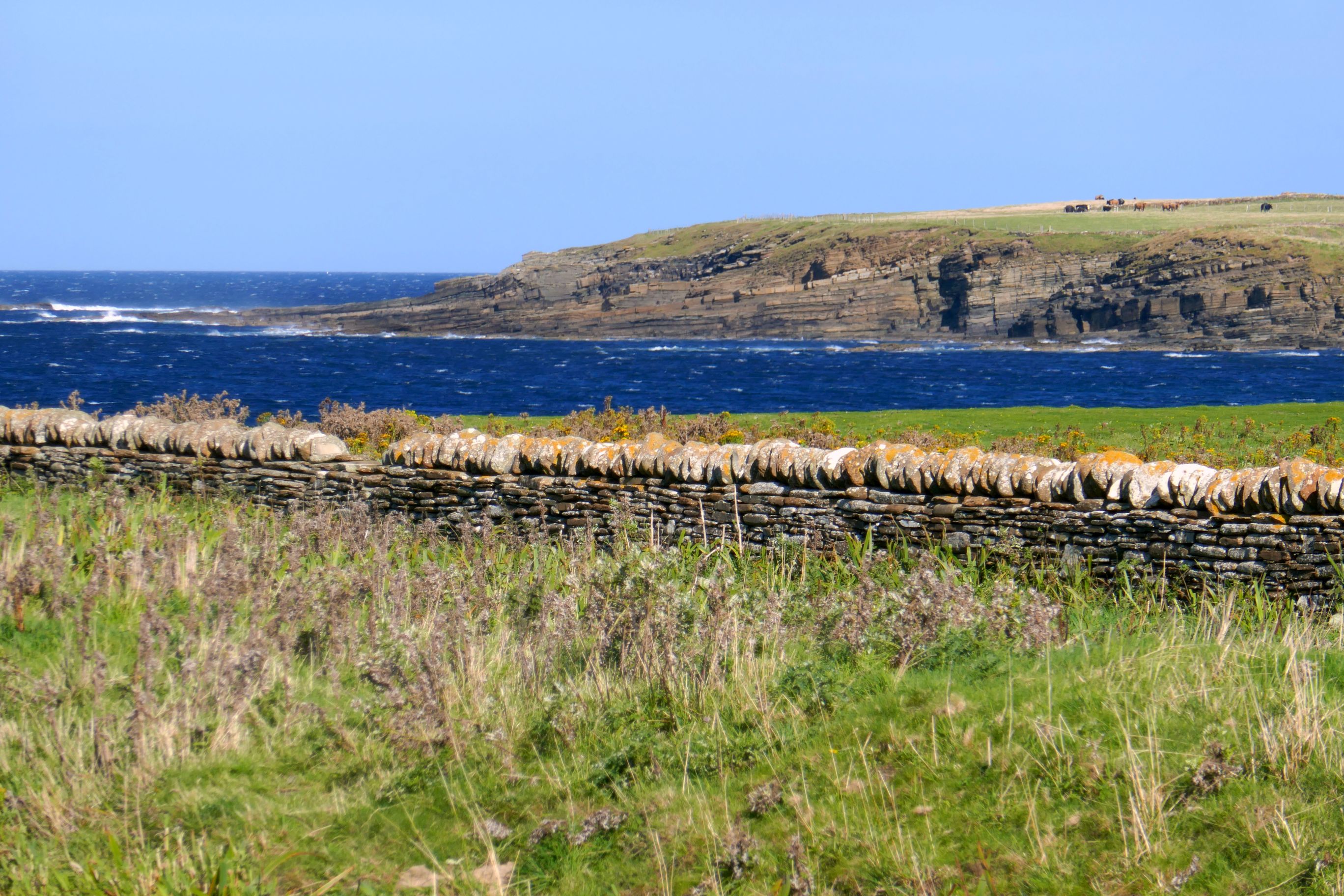
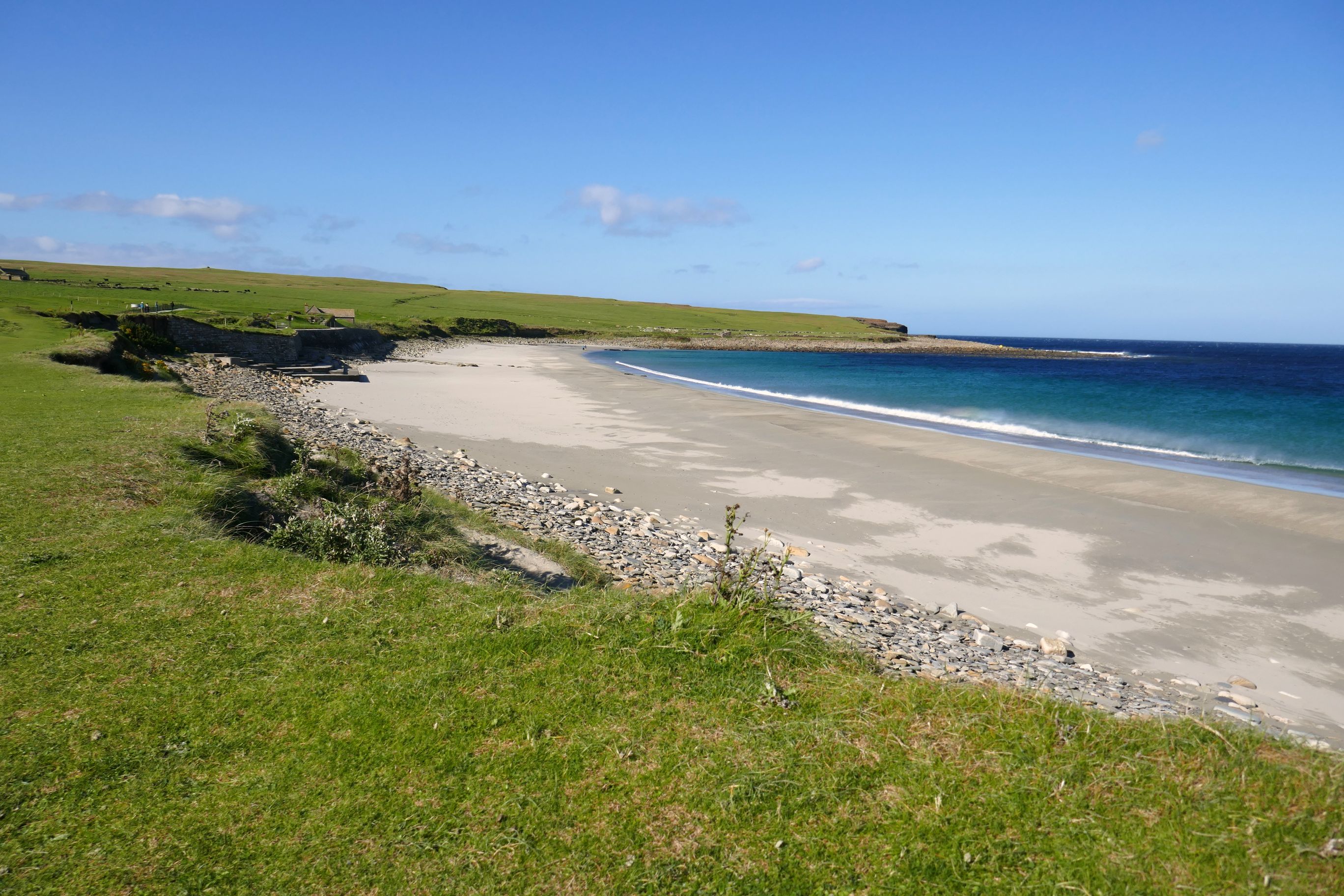
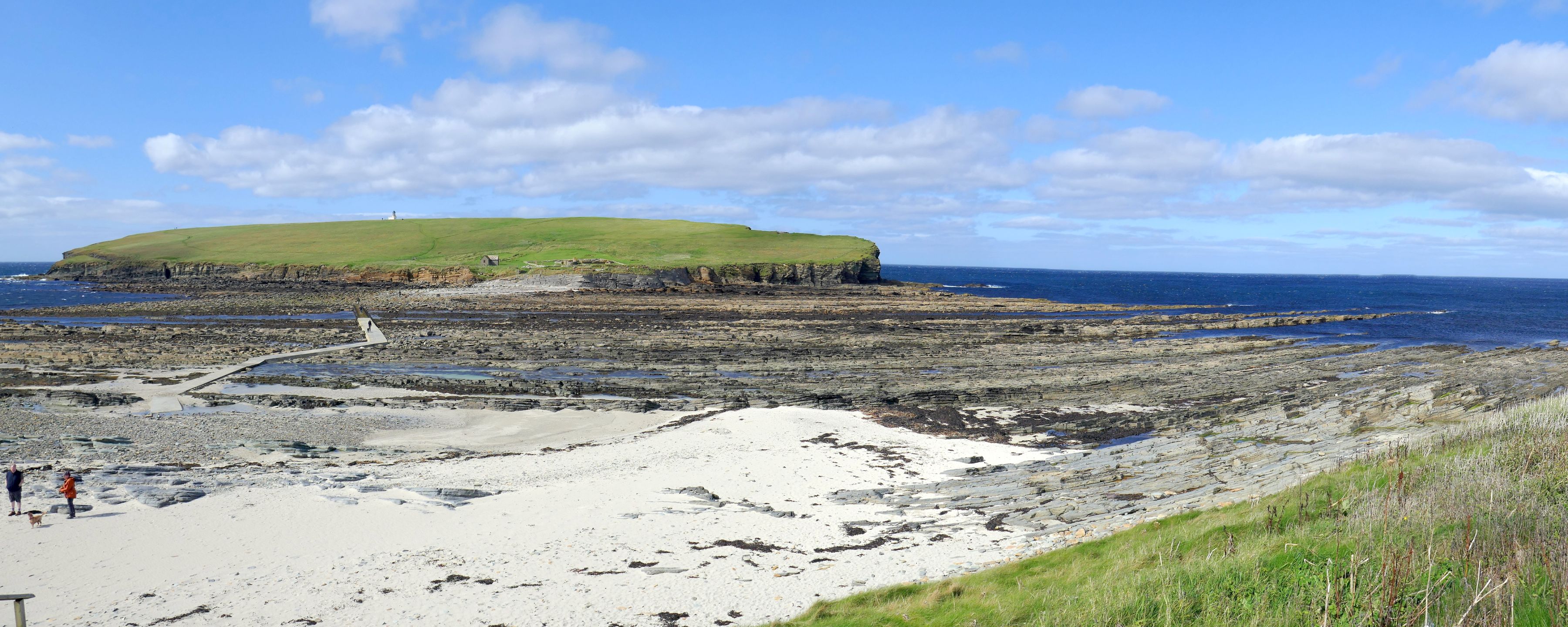
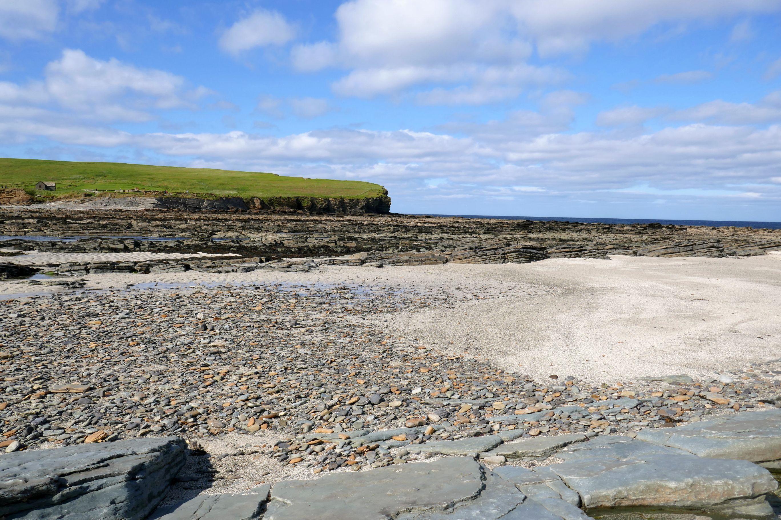
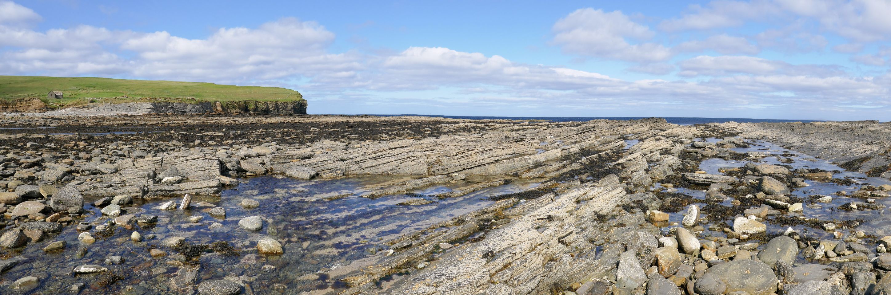
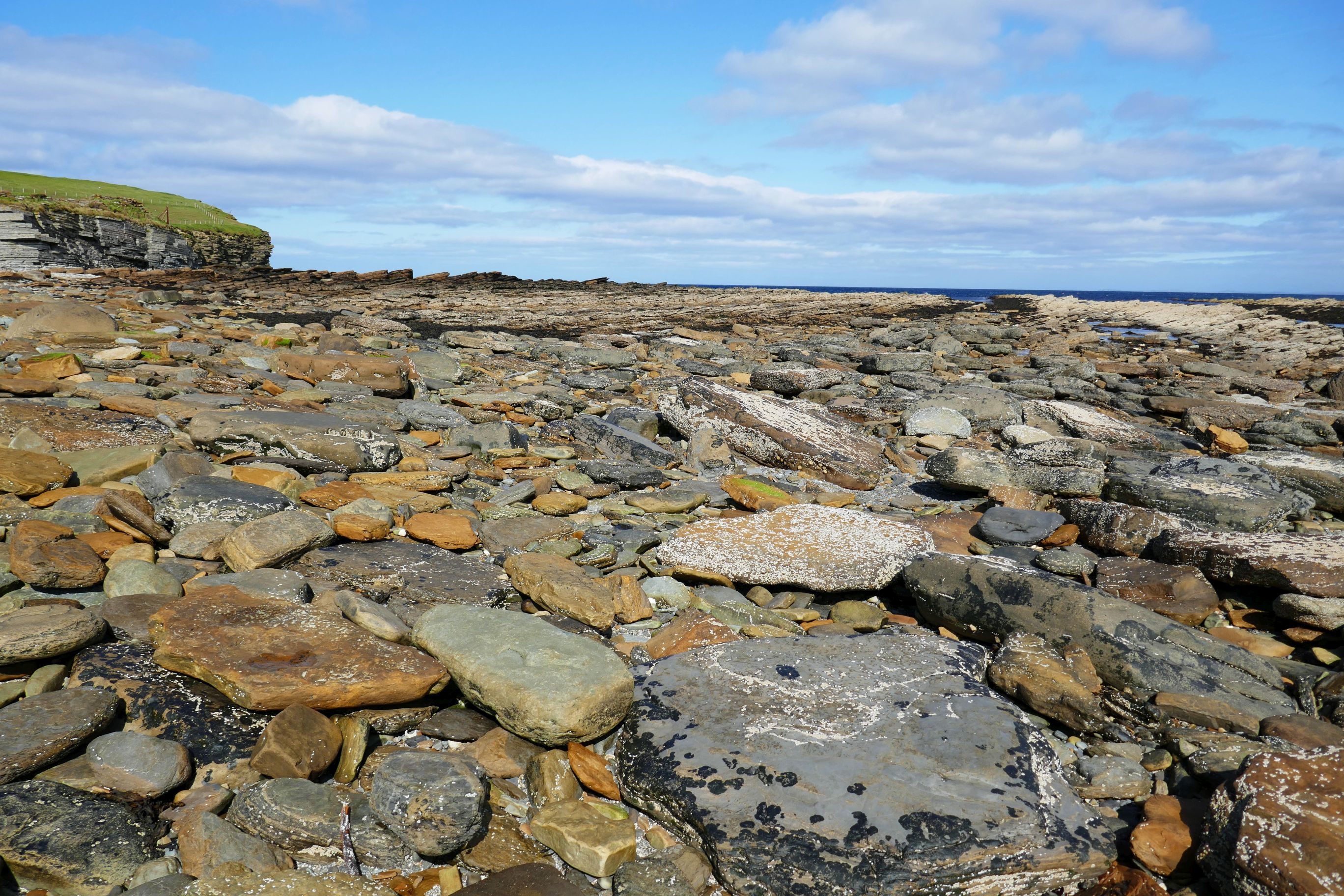
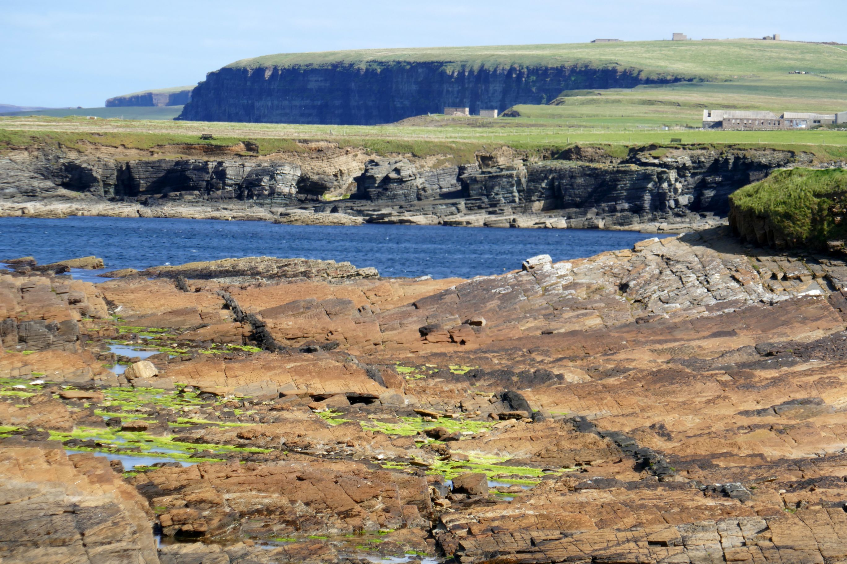
Our final stop was my favorite, and it wasn’t even scheduled! The walk out to Brough of Birsay can only be done at low tide. The conditions must also be calm to avoid being swept away off the rocks by winds and the sea. We hit it just right, so off we went for one of the most beautiful coastal hikes I have ever done!
The Birsay coast faces the Atlantic, so it suffers from high levels of coastal erosion in certain places. Sadly, there have been numerous archaeological sites that have fallen into the sea. The area is being monitored closely by the University of the Highlands and Islands (UHI) Archaeology Institute.
How fortunate we were to be able to hike to Brough of Birsay and back! Once we were out there, I had a choice to either listen to the local guide talk about the history of the area or make a beeline up the steep grassy hill to see the lighthouse. Thankfully, my swimmers’ lungs allowed me to run up the 150 feet to the top for a quick view of the 1925-era lighthouse and spectacular views of the coast below. The run back down, I must admit, was a lot easier!
I was very much in my element in Birsay and it was one of the highlights of our visit to the Orkney Islands. The ocean, beautiful coastline, hiking, and taking photos; it was fabulous!
Coming up next: UNITED KINGDOM #12: FERRY TO INVERNESS& CAIRNGORMS NATIONAL PARK
For those who have followed my travels, you may remember last year’s blog posts on Scotland. We hadn’t planned on returning so soon; however, Edinburgh is on Overseas Adventure Travel’s U.K. itinerary. It was great getting to see this enchanting city again!
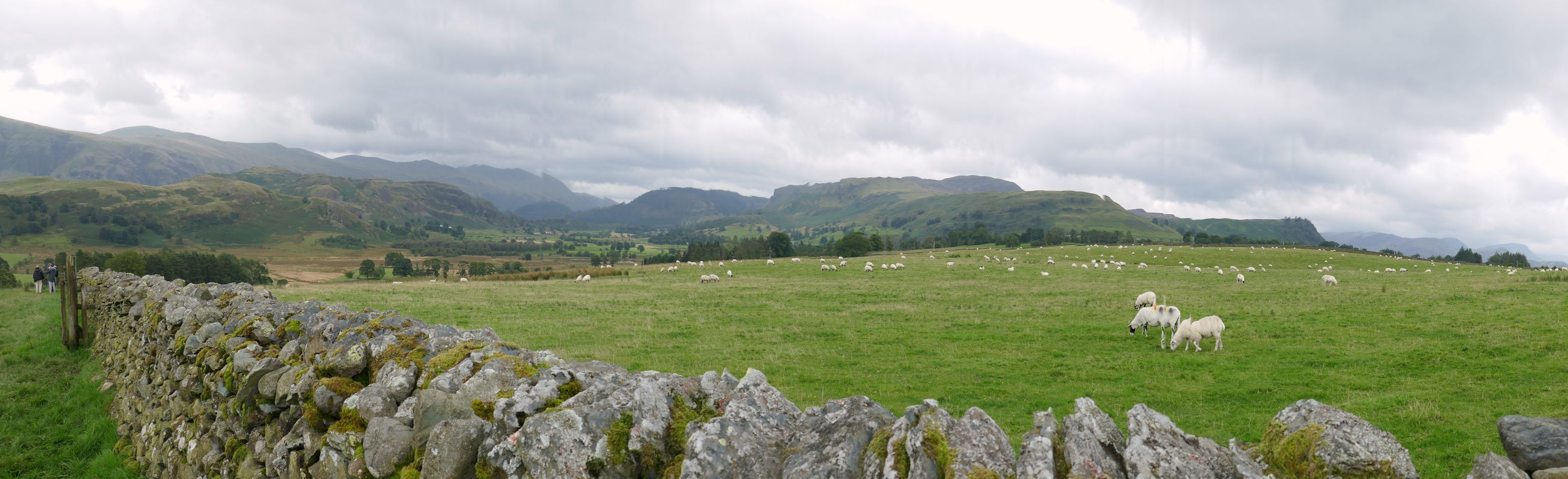
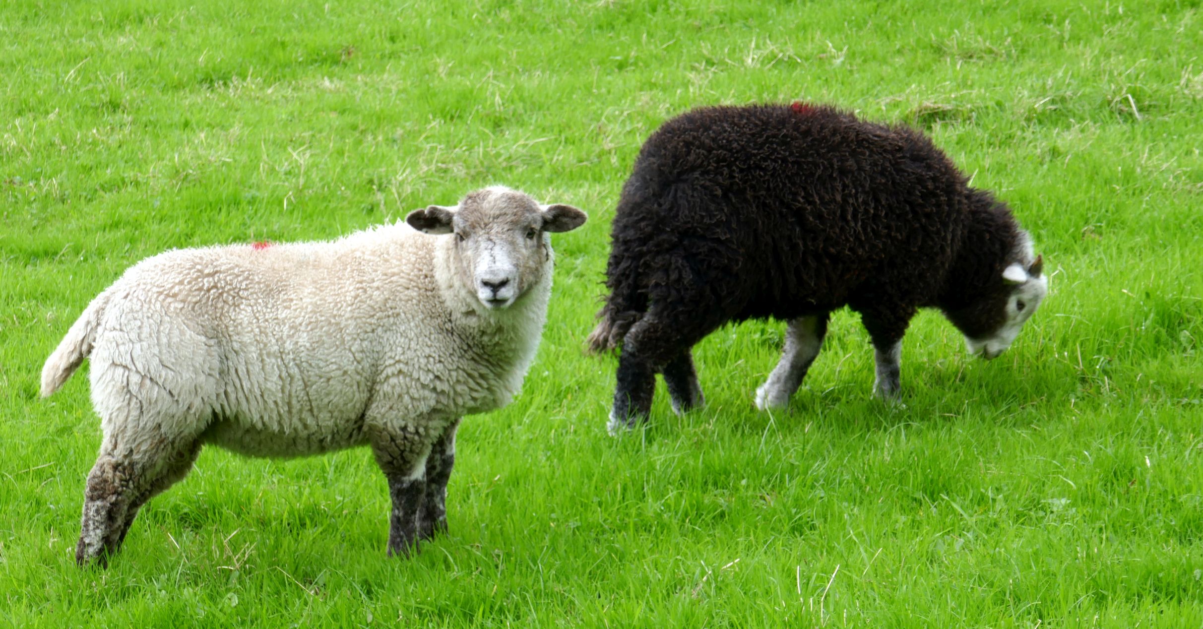
If you first travel through the Lake District of England, and then continue to Scotland like we did, you will notice some differences. The small fields of sheep in the Lake District become larger fields of mostly cattle, and the land is flatter. The accent is different, too. “Carlisle” is pronounced “Car-lyle” by the English and “Ker-leel” by the Scottish.
Scotland has 1/3 the land mass but only 8% of the population of the United Kingdom. Their population is a well-educated one, too– the most educated workforce in Europe.
Even though the country is in the United Kingdom, it still has a degree of independence, because it voluntarily joined the U.K. They can choose what they keep independent, such as their legal system.
Unfortunately, like in many other cities around the world, Edinburgh is experiencing an extreme housing shortage, and it is very expensive to buy or rent in the city. A one bedroom/ one bath rental apartment south of the city will cost you 1,500 – 1,600 British pounds ($1,900 – $2,000+). There are many Edinburgh workers that live in Glasgow and commute to Edinburgh—a 45-60 minute drive each way.
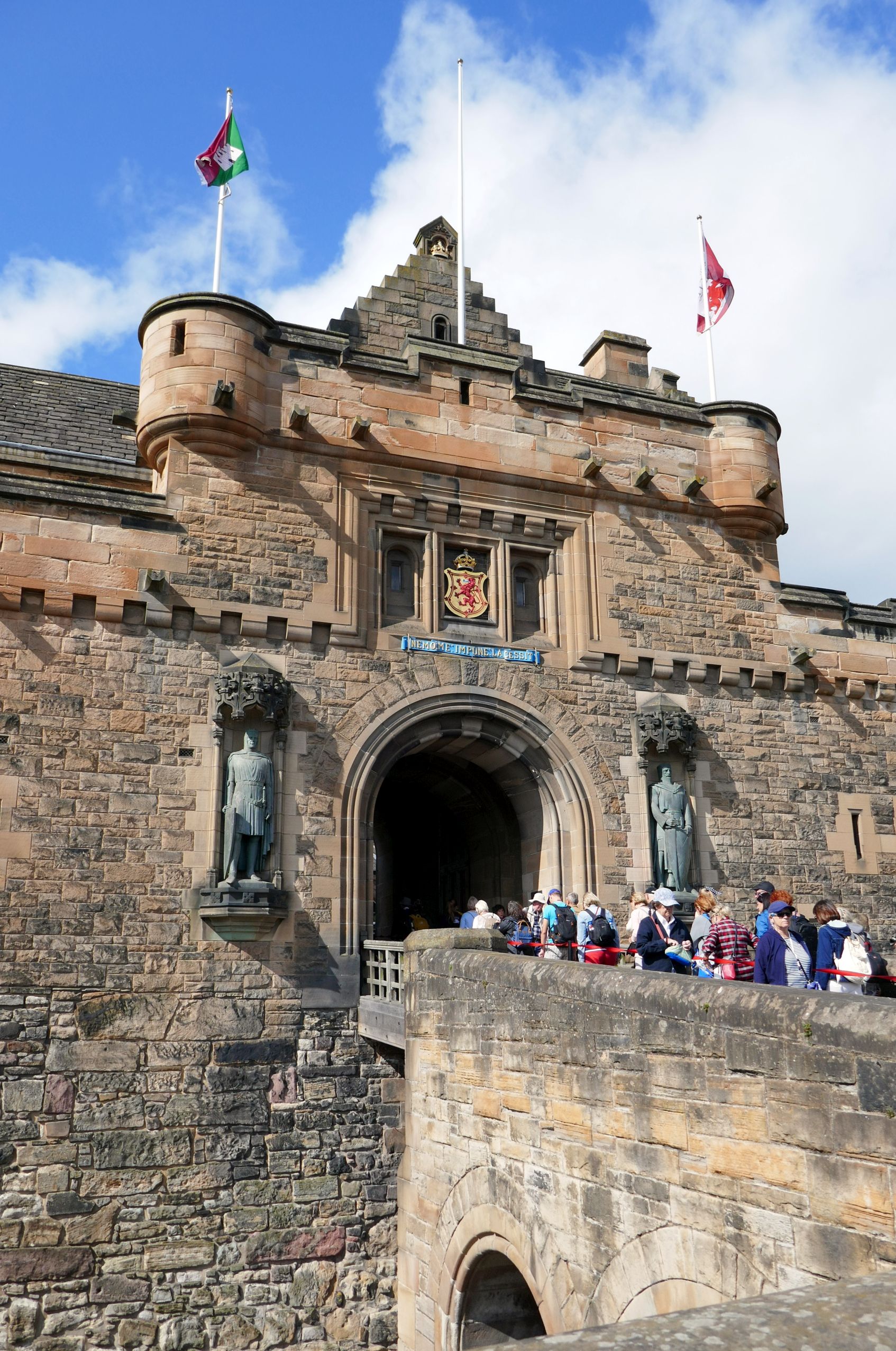
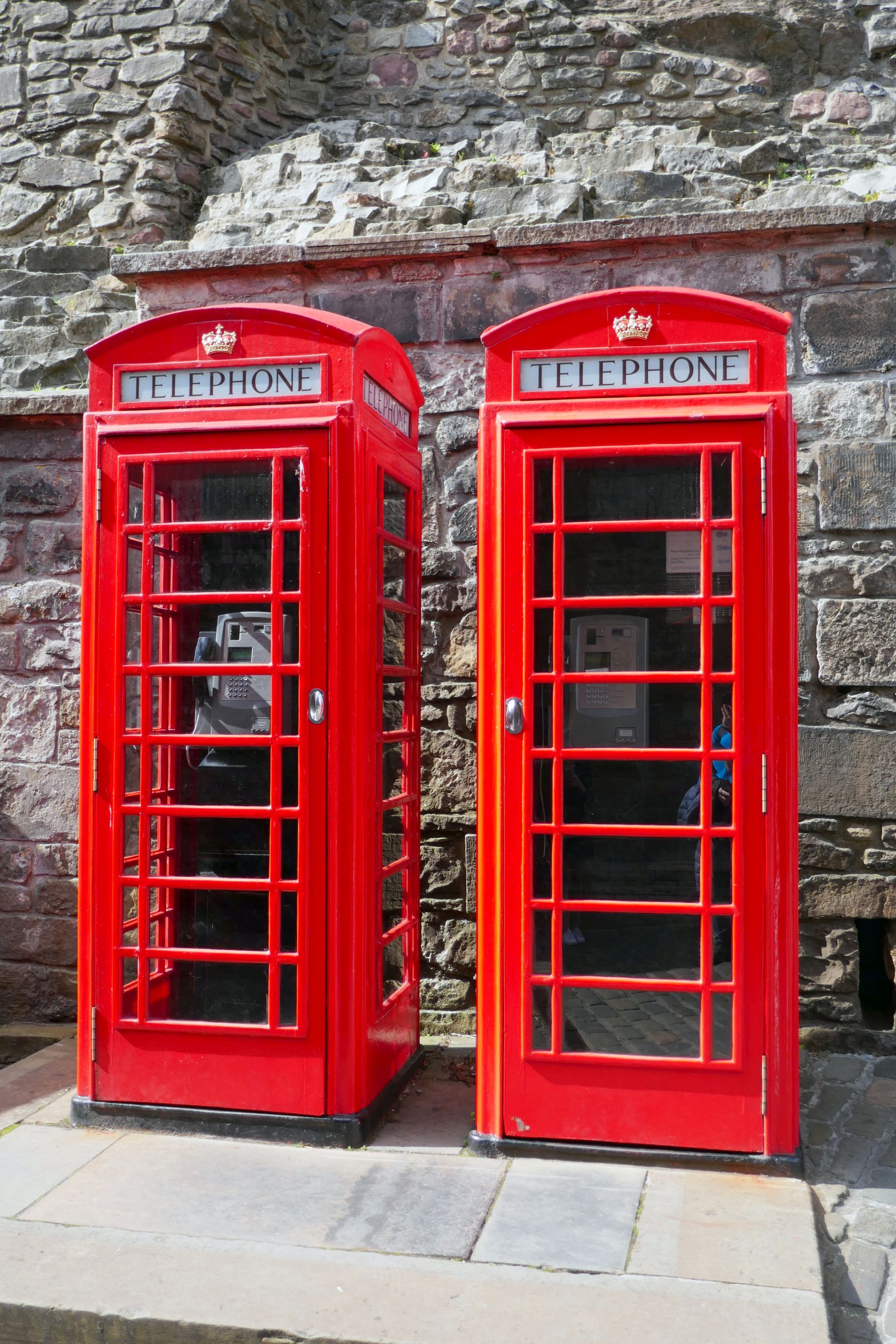
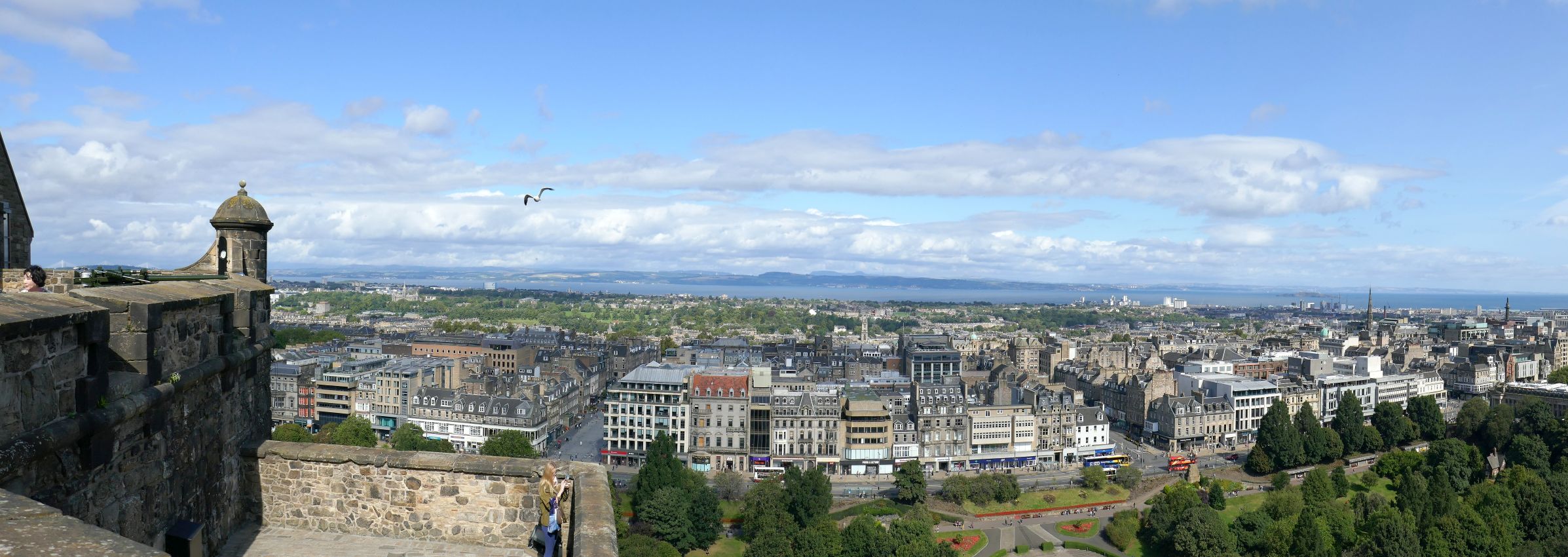
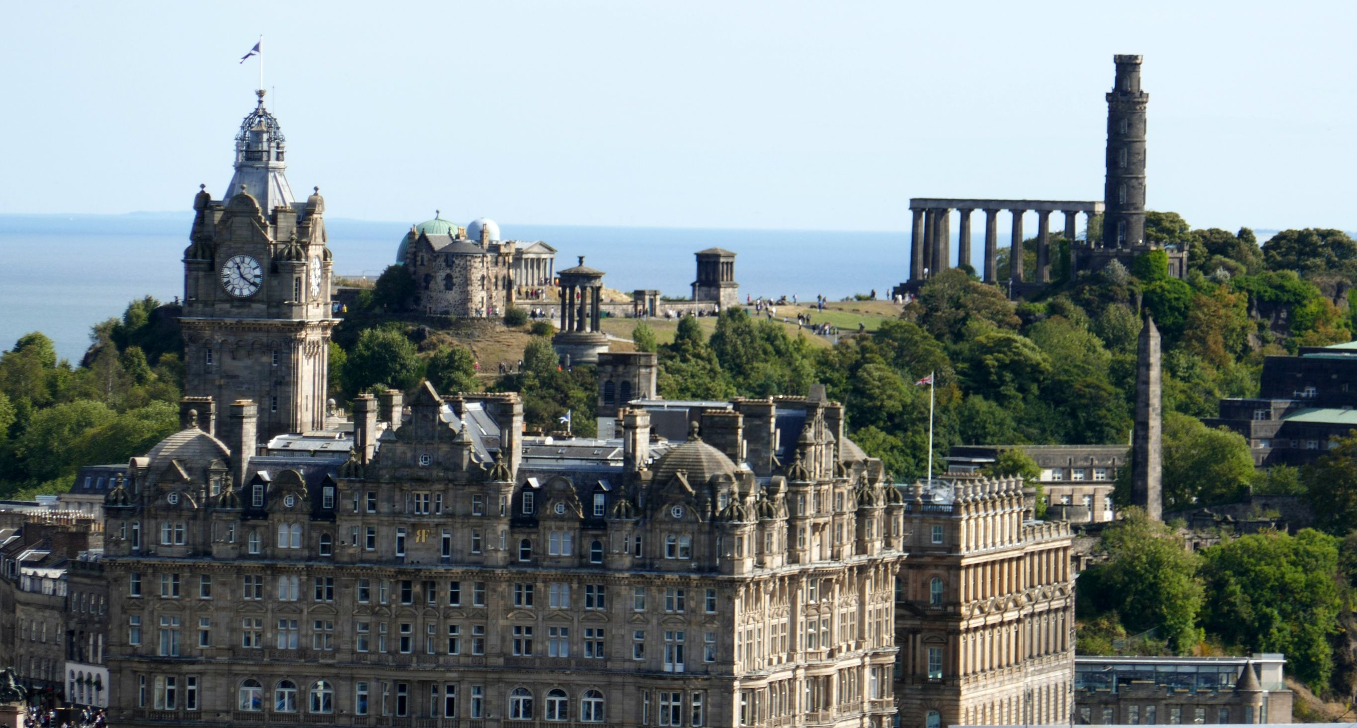
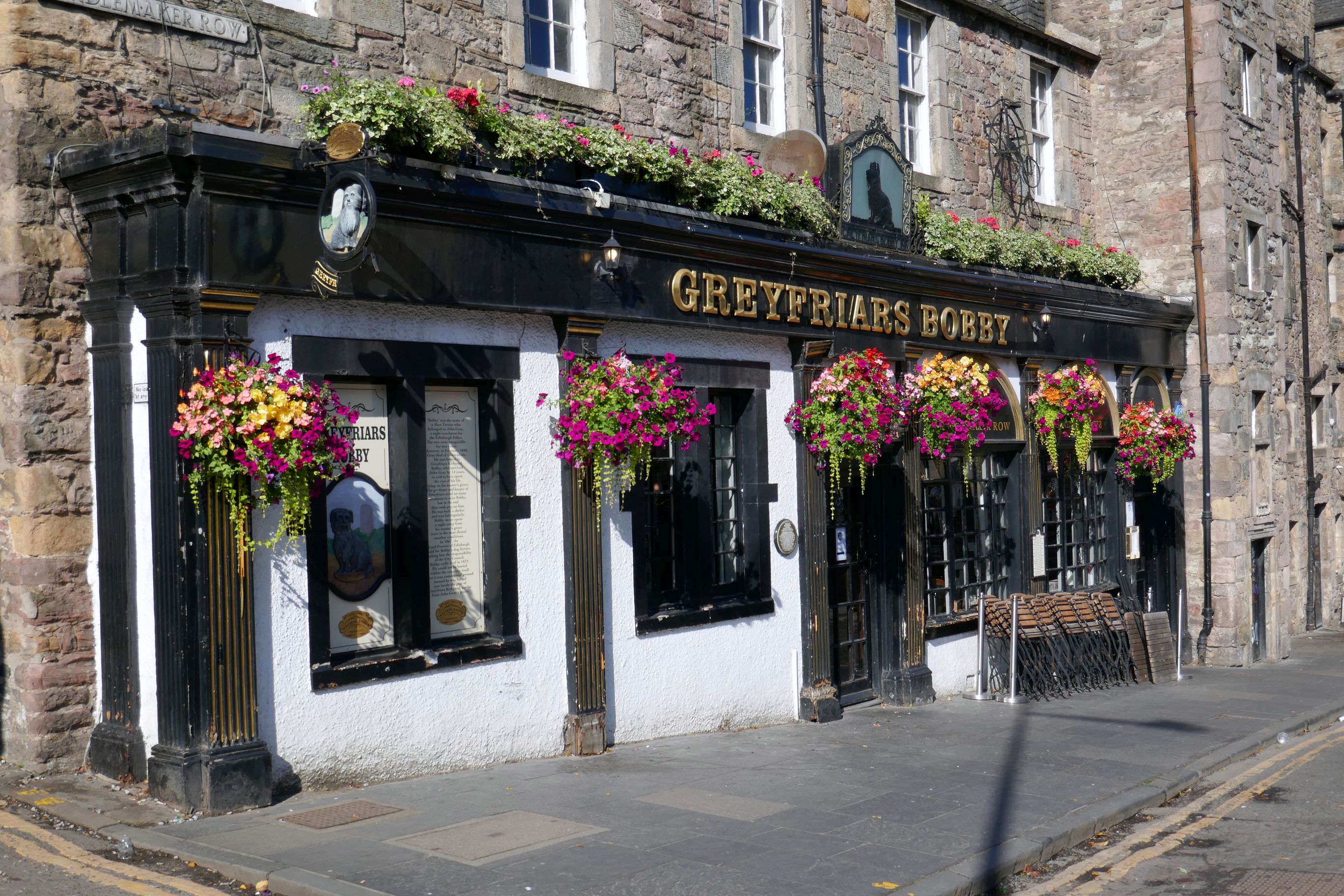
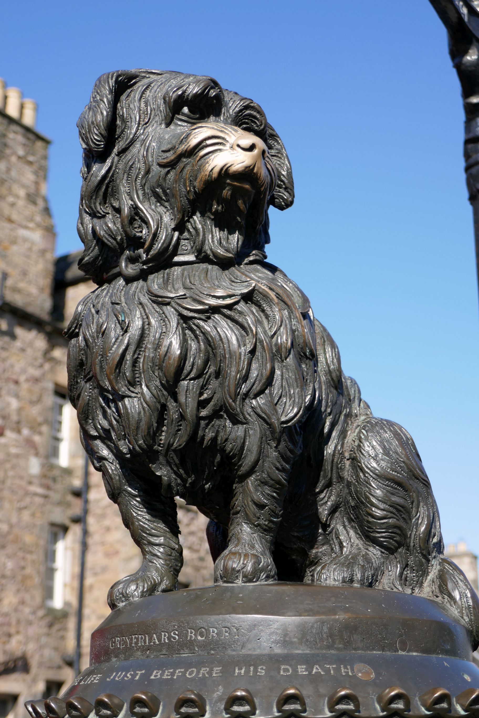
We began our first day with a walking tour of Edinburgh’s Old Town, a UNESCO World Heritage Site, revisiting the places I wrote about in Scotland #1, Scotland #2, and Scotland #5. It was a beautiful day until the clouds and drizzle moved in during the late afternoon, so I found myself shooting many of the same subjects again. Déjà vu!
(For all photos, click on the image for a full screen view.)
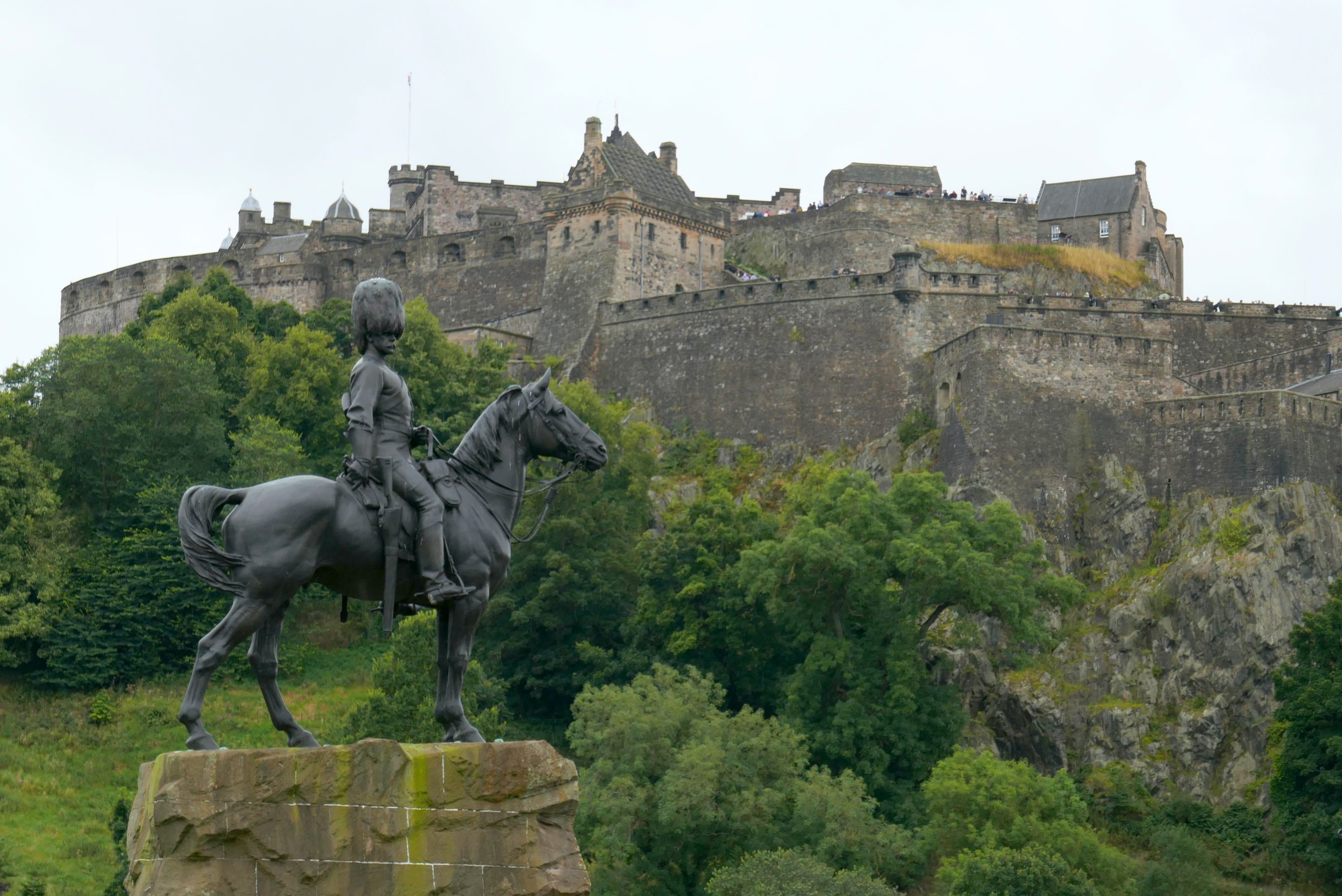
Edinburgh Castle
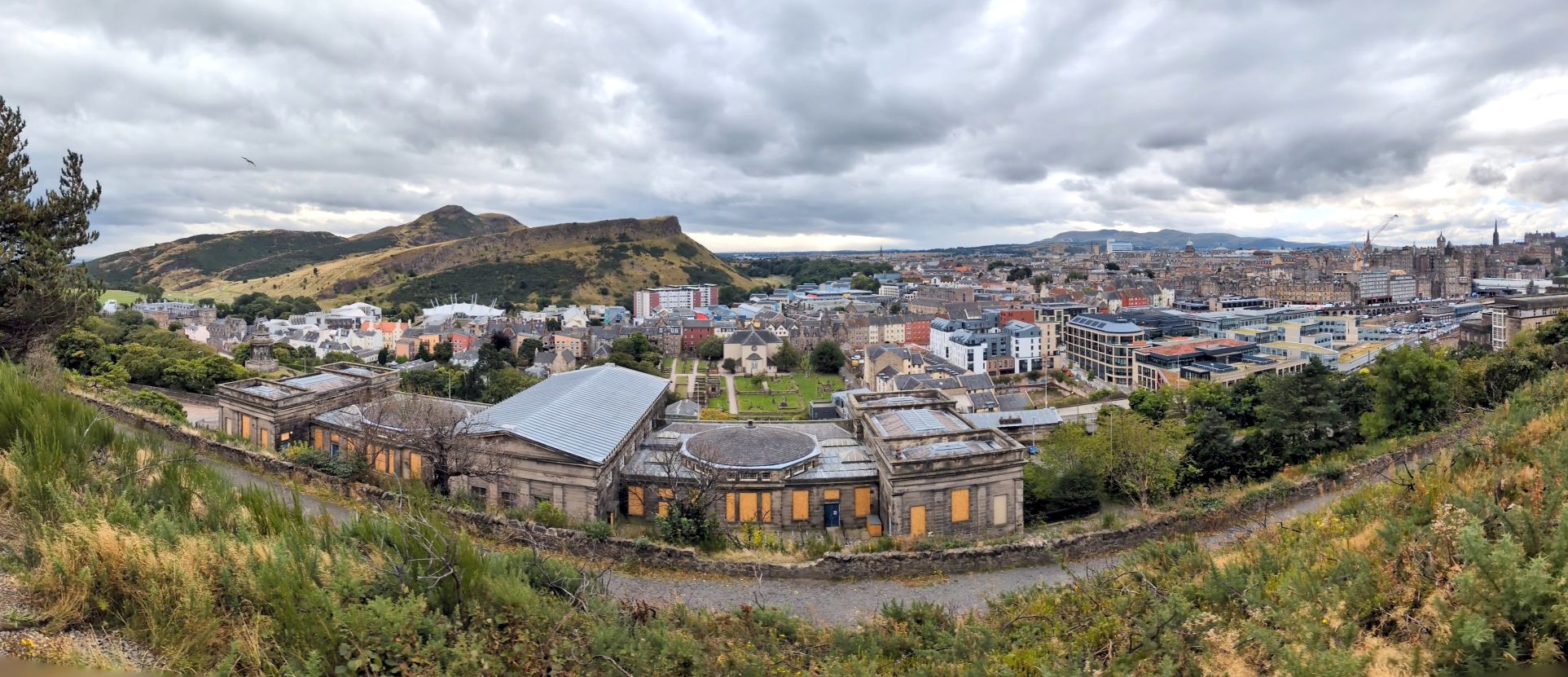
The view from the castle looking down on Edinburgh
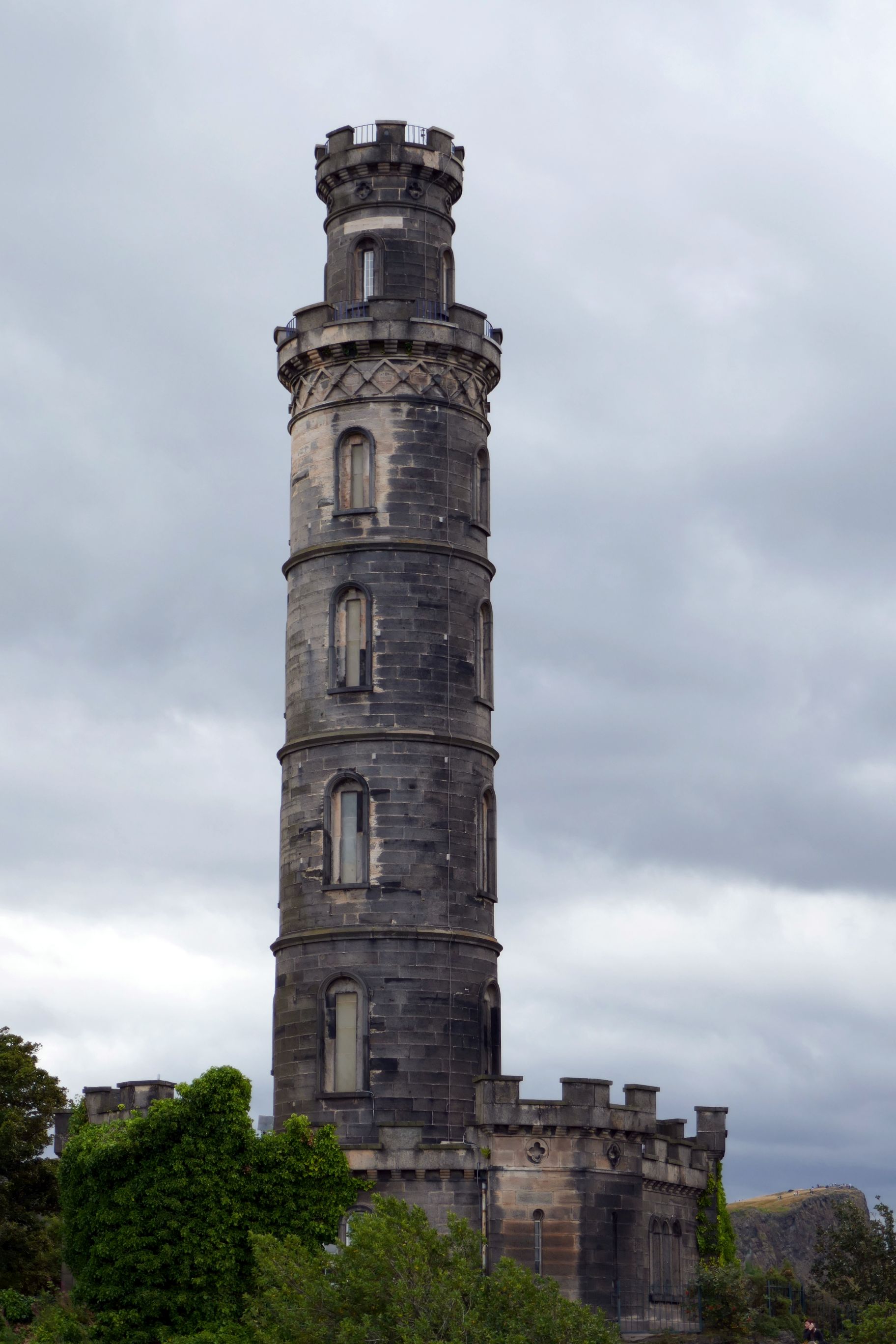
Victoria StreetCalton Hill
The view from Calton Hill to Arthur’s SeatHolyrood Palace
As always on an OAT tour, we experienced a home-hosted meal, and on this itinerary we visited a home in Edinburgh. We were hosted by a lovely young couple, Ashley and Ian, and Ian’s father, Ross, a cool guy who shared our taste in music. The dinner was at Ross’s home, but Ashley and Ian did the cooking. They are working towards growing their catering business to eventually opening a vegan restaurant, so they tried out some recipes on us. I especially enjoyed the dessert—chocolate mousse made with 350 grams (12 ounces) of silken tofu, 150 grams (5.3 ounces) of dark chocolate, and 3 tablespoons of maple syrup. Whip it up in a food processor and chill! How easy is that?
You can’t tell by these pictures, but this was the day our luck with weather ran out. It was bitterly cold and windy, and at one point while we were at Hadrian’s Wall, we all gave up on our local guide and asked if we could go back to the bus to listen to the rest of his talk. I didn’t wait that long; I was already on the bus by the time the rest of the group followed my lead.
(For all photos, click on the image for a full screen view.)
Thankfully, the blustery cold was a one-and-done. The weather was (mostly) fabulous (by U.K. standards) the remainder of our trip!
Back to Hadrian, he was a Roman emperor from AD 117 to 138 and the first ruler to divide Britain. The wall he had built (I’m sure he didn’t lift a finger) beginning in AD 122 was a 73-mile-long stone defensive fortification that runs east to west. It is now a UNESCO World Heritage Site.
It amazed me that so many centuries ago, this barricade was just part of a multi-cultural military zone comprised of forts, barracks, towers, and small towns.
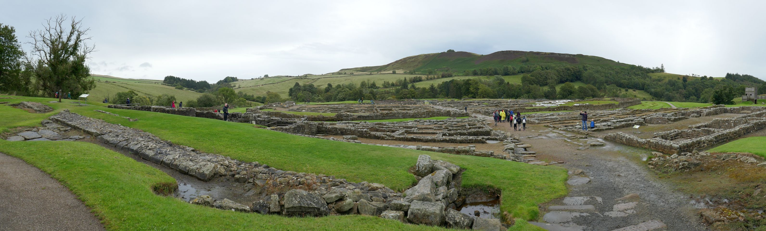
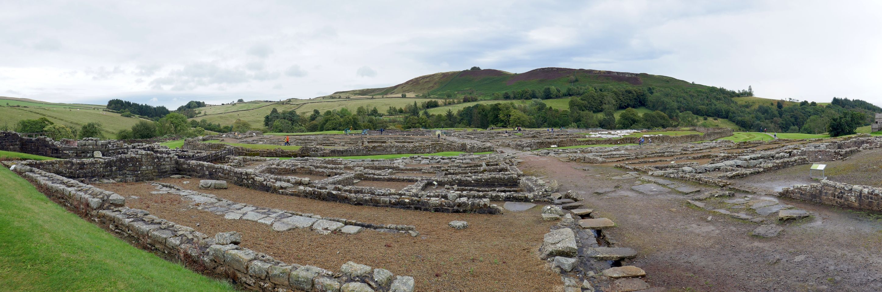
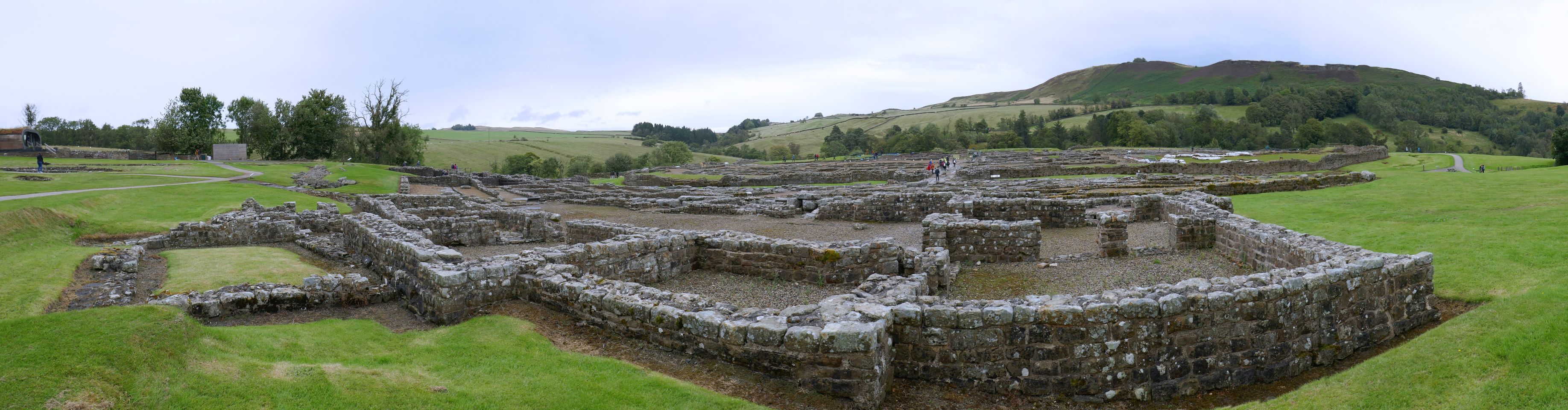
After we thawed out, we visited Vindolanda, near Hadrian’s Wall. It was a Roman auxiliary fort that dates back 40 years prior to Hadrian’s Wall and was occupied until around AD 370. It is considered one of Europe’s most important ancient Roman archaeological sites.
Ongoing excavations have unearthed many amazing artifacts which we were able to see in the adjacent museum—a welcome reprieve from the cold!
Vindolanda has the largest collection of leather items found anywhere in the Roman empire.
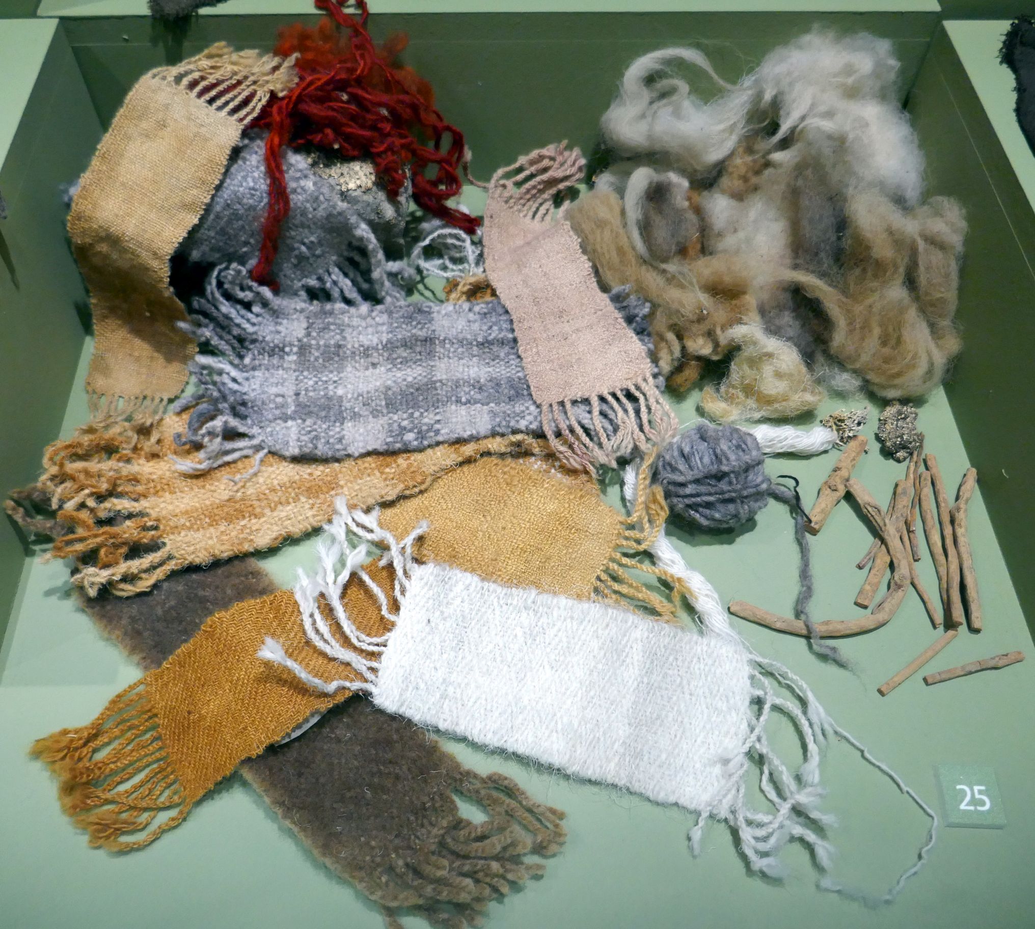
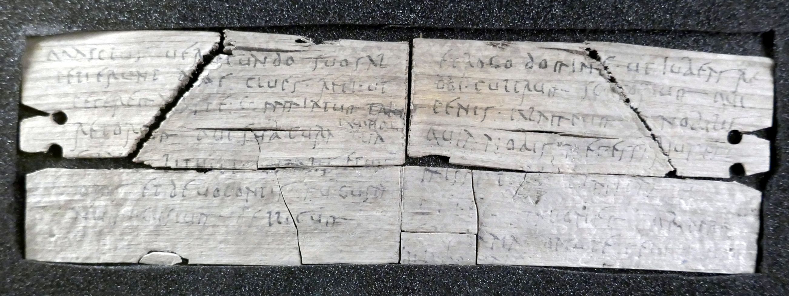
Some of these coins date back to 100 BC! The Romans used a variety of different dyes and chemical treatments to color their textiles. The root of the madder plant was used to produce red dye and lichen was used for purple. A variety of tree barks, lichens and heathers were used for yellow dye. Thanks to the ground conditions at Vindolanda, these textiles survived where they would have completely decayed anywhere else after so many centuries. This is a silver military award depicting Medusa and dates back to AD 105-120.The Vindolanda tablets have been voted Britain’s Top Treasure by the British Museum.
Next, we continued our drive to Edinburgh, Scotland, the subject of my next post:
(For all photos, click on the image for a full screen view.)
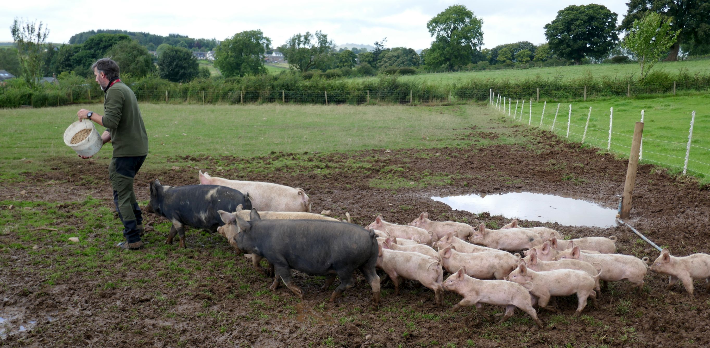
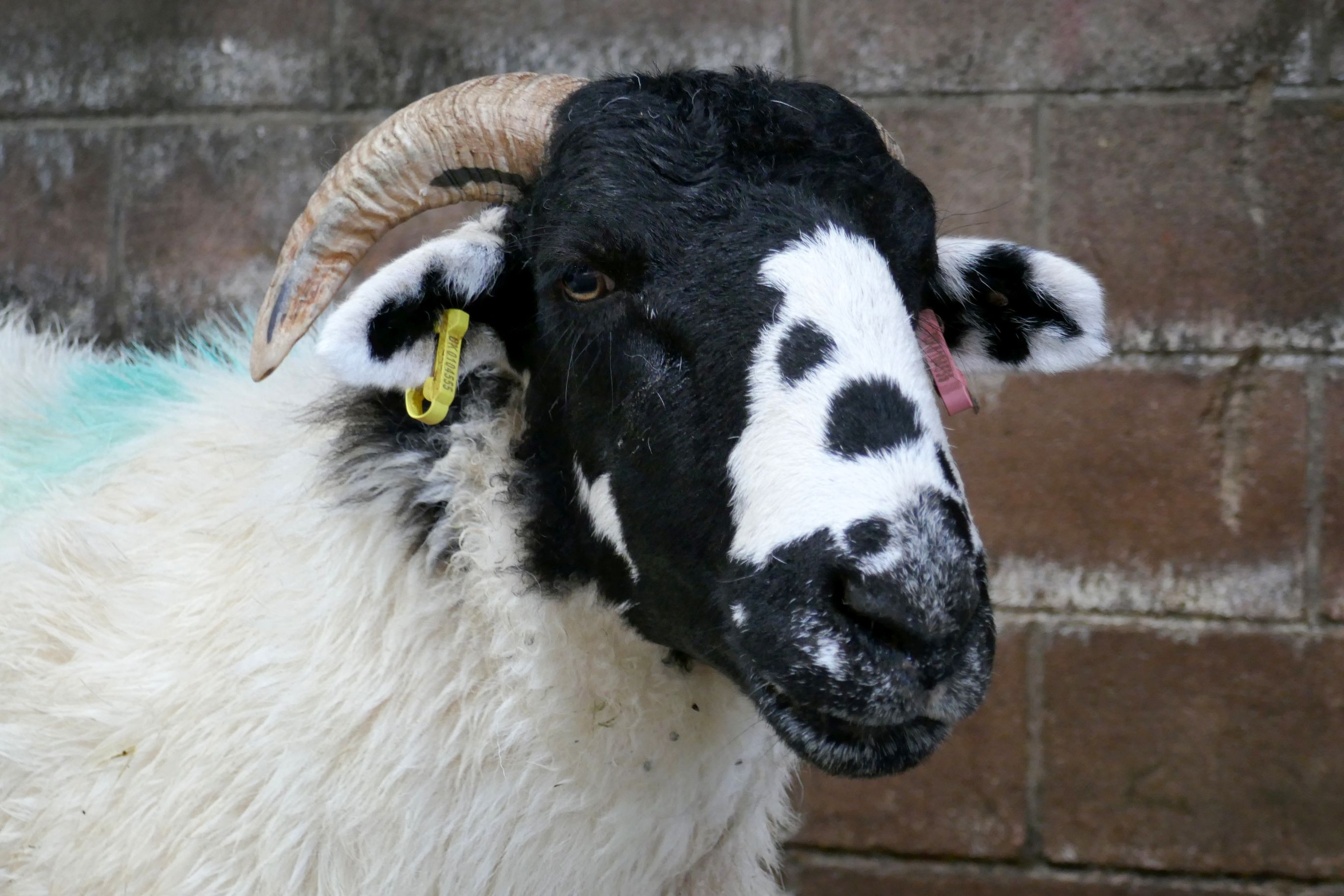
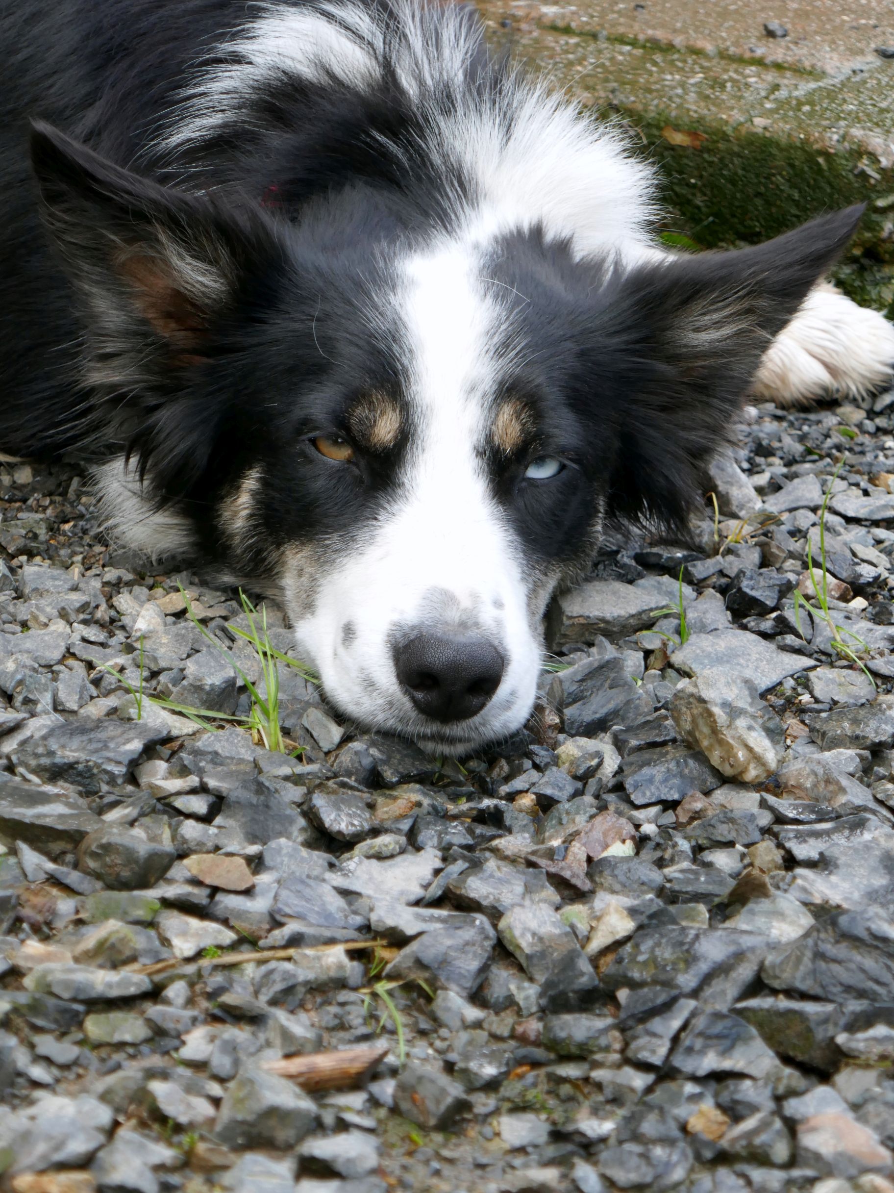
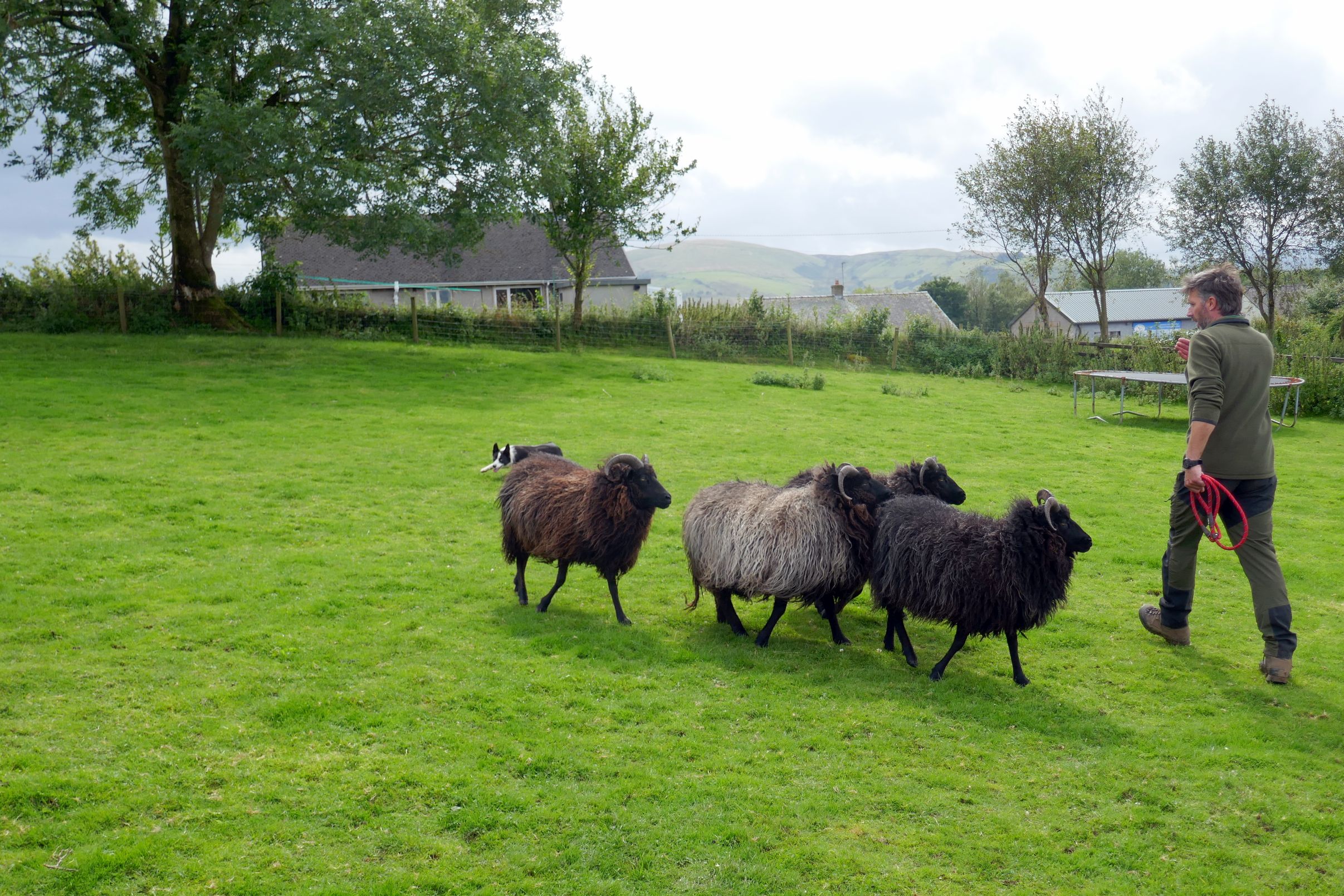
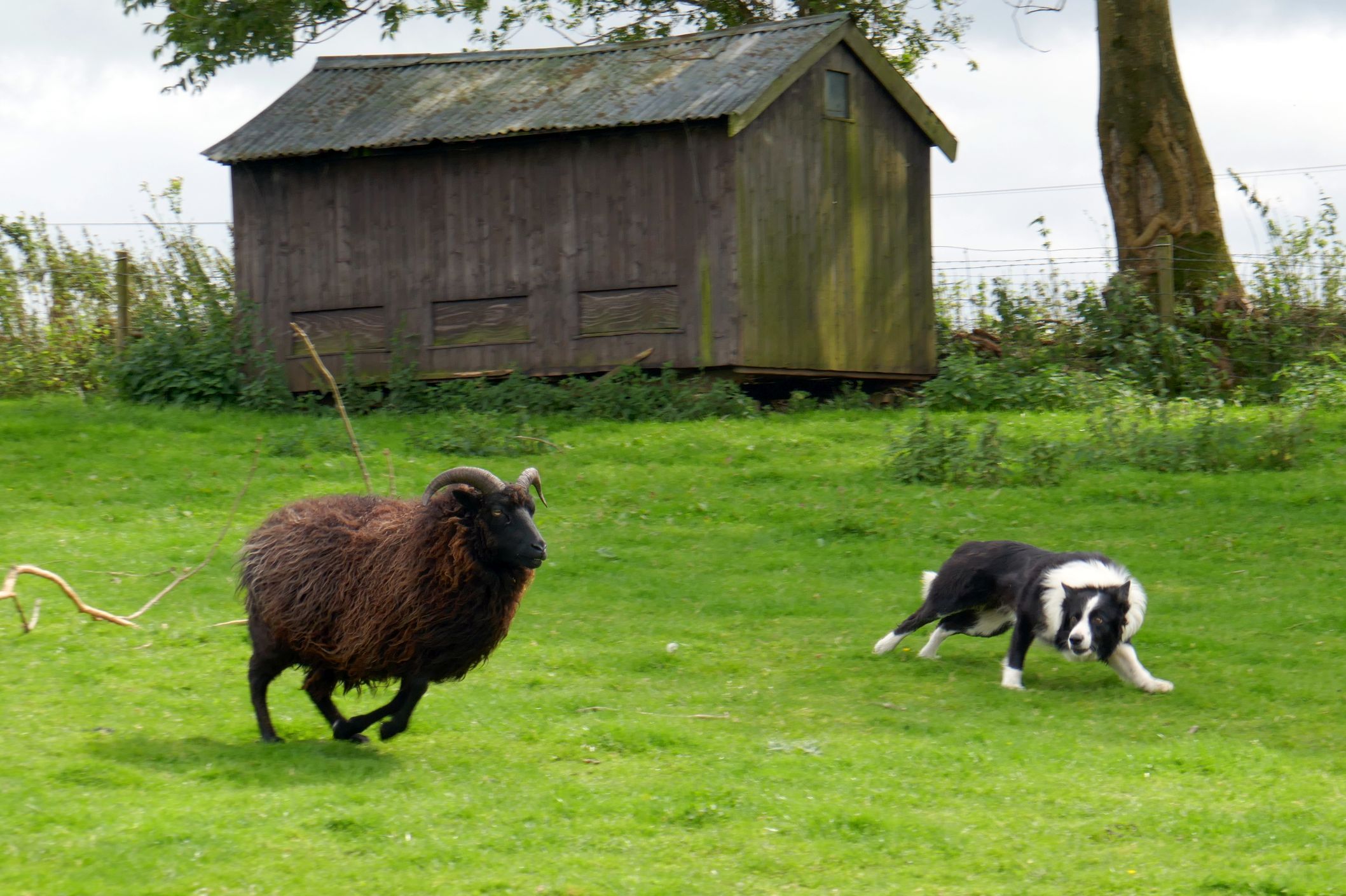
Their story is an interesting one. They are first generation farmers by choice rather than inheritance like many other farmers. Farming is a passion for the Millers and their four kids. They have 600 sheep (which produce about 400 lambs each season), 11 sheep dogs, 6,000 free range hens for egg production, cattle, pigs, horses, and beehives.
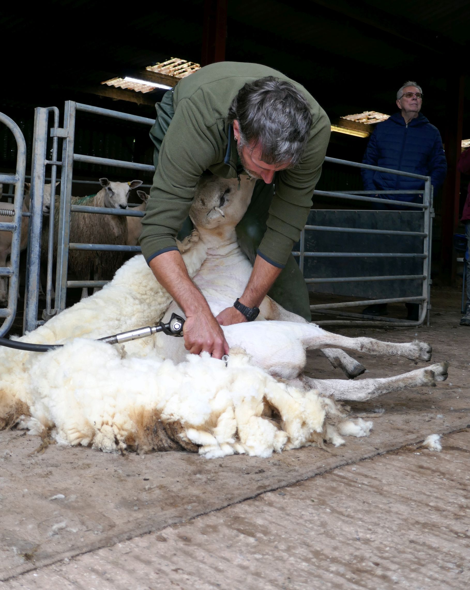
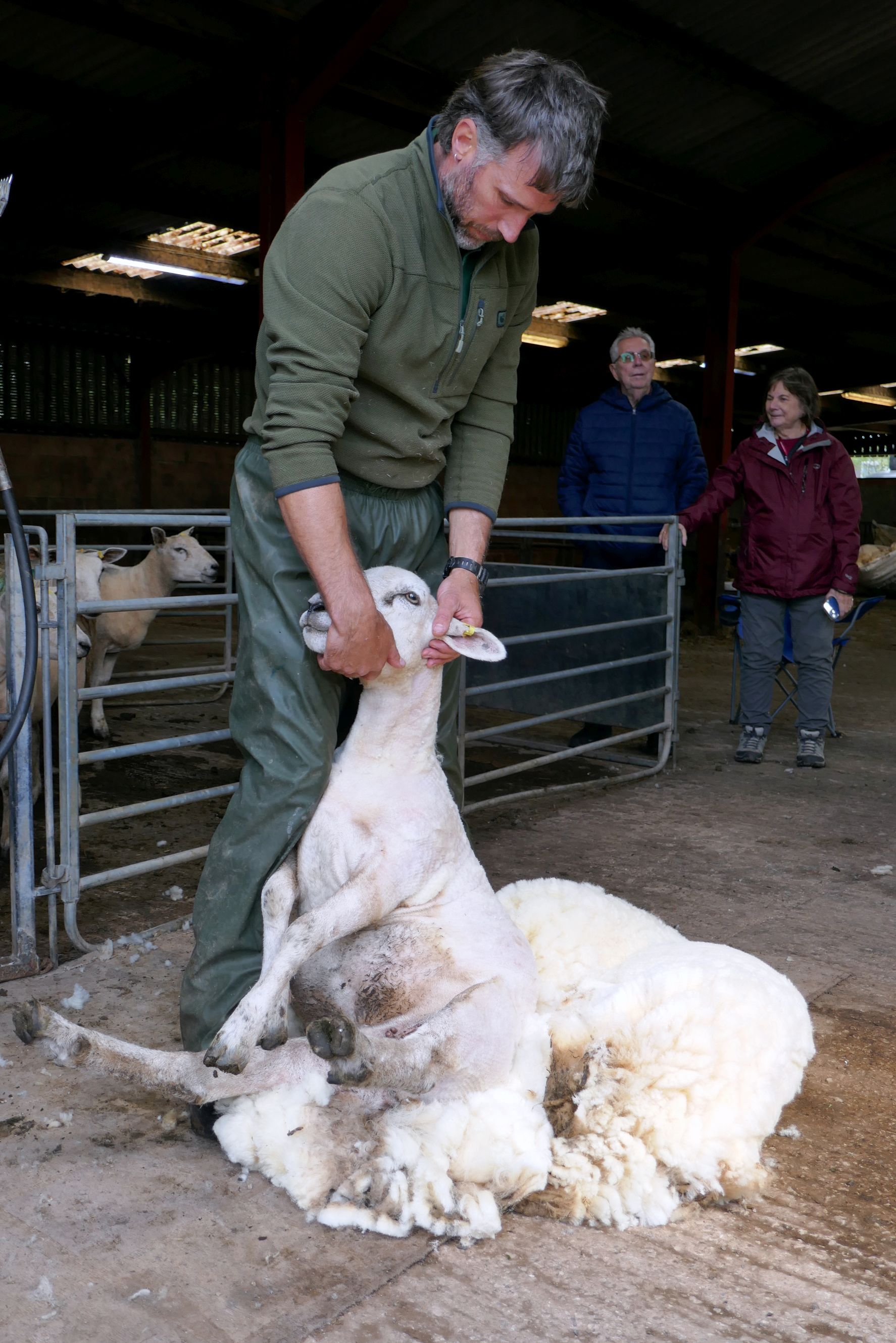
While touring the farm and meeting their animals, Gary demonstrated how he shears his sheep. This guy looked quite naked after losing his full coat of wool!
Unfortunately, wool is no longer worth enough to sell (thanks to synthetics being used for clothing), so they raise their sheep for lamb, which is more lucrative.
Their eggs produced by the 6,000 hens are mostly sold to McDonald’s; however, they make more money selling them directly to the public at local farmers markets.
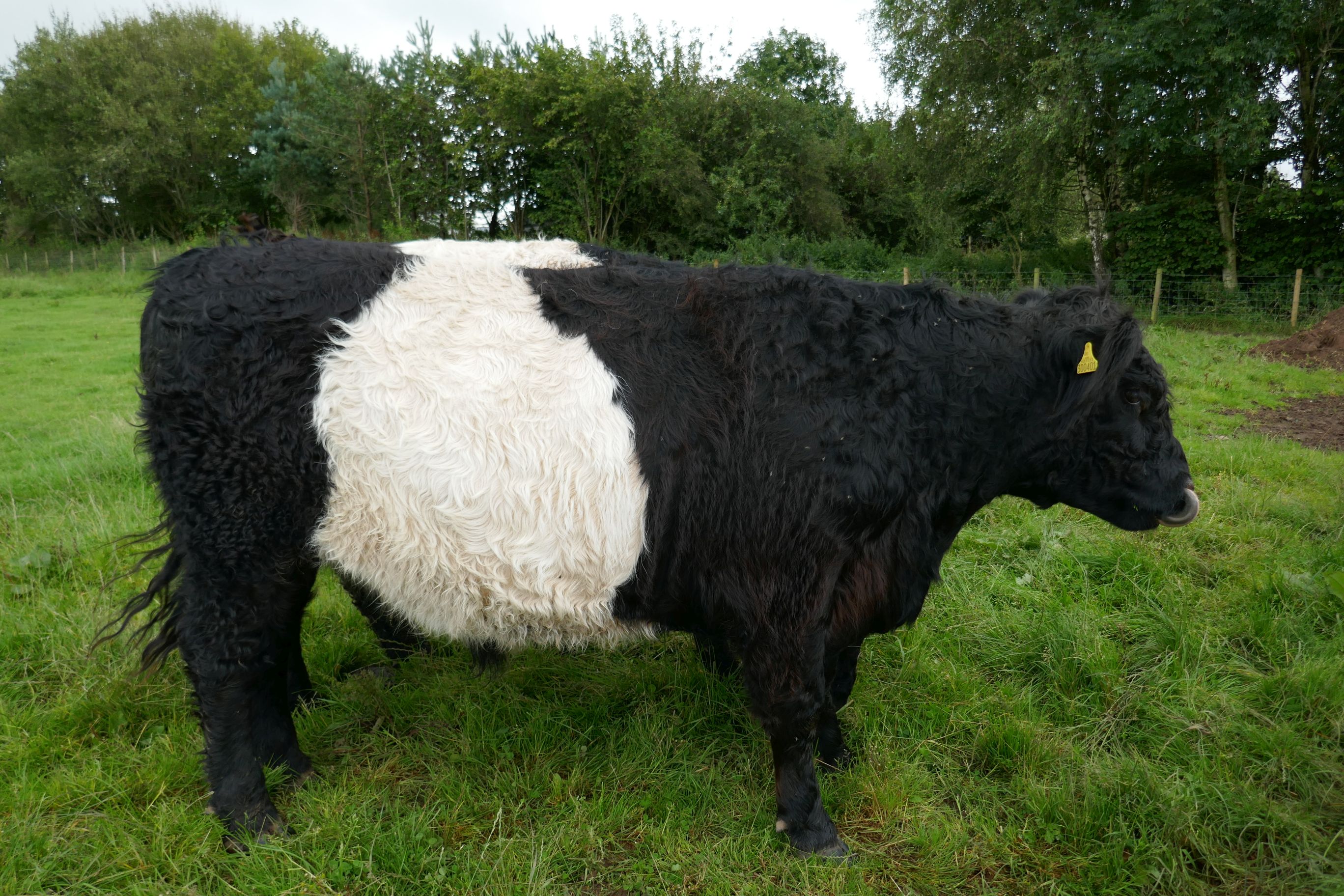
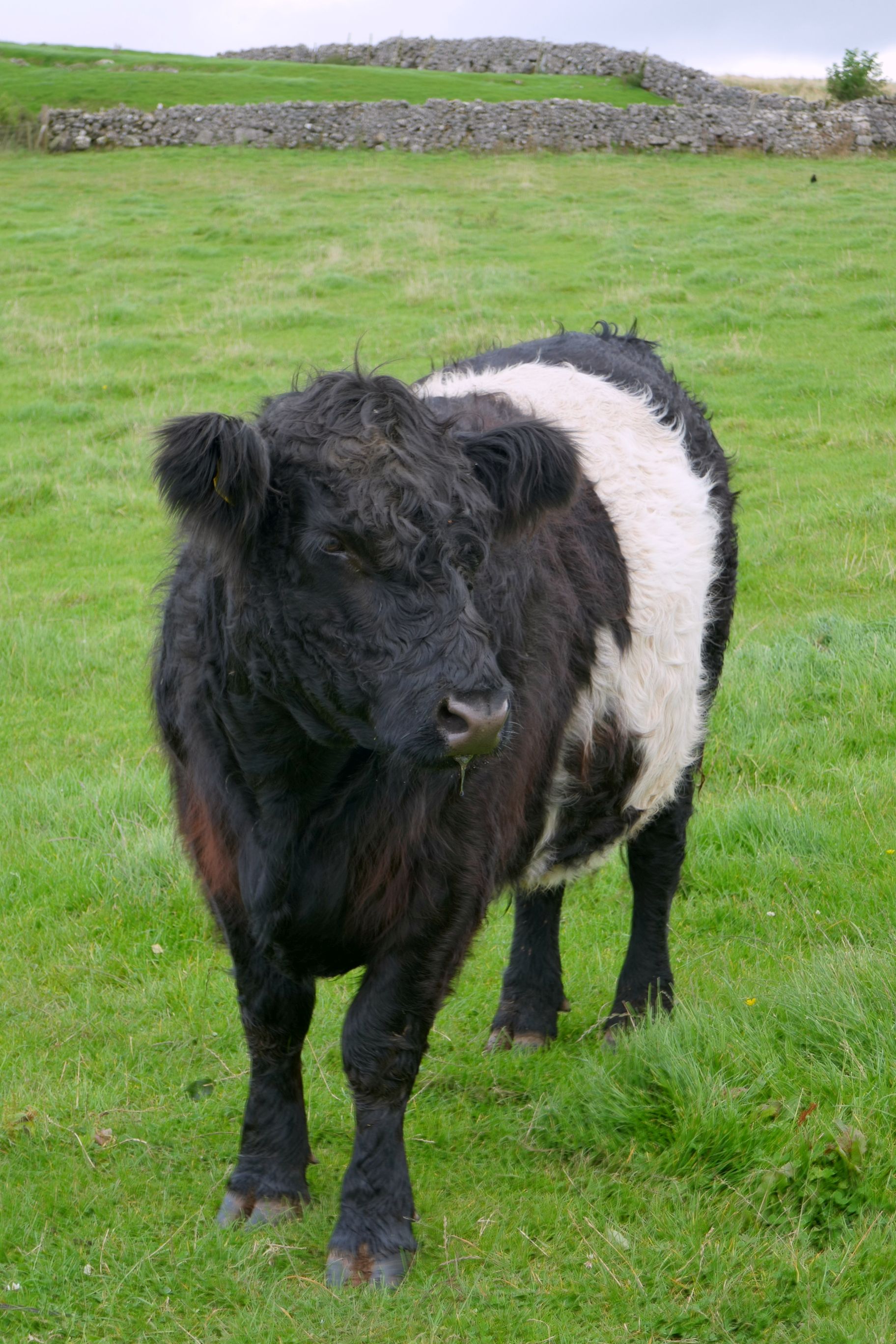
It was fun getting to meet all of their animals, including the Belted Galloway cows, better known as “Oreo” cows. I’m sure you can see why they got that nickname:
Gary’s wife, Hazel
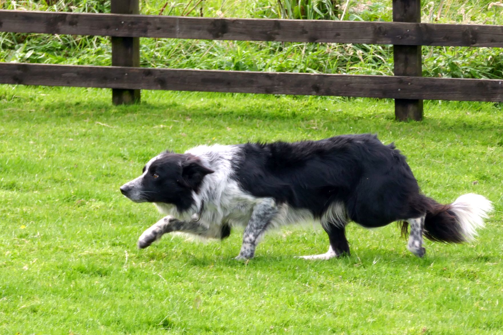
To diversify their income, they do farm tours and sheep dog demonstrations. Gary is also a plumber by trade and still does plumbing work, because it’s tough trying to make a living on just the farm alone.
The sheep dog demonstration was the most enjoyable part of our visit! Gary is self-taught at training sheep dogs and has done well in competition, placing 3rd at the English national competition one year. Here’s Gary in action: https://youtu.be/tydPhrQZEJI
Following our farm visit, we had free time in the afternoon to explore the town of Grasmere. The weather had improved, so I also took a hike in the hills behind our hotel.
Swan Hotel
Coming up next: UNITED KINGDOM #6: HISTORICAL HADRIAN’S WALL & VINDOLANDA FORT
In case you are confused about the terms “Great Britain” and “United Kingdom,” this is the difference: Great Britain includes England, Scotland, and Wales; the United Kingdom also includes Northern Ireland. Our tour covered all four countries.
Located west of Chester, England, Wales is the “forgotten” country of the United Kingdom. At least, that’s how Tom, our tour leader, and probably many of the 3+ million other Welsh people feel about how they are treated by the English government. And, if I were Welsh and living in Wales, I would feel the same way!
This country of 10 million sheep, roughly the size of New Jersey, was (literally) beaten into submission by England to join the U.K., unlike Scotland who volunteered. As a result, the two countries are treated differently with Scotland enjoying a higher status. Wales has its own government; however, London controls the purse strings and seems to ignore the needs of Wales.
Brexit has had a huge economic effect on Wales, and the farmers will have some big decisions to make at the end of the year when the subsidies they received and relied on while part of the European Union will end. Beginning in 2025, farmers will have to convert 10% of their farmland to trees and 10% will have to remain a natural habitat. As a result, food production (and their incomes) will decrease. If farmers comply, they will continue to receive subsidies, but will it be worth it financially? They make so little income as it is and can barely make ends meet. How will the land of Wales change? Will the cost of food increase? There are so many other questions, but the answers remain to be seen…
Currently, one of the big issues in Wales is the housing crisis. The former government promised to add enough housing; however, they failed—miserably.
Bordered by the Irish Sea to the north and west, England to the east, the Bristol Channel to the south, and the Celtic Sea to the south-west, Wales is a mountainous, beautiful country. It is a draw for rock climbers and other outdoor sports enthusiasts, most notably Sir Edmund Hillary, who trained alongside his team on the technically difficult mountains of Wales to prepare for climbing Mount Everest.
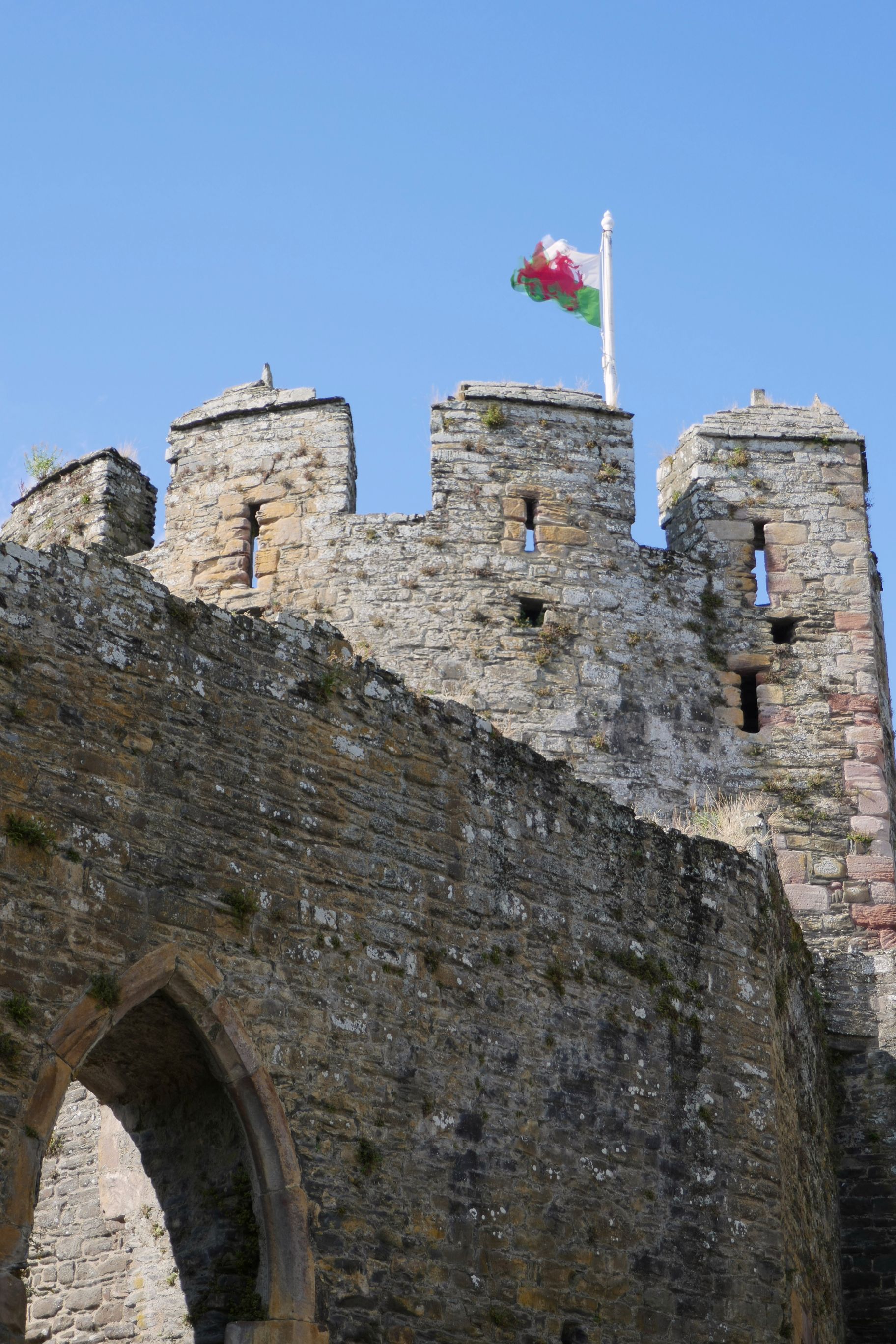
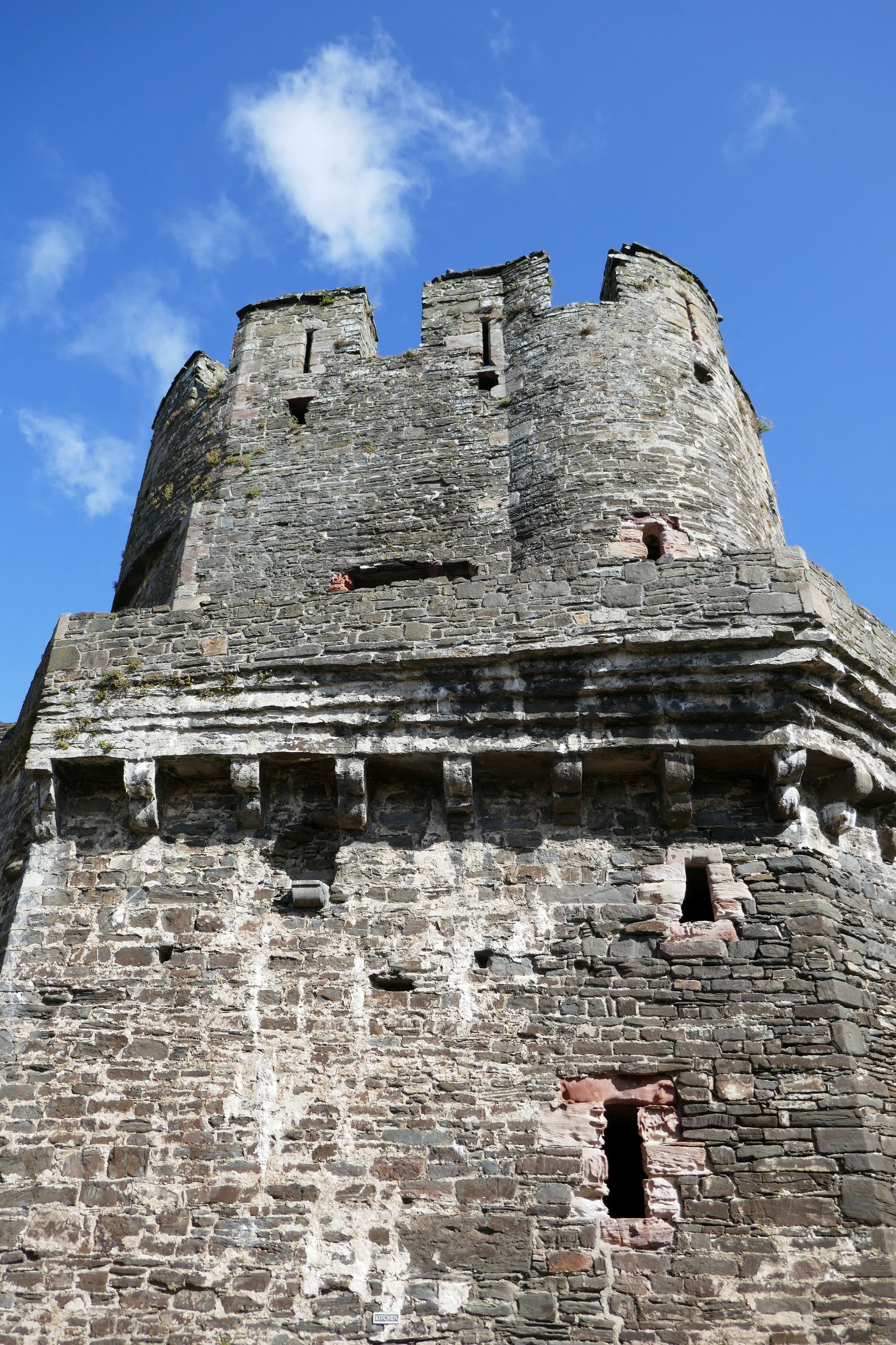
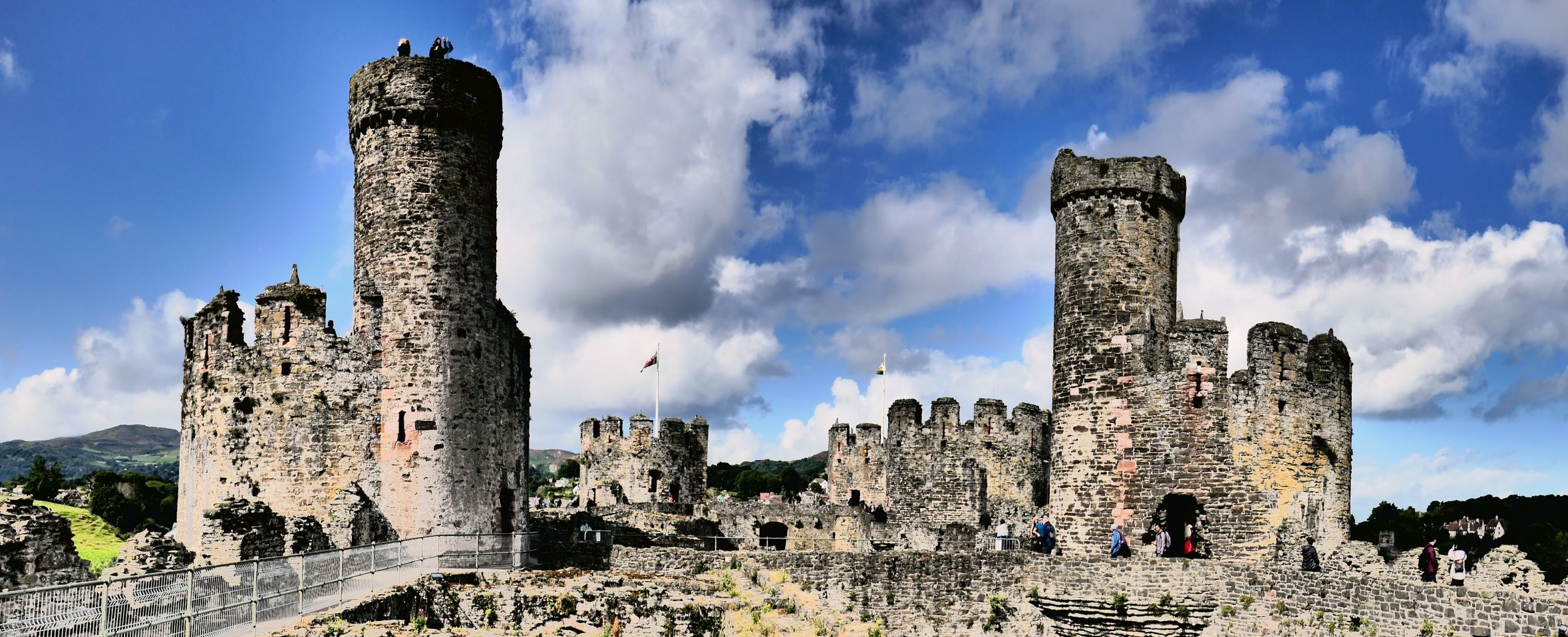
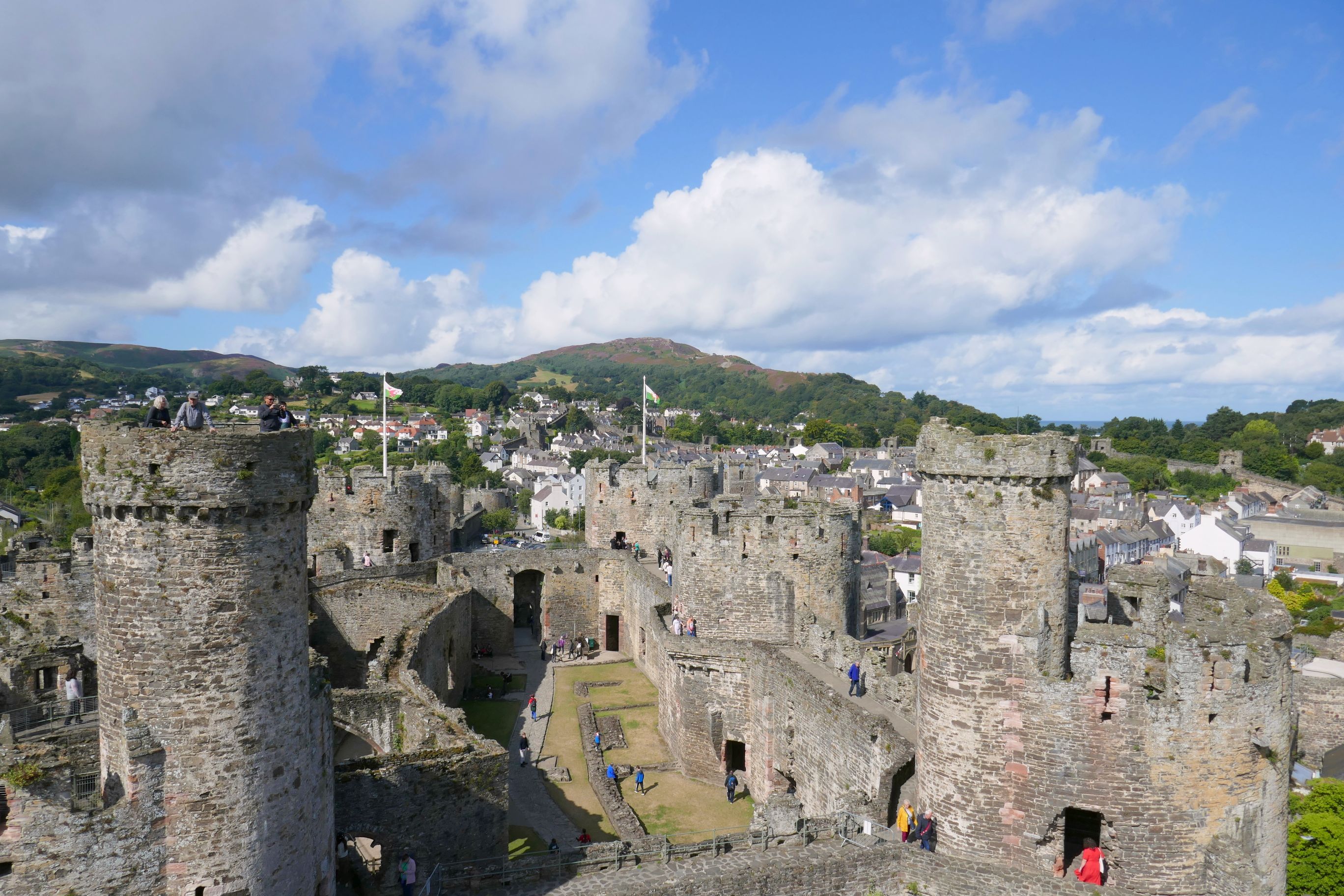
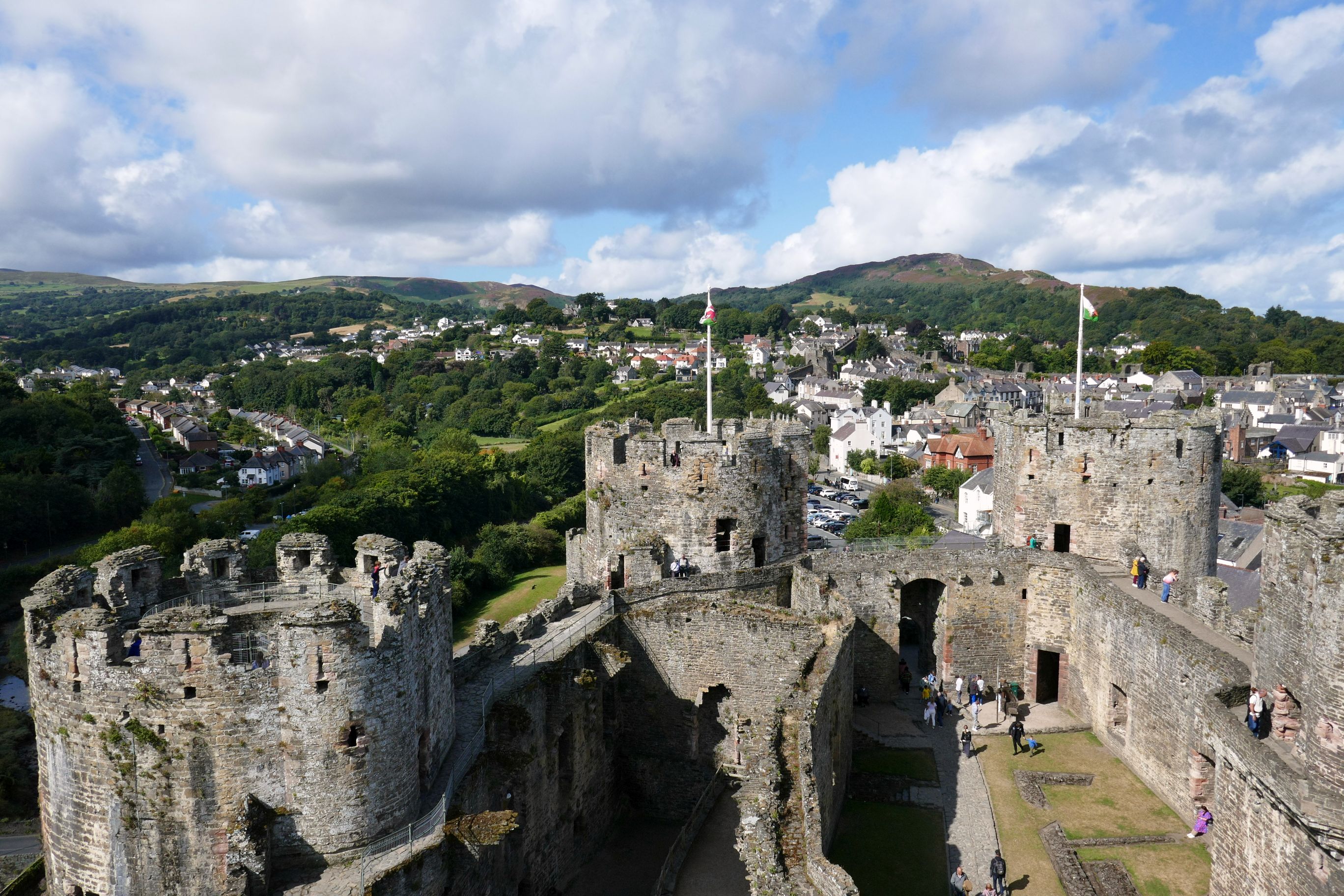
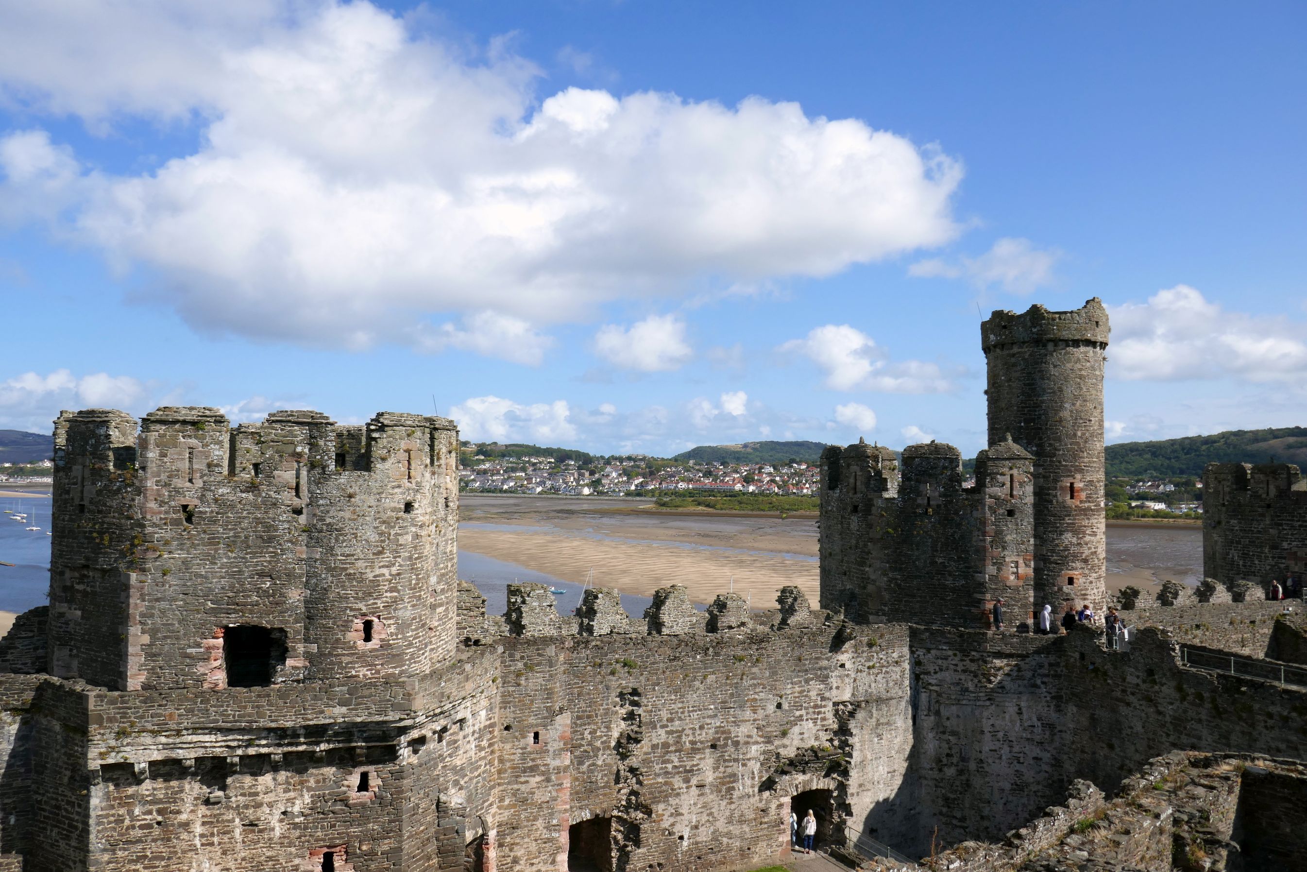
While driving north through Wales on our way to Conwy Castle, we enjoyed the mountain views and looked forward to seeing more in the afternoon. But first, we headed to visit the castle, a UNESCO World Heritage Site.
The weather was a bit questionable at first, cloudy with a brief, light sprinkle. But then the skies turned blue with beautiful clouds adding photographic interest. Again, our weather luck continued…
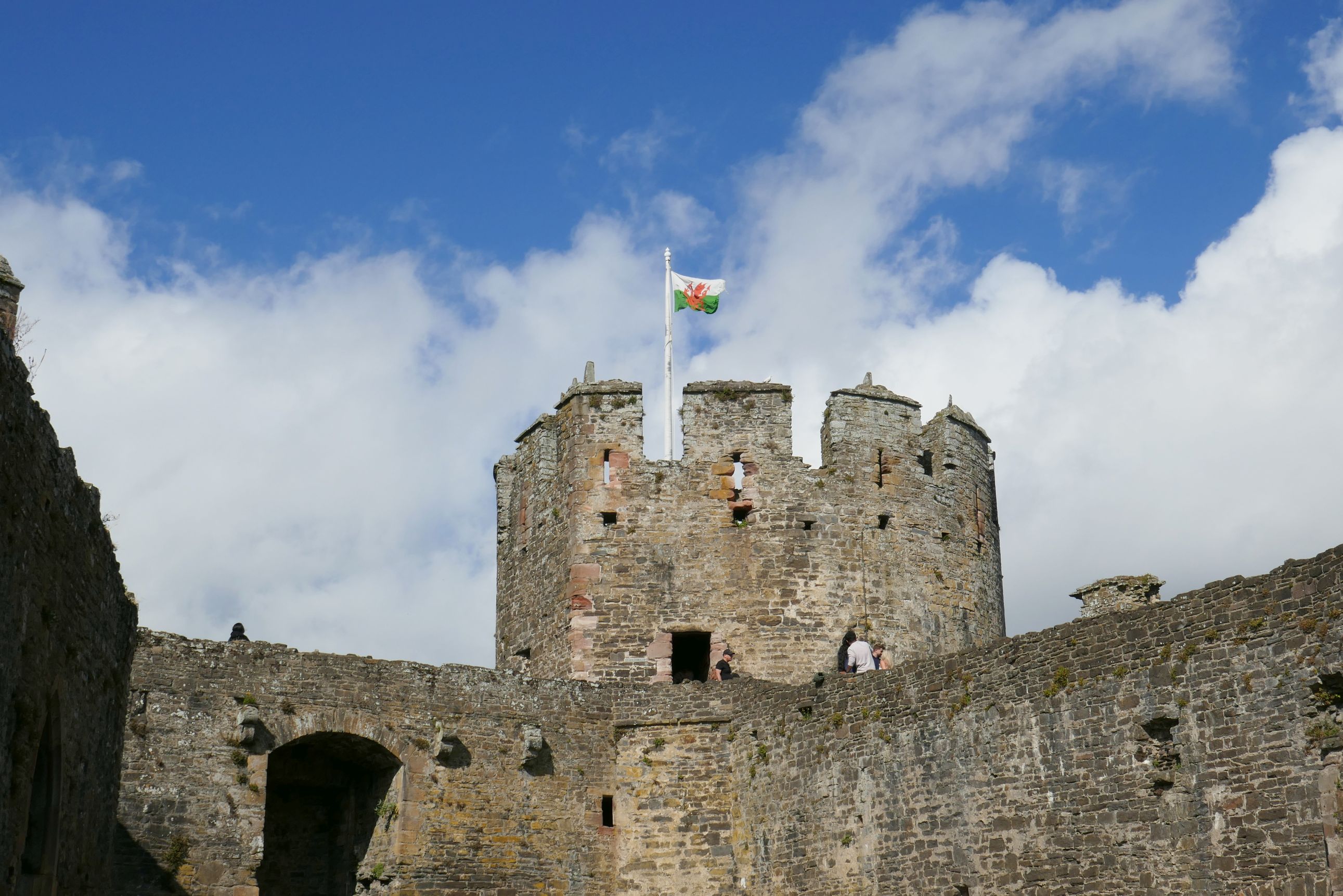
Built between 1283 and 1287 by Edward I during his conquest of Wales, this castle is remarkably well preserved. The adjacent town of 4,000 people is still protected by an unbroken 4,200-foot ring of stone walls.
(For all photos, click on the image for a full screen view.)
I tried out the “Expressive” setting on my camera having no idea this picture would turn out so– uhh- expressive!
While our local guide went into detail about the history of the castle, I noticed people way up high at the top of each tower. Tom noticed I kept looking up, so he pulled me aside and asked if I would like to climb the towers and do some exploring on my own. The local guide wouldn’t be taking the group up the towers, so if I wanted to see them, I had to split off. Tom showed me the way and then promised he would keep an eye out for me when it was time for the group to leave. Thank you, Tom! It was at this moment I knew we had a great guide! He was excellent at helping each of us in the group see and do what interested us the most.
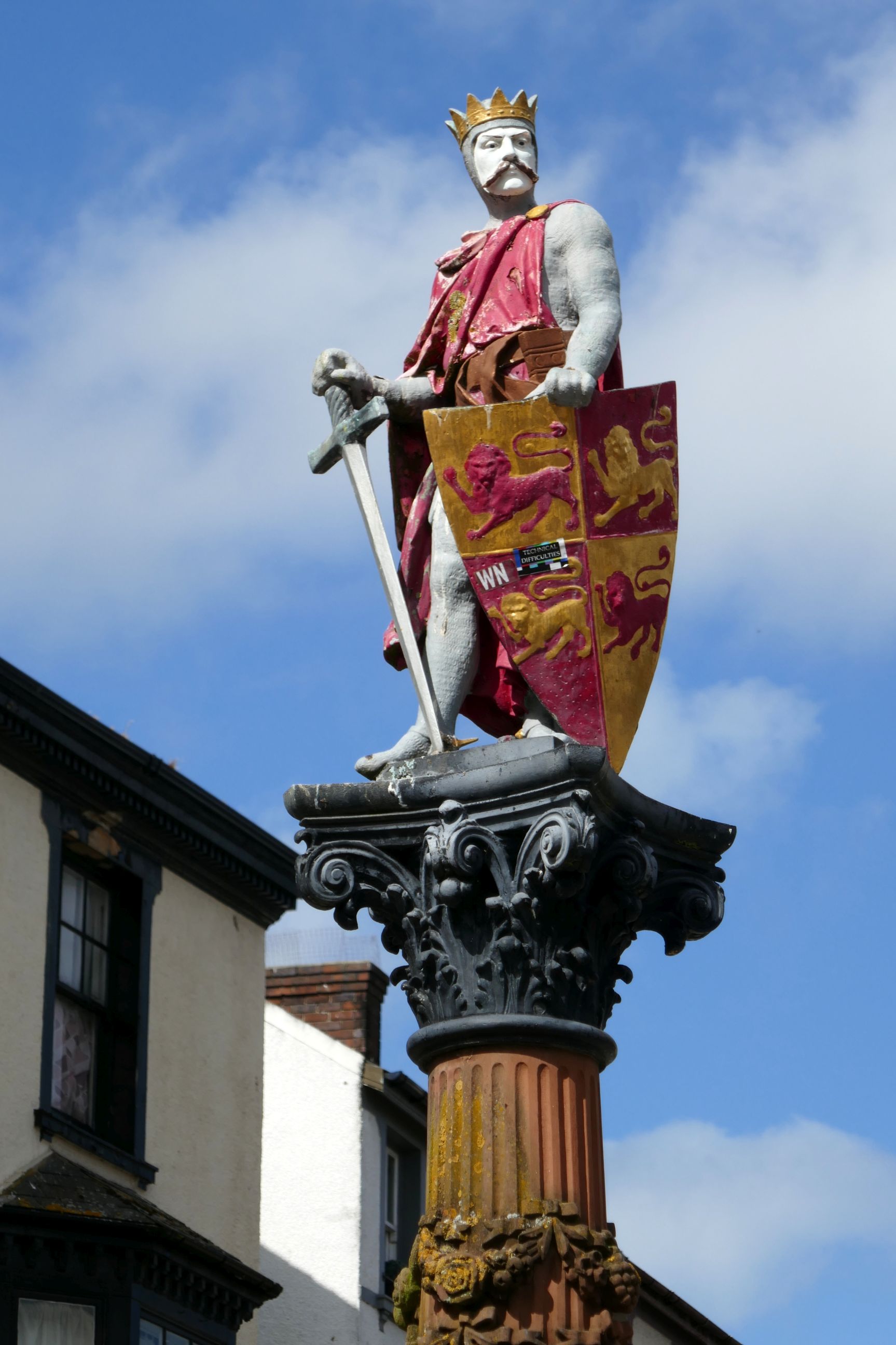
After visiting the attractive little town and having a group lunch, we continued our drive south. In the north, Welsh is the language spoken, and signs are in English and Welsh; but, in the south (where most of the Welsh population lives), English is the predominately spoken language.
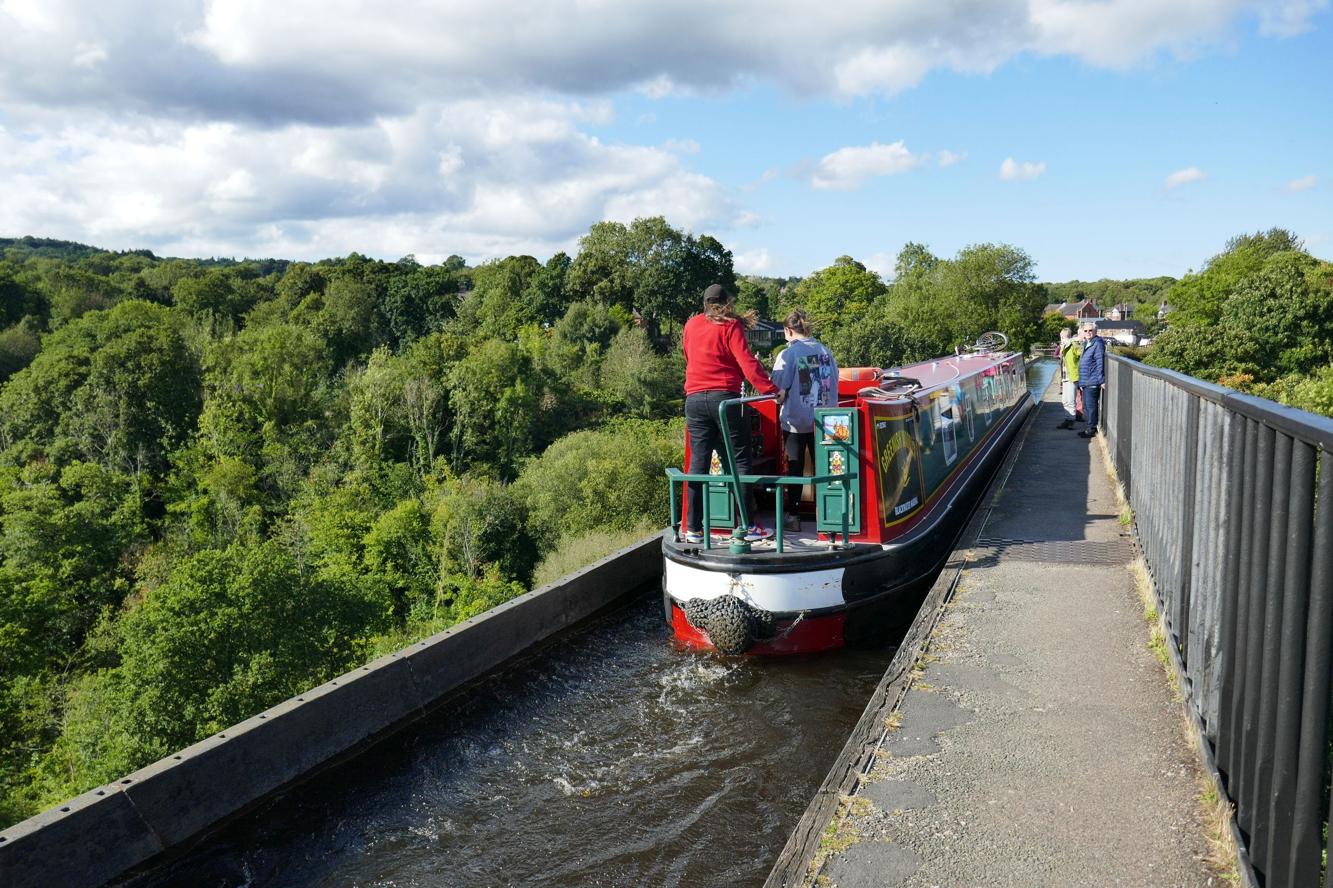
We stopped to see the Pontcysyllte Aqueduct that was built over 200 years ago over River Dee. What an amazing sight seeing canal boats cross the 336-foot long,12-foot wide canal that flows 126 feet above the river!
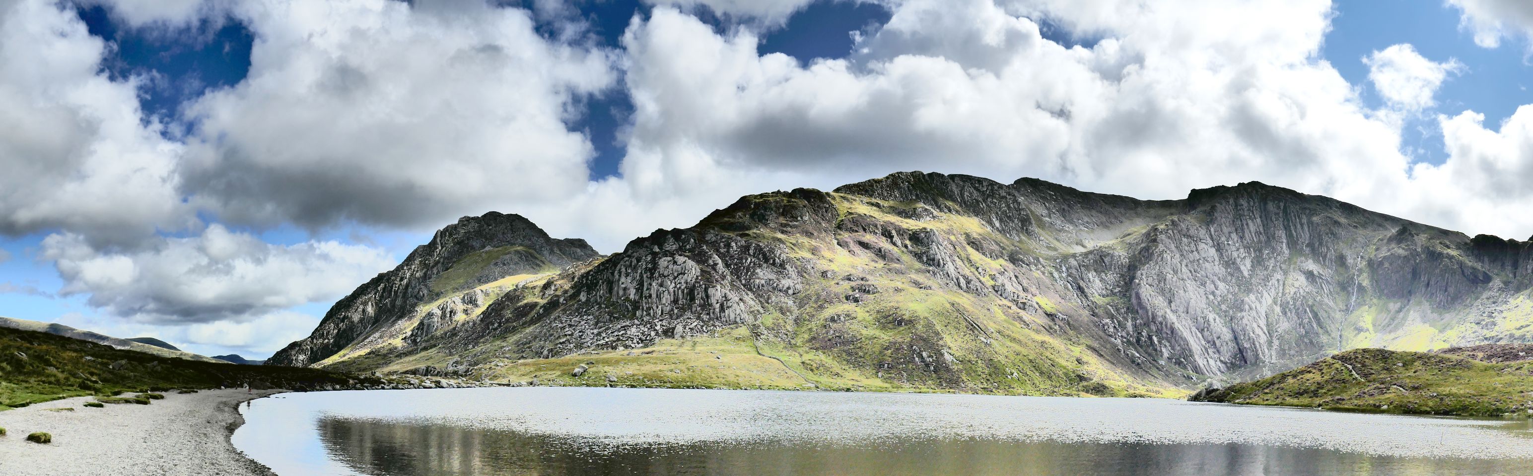
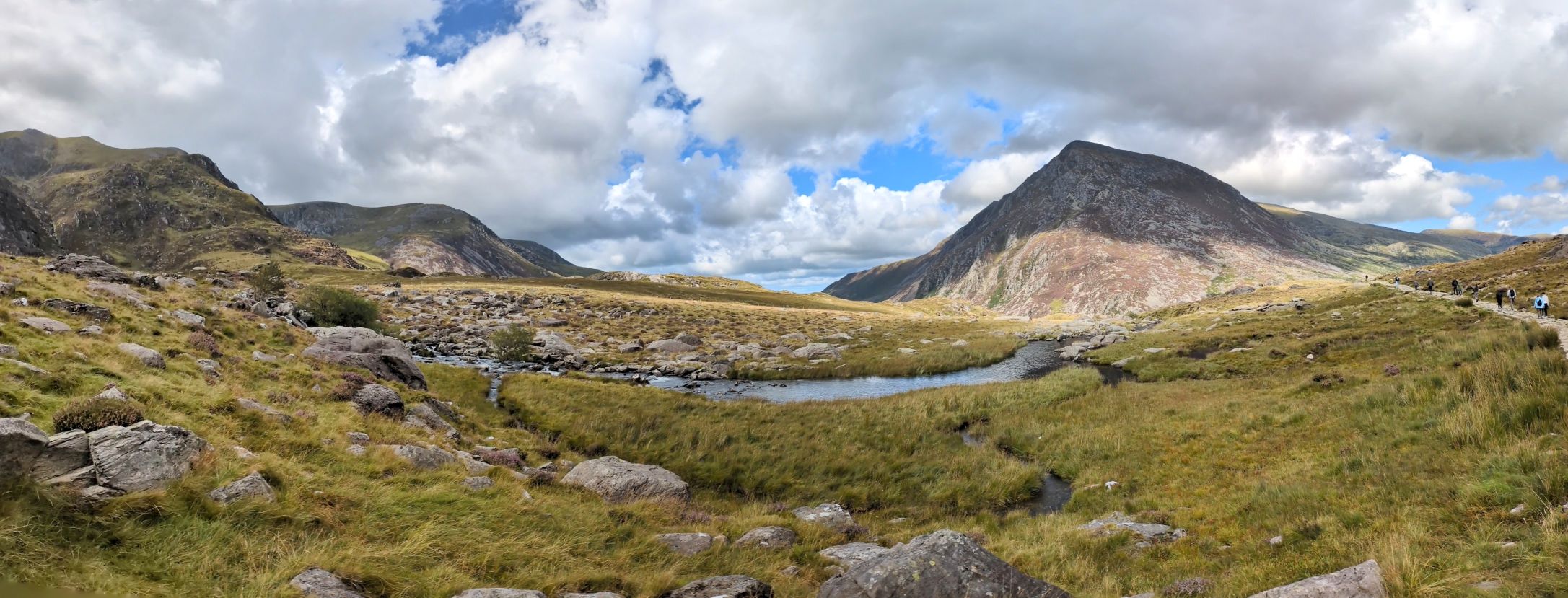
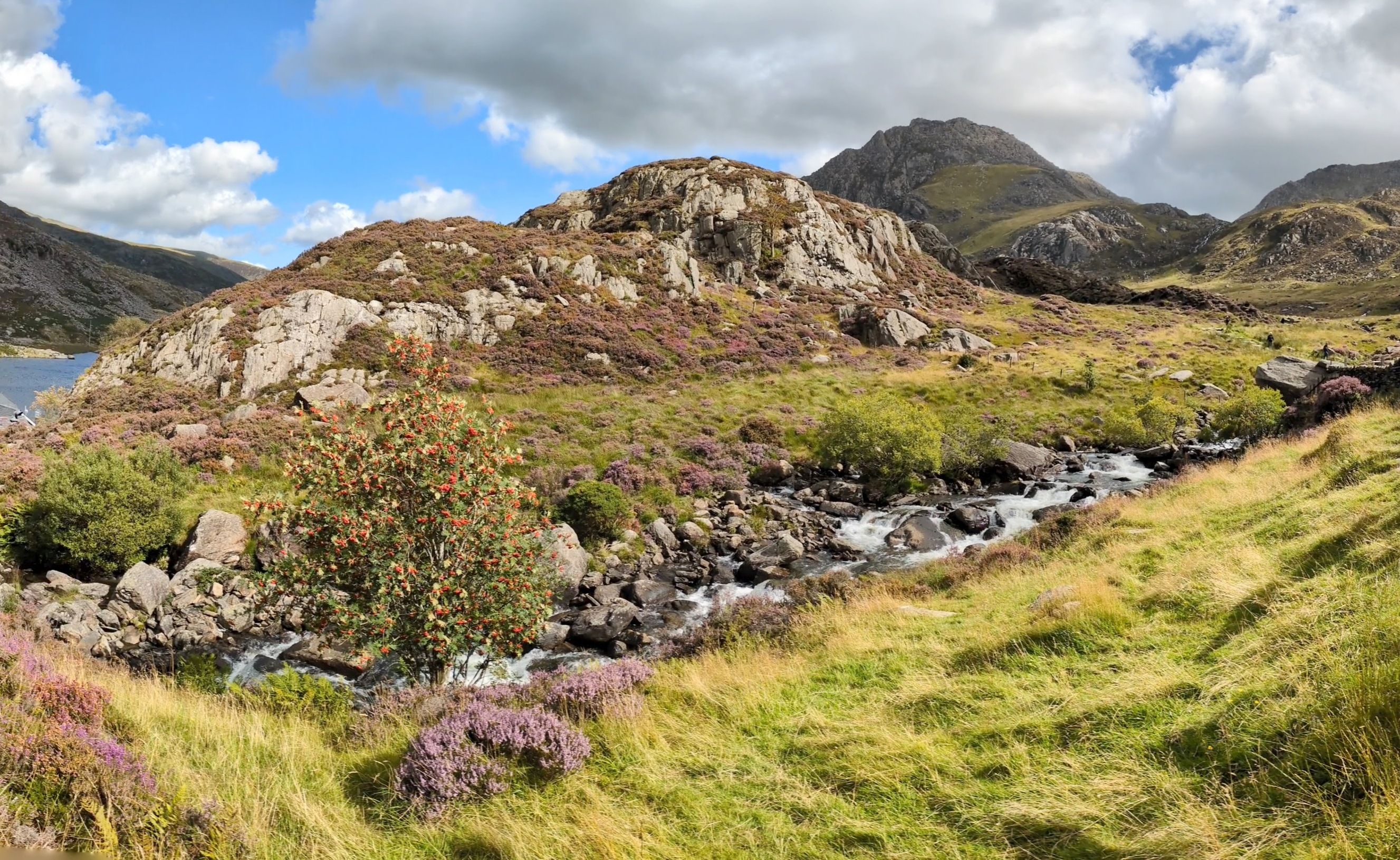
Our drive through the Snowdonian Mountains to Snowdonia Park was beautiful, but I was looking forward to getting out and doing some hiking for an up-close look. Our hike took us to Llyn Idwal, a small lake with spectacular views, including the mountains where Sir Edmund Hillary trained. Slate is also mined in this area, and it’s the standard stone used for fences and roofs. I enjoyed the hike very much!
Another shot on the “Expressive” setting.
On the way back to Chester, Tom honored a special request Bruce and I had: Drop us off in Wrexham.
Another day of hiking and exploring was scheduled, so I was hoping (once again) for good weather. And (once again!), we were greeted with another gorgeous day!
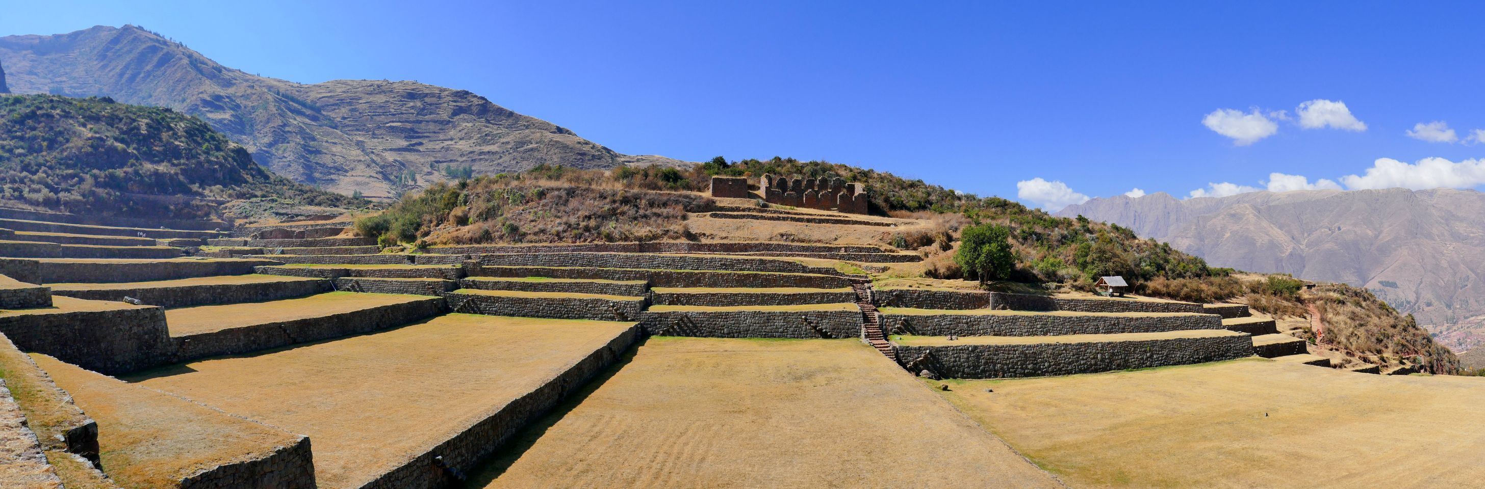
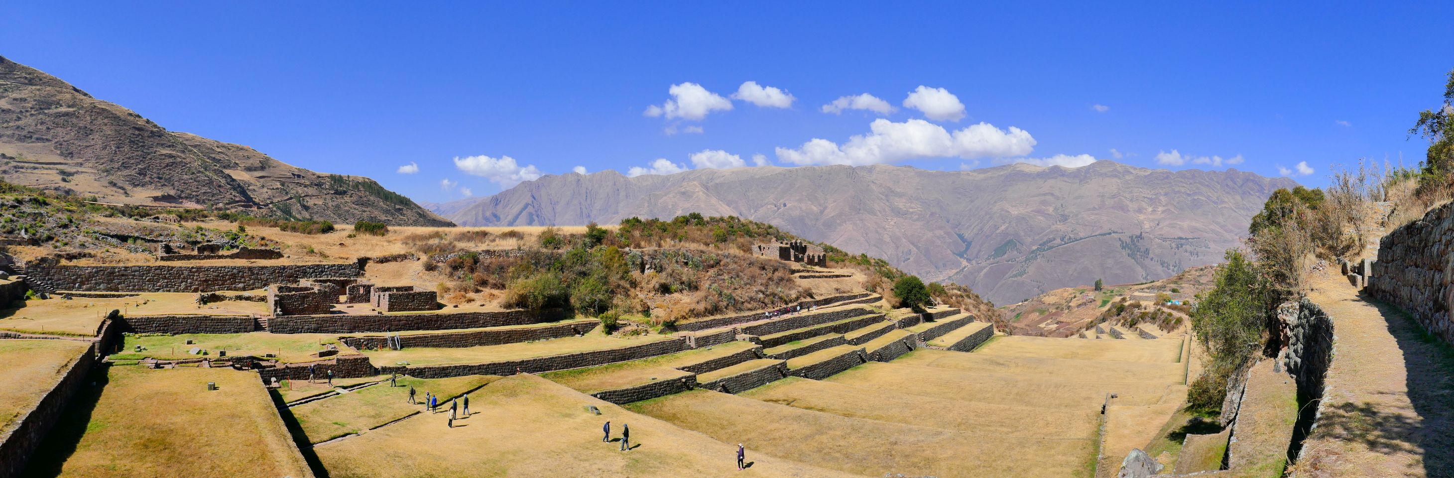
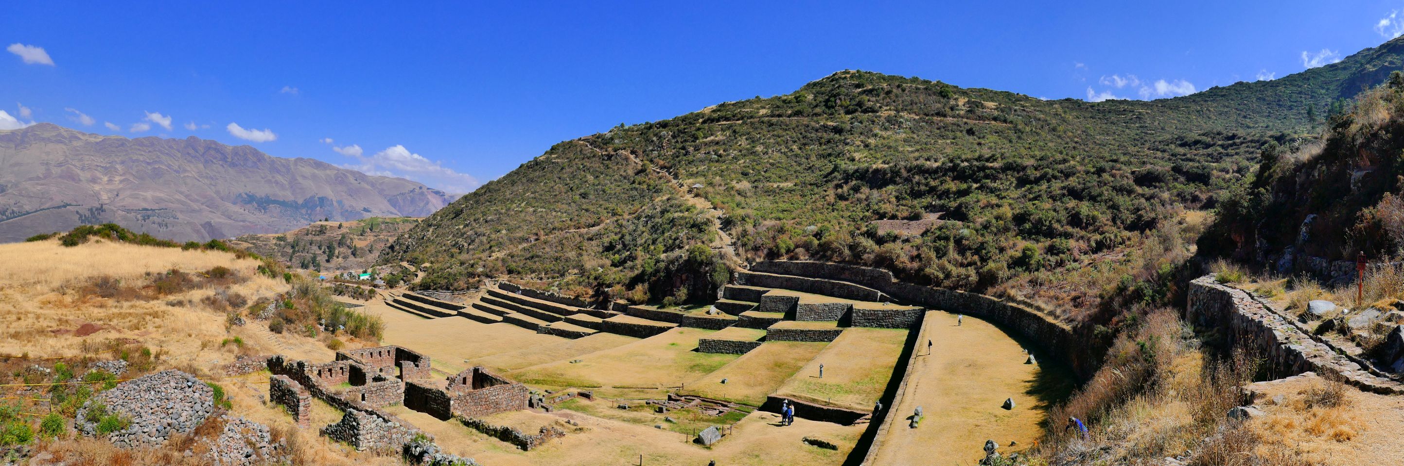
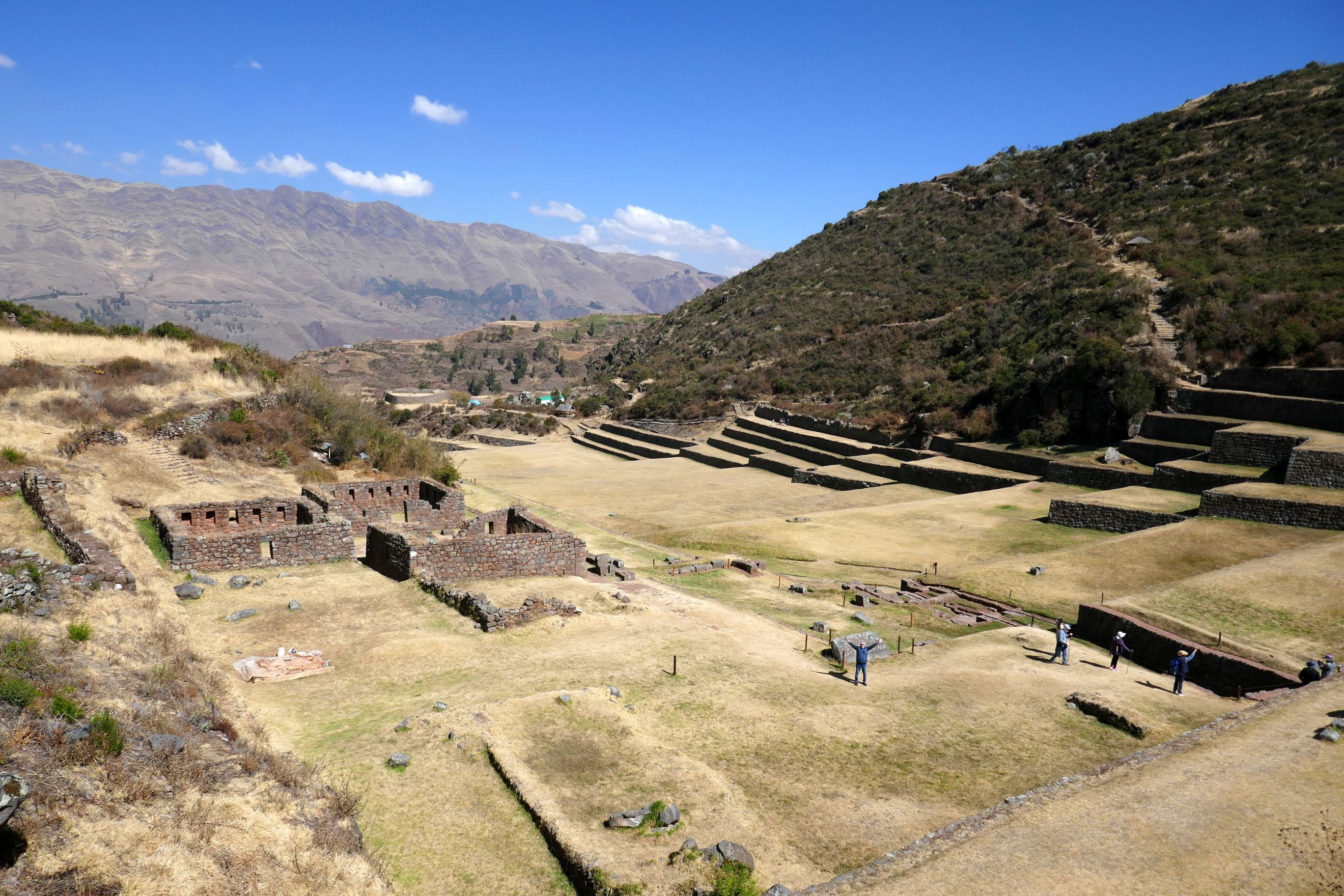
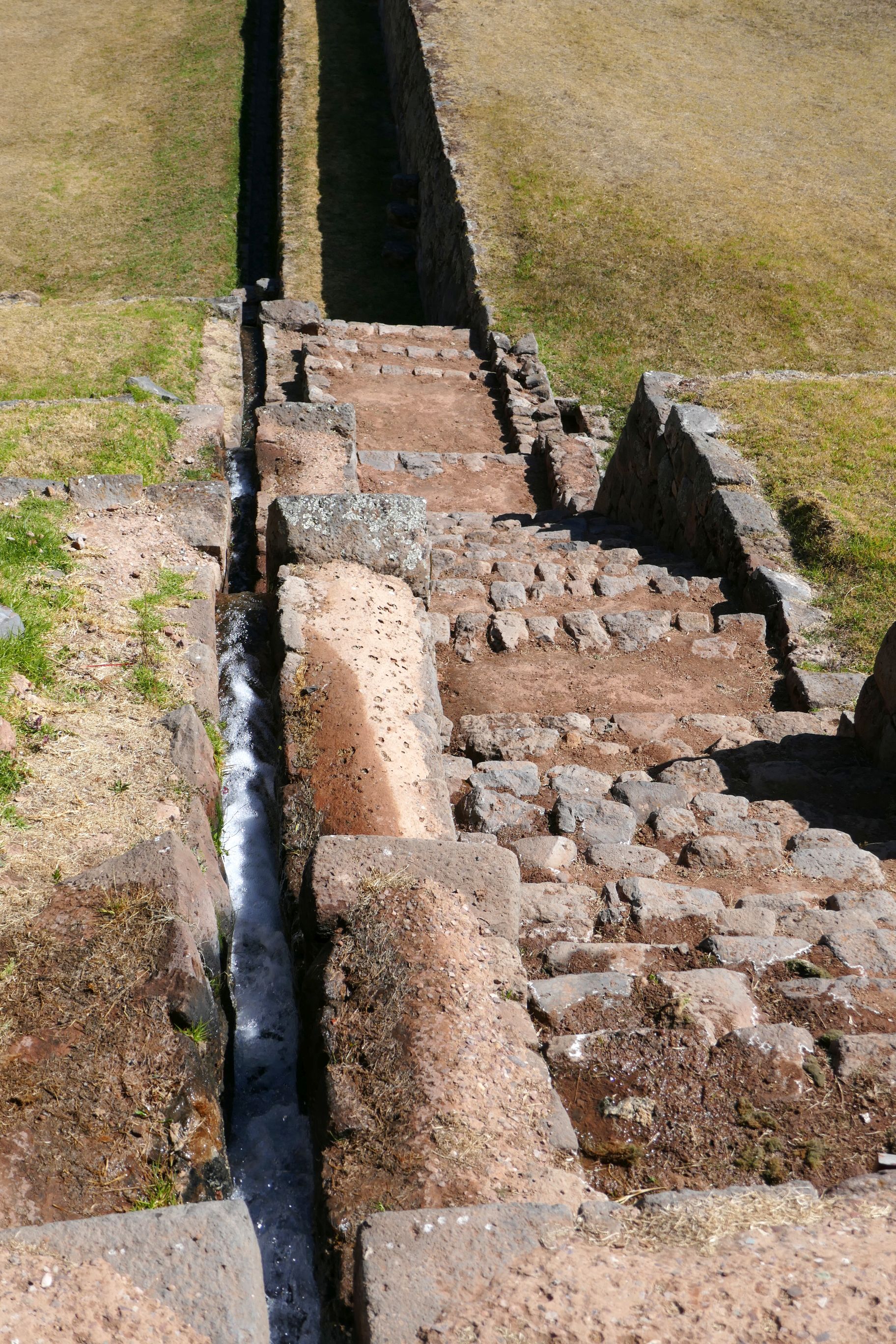
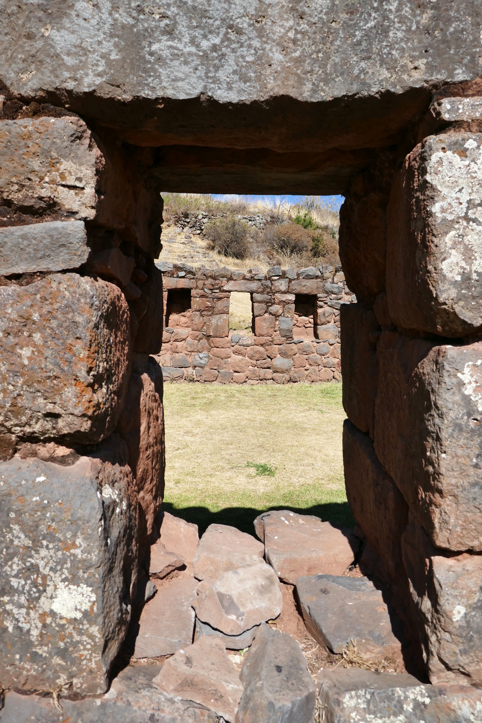
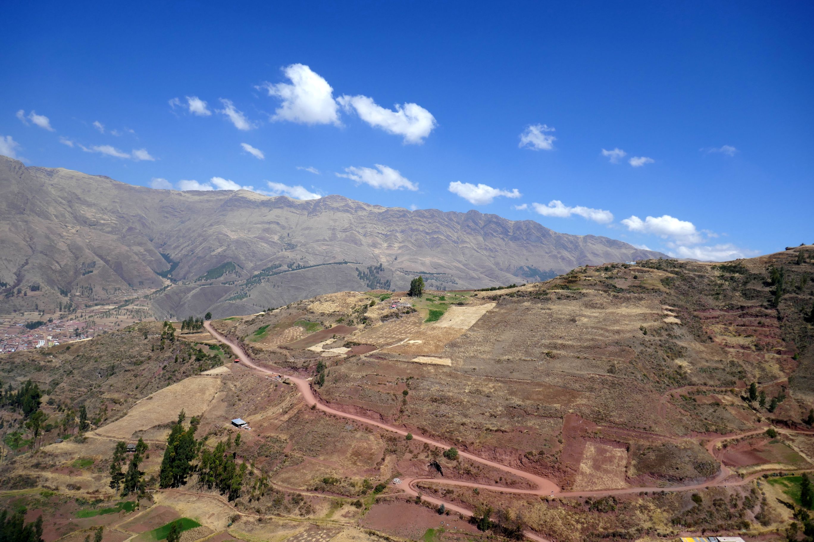
We ventured off south of Cusco to explore Tipon (elevation 11,400 feet), the site of ancient Inca waterworks where a maze of irrigation channels and ritual baths were built in the 1300’s. Amazingly, water still continues to flow in these channels.
I hiked up above the archaeological park so I could get a panoramic view—and what a view it was!
(For all photos, click on the image for a full screen view.)
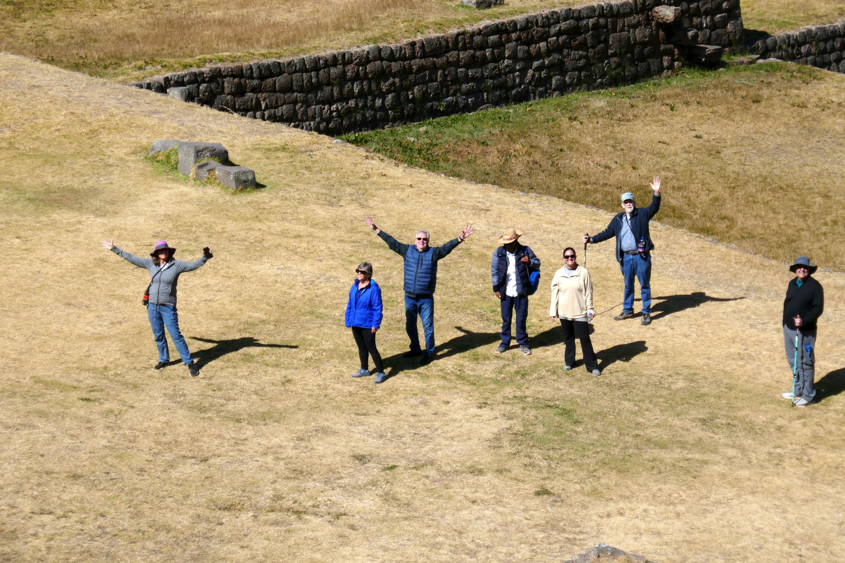
Zooming in from high up above our group. Bruce is third from the left.
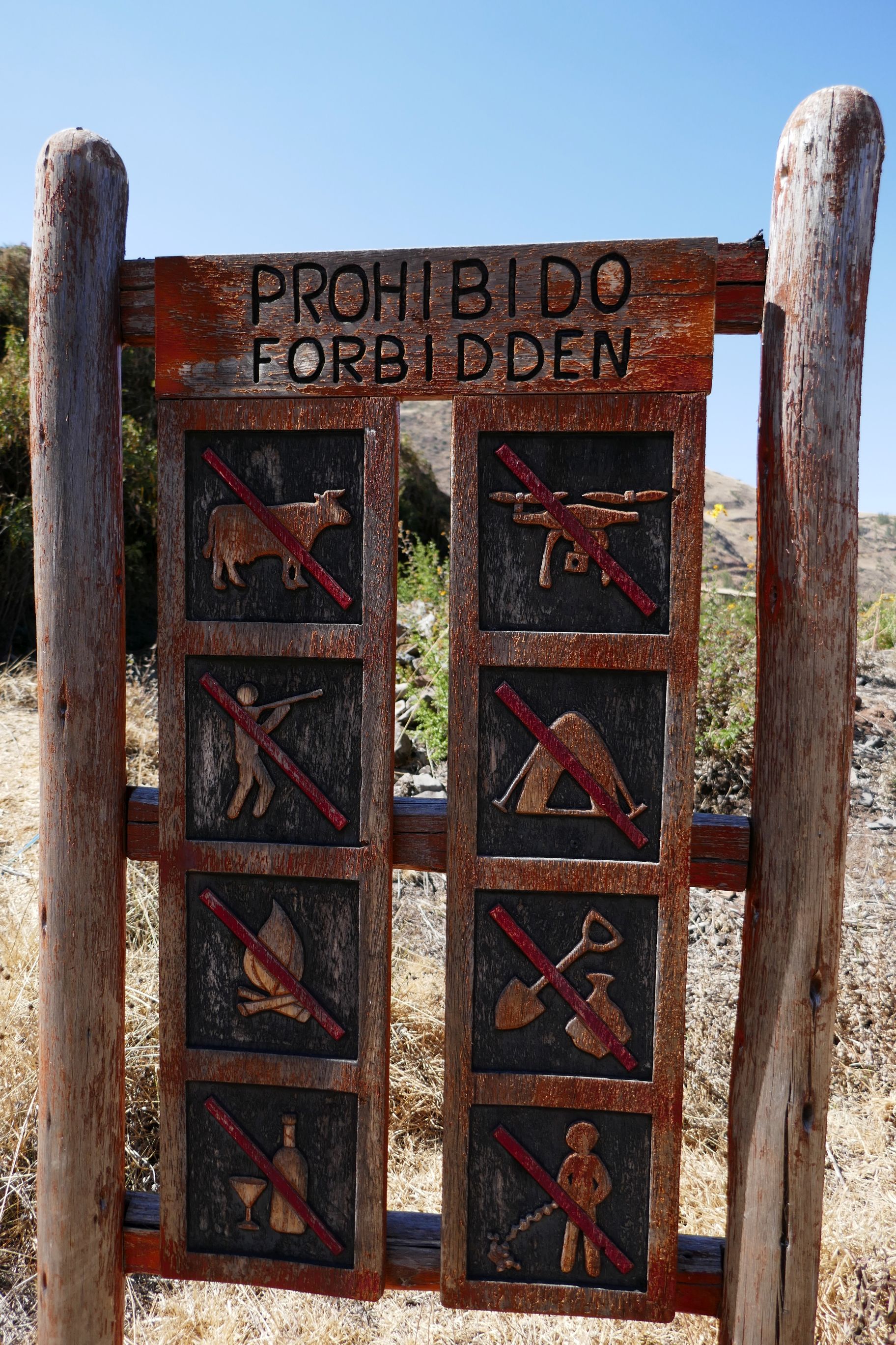
I continued to climb higher above the ruins and was greeted by this elaborately carved warning sign on what NOT to do.
The spectacular view was worth the climb!That tiny person waving from down below was Bruce.
Water still flows through the irrigation channels built centuries ago.
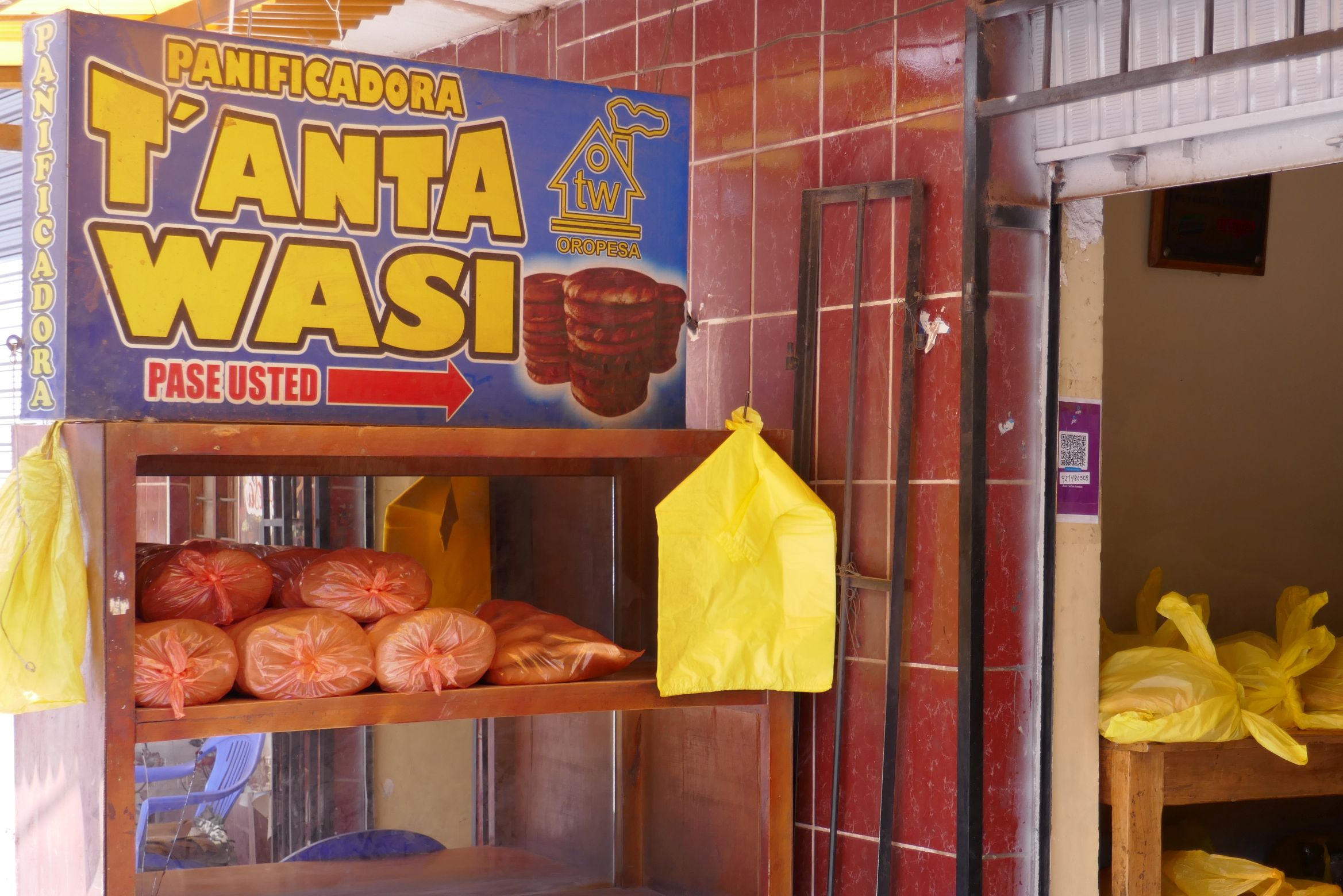
After hiking around the site and learning about the history from Raul (an amazing fountain of knowledge!), we visited the small town of Oropesa, known for making a special bread called pan chuta. The huge wheel-shaped loaves, made with wheat, eggs, flour, lard, and sugar (and other ingredients, depending on the baker), are traditionally offered as a gift to the host when visiting a home in the Cusco area. If you want to know which shops have fresh bread available for purchase, just look for a bright yellow bag tied to a stick out front. The town has 90 bread ovens in use, so chances are you will score on a loaf.
After watching how it was made at a small bakery, Raul bought some for us to taste—a wonderful snack after our morning hike! It was so soft and delicious—especially the bread with dulce de leche in the center. A loaf of this tasty, cake-like bread cost only 10 Peruvian Sol; $2.63 at today’s exchange rate. Without the dulce de leche, the cost of a loaf is half of that.
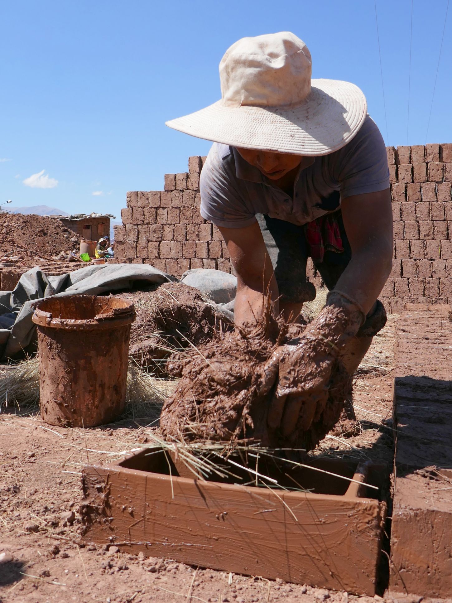
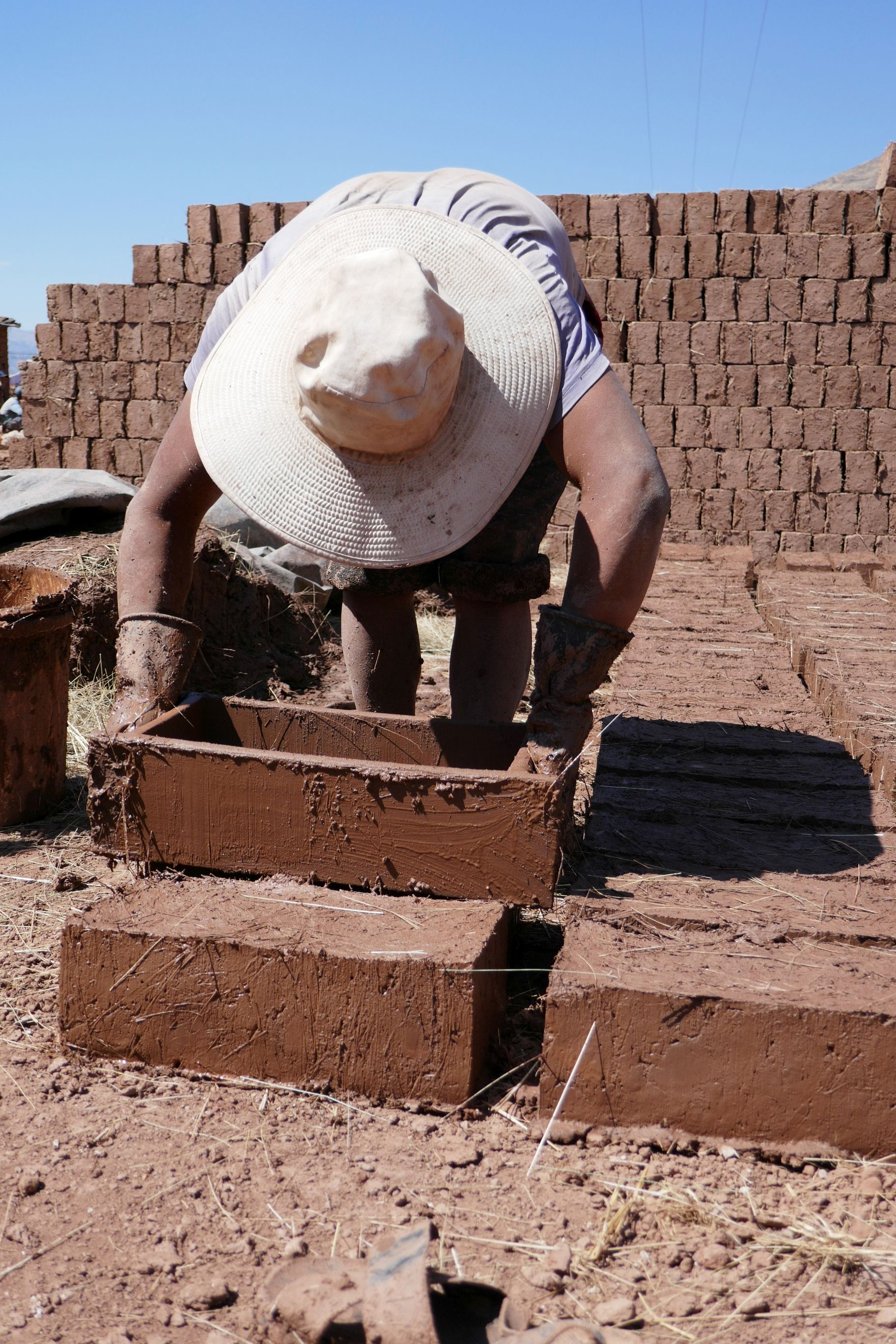
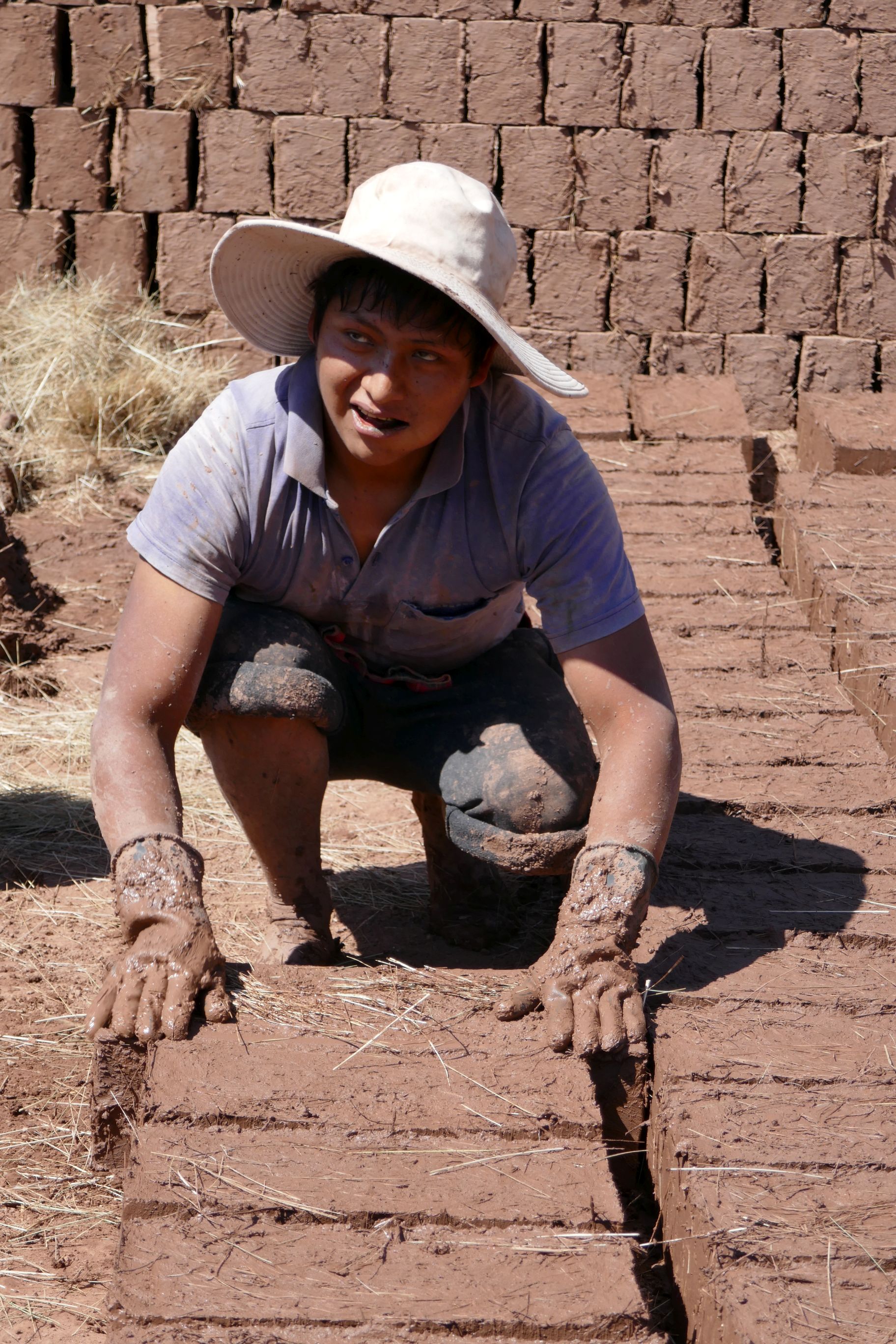
As we made our way out of town, Raul noticed a man making traditional bricks by hand, so he had our bus driver stop so we could watch the process. This guy worked fast! We timed it from start to finish, and it took just 32 seconds to make a brick, which costs .60 Sol to purchase—about .15 cents.
The man explained to Raul that straw is mixed in with the adobe mud for stability and strength. Time is money, so the more he works without a break, the better. To keep from getting hungry and thirsty while making the bricks, he chews on coca leaves, common with Peruvian laborers.
What an interesting, impromptu stop! Along with visiting the bakery, it was a great experience seeing how the locals work and earn their living. On this tour, we had so many of these opportunities (described in my previous posts), and Raul could not have been a better guide to enable these experiences.
On our way to our next stop, we passed by the public university where Raul was educated. He explained how typically about 500 students compete for only 30 available seats each year by taking a two-hour, 100-question test; the top 30 get in. The reason it is so competitive is that private universities are very expensive for most Peruvians. Kudos, Raul, for making the cut!
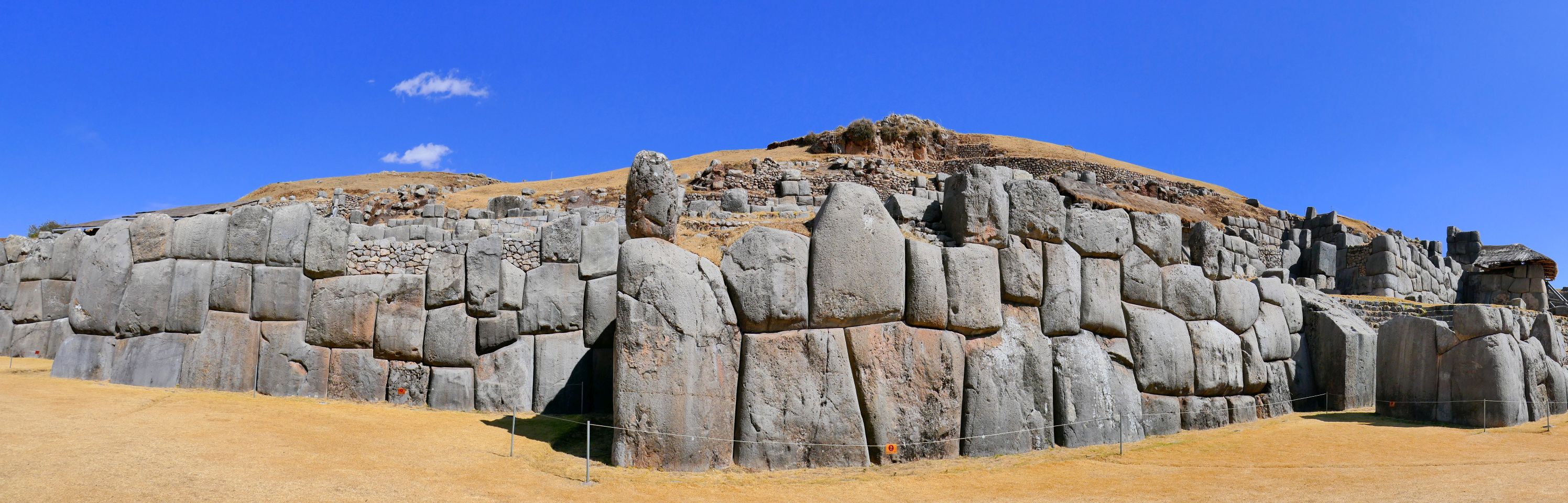
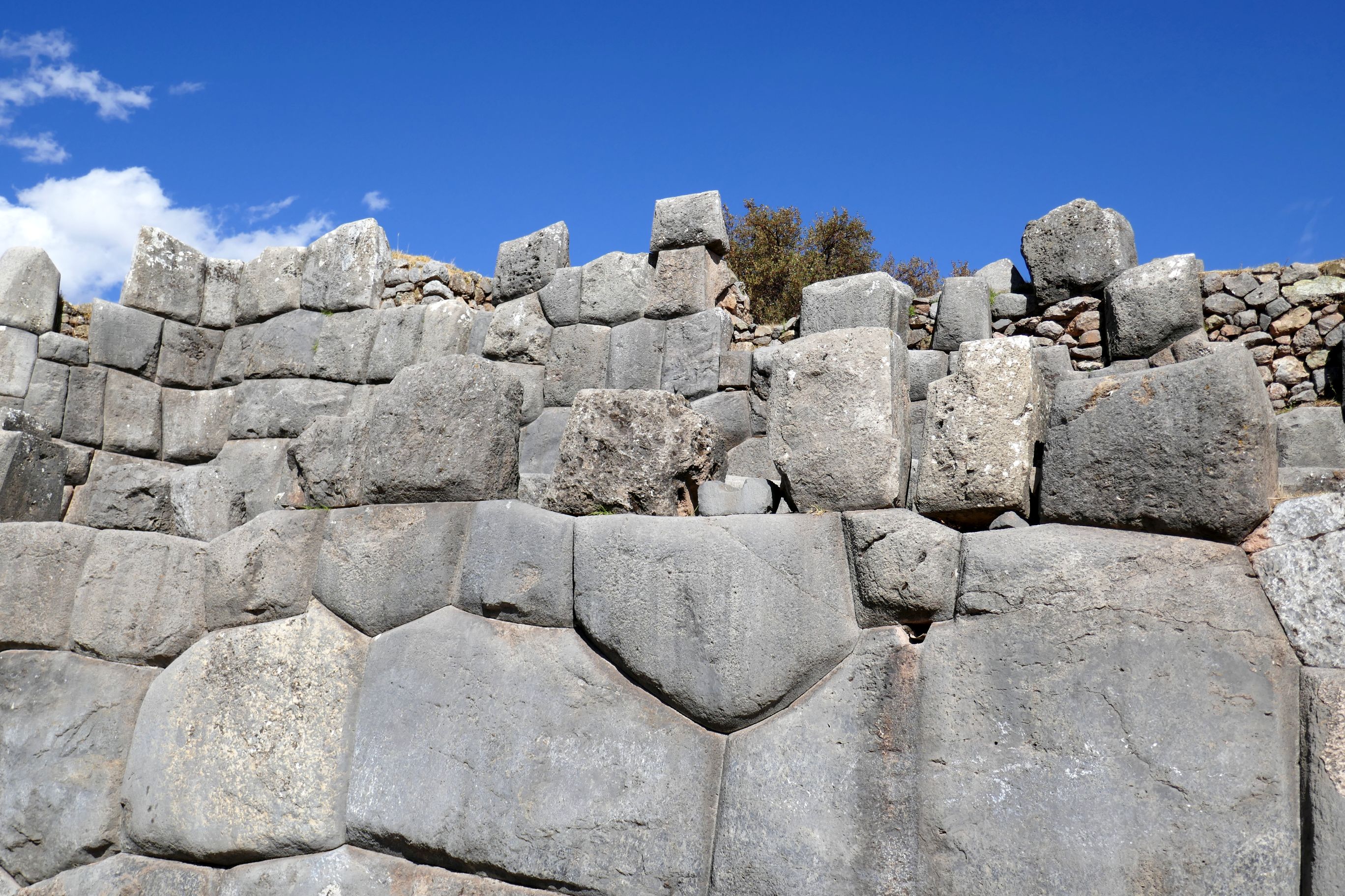
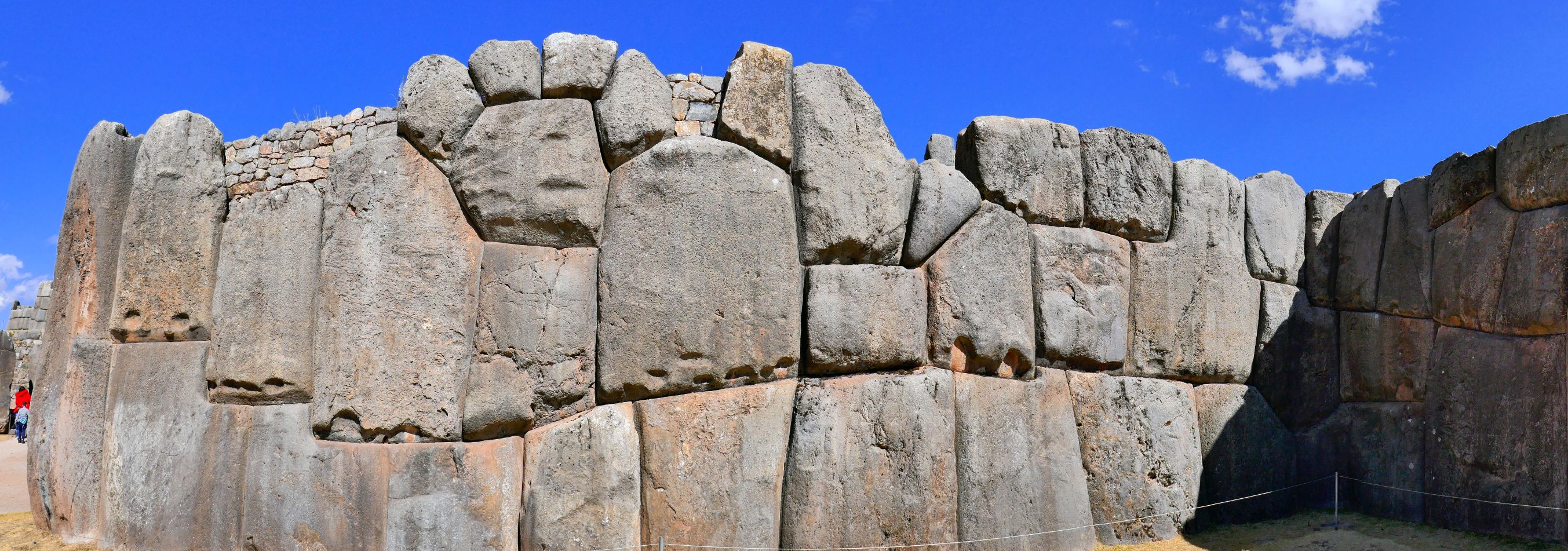
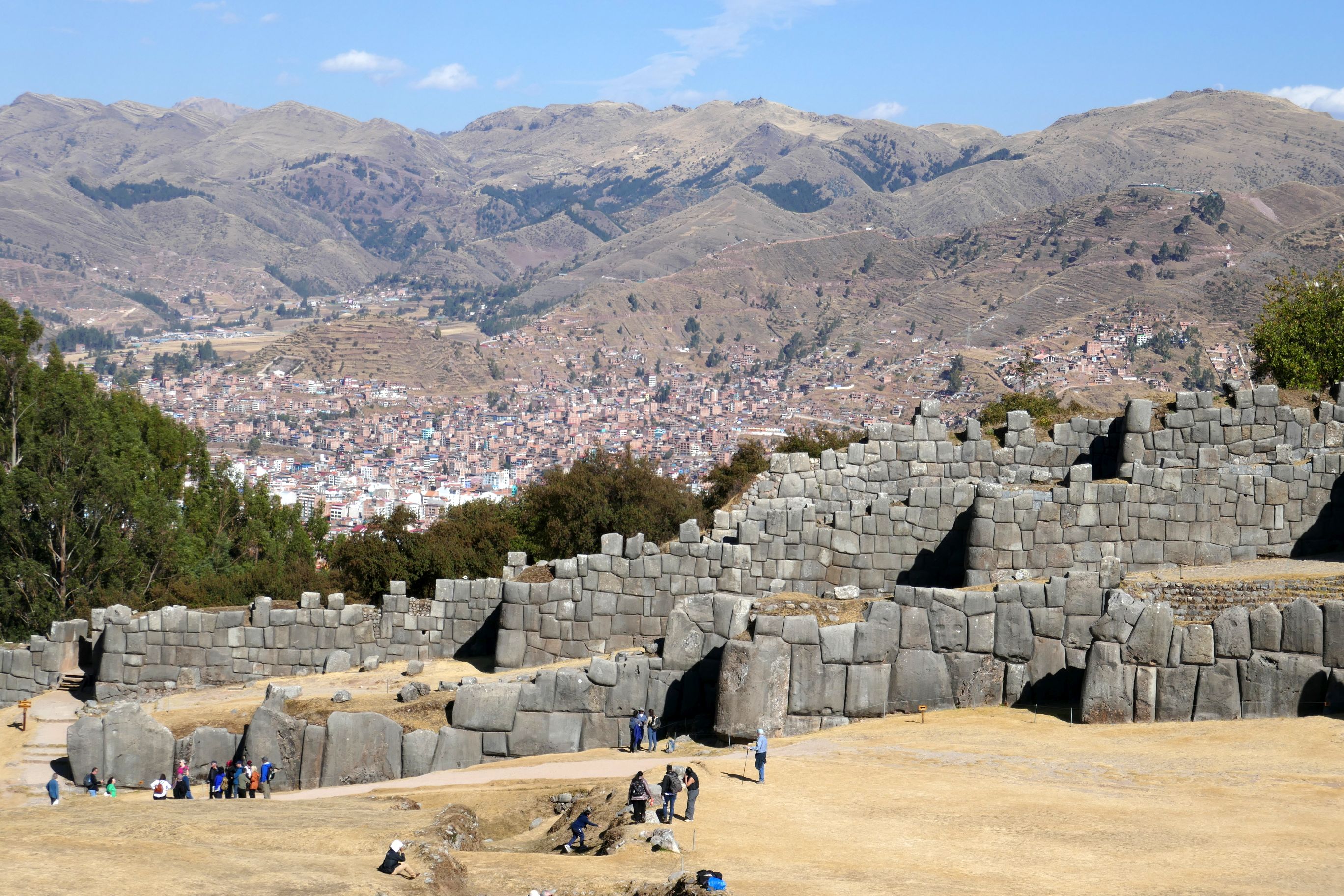
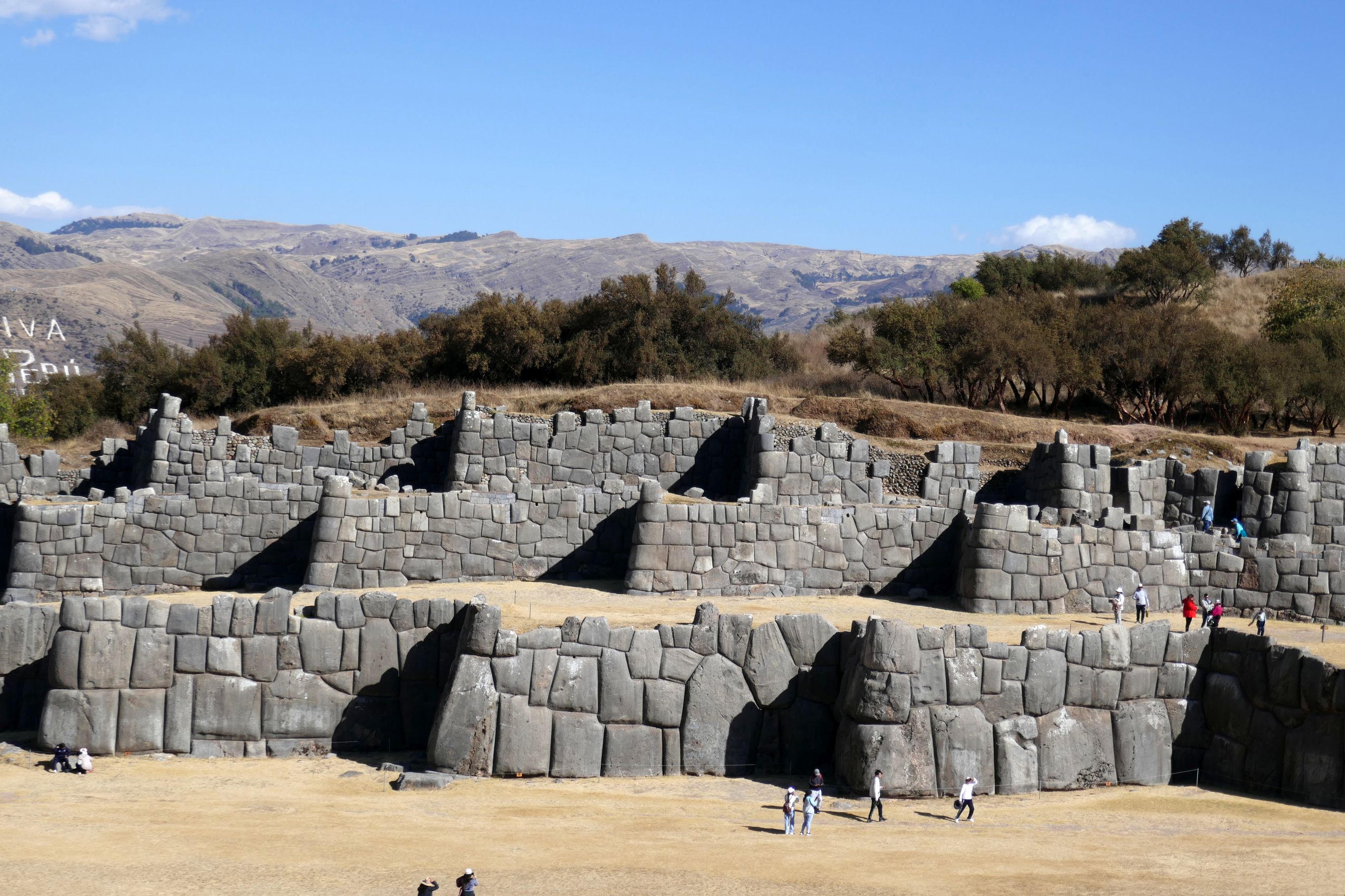
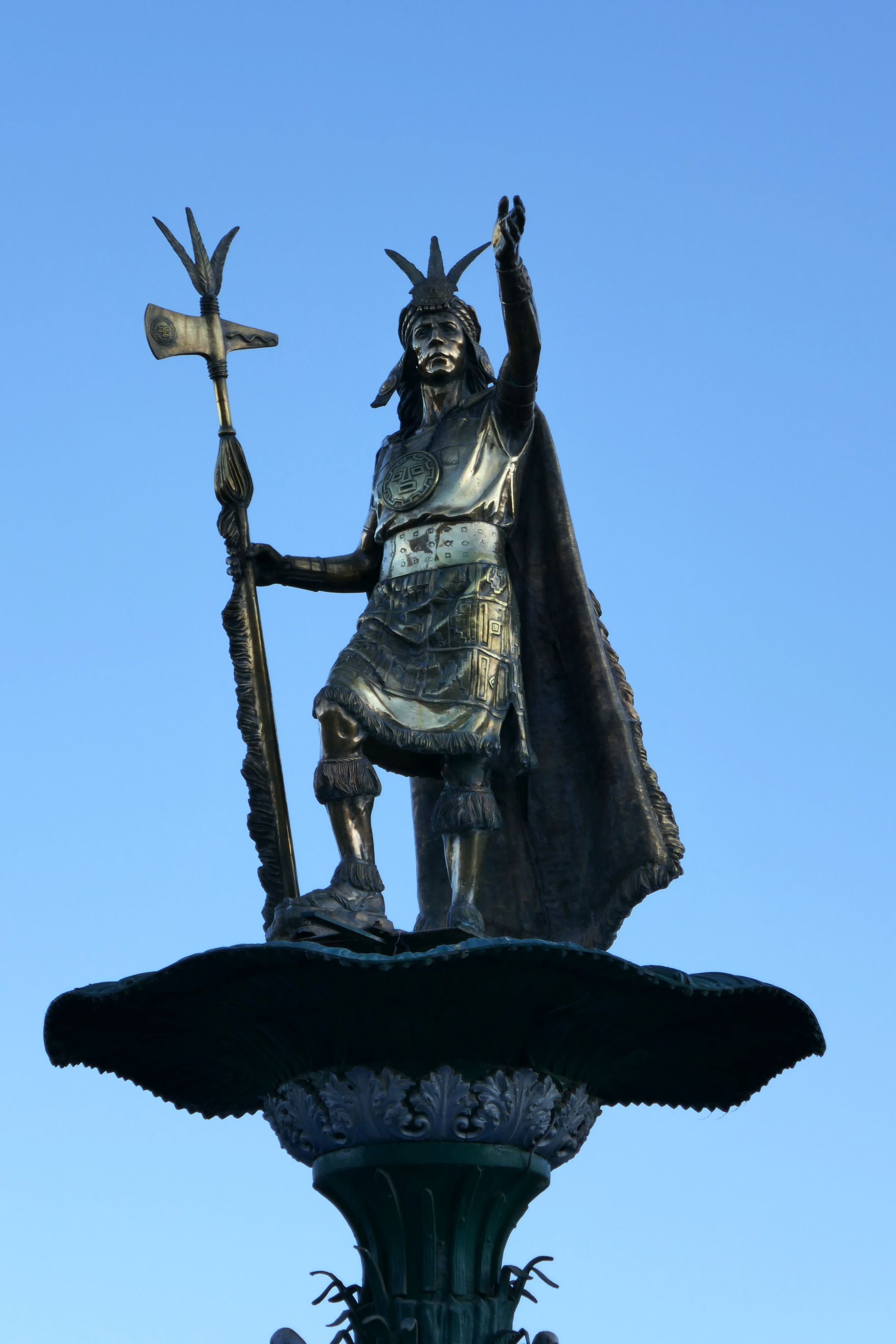
After enjoying lunch at a restaurant with a panoramic view of the city below, we visited Sacsayhuaman, the historical capital of the Inca Empire and a UNESCO World Heritage Site. This ancient fortress, located in the hills on the outskirts of Cusco, is at an elevation of 12,142 feet, the highest elevation I had hiked in Peru. We were well-adjusted to elevation by that point, but several members of our group decided to enjoy the views from the bottom. I couldn’t wait to take off and explore on my own after Raul shared interesting facts about the construction and history of the archaeological site.
How on earth the Incas built it in the 1400’s is a mystery; archeologists don’t even know. The largest of the massive limestone boulders weighs 400,000 pounds! Somehow, the workers carefully cut them so they would fit tightly together like a puzzle without mortar. They are so tight a piece of paper can’t fit between them!
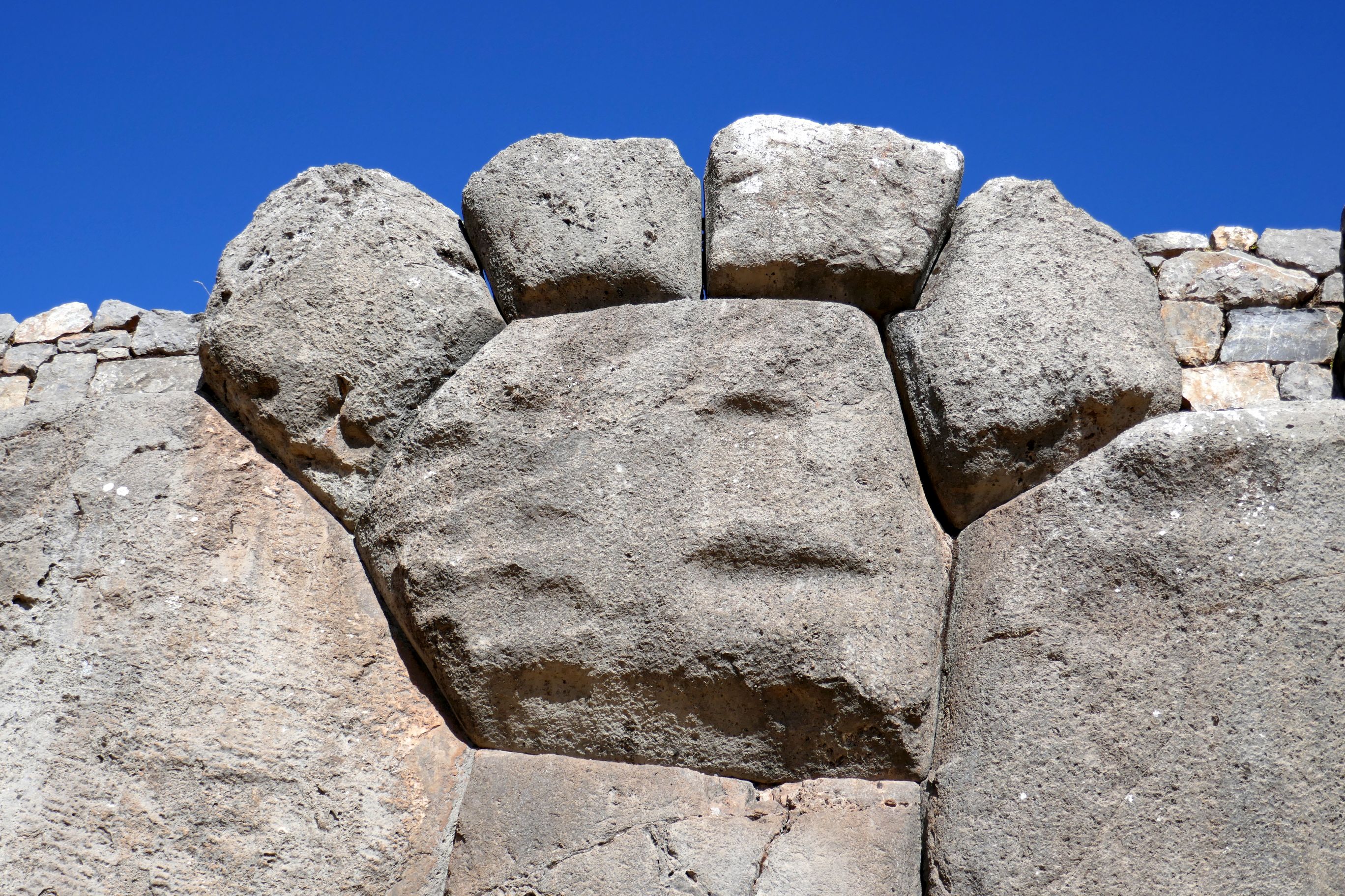
The longest of the three walls is 1,310 feet and about 19 feet high. If you were to view Sacsayhuaman from the air, you would see the shape resembles the head of a puma.
These rocks depict a puma’s paw:
A steep hike up the fortress rewarded me with a fabulous panoramic view.
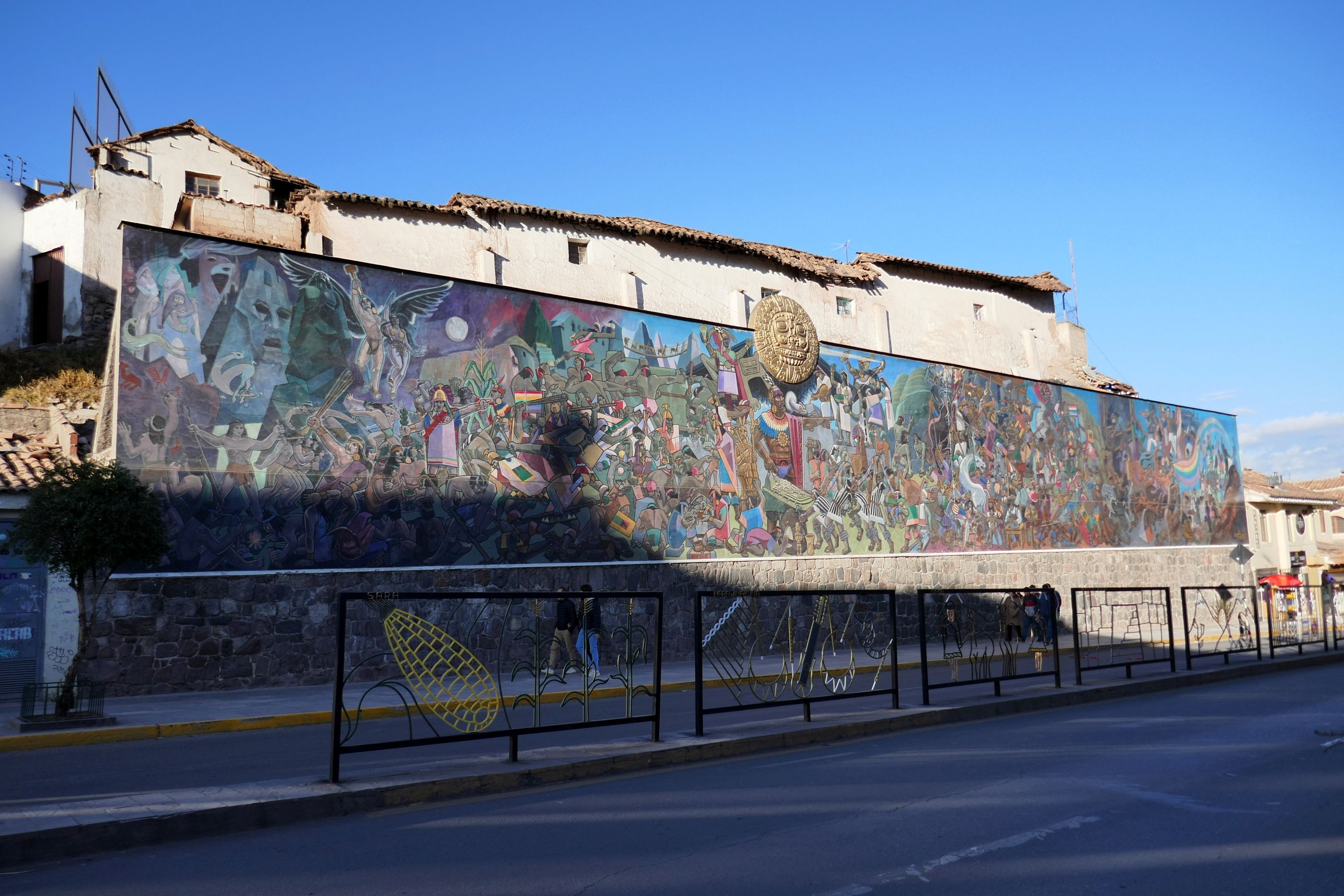
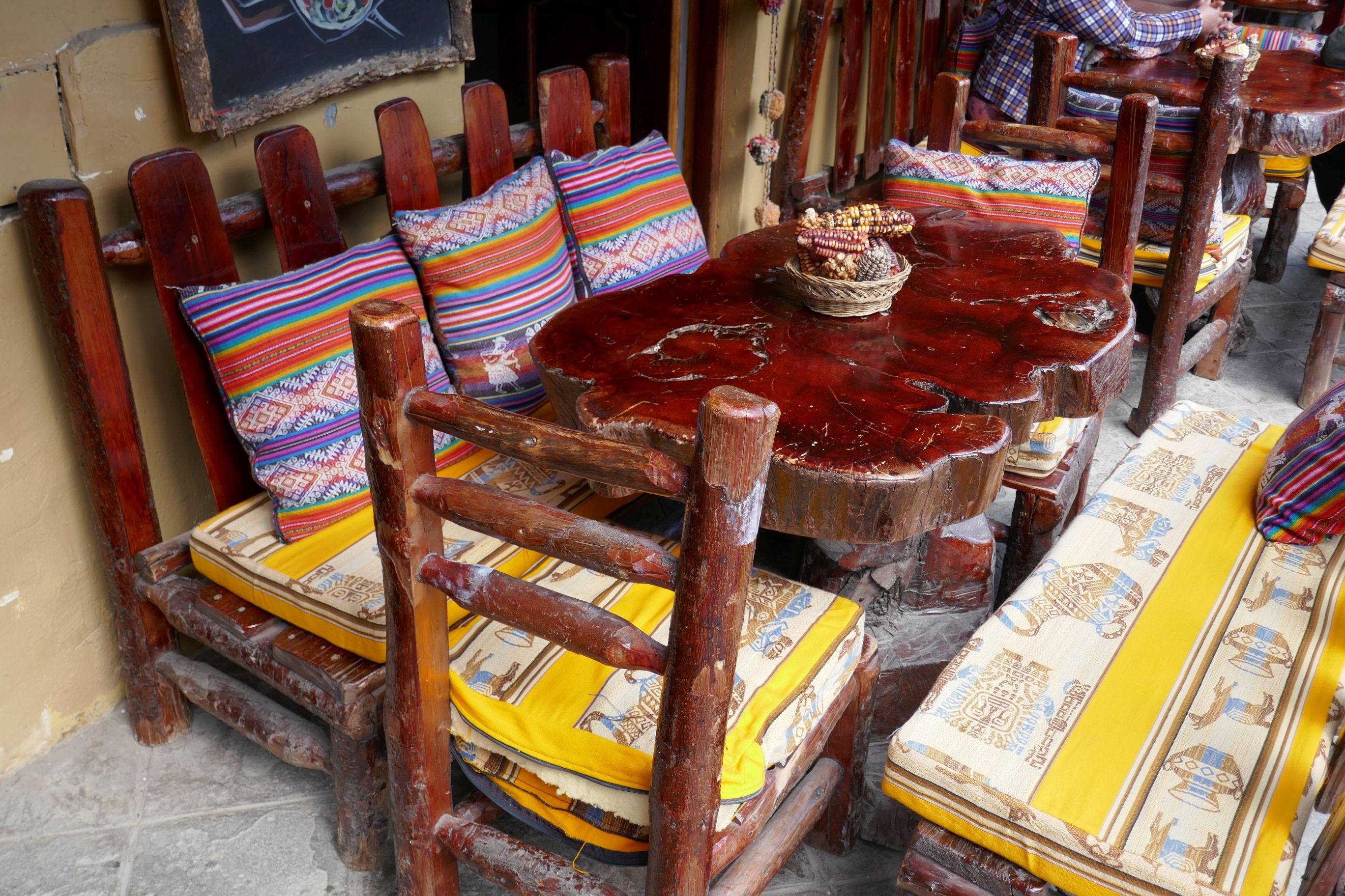
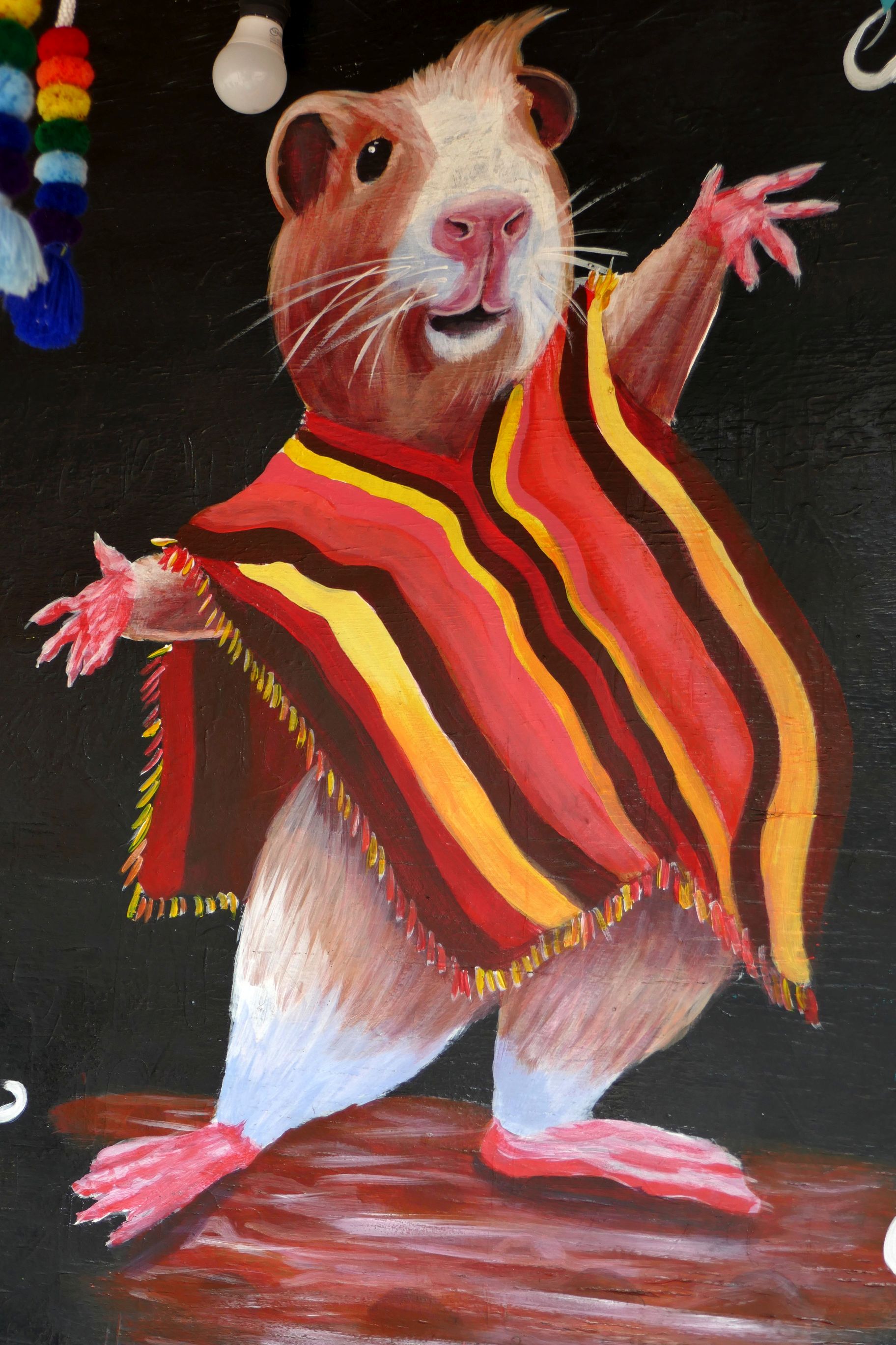
After returning to the hotel, I still had some walking in me, so I wandered over to the market across from the hotel. It was very quiet; only a few tourists roamed the aisles. It was a wonderful opportunity to do some photography and enjoy the bright colors that surrounded me.
A large wall mural painted on the back wall of the market
Another wall mural
I bought some place mats from this sweet lady. I remember her fondly when we enjoy our evening meal!
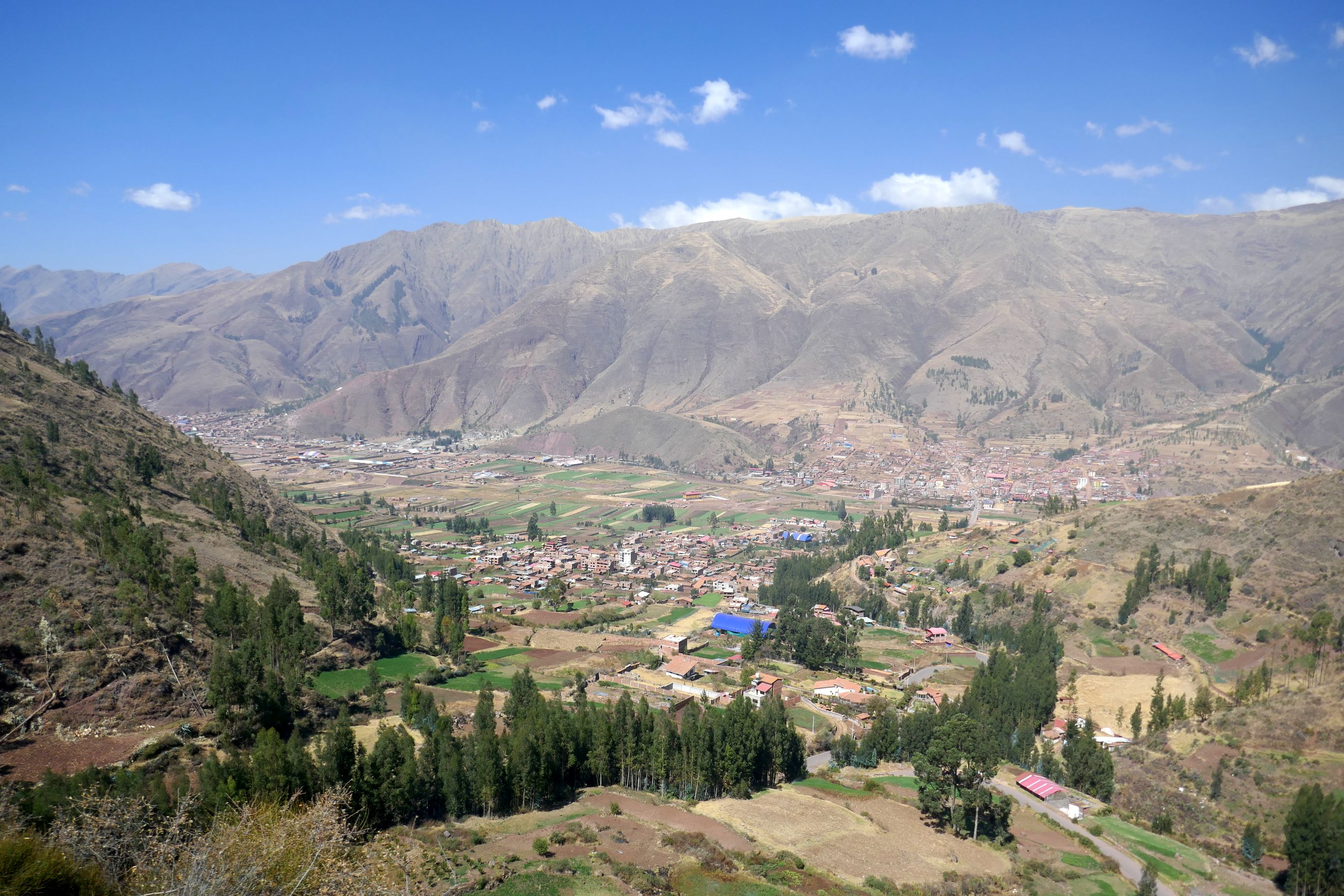
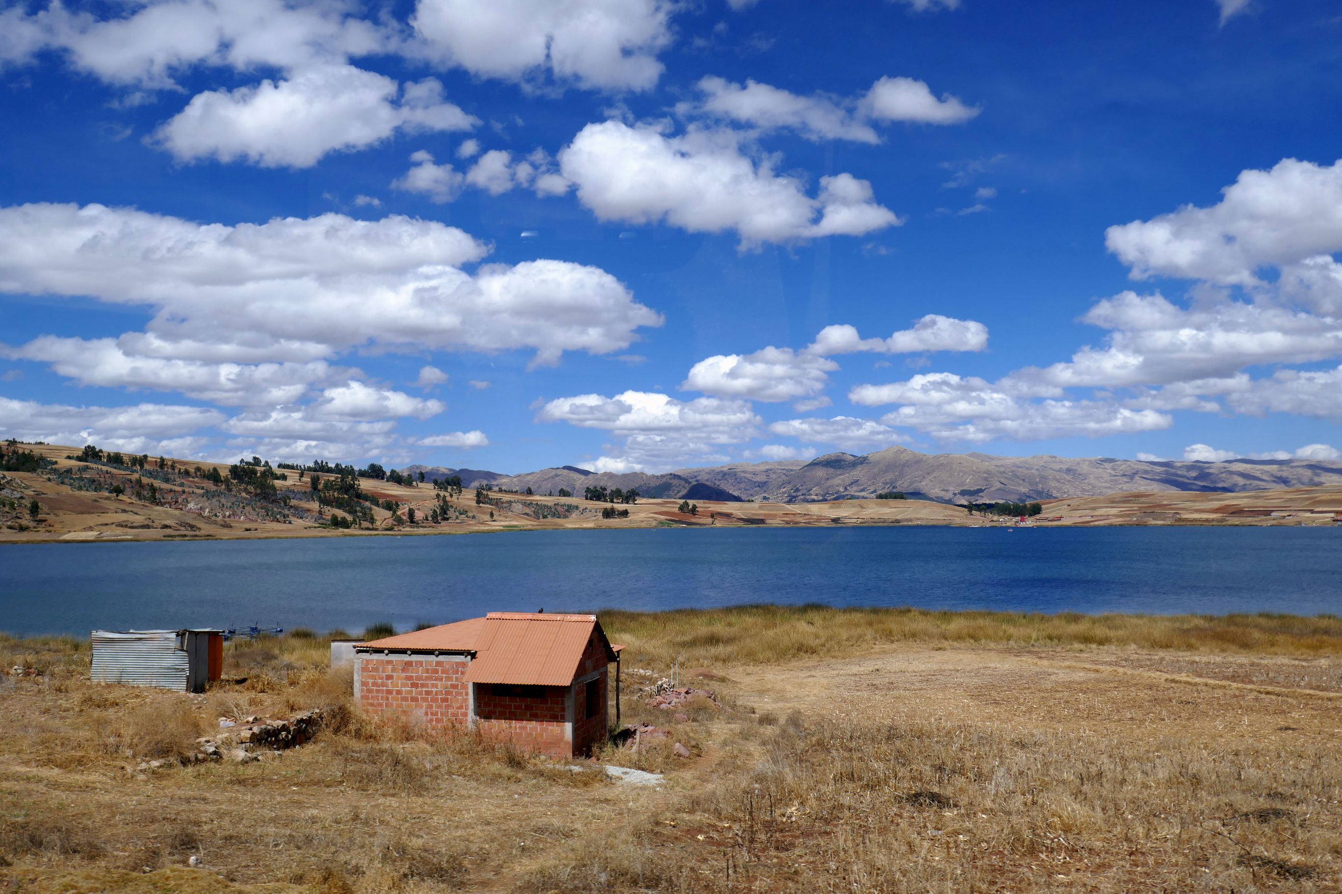
We bid “adios” to Machu Picchu and Aguas Calientes and took the train back to Ollantaytambo. Our tour bus met us there to drive us to Cusco (“Cuzco” in Spanish) where we would be staying for the remainder of the tour.
(For all photos, click on the image for a full screen view.)
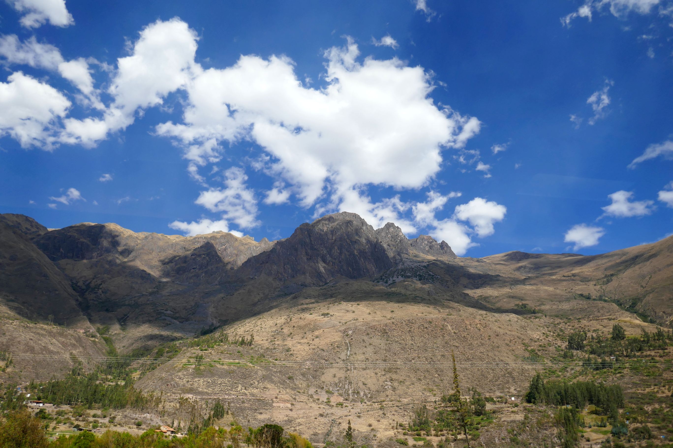
It was a lovely day for a drive!
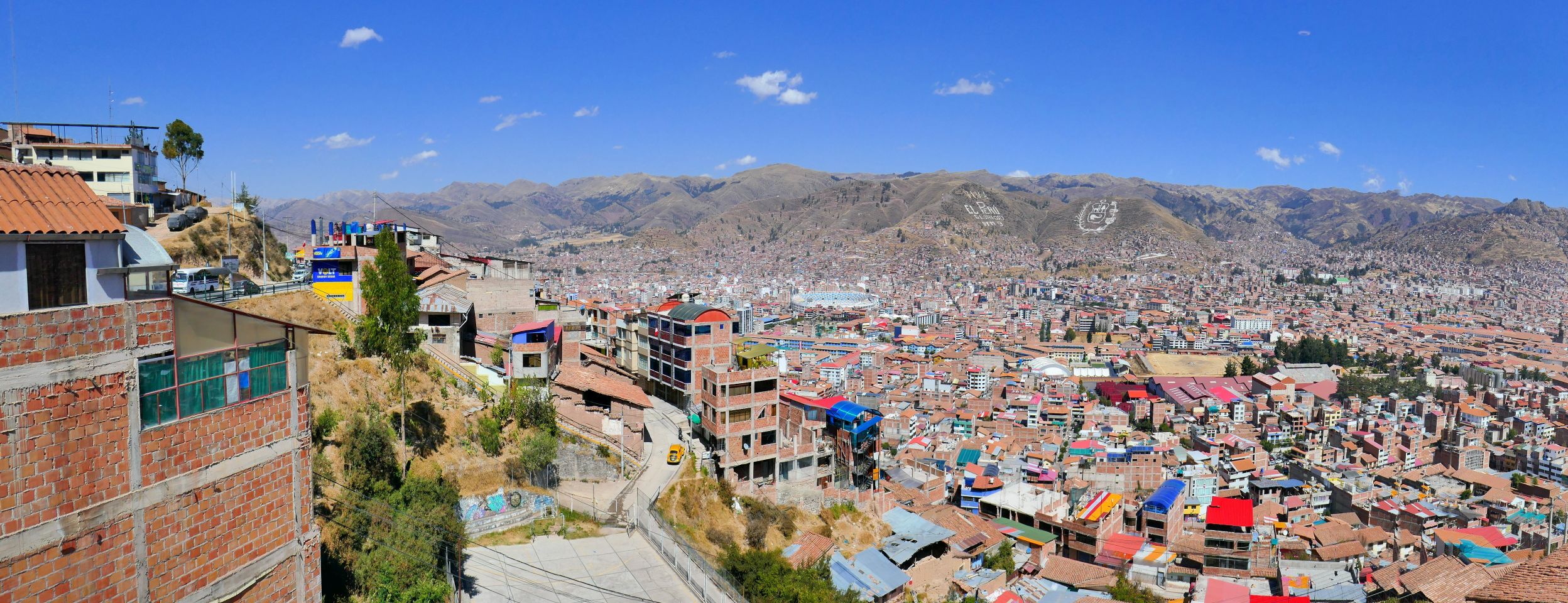
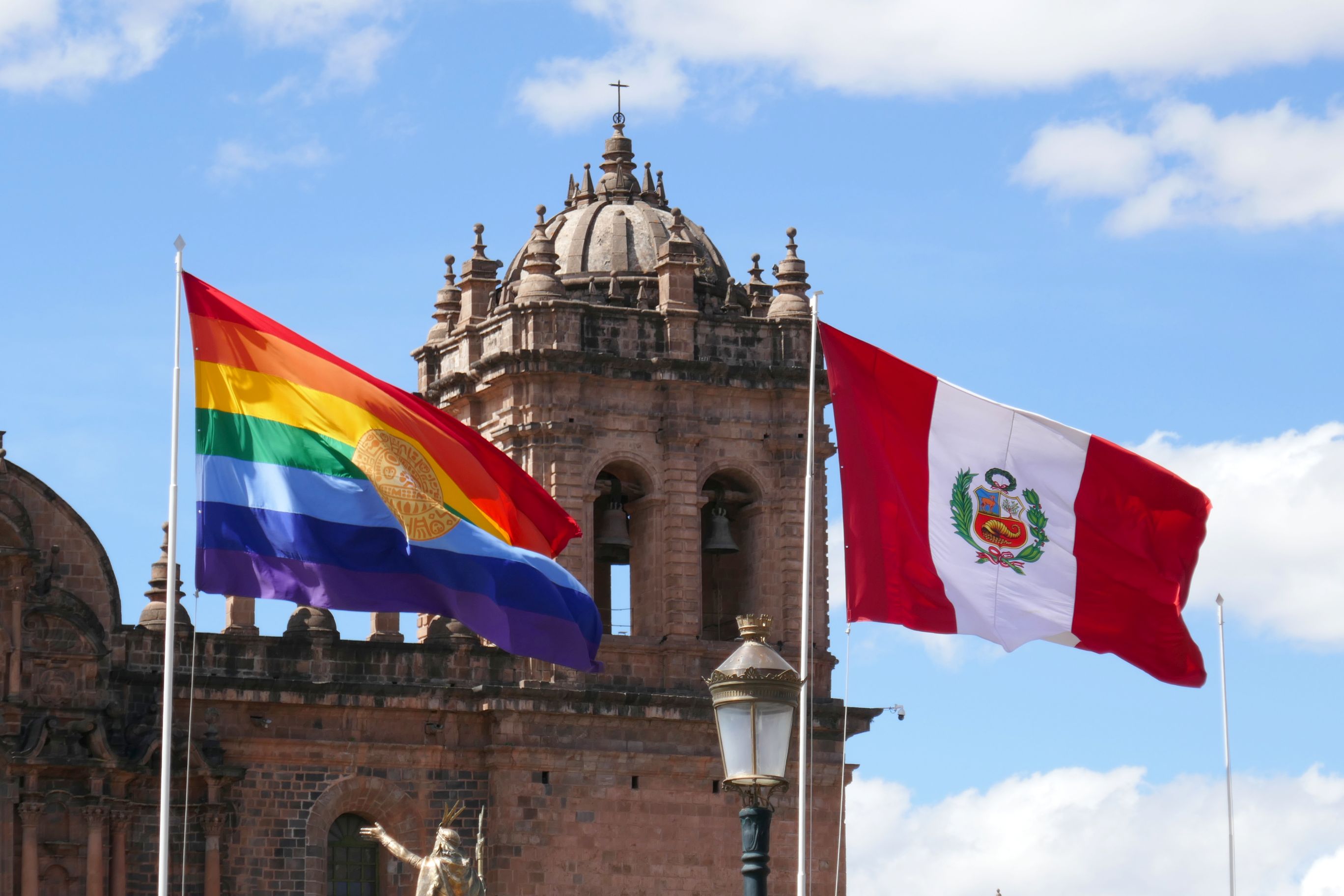
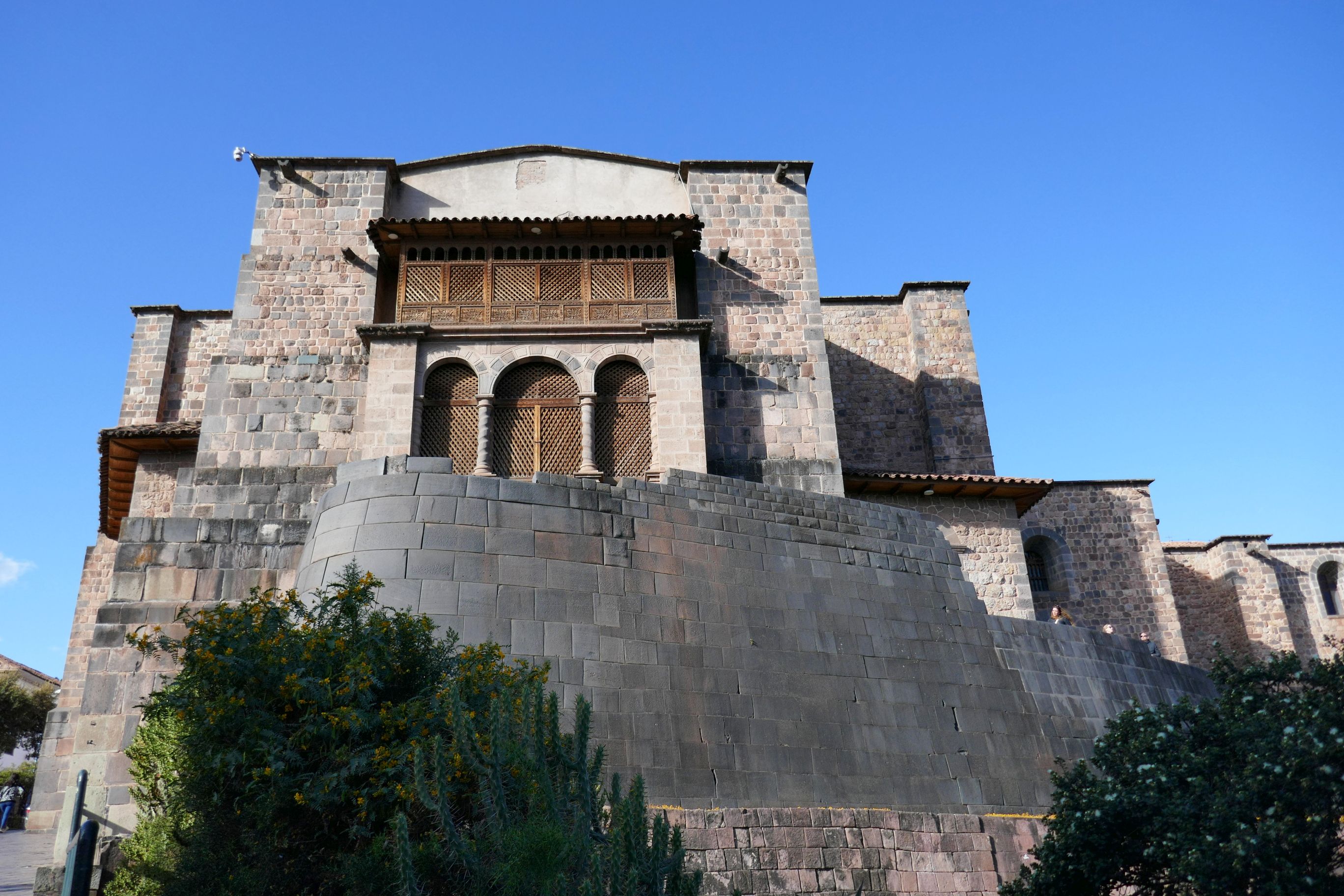
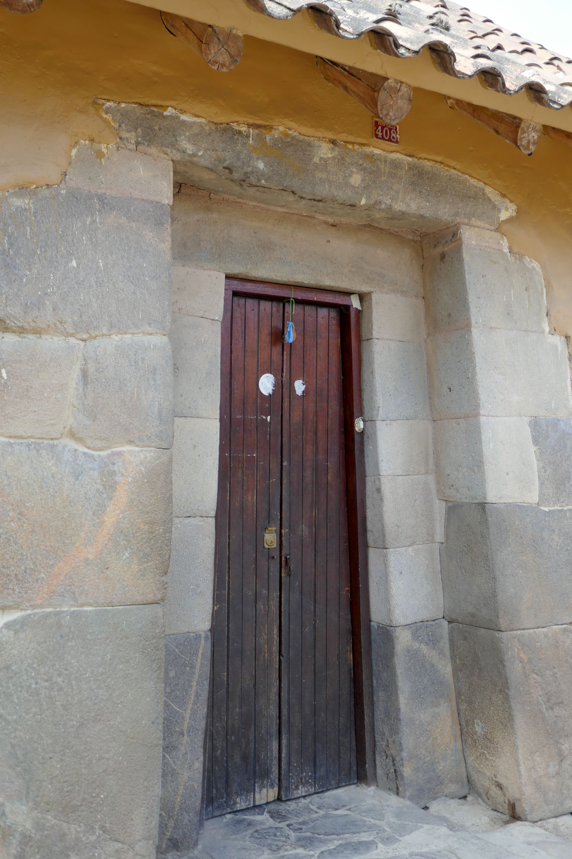
Cusco, a UNESCO World Heritage Site, is at an elevation of 11,200 feet, so there were times Bruce and I could feel our respiration rate increase as we hoofed it around town during our free time.
Now a city of about 428,000 people, it is the capital of the Cusco province. Back in the 13th to 16th centuries, it was the capital of the Inca Empire. That all ended when the Spanish came…
Raul led us on a walking tour of Cusco to explore what the Incas had called “the navel of the world.” The city was laid out in the shape of a puma, which was sacred to the Incas.
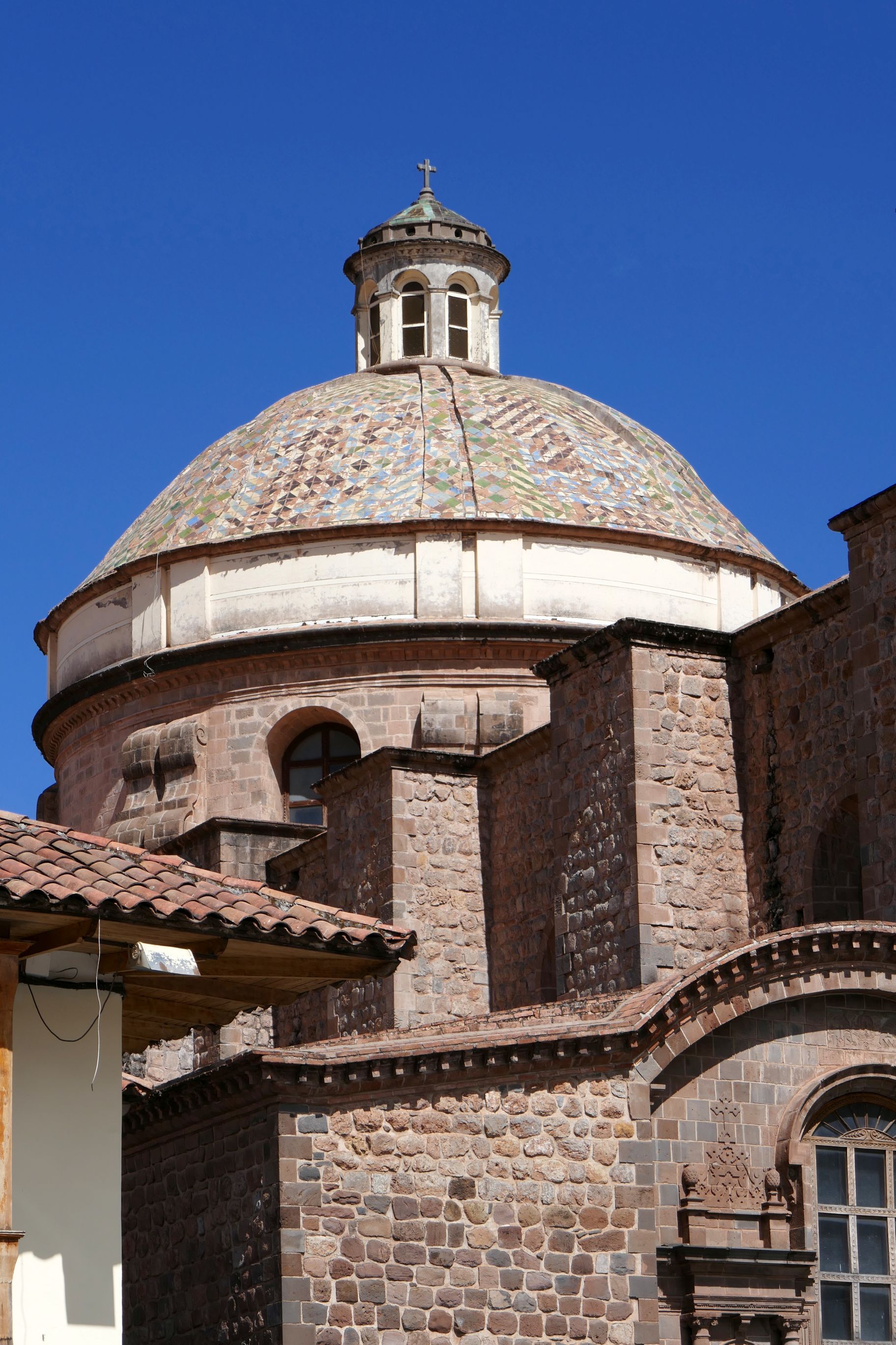
The heart of the city is Plaza de Armas, and its centerpiece is the colonial 17th-century cathedral.
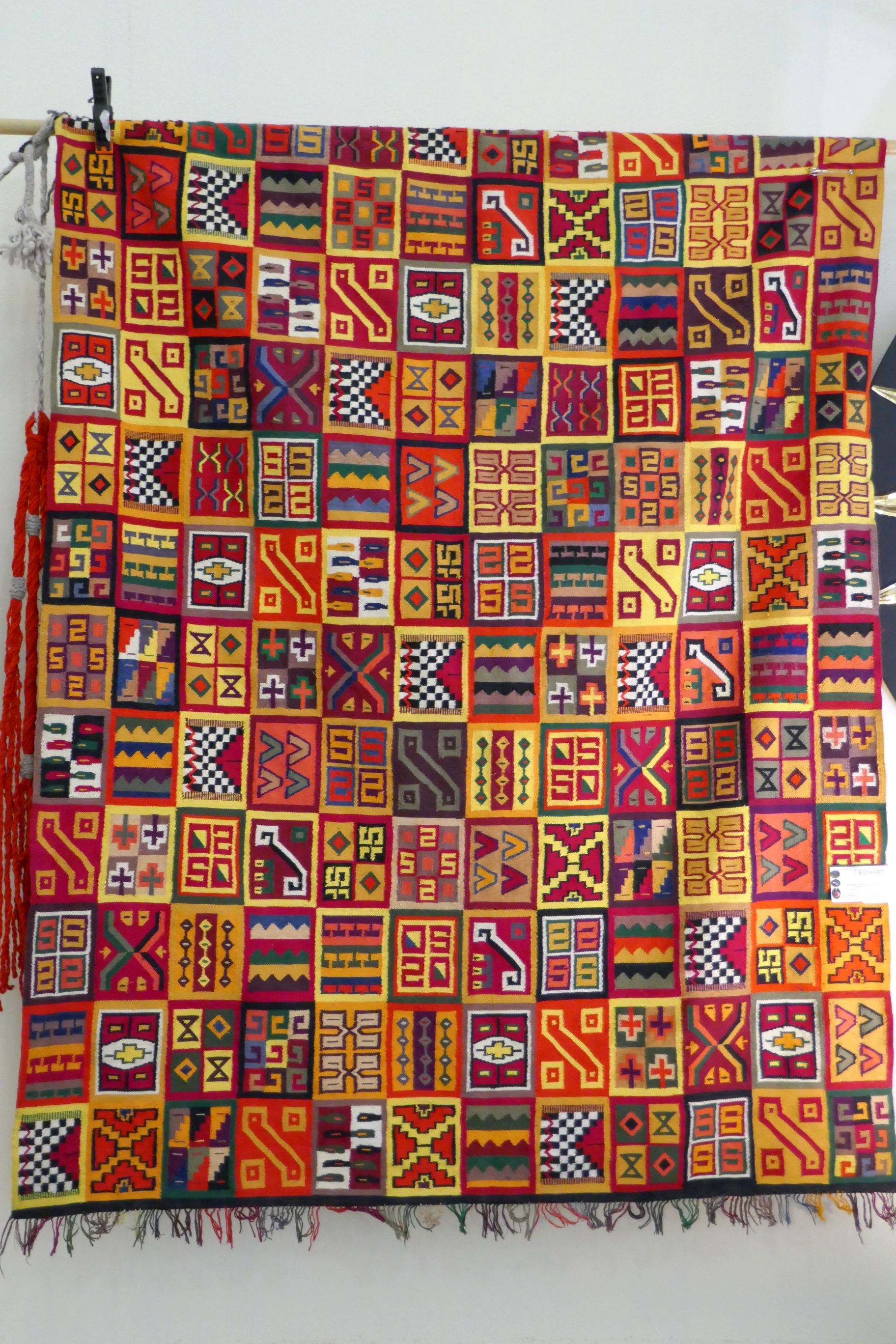
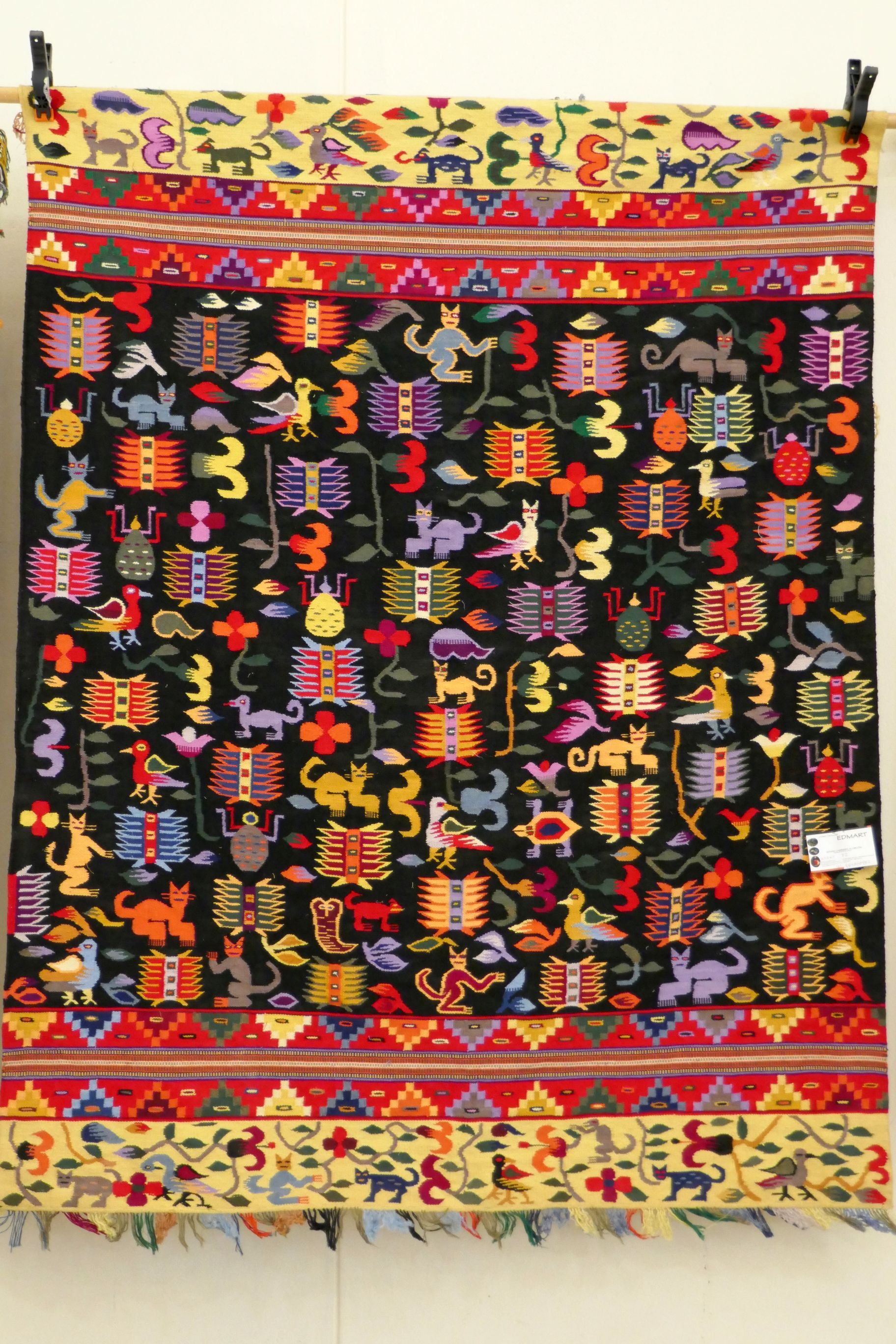
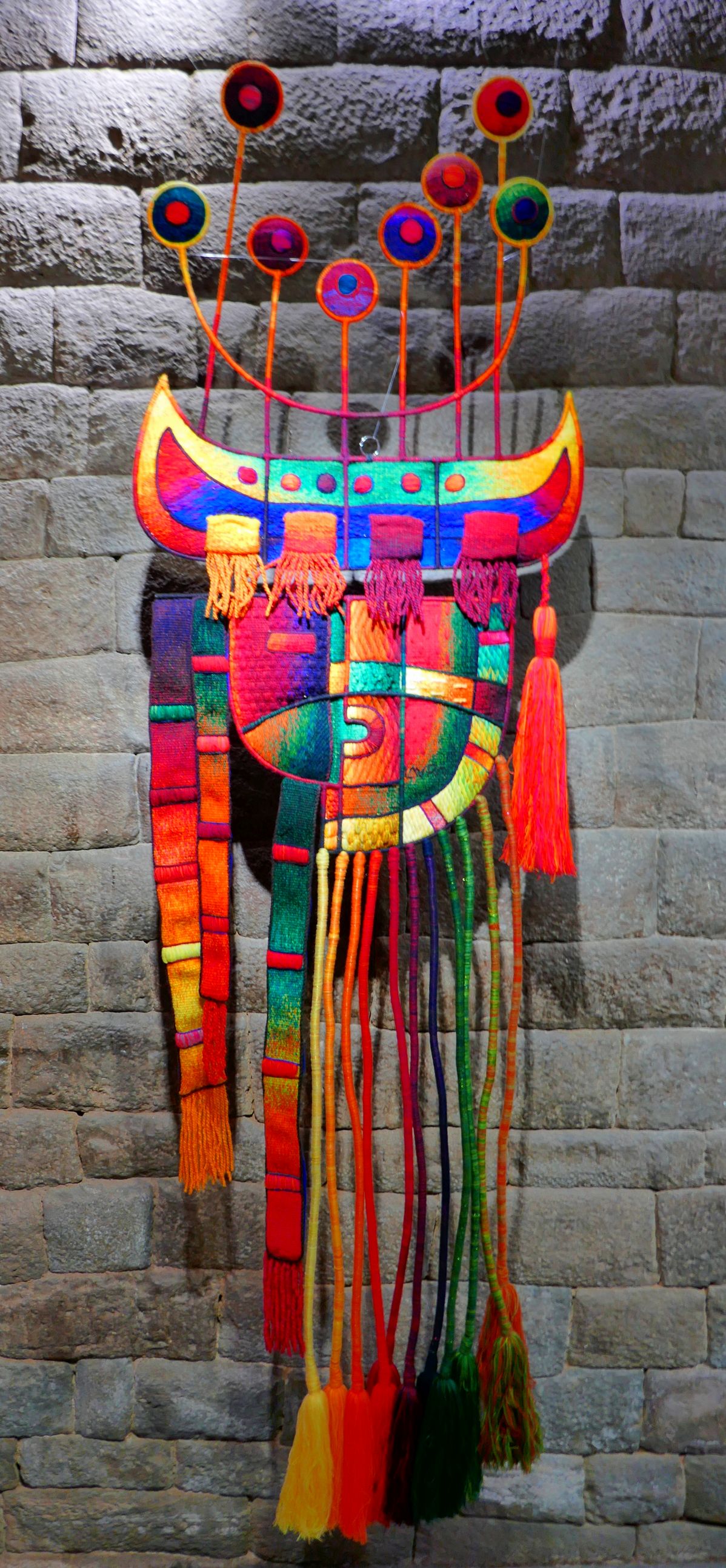
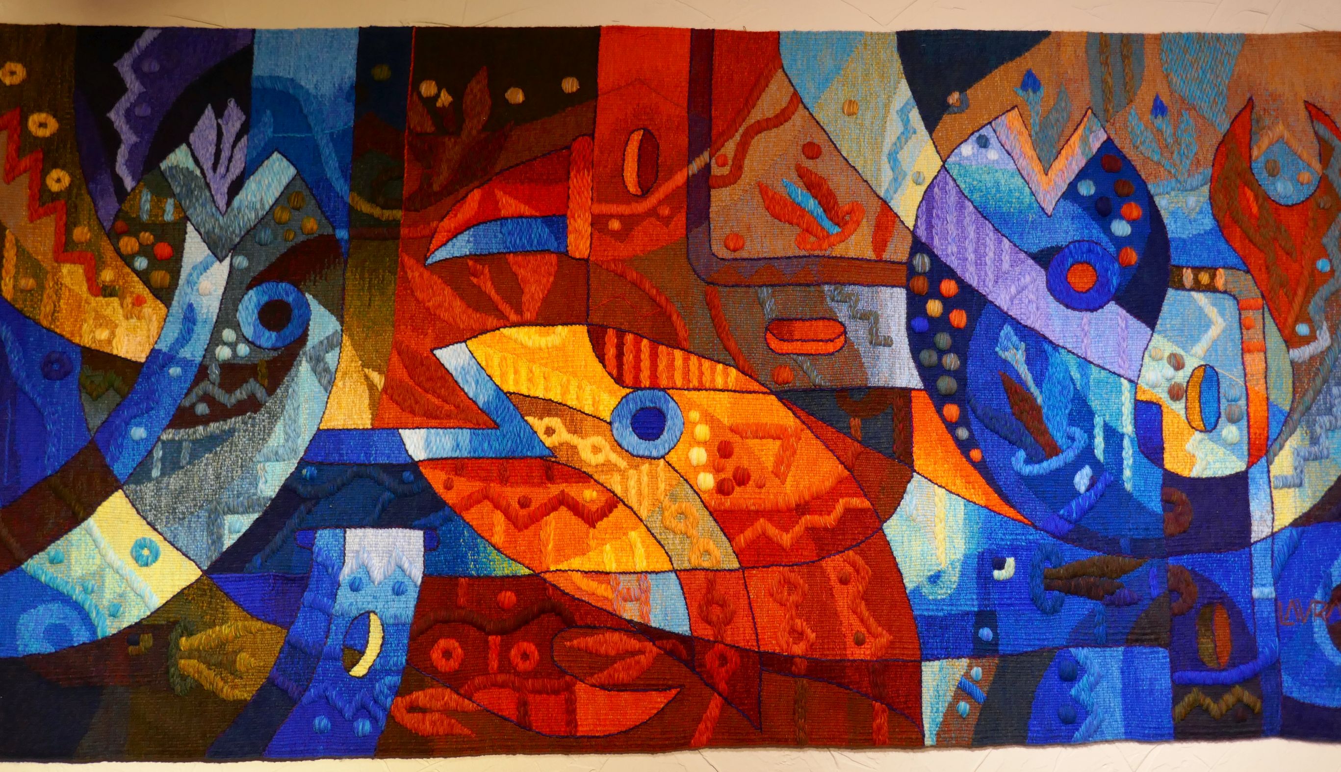
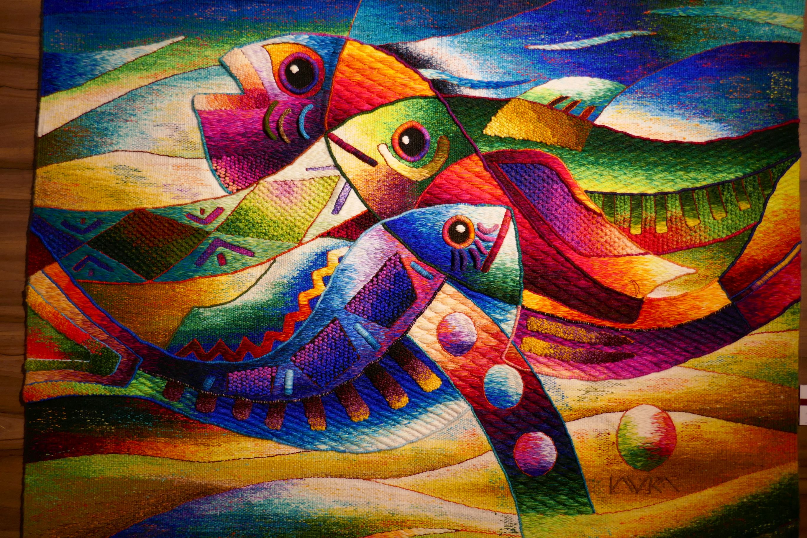
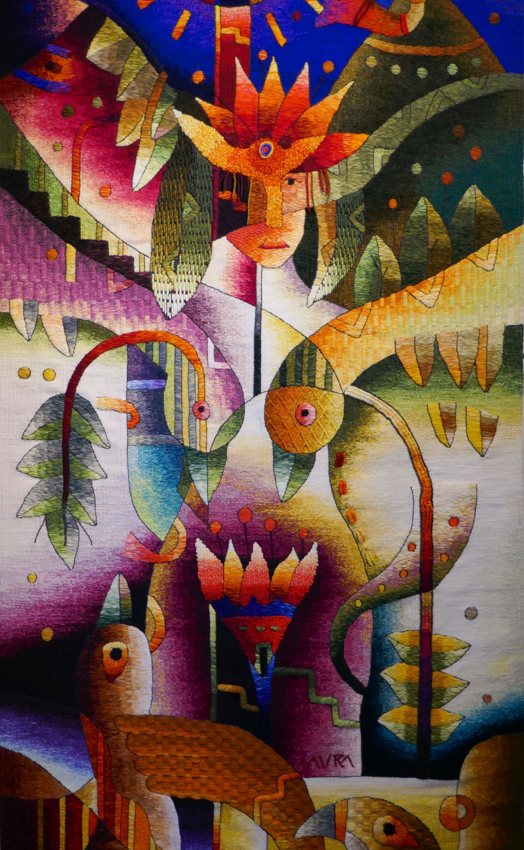
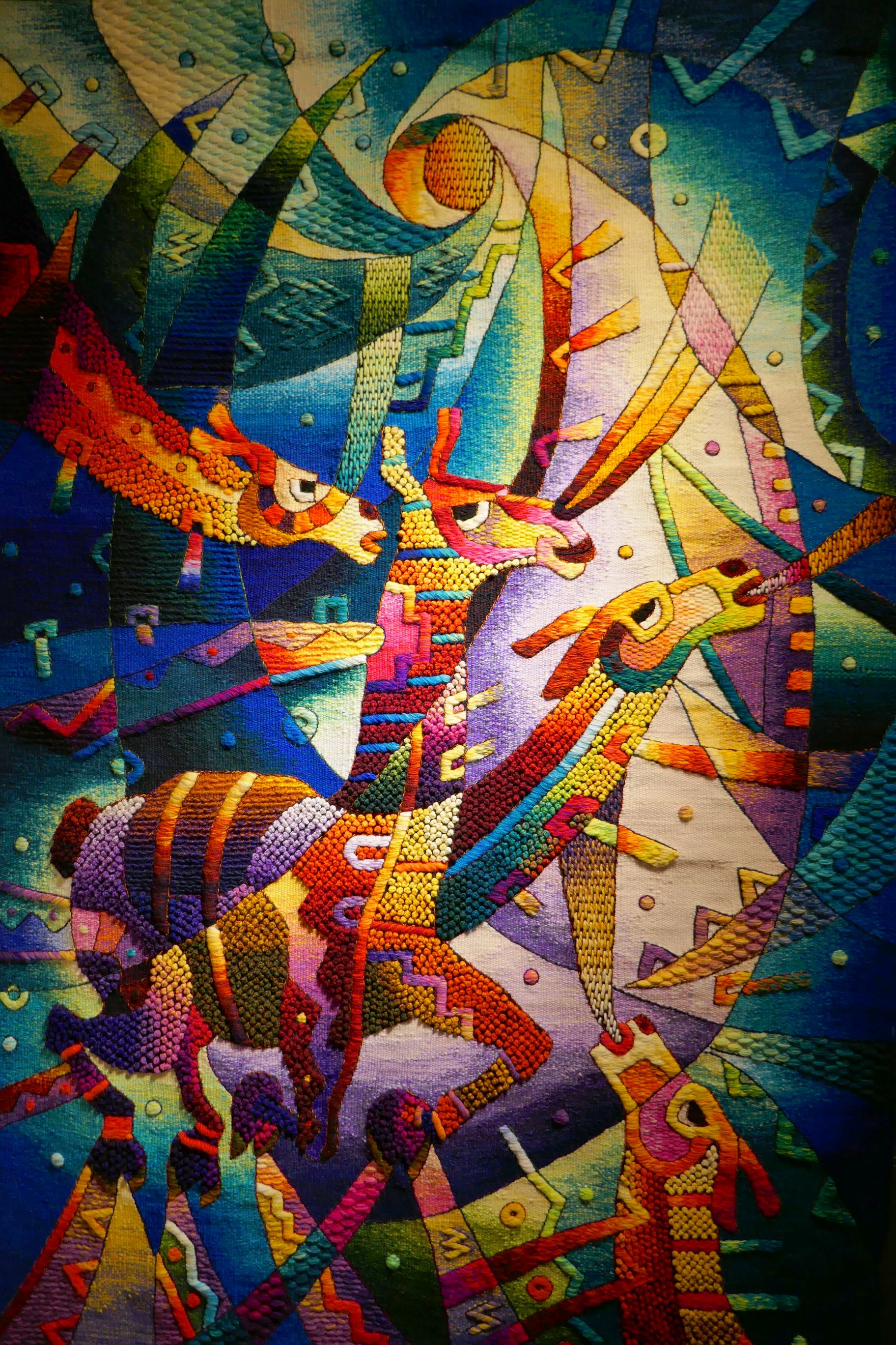
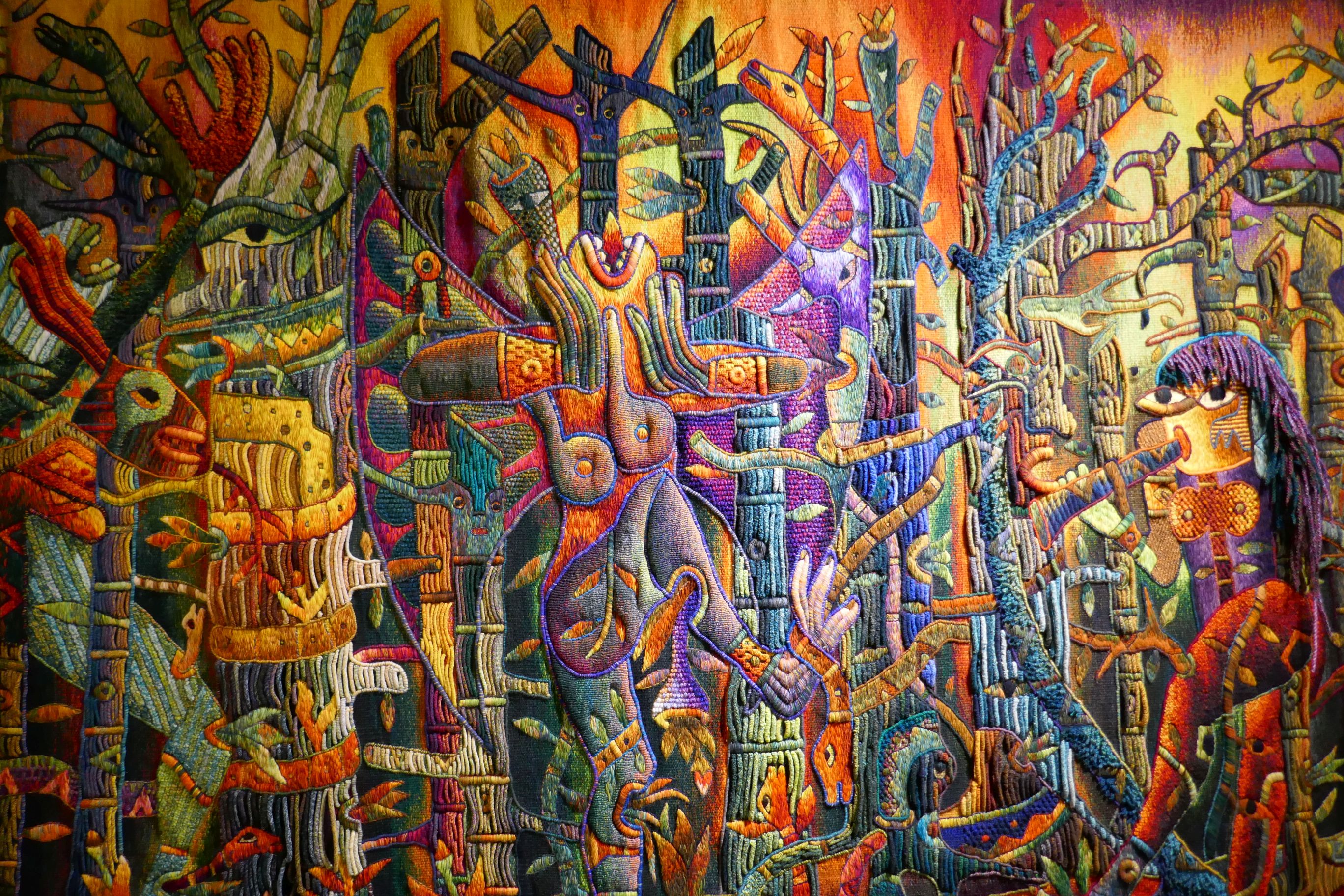
Our favorite stop on the tour was Museo Maximo Laura, which exhibited the vibrant collection of Laura’s tapestries. Check out the link, and I’m sure you will agree the museum is colorful eye candy! We were amazed at the explosion of colors and intricate designs of these labor-intensive works of art.
Thankfully, the signs posted encouraged its guests to take photos and post them on social media. I was overjoyed to do so! Sharing Maximo Laura’s work with you is my pleasure.
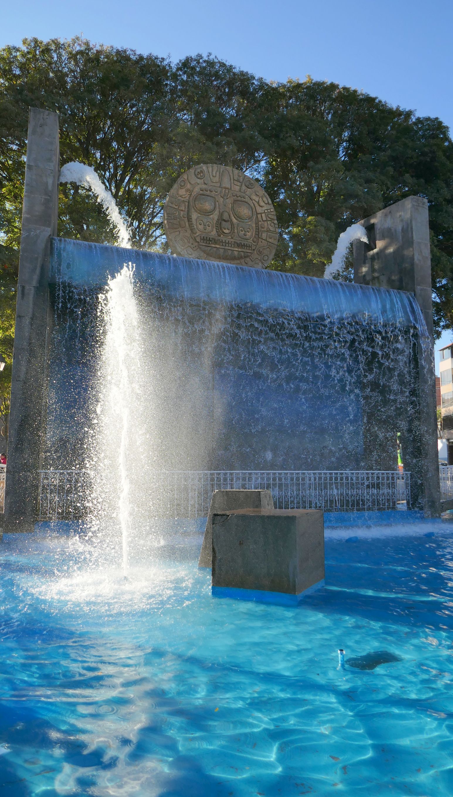
More scenes around Cusco:
Santo Domingo Convent
The view from the convent
We wrapped up the beautiful day by returning to the plaza for an evening stroll.
Next up: PERU #13: A DAY IN THE LIFE OF ISKUCHACA AND CHINCERO VILLAGES
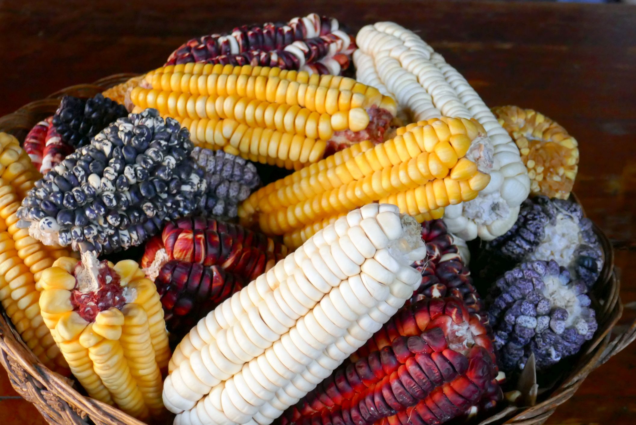
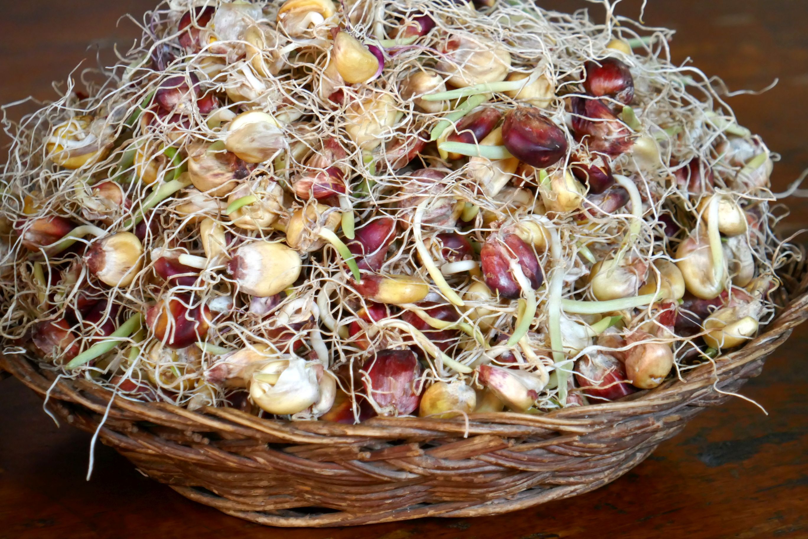
Traveling to Machu Picchu required a return to Ollantaytambo to catch the train. On our way there, we stopped to visit a woman who makes Chicha (corn beer), a very popular fermented beverage in the region, especially since regular beer is not sold in local stores. She sells a large glass of corn beer at her bar for 50 cents and strawberry corn beer for $1.
(For all photos, click on the image for a full screen view.)
We learned about the process of making the beer, which begins by removing corn from the cob and spreading it out on plastic sheets. Water is added, and then it is packaged up, covered, and placed in a cool shady spot to ferment for three days. After tasting both flavors, we all agreed it was, uh, an acquired taste. But if you go to Peru and want to buy some, just look for a Chicheria. If it is available for sale, there will be a red flag on a stick out in front of the store.
The beer is fermented in those large clay pots (in the back).
I noticed they also raise guinea pigs, their national delicacy.
At the bar, the favorite activity while drinking corn beer is playing Sapo, a coin toss game:
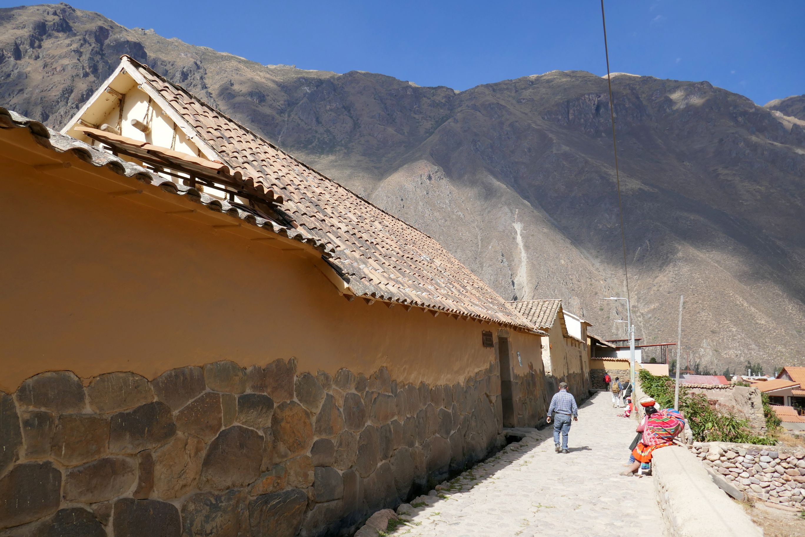
Our group continued back to Olantaytambo, arriving early enough for Raul to take us on a walking tour of the town before boarding our train. We had previously hiked the ruins and saw the craft market, so Raul took us through other areas of the village where we could see how the locals live and meet a few along the way.
The train ride to Machu Picchu was beautiful, gradually becoming more tropical as we got closer. What a spectacular day! Our research on Machu Picchu had left us with very low expectations for good weather, since we had learned it is often foggy (or rainy) with anywhere from low to no visibility. We figured our luck had to run out at some point. Except for the rain we had in Lucerne, Switzerland, back in May, we had experienced unbelievably fantastic weather during our travels this year. Surely, we would arrive in Machu Picchu and see… nothing.
But we didn’t! When we disembarked the train in town, the sky was blue and full of beautiful “Simpson” clouds (named after the white cartoon cumulus clouds that appear at the beginning of “The Simpsons” TV show.) Glorious!
Next step in the journey: Hop on a bus and head up the hairpin switch-back road to the ruins! We were almost there!
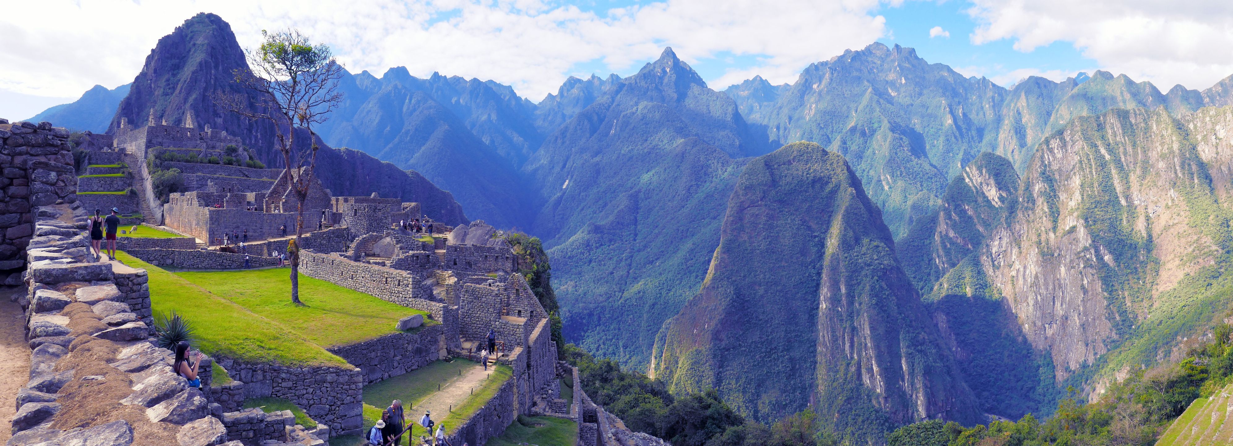
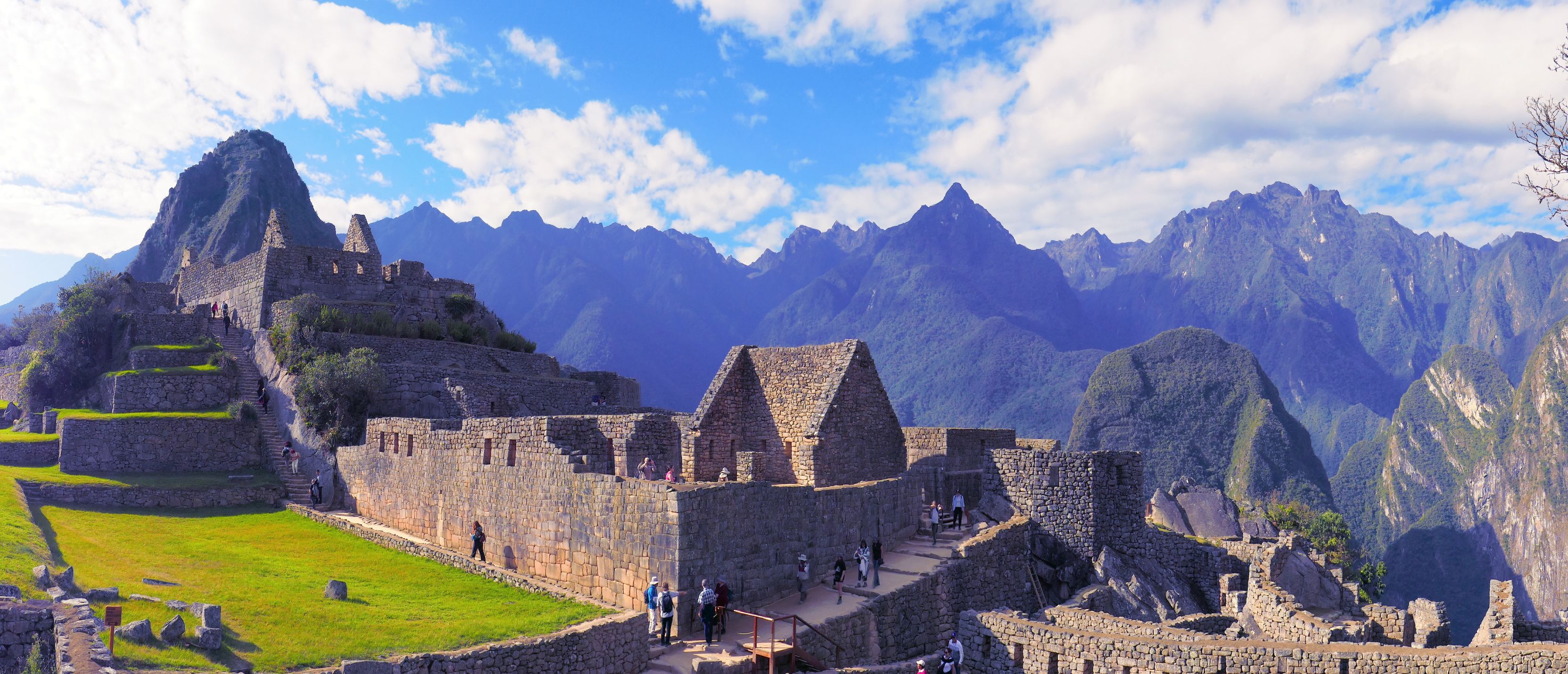
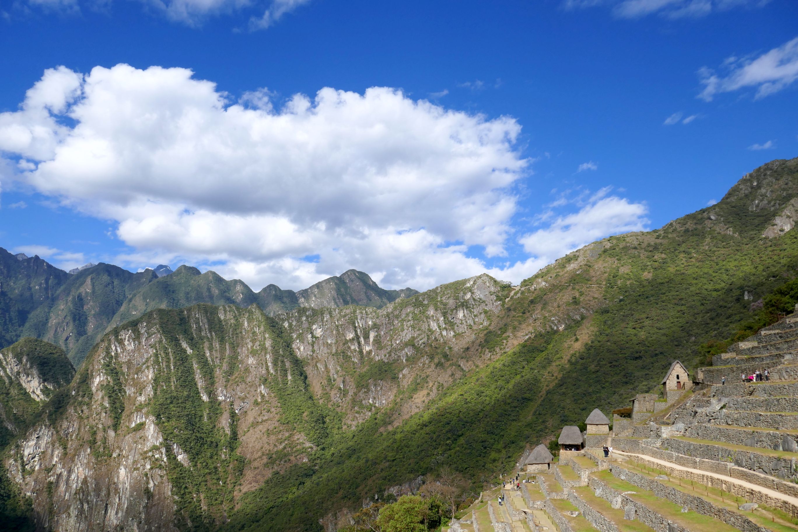
A UNESCO World Heritage Site, Machu Picchu is a 15th-century Inca citadel that was built on a mountain ridge at an elevation of 7,970 ft—a piece of cake to negotiate after adjusting to the higher altitude of Urubamba.
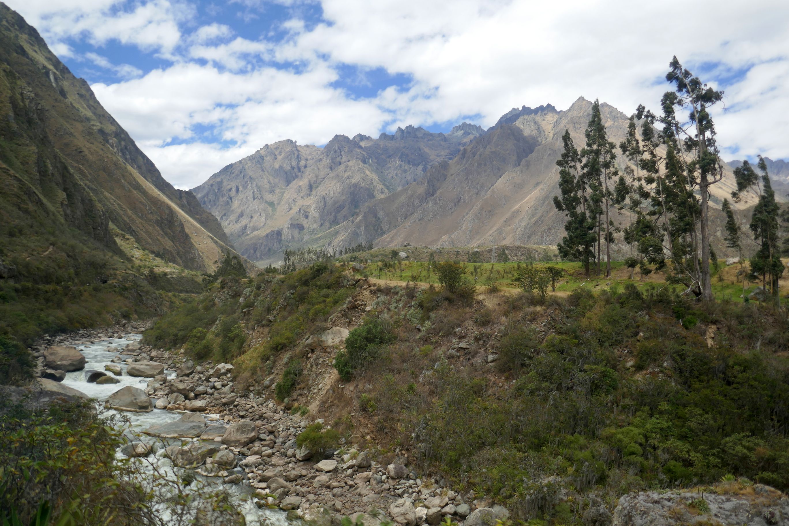
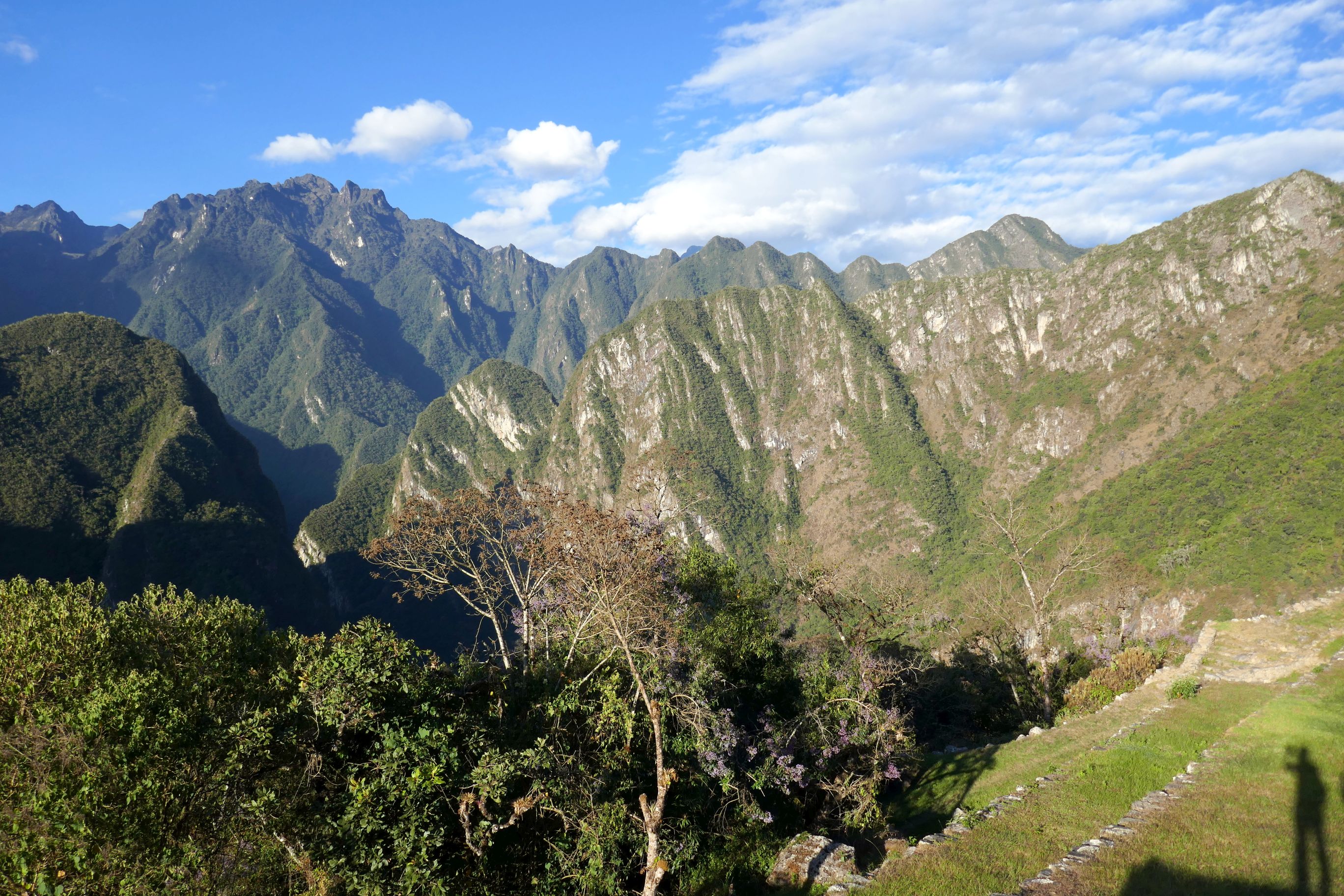
This was our first glimpse of the mountain view before we saw the ruins:
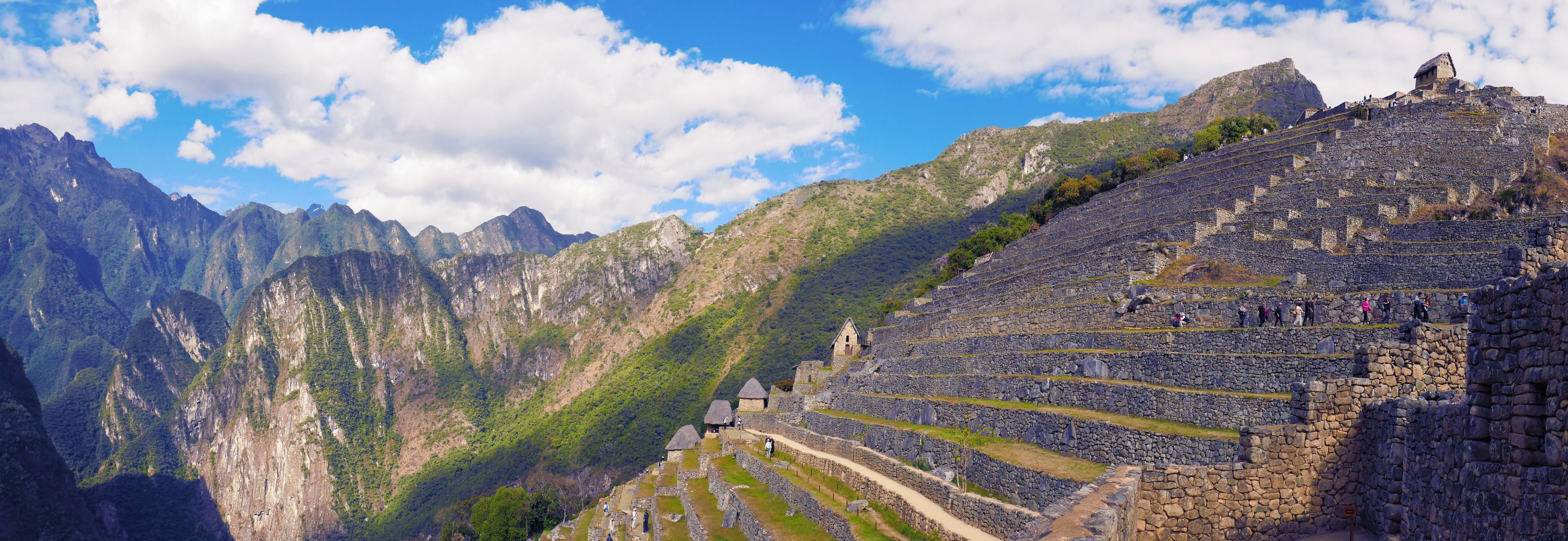
We learned a great deal of fascinating information and history about the Incas and Machu Picchu during our late afternoon visit (as well as during our return visit the following morning). I will spare you the details, however, and just share my pictures instead.
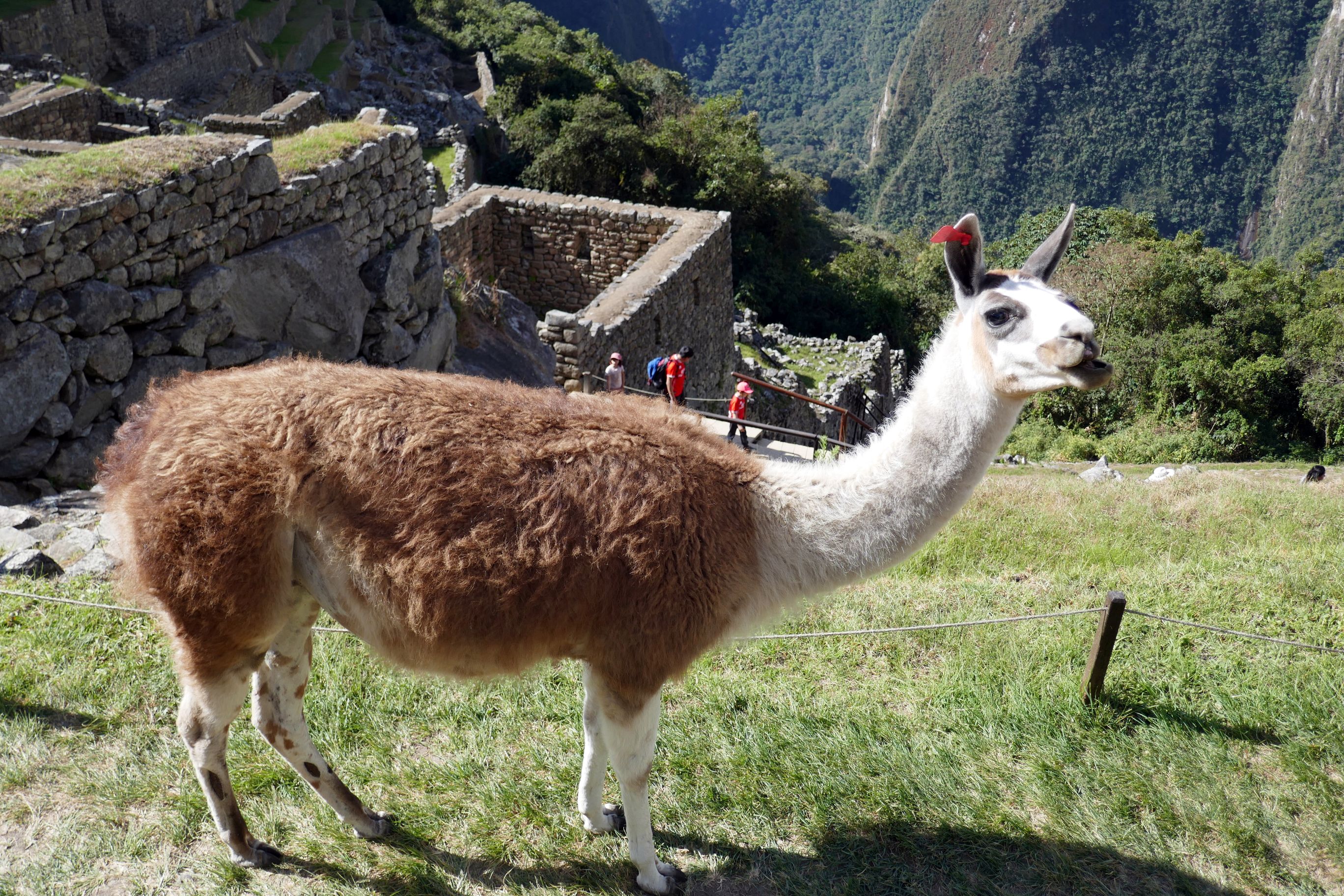
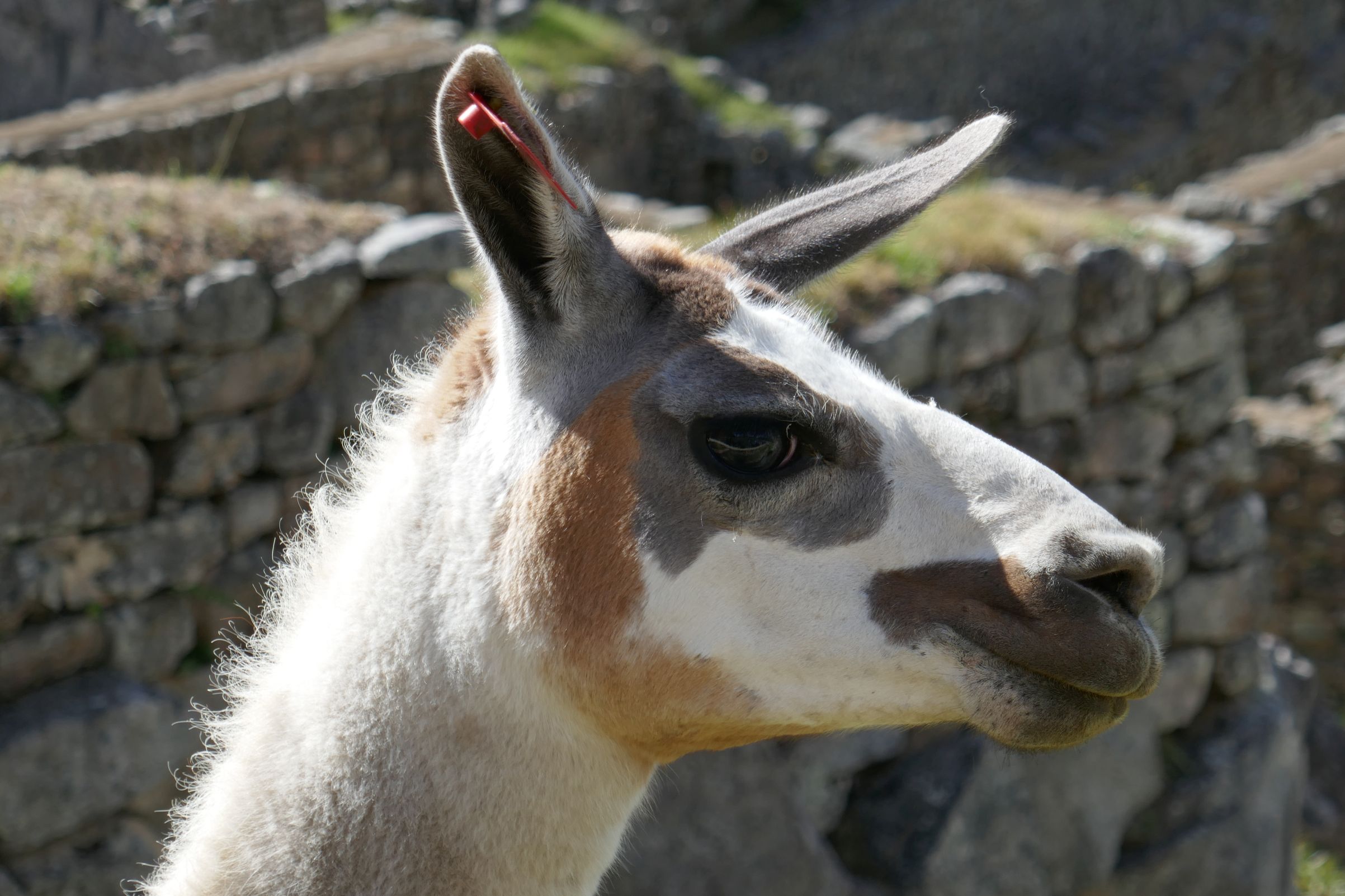
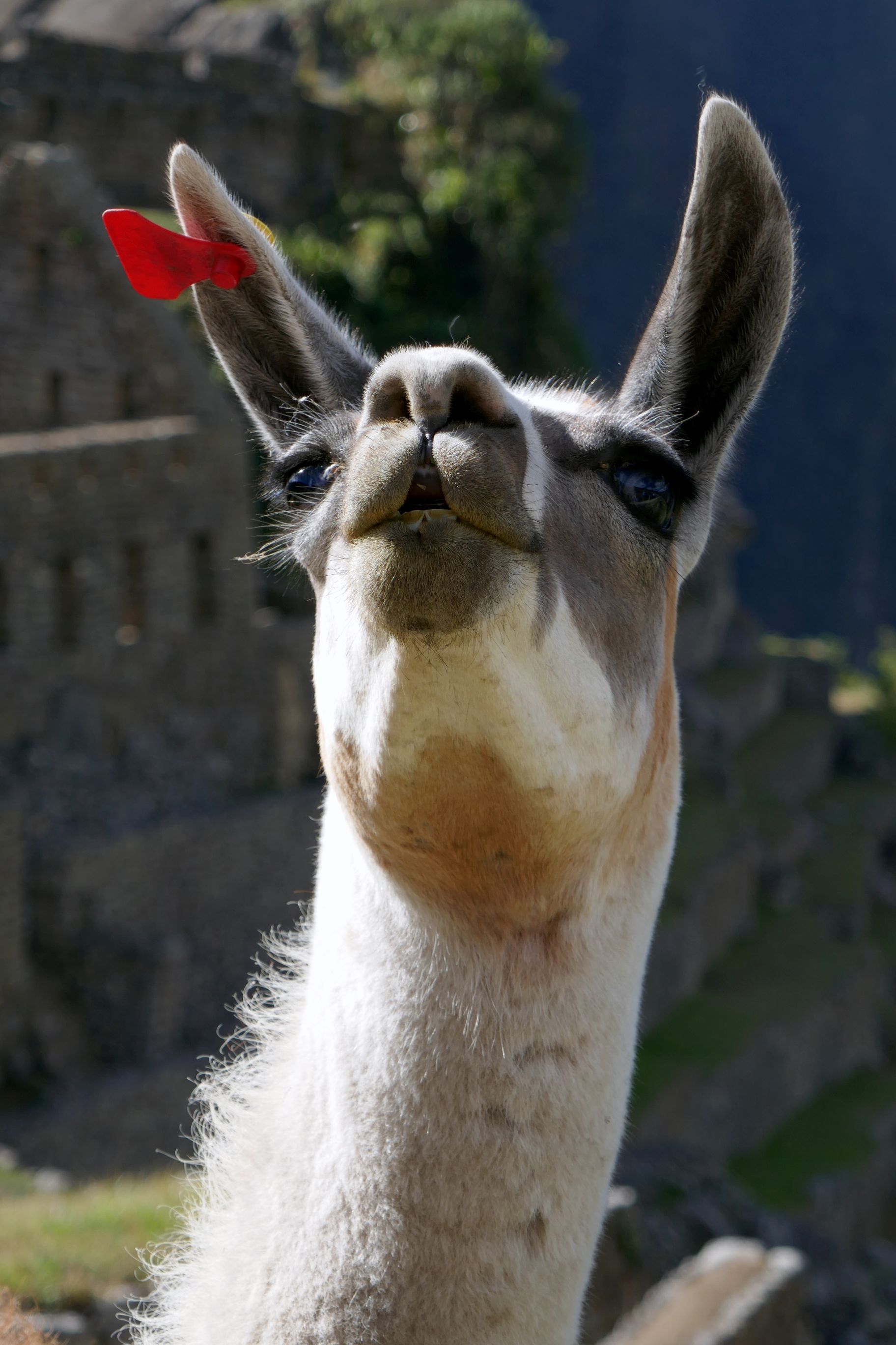
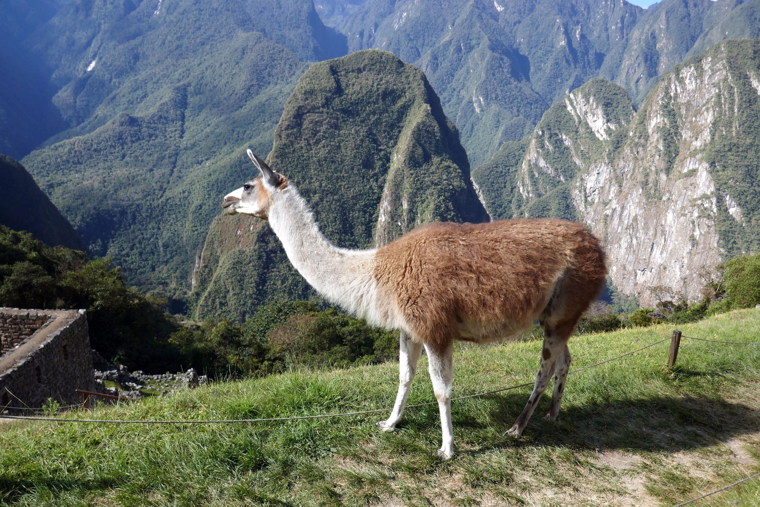
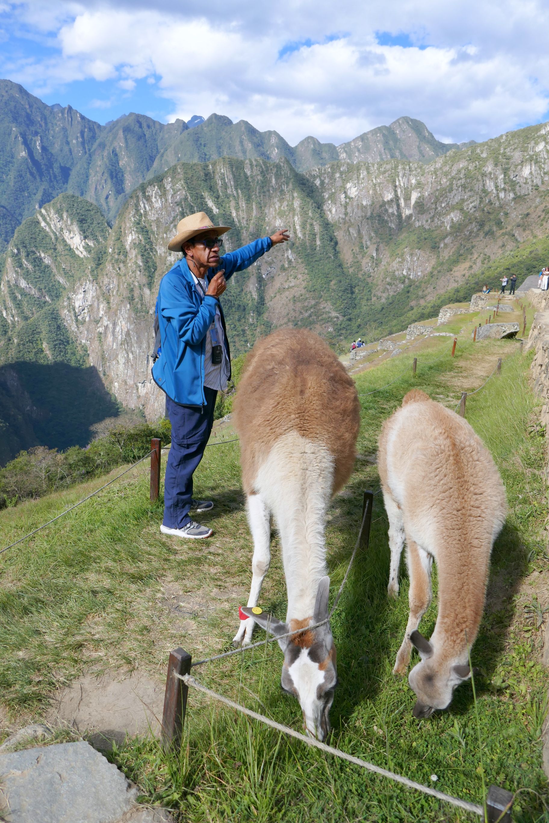
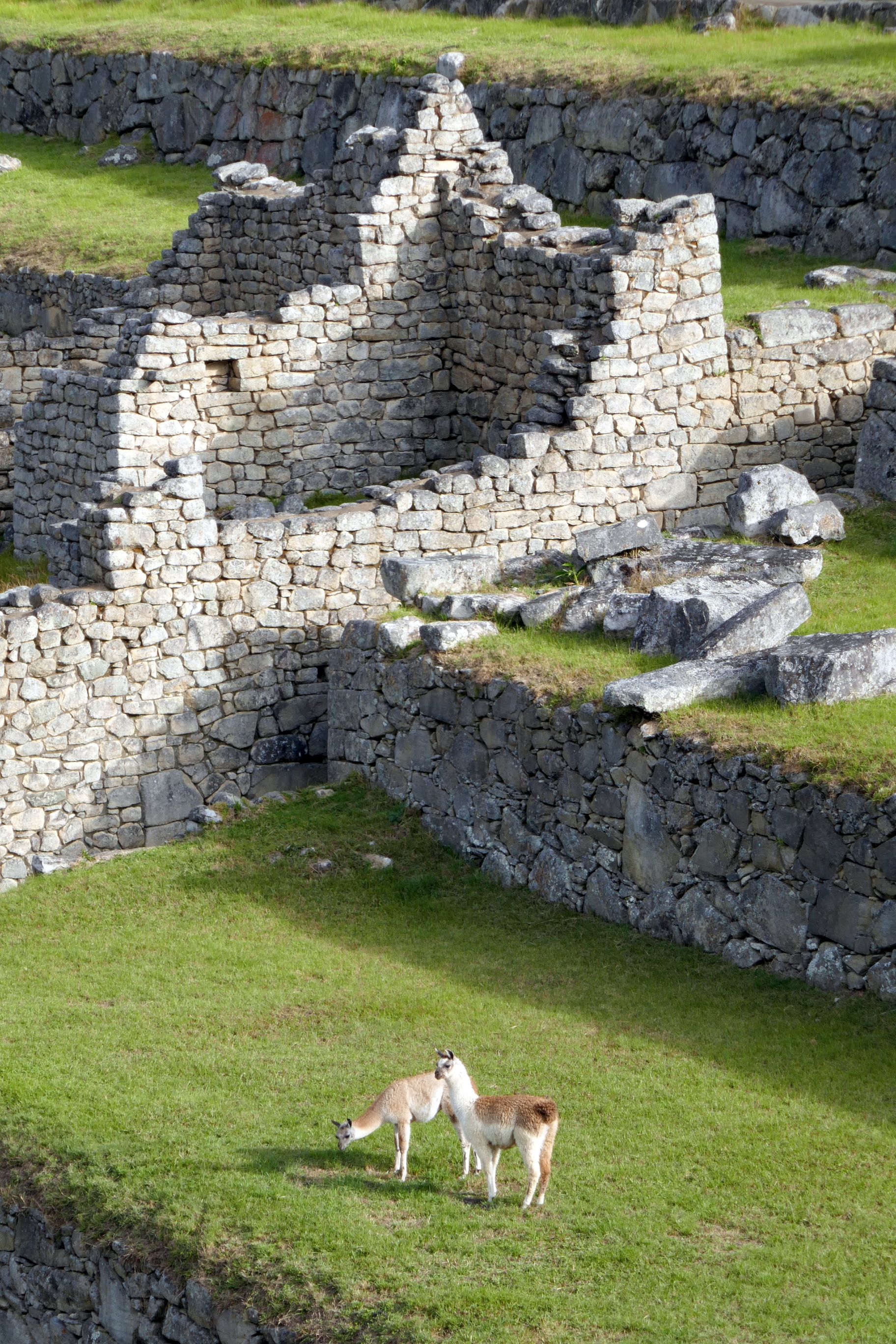
Our research also revealed that we may see an alpaca at Machu Picchu. As Raul stopped in a roped off area to share some of his vast knowledge of the Incas with us, this gal and her baby waited patiently for him to move, so they could walk past him to graze on the grass. They finally gave up and walked behind him, giving us all a good laugh while Raul was oblivious!
I think Raul finally caught on!
How the Incas built these amazing structures back in the 15th century is beyond me! Look at the detail in both this photo and the one below!
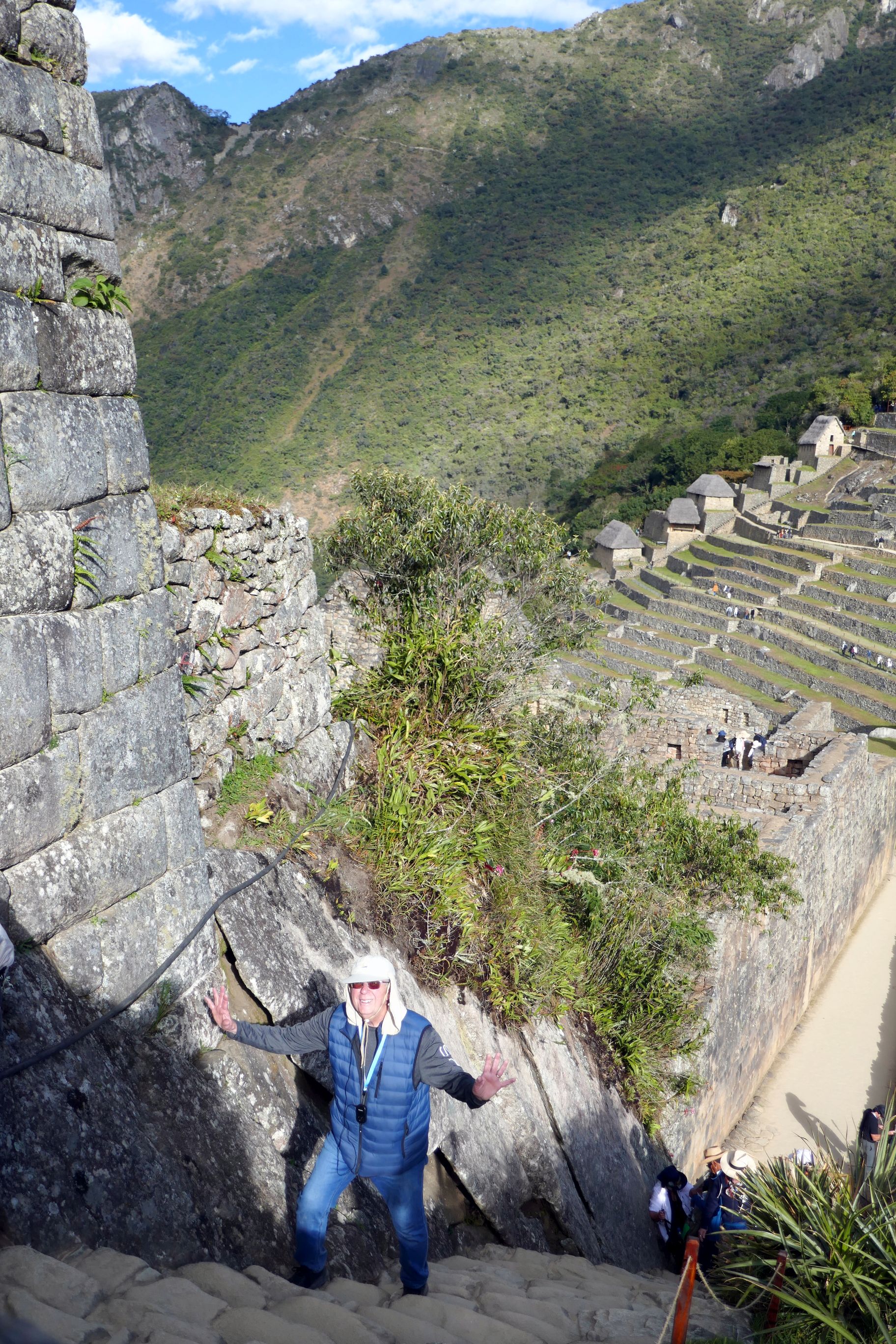
Bruce will soon discover the view from the top was well worth the steep climb!
One last photo of the magnificent view at the end of a beautiful day. That’s me in the lower right corner.